Dark Star
-
Posts
1,731 -
Joined
-
Last visited
Content Type
Profiles
Blogs
Forums
American Weather
Media Demo
Store
Gallery
Everything posted by Dark Star
-

July 2025 Discussion-OBS - seasonable summer variability
Dark Star replied to wdrag's topic in New York City Metro
That's because our night time lows are higher... -
July 2025 Discussion-OBS - seasonable summer variability
Dark Star replied to wdrag's topic in New York City Metro
No worries, almost every year our average temperatures increase. We need some good northern hemisphere volcanic action (just not around here)... -
July 2025 Discussion-OBS - seasonable summer variability
Dark Star replied to wdrag's topic in New York City Metro
June 2025 was hot. Newark was 2.5 degrees warmer than "normal" (the new norm), and had days over 100 degrees. That is hot... -
I am over critical, but I wouldn't call 5 degrees a bust...
-
Always bet on warmer than predicted...
-
July 2025 Discussion-OBS - seasonable summer variability
Dark Star replied to wdrag's topic in New York City Metro
Thank goodness. At my age, sustained heat might be the final nail... -
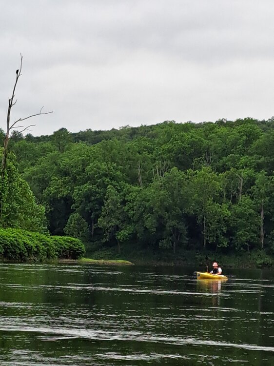
Milford PA to Smithfield Beach, just a few miles north of the Gap...
-
Friday was a perfect day for a paddle down the Delaware River. 3 Bald Eagle sightings (one atop the dead tree), and an unbelievable shad run. You could see their white dorsal and tail fins breaking the surface like a shark...
-
I'm in a "suburb" in Union County NJ, and it was near 90 around midnight. I don't think anyone on this board has any uncertainties about the urban heat island effect.
-
Just the opposite. I can't say the the Urban Heat Island effect was responsible for THI values over 100 for such a large area.
-
UHI? Mongo dunno. I saw THI values up and down the entire east coast over 100 degrees...
-
38% relative humidity doesn't sound that high from Monday afternoon, but with the dew points at 70 degrees or higher is what we felt...
-
What a stark contrast between standing on my driveway vs. under a tree in 100 degree temperatures. I wouldn't want to be working outside in either location.
-
I think it's from the buildup of a static charge in storm clouds?
-
The models yes, but some sniffed it out. Unfortunately, most did not have it in their official forecasts. The NWS did highly consider it as a possibility in their discussion. For most of us, it's just a "busted" forecast, but for those who ventured out into local waterways, it was another story.
-
If there was meteorological gambling, I would put $100 on EWR to hit 90 today...
-
Rats, yes, geese, this was their habitat...
-
and yet in the "suburbs", they continue to fill in the spaces between the spaces...
-
Fertilizer can definitely increase the growth of algae, which some bloom has already shut down Spruce Run in western Jersey from swimming for the year. Happens to that lake more so than others?
-
What does hazardous chemicals have to do with elevated bacteria levels, unless the "hazardous" chemicals are a food source for the bacteria, but I would be surprised if that growth would happen naturally. More likely a washout from a wastewater treatment plant from a sudden storm or just from leaching out of local septic tanks and leach fields.
-
Hail here in Garwood about 5 minutes ago. We sure could use this rain...
-
"The solar winds, keep comin' in"...
-
Weather models are just not as sexy as space exploration. Plus, if you achieve your goals in space, or landing on Mars, you can see your achievements. Even if you improve the GFS, there are still other reliable models, so the increase in forecasting accuracy overall probably wouldn't be noticeable. In the end, no real significant reward for the investment.
-
Dunno, humidity seemed to have dropped as the afternoon went on?
-
Extreme temperature forecast 7-10 days out seldom occurs. Usually, the extremes temper out...