HKY_WX
-
Posts
3,246 -
Joined
-
Last visited
Content Type
Profiles
Blogs
Forums
American Weather
Media Demo
Store
Gallery
Everything posted by HKY_WX
-

Major Hurricane Melissa - 892mb - 185mph Jamaica landfall
HKY_WX replied to GaWx's topic in Tropical Headquarters
I'm not sure there are many good comparisons on this one other than Maria/PR and Dorian/Bahamas. Everyone knows how those turned out. -
Major Hurricane Melissa - 892mb - 185mph Jamaica landfall
HKY_WX replied to GaWx's topic in Tropical Headquarters
Rainfall wise, the entire island is screwed which is the biggest killer in tropical systems. That portion will be pretty epic. The wind damage (at least the extreme portion of it) will likely be confined to the central and western end of the island. -
Major Hurricane Melissa - 892mb - 185mph Jamaica landfall
HKY_WX replied to GaWx's topic in Tropical Headquarters
Kinda looks like the turn has happened or is in the process of happening now. Josh is camped out somewhere near Treasure beach i think, he usually has a good feel for where these things landfall. I like that area but just a bit west (I'm assuming he's trying to get in the eastern eyewall). -
Major Hurricane Melissa - 892mb - 185mph Jamaica landfall
HKY_WX replied to GaWx's topic in Tropical Headquarters
Like most of these turns North, it will likely stall, wobble, and then start drifting North before accelerating. -
Major Hurricane Melissa - 892mb - 185mph Jamaica landfall
HKY_WX replied to GaWx's topic in Tropical Headquarters
That's a good point, but most canes normally approach Jamaica from the east on a westward heading. At that trajectory it lends itself to the frictional land effects and wobbles away from the island. This one will be heading north as its caught up in the trough and the angle of approach will make that scenario unlikely. It's obviously still possible though. The only beneficial factor wind wise would be some small weakening on approach but rainfall wise they are completely effed. -
Major Hurricane Melissa - 892mb - 185mph Jamaica landfall
HKY_WX replied to GaWx's topic in Tropical Headquarters
This has the feel of Maria before it hit Puerto Rico. -
This is my neck of the woods. We had a little over 5.
-
February 19-20 Major Winter Storm Threat
HKY_WX replied to NorthHillsWx's topic in Southeastern States
Total here was about 5.25 -
Mod to Hvy snow up here in Franklinton. I think we might get up to another 2" out of these bands today. Crazy rates.
-
Gorgeous 20250220_105821.mp4
-
Moderate snow again here. We will likely pick up another inch+ out of this
-
Congrats to the guys out west. We're getting some flurries here again this Morn. Sitting at 23 right now. I think I will be officially ready for spring after the next 2 days of working 2 jobs, working from home and daycare.
-
February 19-20 Major Winter Storm Threat
HKY_WX replied to NorthHillsWx's topic in Southeastern States
It's basically a fropa with snow showers. -
22.1. Flurries still flying. About 11 hours of flakes.
-
February 19-20 Major Winter Storm Threat
HKY_WX replied to NorthHillsWx's topic in Southeastern States
Lol nice -
Yeah I measured over 4 in several spots out there. My guess is Wake Forest is similar
-
February 19-20 Major Winter Storm Threat
HKY_WX replied to NorthHillsWx's topic in Southeastern States
The only storm in my life that I remember Charlotte proper capitalizing on was that late Feb 2004 storm. They had like 12+. It's not in a great location climo wise. No elevation like the foothills, too far west for coastals like this one, and normally always mixes to sleet and zr during Miller A's b/c it's too far south. -
I envy you guys. My 4 year old is awake and still going crazy.
-
Winter Wonderland here in Franklinton. Roughly 4"
-
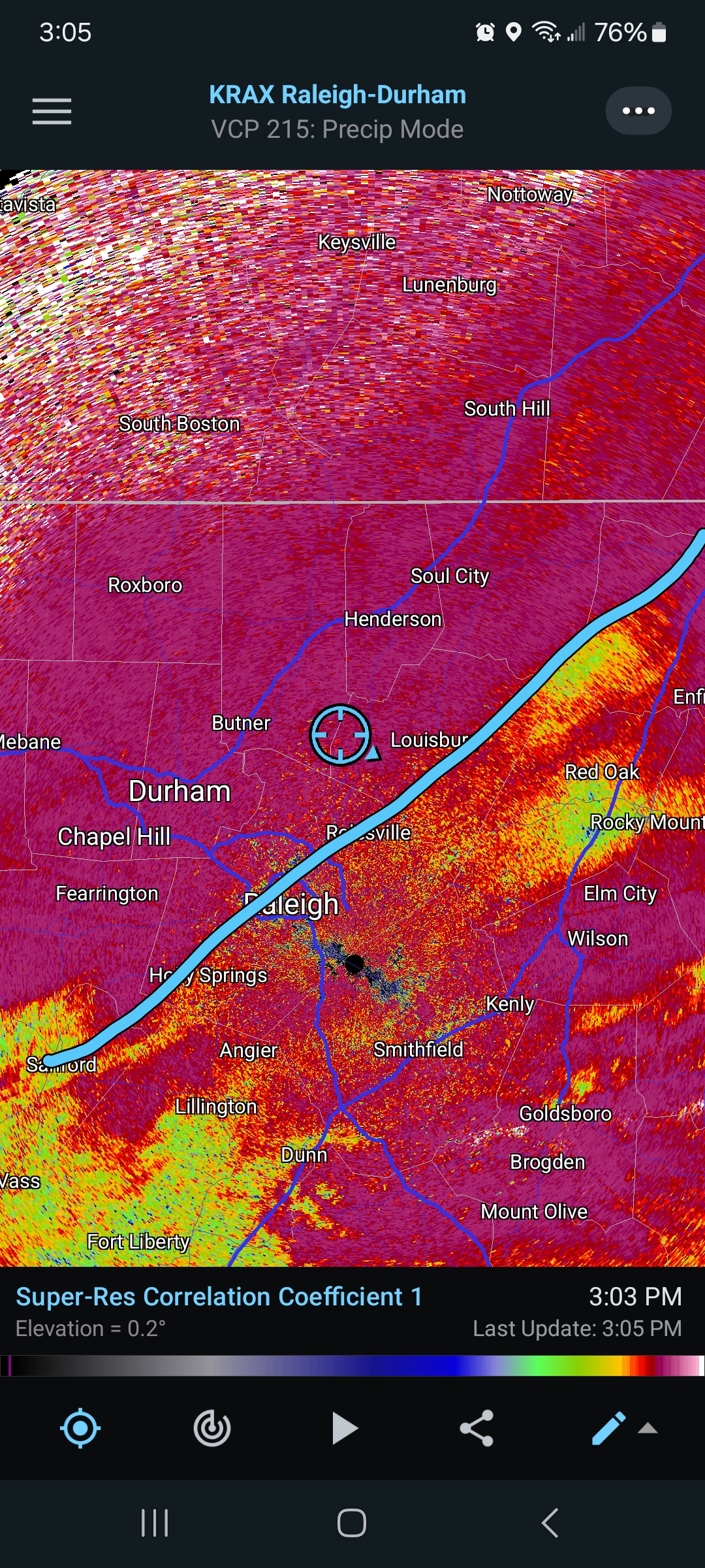
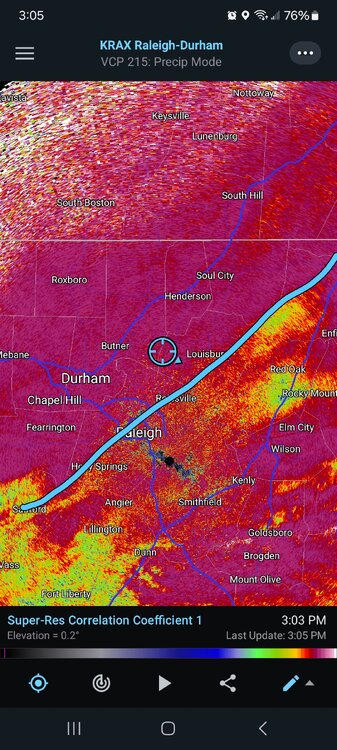
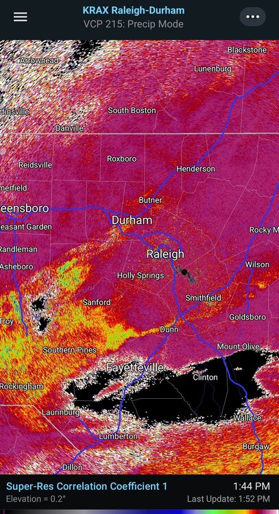
The only convection i see right now is over the Triangle.... Boom

-
Death band here in Franklinton. Approaching 2.5 to 3" i would wager.
-
Dynamics baby
-
Sleet line per CC
-
Changeover still looks south of Wake.
-
26.9* here in Franklinton. Light snow currently. Dusting came fast with the temps.