-
Posts
3,246 -
Joined
-
Last visited
Content Type
Profiles
Blogs
Forums
American Weather
Media Demo
Store
Gallery
Everything posted by HKY_WX
-
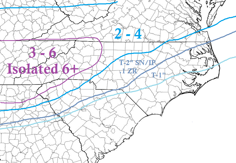
I agree, if you look at the likely SLP track. the above makes the most sense to me. Just fits climatology. There's reason GSP has WSWs and RDU is showing 1 to 2 inches (they are historical pretty conservative). This isn't a major storm but if we manage to screw up and not get a few inches out of it we are truly cursed.
-
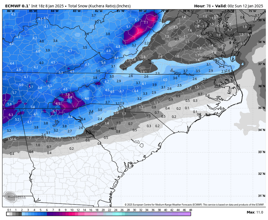
NC-IMBY post. The models continue to key in on a band setting up over i85. Whoever find themselves in that band will likely be where the highest totals fall in NC. Outside of the southwest mountains, the RDPS has consistently shown the highest total along i77 from Statesville to Huntersville (roughly 5 inches).
-
Again guys, when the GFS and NAM get a clue on the SLP track evolution, you will see a similar scenario as the Euro/RGEM evolve with them. Just a bit juicer QPF. The end result will likely be the EURO with a bit more precip totals. I would say .25 to .5. The only thing I could see screwing up SNOW totals is IP in the eastern edges of the snow growth zones.
-
Confident Weenie forecast prediction. 10PM Tonight: We'll be getting closer to the NAM range. It will trend south with the SLP to match up with the EURO and show solid NC snow hit. The weenies will freak out and start buying sleds. 10PM Thursday: The NAM QPF will start to decrease a bit to come in line with the EURO/GFS. Weenies will then starting drinking again and curse about the snow drought. 10PM Friday: It will start to snow resulting in a general 1 to 3 inches across the area and weenies will be rejoice making snow angels talking about how great the models were.
-
I'll qualify this as IMBY - NC related. Given the wave is shearing out it seems the expectation should be for QPF around .25 to .5. The question then arises as to precip type. One thing to note, is the GFS has continually taken the SLP further NW than the euro, which changes everyone over to zr or rain. It literally takes from Augusta GA to Hatteras vs the Euro which has it near Albany GA and exiting near Charleston SC. Those are large differences. I would note, given the setup and climatology, the Euro would be far more likely scenario. Given the limited precip, thermals will be huge in this situation. It could be the difference between 4 inches of fluff and a 1/4" of sleet. Not saying compromise/middle road isn't possible either.
-
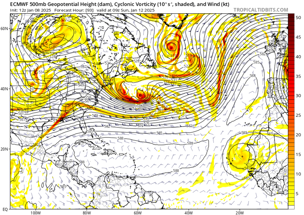
If you look where that SLP track is sitting (that's honestly all you need to pay attention to at this point). If it's in interior SC then sleet/freezing rain is a given. That's pretty far northwest and likely over done a bit if you look at the ensembles and euro. It's a tick east towards the other models which is good news if you like snow.
-
Took a look last night at the model verification scores (Projected SLP vs actual). The best ones in the 3 to 5 day range have consistently been the GFS ENS and EC ENS. Both of those are lined up pretty good. GFS being a little more westward. I like a track from GOM to south of Destin then tracking over southern GA into the Atlantic. From there a track just offshore. Snow wise this favors the northern deep south and western/northern NC area. Central NC would likely be an initial push of snow then over to ice (or rain depending on how far east you are due to the coastal front). With regard to NC only, that would be probably mostly snow in NC Foothills/Mountains over to Winston Salem and then tailing off as you go ENE in NC. The transition line will be somewhere in between. AKA the usual Bullchit.

