HKY_WX
-
Posts
3,246 -
Joined
-
Last visited
Content Type
Profiles
Blogs
Forums
American Weather
Media Demo
Store
Gallery
Everything posted by HKY_WX
-
Wind wise Hugo was worse. Flood wise, definitely in the past 50 years. Probably more.
-
There's been many late Feb and March Ice events. It's a non issue, at least in NC.
-
I'd take anything at this point.
-
It is also pretty amazing how well it's been forecasted by the weekly cfs for the past month or so.
-
This is normally an amazing winter weather pattern for NC, climo wise. It's the best pattern printed up by the models in many years from a snow and ice standpoint. Hopefully we don't screw it up.
-
And this is why you guys are weenies.
-
Yeah just noticed this. Long way to go, especially for new England.
-
Eyewall is starting to look like a major cane now on radar. I wish the timing of this was 12hrs later so I could sleep.
-
Water vapor is often good in these scenarios when you're watching eyewall dynamics. I think we're about 2 or 3 hours from it truly clearing out.
-
Wouldn't take much of a leap to get there.
-
It's probably a bit premature to judge the Eye size. Eye is still clearing out/obscured and looks slightly elliptical on radar. I'd wait a few more hours to see how it matures.
-
Radar looks pretty classic. Only difference is the eyewall doesn't have that ring of fire look you see in high end cat 4 and 5. Can she make it before running out of water? We'll see. Cat 3 is pretty much a given at this point.
-
Water temp at this buoy 112m NW of Tampa is 88F. This is about 2 to 3* above the August average for that location. Combined with the low shear and upper level trough enhancement, pretty ideal setup up until landfall. Not sure I would expect any weakening. In fact, this looks pretty ideal for some explosive strengthening tonight. Perhaps more so than even forecasted. Not looking too good. If we see anymore trends west TLH could see some wild winds. NDBC - Station 42036 Recent Data (noaa.gov)
-
Seeing a polar vortex or piece of it over the lakes is pretty impressive. This can sometimes produce strong vorts/clippers for our area. There's a lot of possibilities, but I don't see anything until after this upcoming system. The ski areas are about to cash in big time.

-
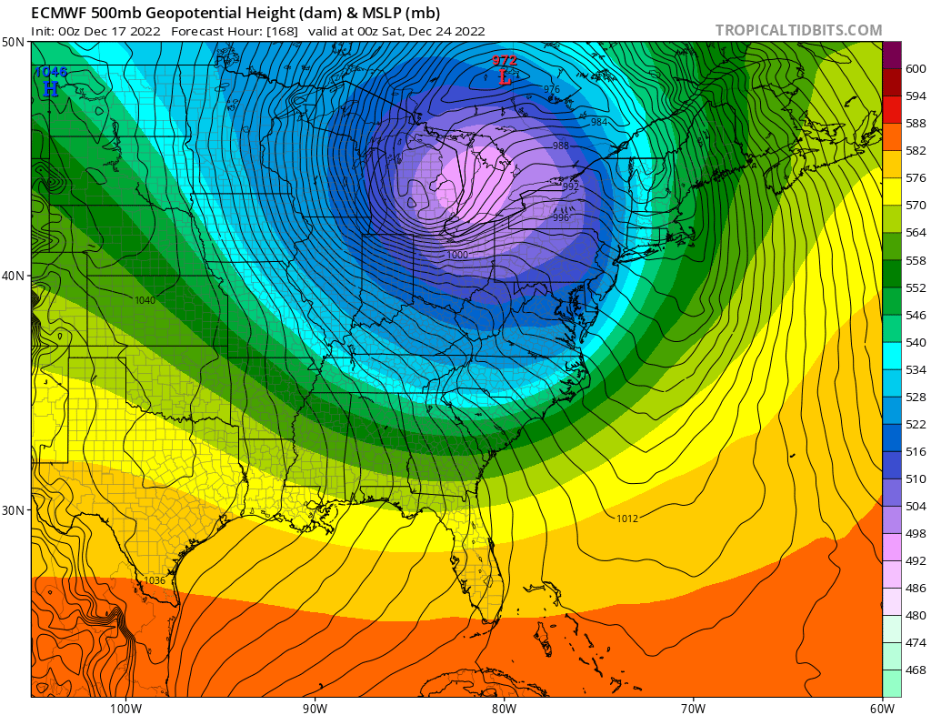
The Northern Hemispheric pattern setting up is probably the best we've seen since 09/10 and 10/11(if you like snow in the east). Anytime you get such extreme blocking in the Atlantic (-NAO), the model trends are usually in favor of increased amplification and cutoffs upstream. Aka any fart in the wind can turn into a SECS. This pattern will likely produce, but I wouldn't get too caught up in the individual model solutions this far out.
-
I Def think there will be some gusts 60+ in the triangle this evening. Not sure what amount of power outages that will equate to though.
-
Yeah the centers are no longer vertically stacked like a traditional Hurricane. It's tougher to make a real landfall call. I'd prob go by the slp wherever that is currently located.
-
55 here in Wake Forest with gusts in the 30s. It does feel more like a noreaster than a cane. Def more of a subtropical storm now as it gains lattitude.
-
Best wind potential will be this evening. IMO this storm will continue to error east of track. Should be some good rain totals and gusts later this eve in central NC.
-
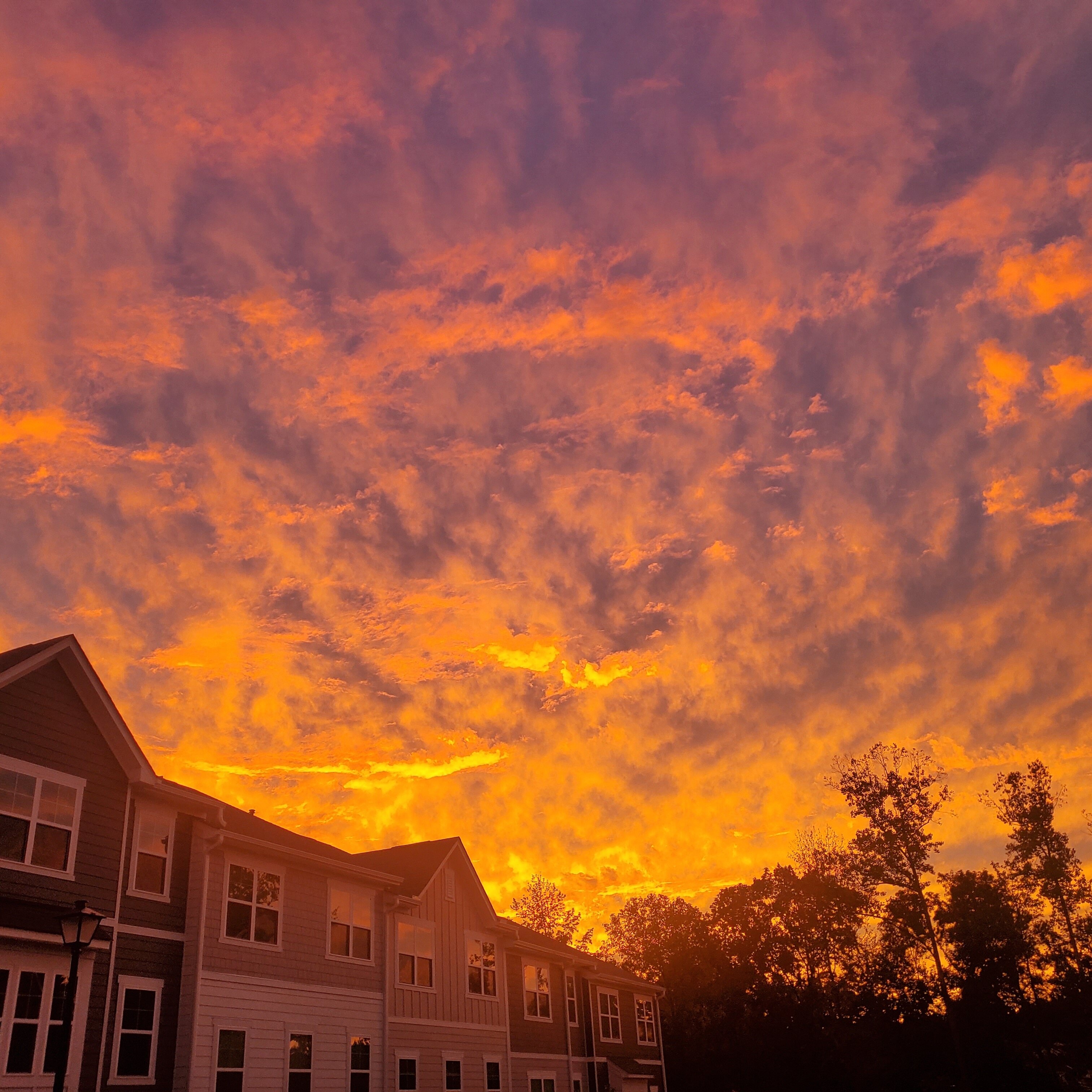
Pre Ian sunset

-
This will be a solid wind event through central SC/NC. The main reason is we're combining a Hurricane with a HP over the northeast. The gradient will be strong. The wind will mostly be confined to Friday/Friday Night though.
-
NC piedmont will definitely have some good gusts tomorrow afternoon/evenining. The trends continued to push it further east up the coastline. Combining this with the HP will make for a tight pressure gradient up here. Should be an interesting day tomorrow.
-
I'm assuming this might be based on the amount of rescue calls they were getting in yesterday and couldn't respond to. Let's hope those people figured out a way to stay alive.
-
Haven't seen surge images like this since Katrina.
-
Lots of water rising/help calls on the Lee county florida ems/fire line.