

78Blizzard
-
Posts
4,061 -
Joined
-
Last visited
Content Type
Profiles
Blogs
Forums
American Weather
Media Demo
Store
Gallery
Everything posted by 78Blizzard
-
“Cory’s in LA! Let’s MECS!” Jan. 24-26 Disco
78Blizzard replied to TheSnowman's topic in New England
Monday @12z has me at 21", and 27" at 06z Tuesday, so 6" inches. -
“Cory’s in LA! Let’s MECS!” Jan. 24-26 Disco
78Blizzard replied to TheSnowman's topic in New England
Pretty much held serve. -
“Cory’s in LA! Let’s MECS!” Jan. 24-26 Disco
78Blizzard replied to TheSnowman's topic in New England
-
“Cory’s in LA! Let’s MECS!” Jan. 24-26 Disco
78Blizzard replied to TheSnowman's topic in New England
And the qpf enhancement continues run after run. -
“Cory’s in LA! Let’s MECS!” Jan. 24-26 Disco
78Blizzard replied to TheSnowman's topic in New England
Gives me 6" after 12z Monday, right up to 06z Tuesday. -
“Cory’s in LA! Let’s MECS!” Jan. 24-26 Disco
78Blizzard replied to TheSnowman's topic in New England
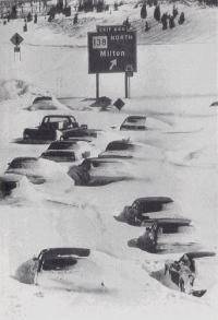
Boston in Feb '78 had snow at rates of up to 4 inches/hr, combined with hurricane-force winds and coastal flooding due to a record storm surge. This storm will be tame compared to that one. -
“Cory’s in LA! Let’s MECS!” Jan. 24-26 Disco
78Blizzard replied to TheSnowman's topic in New England
The town finally picked up the Christmas trees yesterday. I had sent them an email 2 days ago warning them that the trees could become a hidden hazard under the snow, and that all the snow and ice would only make the trees heavier for pickup. I guess they got the message. Usually they pick up the trees the week following New Year's Day. -
“Cory’s in LA! Let’s MECS!” Jan. 24-26 Disco
78Blizzard replied to TheSnowman's topic in New England
The Euro is the weakest of the models in eastern areas. -
“Cory’s in LA! Let’s MECS!” Jan. 24-26 Disco
78Blizzard replied to TheSnowman's topic in New England
Each model run of just about every model keeps increasing the qpf, getting closer to 2" for the storm total. It looks like we should add 3-4 inches on Monday after 12z. -
January 2026 regional war/obs/disco thread
78Blizzard replied to Baroclinic Zone's topic in New England
Euro has a nice snowstorm for the Cape on Friday. -
“Cory’s in LA! Let’s MECS!” Jan. 24-26 Disco
78Blizzard replied to TheSnowman's topic in New England
Yup. -
“Cory’s in LA! Let’s MECS!” Jan. 24-26 Disco
78Blizzard replied to TheSnowman's topic in New England
Agree. -
“Cory’s in LA! Let’s MECS!” Jan. 24-26 Disco
78Blizzard replied to TheSnowman's topic in New England
I noted earlier that there is something wrong with Pivotal's 10-1 ratio on both the 18z and 0z runs for the Ukie, at least. The 10-1 snowfall total doesn't correspond with the qpf. -
“Cory’s in LA! Let’s MECS!” Jan. 24-26 Disco
78Blizzard replied to TheSnowman's topic in New England
Those Storm Vista maps are always overdone. I don't see that in any of the model runs on Pivotal. Those are 10-1 ratios, which would bring E MA to 30" or more with the higher ratios. -
“Cory’s in LA! Let’s MECS!” Jan. 24-26 Disco
78Blizzard replied to TheSnowman's topic in New England
Something is wrong with Pivotal's Ukie algorithm. The 18z and 0z 10-1 snowfall totals are much higher than the qpf would suggest. -
“Cory’s in LA! Let’s MECS!” Jan. 24-26 Disco
78Blizzard replied to TheSnowman's topic in New England
ICON was a bit colder aloft than at 18z, so that helped the ratios. And that was a good trend to stop the progression of the taint. And verbatim after 12z, that added another 4 inches thanks to the ratios. -
“Cory’s in LA! Let’s MECS!” Jan. 24-26 Disco
78Blizzard replied to TheSnowman's topic in New England
The Canadian models are the least impressive. -
“Cory’s in LA! Let’s MECS!” Jan. 24-26 Disco
78Blizzard replied to TheSnowman's topic in New England
Sleet doesn't get as far north as the Nam in SE NE. Also, more amped than 12z. -
“Cory’s in LA! Let’s MECS!” Jan. 24-26 Disco
78Blizzard replied to TheSnowman's topic in New England
NAM is a touch warmer this run. -
“Cory’s in LA! Let’s MECS!” Jan. 24-26 Disco
78Blizzard replied to TheSnowman's topic in New England
GFS does show winds of 15 kts with higher gusts in eastern areas between 06z and 12z Monday, so there could be some blizzard conditions for a time, but few will be on the road at that time thankfully. Winds were even stronger and for longer on the NAM. -
“Cory’s in LA! Let’s MECS!” Jan. 24-26 Disco
78Blizzard replied to TheSnowman's topic in New England
Very little here. Just noise at this point. -
“Cory’s in LA! Let’s MECS!” Jan. 24-26 Disco
78Blizzard replied to TheSnowman's topic in New England
It's been quite a while since we've had days and days of model consistency so far ahead of a blockbuster storm, without even one model run losing the storm or sending it ots, . -
“Cory’s in LA! Let’s MECS!” Jan. 24-26 Disco
78Blizzard replied to TheSnowman's topic in New England
-
“Cory’s in LA! Let’s MECS!” Jan. 24-26 Disco
78Blizzard replied to TheSnowman's topic in New England
That was 12z. The 0z is even more amped. -
“Cory’s in LA! Let’s MECS!” Jan. 24-26 Disco
78Blizzard replied to TheSnowman's topic in New England
Still adds another 3-4 inches in far eastern areas after 12z, with around .2 qpf, with ratios.


