George001
-
Posts
6,996 -
Joined
-
Last visited
Content Type
Profiles
Blogs
Forums
American Weather
Media Demo
Store
Gallery
Everything posted by George001
-
Looks a bit like the 12z Canadian with that northern energy closed off
-
I disagree no steps back from the NAM. ICON yes, but the ICON is terrible.
-
This does not look bad at all
-
Yeah 18z looked a little better, slower overall evolution with the northern branch farther west. But even the 12z euro which had a really weak surface reflection I thought looked good at h5.
-
This looks really close to something big (12+). I don’t get how the surface can be so weak with this look at h5. It needs some work yeah but even as is I would think the surface low would end up stronger.
-
What really interests me is that piece in Canada. A slower evolution would hopefully give that more time to catch up and phase in. Without that this is just a moderate event, I’m looking for something big.
-
I hope the models are wrong
-
Eh I hate winters that shut off early (like last year). If we get this threat to pan out, then after the warm spell late month another big one to pan out in March, I’ll be happy.
-
That’s not true, sometimes cutters in the long range turn into Miller bs. The Dec 2020 storm was modeled to cut to Wisconsin in the long range, and ended up being a Miller b nor’easter with over a foot of snow in my area.
-
I’m straight up ignoring the surface this was a good run. Not a hit but a step in the right direction. Need to get that third piece to phase in though if we want something really big.
-
euro is better than 0z at h5. Northern stream is digging more and less energy being held back out west.
-
That’s like a 200 miles shift west in one run, I buy it too with the ridge axis as far west as it is. This seems familiar…
-
That is amazing. It’s actually so far west at the surface that eastern areas rain lol
-
Subby hole over eastern mass, big hit for the cape and western areas.

-
Big shift west from last run, great start to the 0z suite.
-
I have a question for those smarter than me with this stuff, it looks like this run of the gfs is going to be a close miss or graze eastern areas. That third piece of energy diving in from Canada looks to be a wild card, do we want that closer to us to phase in, or is that unrealistic? Would we be better off having that hold back more? My thought process is that we don’t need the third piece, and if we get the phasing of the first 2 pieces we can get a big storm but not historic like the blizzard, which is a high probability outcome. However, if the 3rd piece trends closer, if it phases in it has the potenital to be historic like the January blizzard, which is a low probability outcome. If it does trend closer but not close enough to phase though, it would act as a kicker and we get nothing, which is also a high probability outcome.

-
Nice, good start to the 0z suite. Hopefully the other models trend in the right direction as well.
-
Hopefully the 2/13-14 shortwave gets out faster and the 2/15 one is a little slower. I’m going to root for the Miller b, those are usually better here. EPS will be interesting.
-
Euro trying for a Miller b
-
I don’t understand all the negativity with this storm, the upper air pattern looks good and we are really just a few small tweaks away from a big hit.
-
Theres one and a half months left of winter, SSW or not there’s no reason to be negative at this point.
-
This doesn’t look that bad, just need all the energy to consolidate. With the strong western ridge I don’t see why the northern energy would be that progressive.
-
Wow that is so close to something much bigger

-
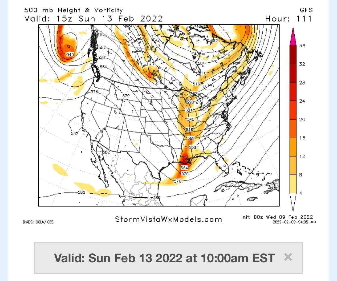
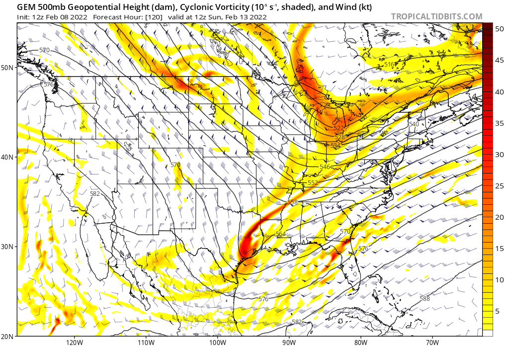
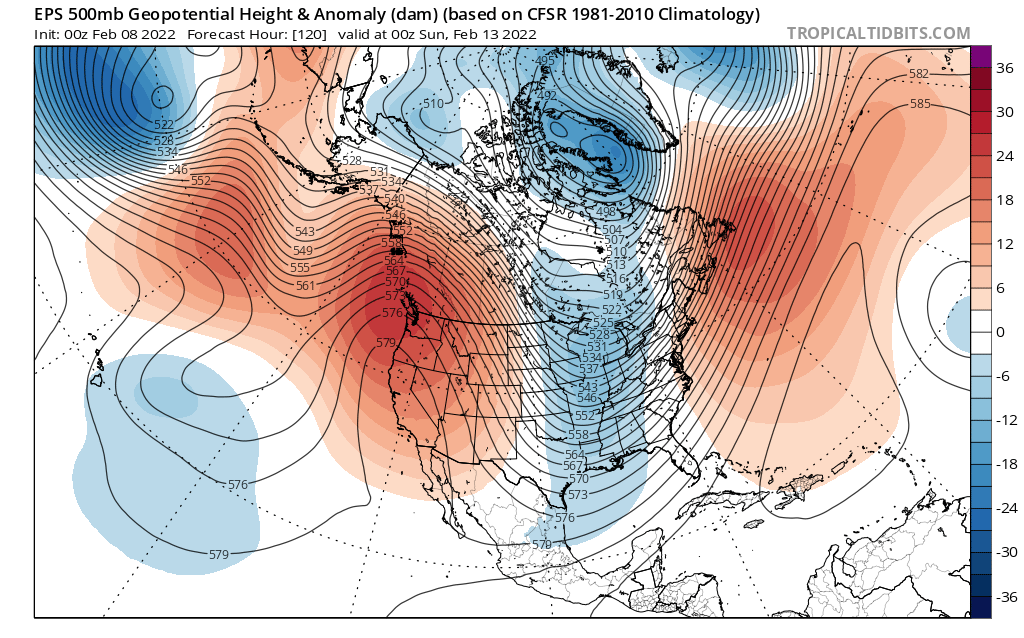
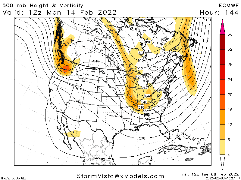
Lots of improvements in the upper levels on the models. Ensembles are starting to show more hits at the surface as well though it still needs a little work. The pattern looks really good, and it doesn’t look like it’s far from something much bigger looking at the pattern and upper levels on the models either.
-
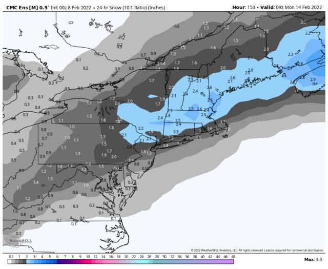
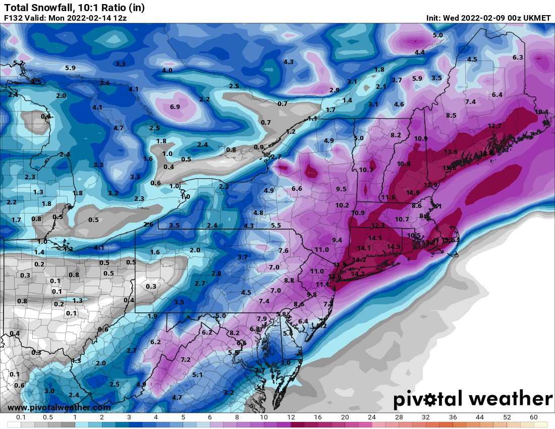
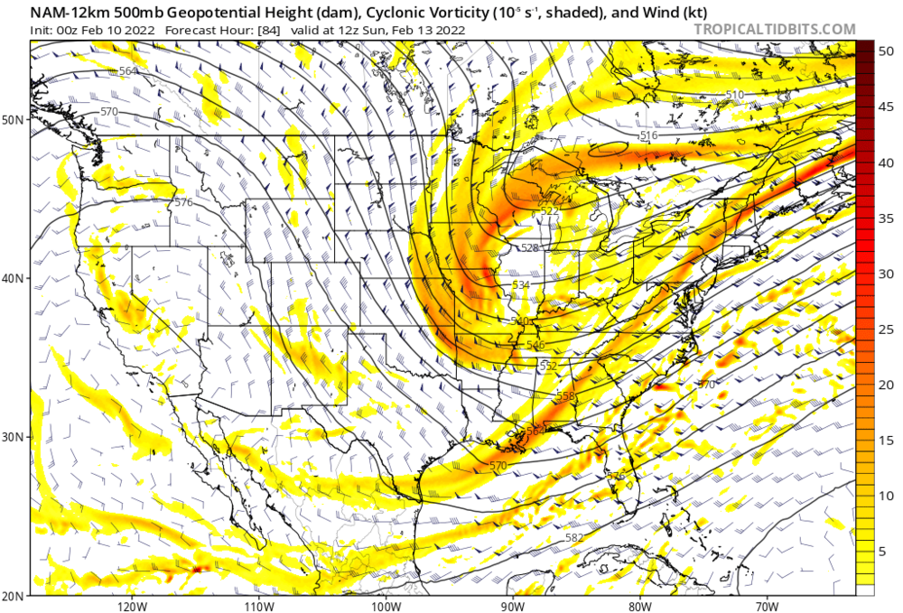
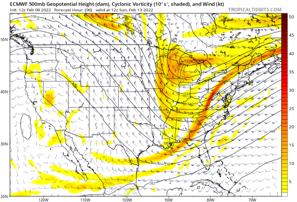
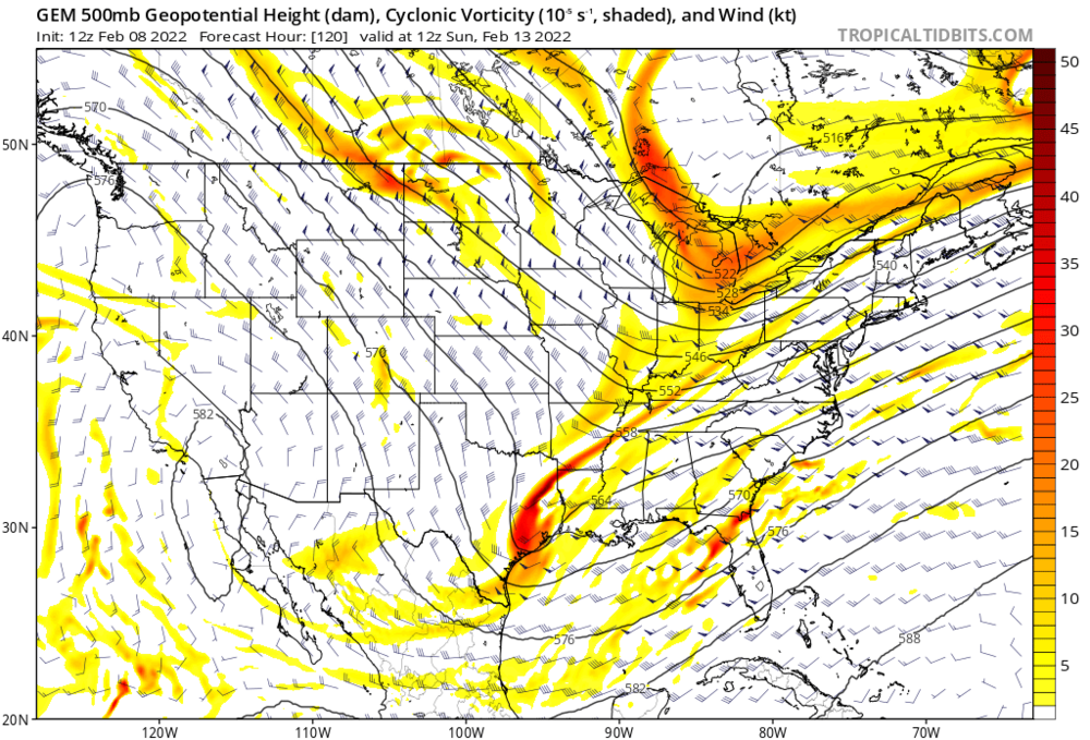
The Euro appears to be a miss, like the other guidance. However, the Canadian ensembles have trended towards much more amplified northern energy, leading to a massive shift west with the lows as well as increasing the strength of the lows. It is now signaling snow in New England. Lets see what the eps says, I’d like to see continued improvement in the upper levels even if the surface doesn’t reflect it. This far out having the ensembles on board is a big deal.