George001
-
Posts
6,996 -
Joined
-
Last visited
Content Type
Profiles
Blogs
Forums
American Weather
Media Demo
Store
Gallery
Everything posted by George001
-
Not saying it’s going to be anything huge, but if it gets cold the snow chances will follow. Some of the models are showing below average temps.
-
Even late Feb which looked like it was going to torch is trending cold and snowy.
-
Yep (from another forum)
-
Yeah the eps has shifted colder in the long range. Winter isn’t going anywhere.
-
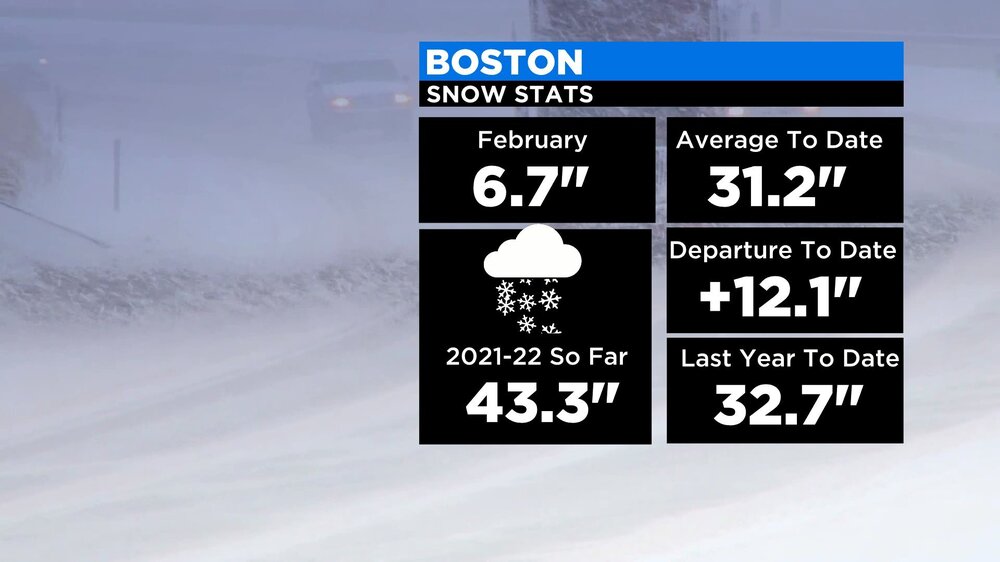
I’m feeling much more optimistic about winter than I was a few days ago with the big overperformer yesterday and positive trends on the models for the long range. Boston already has had more snow than all of last year (I believe Boston finished with just under 40 last year) and we have a month and a half left of winter.
-
Yeah although climo isn’t quite as favorable as late Jan to early Feb, March is without question a winter month. I don’t know what the exact data is for this, but it seems like in SNE it’s easier to get a big March than a big December.
-
I’m seeing a lot of people writing off winter, wayyyyy too early. Honestly, I’d be surprised if we don’t get at least one more significant storm (6+) before spring.
-
I woke up to 8 inches of snow, wow. We were forecast to only get a dusting just the day before the storm, nice positive bust.
-
I agree, there are signs that March could be interesting. Latest models look better with the MJO, no more getting stuck in the warm phases.
-
I don’t get the whole mid March is too late, climo sucks ect. I got a massive 2 foot blizzard in mid March 2018, which was just a few years ago…. Yeah temps are often an issue, but with March storms you also often will have more moisture available so it’s kind of a double edged sword there. If the setup is good, some of the biggest storms happen in March.
-
The snow rate has increased here over the past couple of hours.
-
You still thinking big March, even if it’s for a different reason than you thought originally (pac driven instead of SSW)? The models are showing signs that the mild pattern could break first week of March.
-
MJO looks to be going into the COD on the latest models end of Feb. Hopefully that’s right.
-
That fronto band has definitely delivered so far, got a couple inches already.
-
Yeah hrrr looks good, already got a couple inches from the first band. This is shaping up to be a nice storm, nothing huge but it’s nice to have what looked like nothing even 24 hours pan out as a moderate snow event.
-
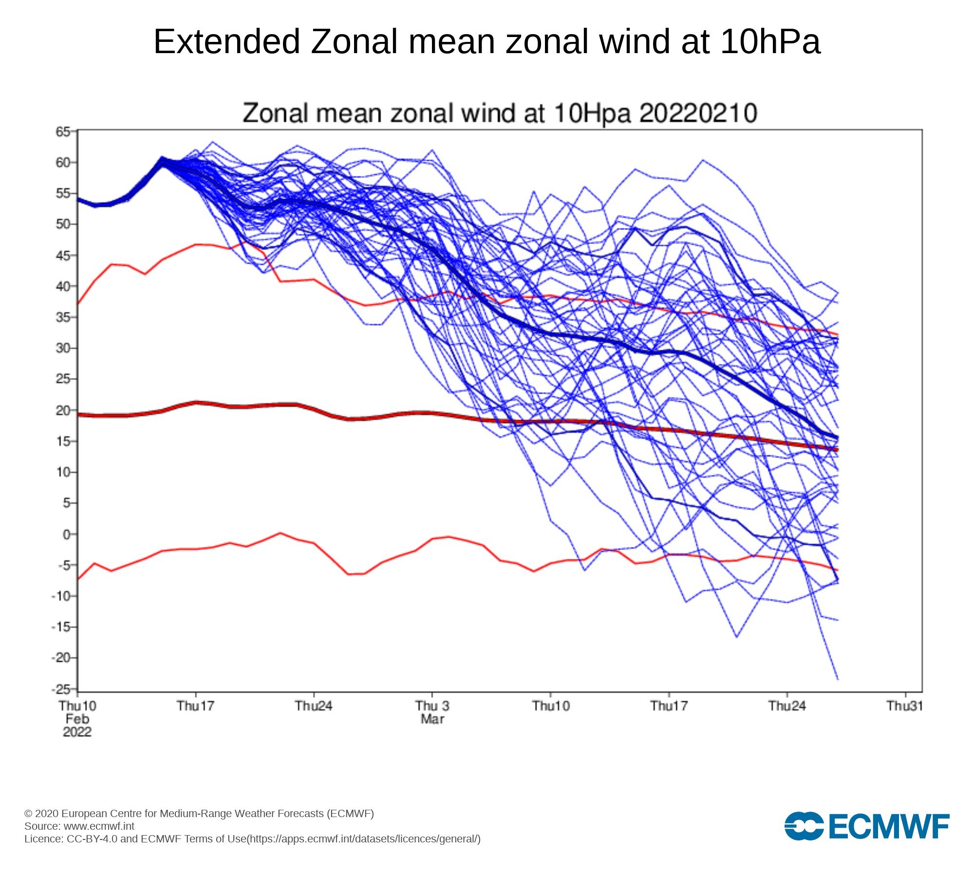
We need this to weaken much faster for a big March. We aren’t going to get a SSW or anything before it’s too late, but if we can get it to weaken to like average and then get some pacific help we have a shot.
-
This storm looks like it’s coming back. I’m honestly surprised I thought it was dead like 2 days ago, and gave up on it. The radar looks really good and the models keep trending west. I’m thinking 6-10 with an iso foot in some areas. 6+ as far NW as central mass, with high snow ratios leading to higher totals than model snow maps have. This setup looks similar to the early Jan storm.
-
Right now I am, but if this winter goes out with a whimper like last year I’ll end up below average. The long range looks awful too.
-
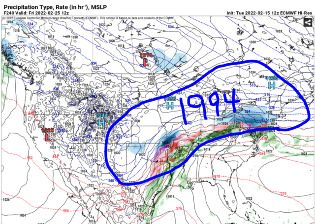
This looks like an interesting setup for the 20th. Not great, looks too flat but with a few adjustments maybe we have something. It looks like we are going to torch after this so maybe we were looking at the wrong system for the big pattern changing storm.
-
Not perfect but I would take that and run, nothing wrong with a bunch of smaller 6-12 type deals. We have been missing that this year. I would like to see one more big one before winter ends, but it looks like if we get one it’s going to wait until March. This mid month threat just doesn’t want to cooperate.
-
I’m out on this. Too many steps back, we are going to need major changes for something big which is very unlikely at this point. The energy just doesn’t want to phase.
-
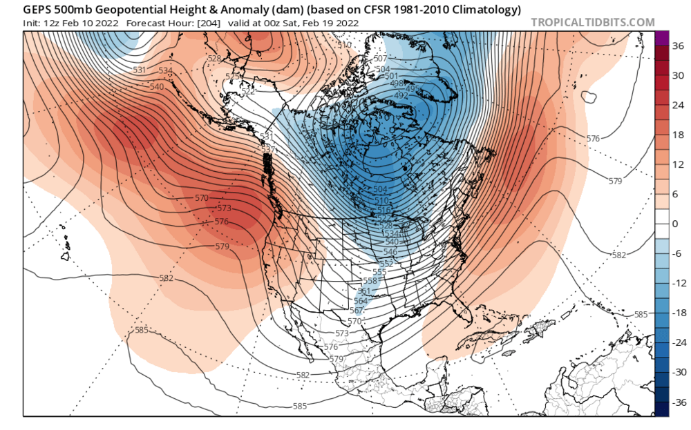
This winter ****ing sucks it’s last year all over again. Looks promising in late Jan and early Feb, then the models have the pattern going to shit with a death vortex over the North Pole and Alaska. The mid month pattern changing storm trended in the wrong direction and now it’s looking like that which once looked promising, has a low probability to become a big storm. This winter is going to go out with a whimper just like last year, absolutely pathetic sorry excuse for a winter. I should have known once the polar vortex started deepening well into January that winter was cooked.
-
I’m starting to get nervous. Not giving up yet, still has time to come back but I wanted to see a stronger low tonight even if it’s offshore. We need the southern energy to be more consolidated, with the ridge axis so far west and amplified I would think it would be more consolidated. Idk what’s going on.
-
God ****ing damn it we can’t afford to have steps back like that at this stage. Navy is out to sea too. We need to get the Navy on board asap.
-
I’m interested to see what the Canadian says. If we get another bump west with the northern energy on that we will start seeing the strength of the low increase a lot, none of that 1000s and 990s mb nonsense.