George001
-
Posts
6,996 -
Joined
-
Last visited
Content Type
Profiles
Blogs
Forums
American Weather
Media Demo
Store
Gallery
Everything posted by George001
-

Winter storm for the 25th of February is imminent.
George001 replied to Typhoon Tip's topic in New England
Looks a lot better in the upper levels as well -
Winter storm for the 25th of February is imminent.
George001 replied to Typhoon Tip's topic in New England
0 line looks pretty far south to me. That’s all snow everywhere outside extreme southern CT and RI.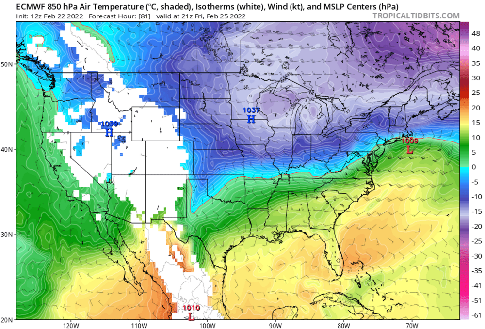
-
Winter storm for the 25th of February is imminent.
George001 replied to Typhoon Tip's topic in New England
This isn’t a normal SWFE, it’s starting to morph into a SWFE/Miller B hybrid. The miller B redevelopment would keep us south of the pike snow for longer, possibly even the entire storm. -
Miller B?
-
Winter storm for the 25th of February is imminent.
George001 replied to Typhoon Tip's topic in New England
That’s a decent improvement over the last run. 10 inches all the way to the CT-RI border. -
Winter storm for the 25th of February is imminent.
George001 replied to Typhoon Tip's topic in New England
Pics? -
March 2022 Obs/Disc: In Like a Lamb, Out Like a Butterfly
George001 replied to 40/70 Benchmark's topic in New England
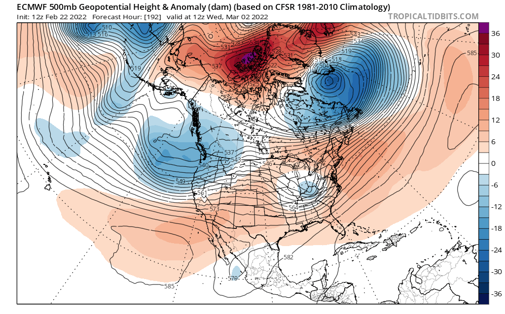
Eps looks really interesting. Still needs a few tweaks but this far out it’s a good look.
-
March 2022 Obs/Disc: In Like a Lamb, Out Like a Butterfly
George001 replied to 40/70 Benchmark's topic in New England
Ray, what do you think about the early March threat? I’m not a fan of that energy out west with a shallow and too far east pac ridge. If we can get some changes with the pac though this could be an interesting threat. The Atlantic doesn’t look as hostile.
-
It’s definitely a long shot with how bad the models look right now for that, but like Ant said it’s still 6 days out and there’s another storm ahead of it so there is still a lot of time for changes. I agree though 3/2 is looking like it has a better chance.
-
Yeah I’m still keeping an eye on it but the models aren’t even close. Could the wave spacing with the Friday storm lingering a bit be an issue?
-
Winter storm for the 25th of February is imminent.
George001 replied to Typhoon Tip's topic in New England
Yeah I do think it’s overdone, but not by much especially northern areas. Will I get 18 inches? Probably not, but someone farther north might. I could easily end up with 10-12 inches if the reach around idea ends up verifying. -
Winter storm for the 25th of February is imminent.
George001 replied to Typhoon Tip's topic in New England
Holy shit that gives even Ant 8 inches. That’s more aggressive than even my forecast. -
Winter storm for the 25th of February is imminent.
George001 replied to Typhoon Tip's topic in New England
I don’t really know how to read those super well but it looks like to my untrained eye that everything is below freezing. I’m not so sure it is overdone, that reach around signal is on all guidance. Features like that wouldnt the mesoscale models be able to pick up on better? If anything, I would think it’s being underdone by the global models. -
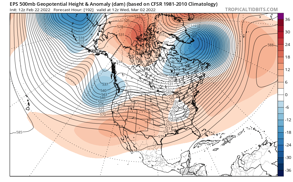
The ridge out west looks very good but right now the guidance doesn’t want to phase the energy. With that upper air pattern though this storm has a chance to come back. Even if it misses guidance is hinting at a vigorous shortwave behind it, could lead to a threat in the March 2-4 period Tip mentioned earlier. We would need the shortwave to dig more, but the upper air pattern suggests it has room to do so. So that would be 3 threats over the next 10 days, active pattern ahead.
-
Winter storm for the 25th of February is imminent.
George001 replied to Typhoon Tip's topic in New England
Tossed, not in line with the other guidance. -
Winter storm for the 25th of February is imminent.
George001 replied to Typhoon Tip's topic in New England
Yeah there is a limit to how far north this can go. -
Winter storm for the 25th of February is imminent.
George001 replied to Typhoon Tip's topic in New England
New Euro is out, and it looks really good even south of the pike. North of the pike it has some areas with over a foot. Goalposts are narrowing with a similar look across guidance. Looks like the Euro is most north and Canadian is most south. I’m thinking a blend of my big 3 with more weight towards the Euro. I do think we will see qpf juice up some closer to the event with the trend towards aggressive secondary redevelopment (Miller B) continuing. Snow ratios I’m assuming 10:1. My early call: Boston and pike north: 12-16 inches, isolated 18 inches CT-RI/Mass border on north up to the pike area: 10-14 inches South shore and upper cape: 6-10 inches -
Winter storm for the 25th of February is imminent.
George001 replied to Typhoon Tip's topic in New England
I agree that it’s going to tick north a bit. However It’s also going to become more juiced up, and the better dynamics would offset the north tick, leading to a cooler and snowier solution even south of the pike imo. -
Winter storm for the 25th of February is imminent.
George001 replied to Typhoon Tip's topic in New England
Navy on board!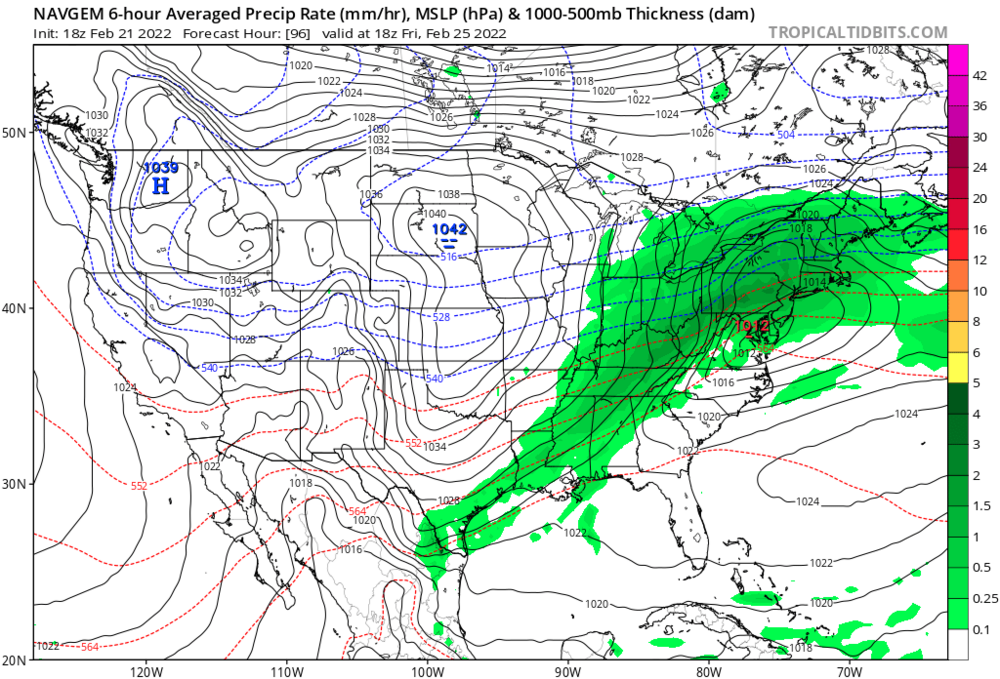

-
Winter storm for the 25th of February is imminent.
George001 replied to Typhoon Tip's topic in New England
If they do, that would put even your area back in the game. You wouldn’t stay all snow in NYC but several inches of front end is very possible if the models keep trending that way. -
Winter storm for the 25th of February is imminent.
George001 replied to Typhoon Tip's topic in New England
Wow that’s a snowstorm right down to the cape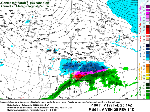
-
Winter storm for the 25th of February is imminent.
George001 replied to Typhoon Tip's topic in New England
I’m extremely bullish on the Feb 28th threat. It doesn’t look great at the surface, but the upper levels tell a different story (I go in more detail in the late winter finale thread). Aside from being a little more optimistic about the Friday storm now, my thoughts have not changed since I made that thread. The guidance is still advertising a very good pattern. -
Winter storm for the 25th of February is imminent.
George001 replied to Typhoon Tip's topic in New England
Even your area in NYC gets half a foot now on that. That’s a big shift south on the gfs. -
Winter storm for the 25th of February is imminent.
George001 replied to Typhoon Tip's topic in New England
Not as much as it seems. 80 inches is a lot, but there’s a good chance Boston gets to 50 on Friday, probably more. Then there is the next week storm, which I am extremely bullish on due to how amplified the ridge out west is. There is a good chance Boston is at 60 or so inches headed into March (this is conservative based on the upper air pattern for the end of Feb) Then 20 or more inches on March. -
Winter storm for the 25th of February is imminent.
George001 replied to Typhoon Tip's topic in New England
Boston will be close to if not over 80 inches by the end of the winter imo