-
Posts
6,887 -
Joined
-
Last visited
Content Type
Profiles
Blogs
Forums
American Weather
Media Demo
Store
Gallery
Everything posted by George001
-
Canadian has the storm a couple days later
-
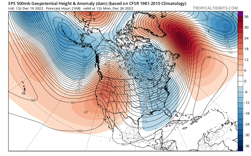
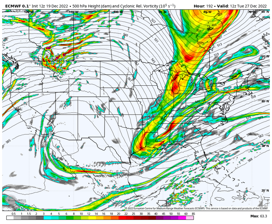
I know the models aren’t showing hits yet, but the 500s tell a different story. This look is REALLY close to something big for the shortwave diving down for the 27th threat after the big cutter. The western ridge axis is still quite far west, but it’s not offshore anymore. The NAO isn’t super negative but it is still negative which argues against a progressive solution (why I’m not buying the wave spacing issues, I’m thinking the northern energy will be much slower to enter the country). If that ridge pokes up a bit more and links up with the decaying block, I bet we will start seeing big solutions on the models. It’s really not far from doing so, it only needs a couple minor adjustments. This is a legitimate big dog Miller B nor’easter threat. That northern stream energy is quite powerful, and the teleconnections are in a transitory state.
-
Verbatim too progressive but it’s worth it watching this storm. This will likely change a lot until after the inland runner on Friday. The pieces need to come together, but if they do this storm has big potential, there is a lot of energy there.
-
It’s not looking great right now but just like how the models were wrong about the epic pattern, they could easily be wrong about the nasty +epo look. We track
-
March 2018 was amazing. It can snow in December, but climo is really unfavorable for anything big. March is more prone to massive blizzards. People can say im exaggerating, but that’s what March 13th 2018 was. I got so much snow it caused a gigantic tree in my backyard to collapse under the weight of the snow. It was also extremely windy, that was no ordinary nor’easter, that was 12+ hours of blizzard conditions.
-
Shades are wide open. Nothing is showing right now but something could easily pop up and bury all of SNE. I don’t think the pattern is great but who knows maybe we can get lucky.
-
Yeah just because we’re on the warm side of the storm doesn’t mean the storm isn’t impressive. It has the potential to develop into a historic blizzard, just not for us. It’s still going to be one hell of a storm for us with huge winds, coastal flooding, and heavy rain. That’s something that is worth tracking. It’s a weather board after all not just a snow board. We track rainstorms too on this forum, hell some of us even enjoy tracking rainstorms. Torch Tiger and Snowman19 for example probably threw a damn party when they saw the Euro cut the low into Michigan last night. They like warmer weather and massive rainstorms. They get a lot of shit for it, but all they are doing is celebrating the weather they enjoy. That’s no different than what snow weenies like myself do. I’m happy for them, we will get our blizzards later in the winter most likely, they will get their cutter for Christmas week. That’s why I love New England weather, there is something for everyone. If it just snowed all year long we wouldn’t have cool shit like bass fishing, golfing, etc.
-
The pattern did come (-nao, -epo, +pna), but the analogs didn’t work because the earth is warmer than it used to be. Yes I’m blaming climate change for this, I know I’ll get a lot of shit for it but this type of pattern used to be good until the damn ocean furnaced. Hell, the Atlantic is so warm I’m considering going to the cape and trolling for stripers right now in mid December. I bet I’d catch a massive bass. Oh well, on to January. After this cutter it looks like we will get a thaw for a bit on the long range models. I say bring it on, we need a pattern reset and reload.
-
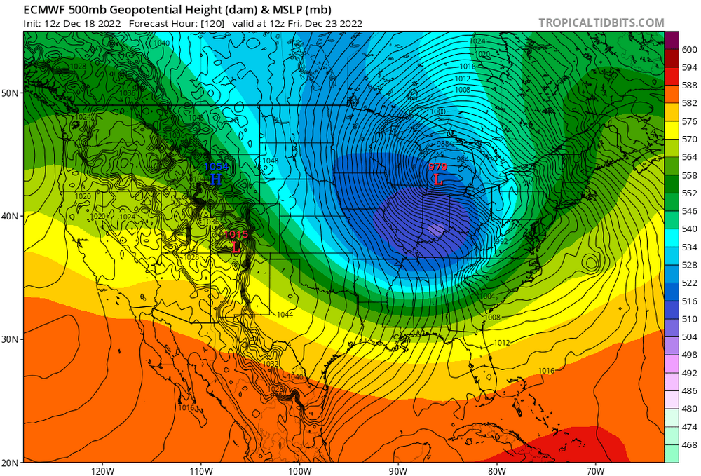
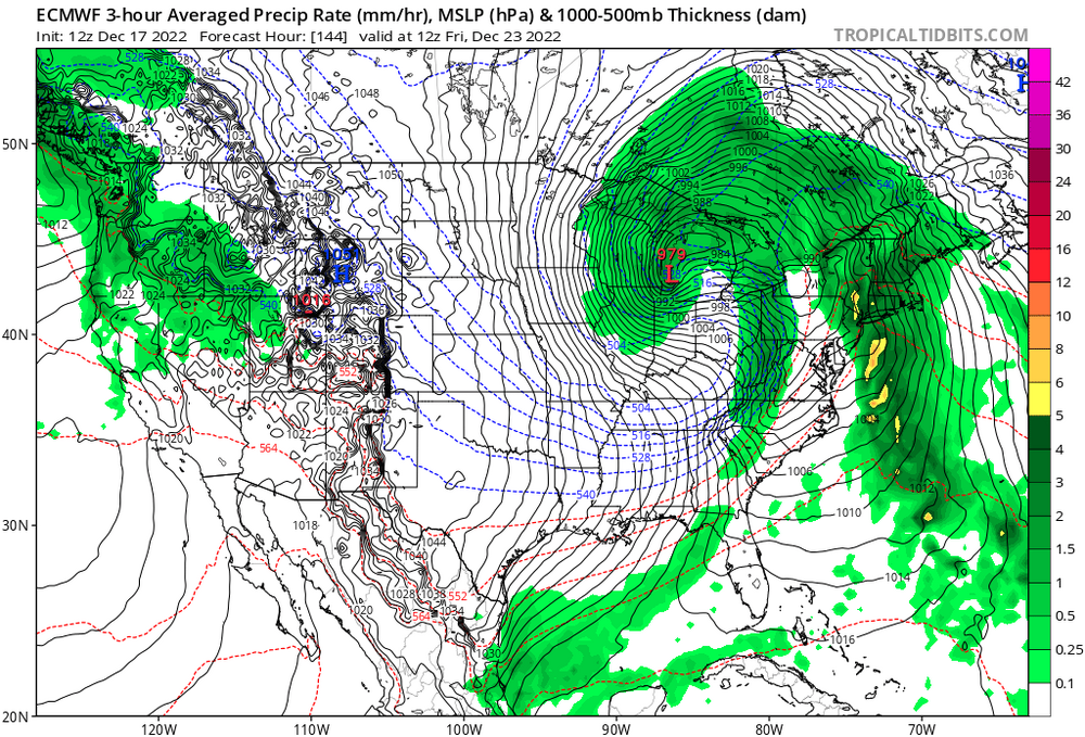
Euro has one hell of a storm, a 979mb low in Michigan. It looks like the models are starting to come to a consensus, the low isn’t quite going to get to Minnesota, but it’s not going to go over SNE like the gfs was saying either. It sucks that this won’t be snow for us, I jumped the gun for sure when I looked at negative NAO analogs in the past and assumed it would translate to multiple blizzards. Unfortunately, it doesn’t work that way. The temperature of the earth has increased, patterns that used to do one thing in the past may not do the same now. Is winter over? Hell no it isn’t, but this epic pattern that was hyped up didn’t really pan out. Oh well, I’m going to continue to track this storm. Yeah it’s going to rain, but still it’s one hell of a storm and will be exciting to track. Although most of us like snow here, there’s nothing wrong with getting excited about rainstorms too if they are a powerhouse like this one.


