George001
-
Posts
6,996 -
Joined
-
Last visited
Content Type
Profiles
Blogs
Forums
American Weather
Media Demo
Store
Gallery
Everything posted by George001
-
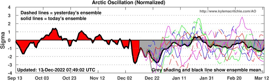
this threat looks a lot better than the Friday one. Verbatim the low is too inland to eastern areas, but the airmass is way colder than it will be for the Friday threat. The Friday threat probably won’t pan out for eastern areas, but it did go from a low In Wisconsin to a Miller B. Hell, the airmass is so cold for this threat, we might see decent snow totals even east of the low.
-
I hope this is right and we don’t have a long thaw in the middle of winter (3-4 week+). November and the first part of December were mild so we might have gotten the thaw out of the way early.

-
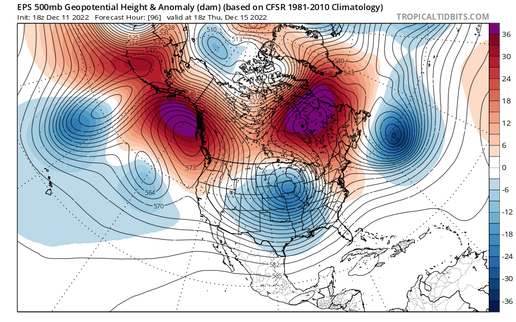
As frustrating as this pattern has been so far this is promising. The key will be getting the pacific to cooperate as well.
-
A lot of this subforum is still in the game, but I dipped once I saw the west to east winds on the models. Back to tracking the pattern for me unfortunately.
-
Ok the blizzard bumps last winter out of bad territory, but the previous 3 winters were bad and even last winter was really just a 3 week period in Jan, then shut off the next 8 weeks. Maybe my expectations are too high, but I was thinking we would get multiple blizzards this year looking at the pattern late November. Like 2010-2011 or 2014-2015.
-
Yeah, we need the mid Jan relaxation to disappear or be delayed to mid Feb for the epic winter that it looked like we were headed for in late November to verify. To be fair, that’s very possible and the EPS weeklies show about a 6 week favorable period. There’s going to be lulls, but the question is always when we get a favorable pattern how long will it last? Most years we do get a favorable pattern at some point (there are exceptions). How good the winter ends up being often depends on how long that favorable pattern lasts. Last year it only lasted 3 weeks (granted those 3 weeks were REALLY good), and the rest of the winter sucked. Hopefully we get 6-8 weeks of that epic pattern that showed up on the models earlier and not just 2-3 weeks.
-
It’s frustrating that we are still tracking a pattern and not an actual storm. We had a massive -nao and nothing to show for it, what kind of bullshit is this? The teleconnections looked great for a big snow on Friday and now it’s a strung out piece of shit. Sorry for the negativity it’s just the past few winters have been bad so it’s frustrating to see the same shit over and over again. Lows aren’t supposed to ram into a block!
-

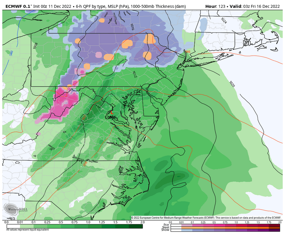
Preliminarily ... a medium impact partial Miller B, Friday
George001 replied to Typhoon Tip's topic in New England
For me I saw those west to east arrows and dipped, can’t have that mild ocean air blowing onshore especially this time of the year for eastern areas. Low isn’t strong enough to make up for it either, sucks. Farther inland has a better shot though. -
Preliminarily ... a medium impact partial Miller B, Friday
George001 replied to Typhoon Tip's topic in New England
Low is too weak for us -
Yeah I know I’m getting sick of it. The 10 days away thing gets old fast.
-
The pacific looks great on that, massive ridge out west. The current pattern we are in isn’t working so hopefully this verifies. I’m getting sick of seeing a trough out west.
-
How does sacrificing the 16th up the ante for the pattern after
-
Weaker is bad we want the low to get to the 970s
-
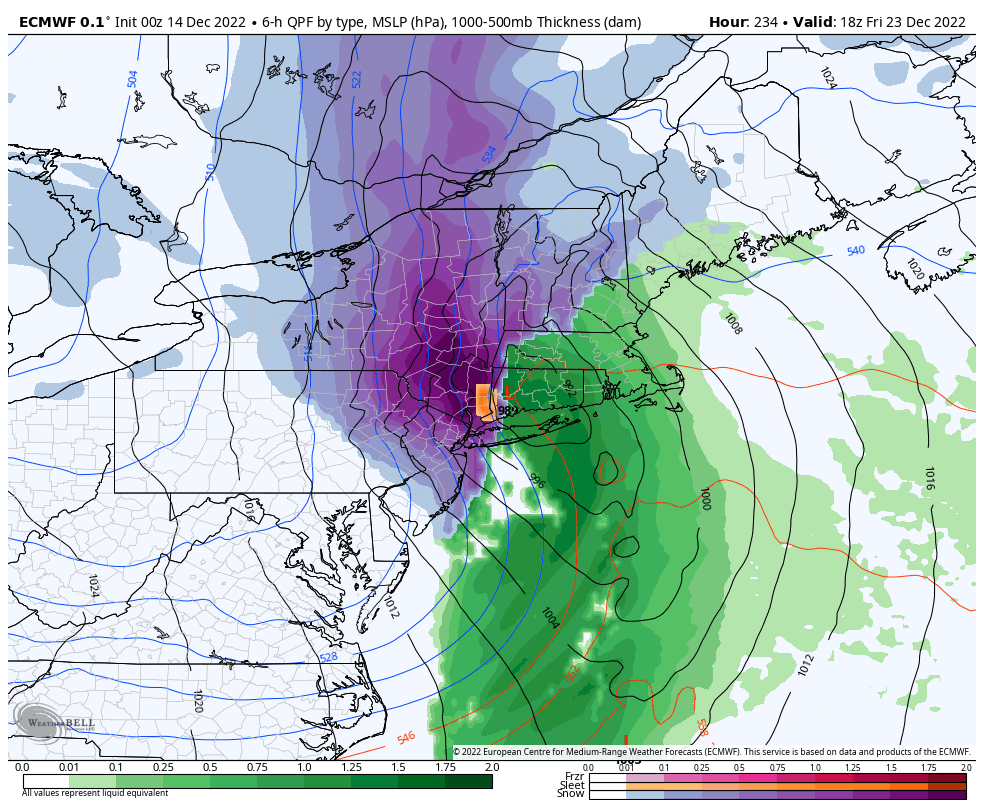
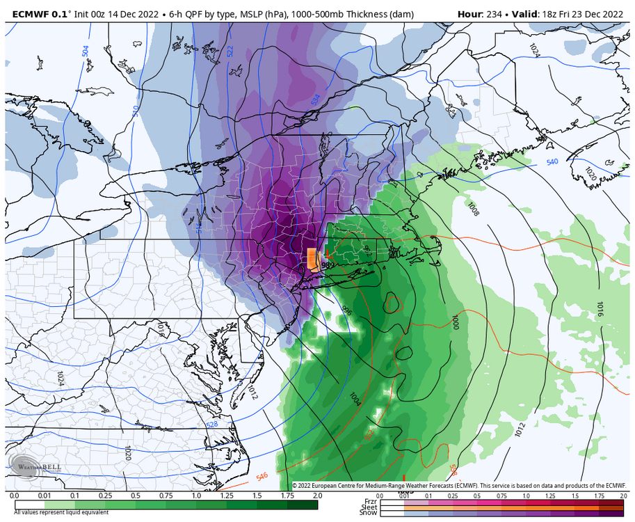
Agree, there’s no reason to kick the can with this look. There’s no way in hell the low cuts with this blocking in place, and there’s bo way in hell the low stays weak with a storm this powerful. Could I be wrong? Sure, but despite the bad trends im not going to give up on the potential for a slow moving Miller B like that Canadian run had a few days ago. It could easily trend back to that. Yeah there’s a threat xmas week, but there is a big threat this week as well.
-
We need to get back to the ULL going underneath for big snow chances. I’m getting fed up with the whole “tracking the pattern” thing, it’s time for some actual goddamn storms with 12+ potential!
-
Still time for the bad trends to reverse
-
holy shit that’s a big increase!
-
In all seriousness, that’s the look we need to start seeing on the other guidance the next couple of days. Seeing the Navy on board gives me a bit more hope that last nights bad trends didn’t kill this threat.
-
NAVY ON BOARD! LETS FUCKING GO!
-
Does it have more eastern extension? I noticed an increase in snow totals in eastern mass on the models last night.
-
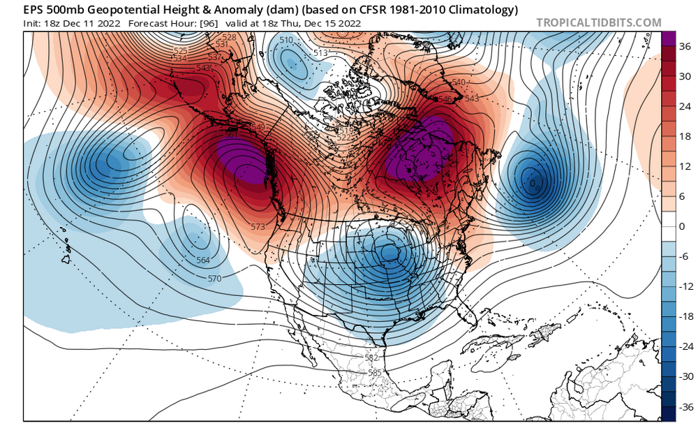
Nope, I don’t like seeing the ULL so far north on the models. The 500mb evolution looks a lot different and lower ceiling than it did 12z yesterday. We need that to come under us, none of that ULL staying in the Midwest and a piece of energy escaping out ahead of it bullshit. Fortunately there is still plenty of time for it to change back to the look it had yesterday.
-
Sure it’s possible but we would have to get very unlucky to get an inland runner with blocking this strong. But yeah my earlier post about the Euro looking better was wrong. I thought the better ridging out west would be good for us.
-
Gotta see the EPS first
-
Huh? I thought the Euro looked better early on. There was more ridging out west, the runs with more ridging out west had a more consolidated ULL, farther north track and a stronger low.
-
Looks good for us. Looks like it gets going a little later than last run, but is about to undergo rapid cyclogenesis as it moves ENE.