

George001
-
Posts
6,983 -
Joined
-
Last visited
Content Type
Profiles
Blogs
Forums
American Weather
Media Demo
Store
Gallery
Everything posted by George001
-
There’s 3 months left…. Way too early to give up. 2014-2015, 2012-2013 both started slow.
-
We need a weak nino not a big one
-

December 2021 Obs/Disco...Dreaming of a White-Weenie Xmas
George001 replied to 40/70 Benchmark's topic in New England
Wow that looks really good -
December 2021 Obs/Disco...Dreaming of a White-Weenie Xmas
George001 replied to 40/70 Benchmark's topic in New England
A week ago, I forecasted severe blizzard conditions in eastern mass due to the North Atlantic blocking in place. Today is the day I forecasted the blizzard conditions to occur, it is raining outside right now. -
December 2021 Obs/Disco...Dreaming of a White-Weenie Xmas
George001 replied to 40/70 Benchmark's topic in New England
Nope, my forecast busted again. I do think we get a couple of blizzards later in the winter though. The pattern change is getting delayed more than I thought. -
December 2021 Obs/Disco...Dreaming of a White-Weenie Xmas
George001 replied to 40/70 Benchmark's topic in New England
oh well, hopefully we can get a few decent storms and be on the right side of the gradient for the next couple weeks, and then once the trough out west goes away we start getting big nor’easters in January and February. The pattern looked really good, but the trough out west kept strengthening as we moved up in time. -
December 2021 Obs/Disco...Dreaming of a White-Weenie Xmas
George001 replied to 40/70 Benchmark's topic in New England
When is the trough out west expected to go away? -
December 2021 Obs/Disco...Dreaming of a White-Weenie Xmas
George001 replied to 40/70 Benchmark's topic in New England
I agree, it’s been a rough stretch but its too early to give up and start being negative. There are still a little over 3 full months of winter left. -
December 2021 Obs/Disco...Dreaming of a White-Weenie Xmas
George001 replied to 40/70 Benchmark's topic in New England
Does the trough out west go away on them? -
This is actually looking really bad. I should have just stuck to my guns the whole time. The pattern change is upon us now, and it only looks to be getting better in Jan. The polar vortex doesn’t need to be super weak, as long as it’s not consolidated over the North Pole we will be fine with the other factors in place as good as they are.
-
December 2021 Obs/Disco...Dreaming of a White-Weenie Xmas
George001 replied to 40/70 Benchmark's topic in New England
From what I saw on the models I’m going to double down, I will be surprised if we get out of December without a 12+ inch storm in eastern mass. I believed in that last week, and I’m not going to give up over a couple bad OP runs. -
December 2021 Obs/Disco...Dreaming of a White-Weenie Xmas
George001 replied to 40/70 Benchmark's topic in New England
When I see blocking this strong I believe we will get a couple of em. We’ve had some nice storms but we haven’t had a real blizzard since March 2018. It’s been a while so im looking for something big. -
December 2021 Obs/Disco...Dreaming of a White-Weenie Xmas
George001 replied to 40/70 Benchmark's topic in New England
No way I’m not closing shit! When there is North Atlantic blocking in place there will always be a chance for a severe nor’easter bringing blizzard conditions to eastern mass. -
December 2021 Obs/Disco...Dreaming of a White-Weenie Xmas
George001 replied to 40/70 Benchmark's topic in New England
Yeah December usually sucks until the last week in eastern mass. That’s the good thing about this, we wasted shit climo with this mild stretch and now are staring down a good to possibly epic pattern by late Dec and well into Jan. -
December 2021 Obs/Disco...Dreaming of a White-Weenie Xmas
George001 replied to 40/70 Benchmark's topic in New England
Yes, this has been a mild month and will end up finishing well above average temp wise. However that doesn’t mean we can’t get a big storm. The models did take a step back today but I still believe in the 22-23rd threat. This pattern is going to be explosive with plenty of chances, due to the trough out west we won’t always be on the right side of the rain snow line, but it’s going to be active with well above average precipitation. -
December 2021 Obs/Disco...Dreaming of a White-Weenie Xmas
George001 replied to 40/70 Benchmark's topic in New England
Those isobars are packed tightly too, I remember from a Bernie Rayno video a few years ago he mentioned that this is an indicator of high winds. If that low comes up the coast (doesn’t look like it does this run), that will be a blizzard. -
December 2021 Obs/Disco...Dreaming of a White-Weenie Xmas
George001 replied to 40/70 Benchmark's topic in New England
In my opinion we will get a major nor’easter 6-7 days from now. The North Atlantic blocking is strong and well established. That southern storm isn’t going anywhere with the block in place, I don’t see that escaping out to sea. Due to the severe North Atlantic blocking and ridging out west, I believe this the northern stream will dig even more than the models are saying right now. I don’t buy a progressive solution at all, not with that severe North Atlantic in place. The models have the flow a bit too progressive, but that has been correcting more amplified on recent runs, leading the the low coming back to the north and west. im thinking we see a slow moving Miller B nor’easter, the ridge out west is not as sharp as I would like, but it is positioned over Idaho. That is fairly far west, enough that when the models abandon the progressive flow idea (which I believe they will if the blocking is that strong), this storm is going to not only continue trending north and west but it will get stronger as well due to the northern stream digging more and phasing earlier. I do think it’s time to start planning ahead and stocking up on everything we need this weekend, due to potential blizzard conditions in eastern mass during this time frame. I was keeping an eye on it but wasn’t too sure a few days ago due to the trough out west, but as the models have trended towards having a transient well place ridge during that time frame, it looks like everything is coming together now. -
December 2021 Obs/Disco...Dreaming of a White-Weenie Xmas
George001 replied to 40/70 Benchmark's topic in New England
Didn’t March 2018 start with a trough out west and then once that went away the epic pattern set in? Maybe we have to wait a bit, but even if we miss in late December the North Atlantic blocking isn’t showing any signs of weakening. -
December 2021 Obs/Disco...Dreaming of a White-Weenie Xmas
George001 replied to 40/70 Benchmark's topic in New England
The trough out west could definitely be an issue, but as long as we have North Atlantic blocking there will be chances at big nor’easters. -
I know Phineas posts on off topic and he is very outspoken about his views that do not align with the mods over there. He may have gotten muted for that, which sucks. The mods over there and their tendency to ban or mute anyone they don’t like was why I haven’t been posting there as much.
-
Based on what I have seen on the models, I do not believe the storm will be all snow in my area. However I do think we get a couple of inches before the warm layer moves in, and the snow changes to sleet and then freezing rain. The 500 mb pattern has some blocking, but it hasn’t really established itself yet, and there is still a ridge in the east and trough in the west. A warm layer makes sense, but there is a high pressure to the north and the surface is freezing while the upper levels are above for part of the storm. That makes me believe we are getting an ice storm.
-
That’s such bullshit that Phineas got suspended, he is a great poster. Forkys just a hater, and there is a legitimate debate about whether or not his met degree is real. Some think it is, others don’t but there are valid arguments on both sides of the debate. I personally think his met degree is indeed real, but he forgot everything he learned. I don’t think he’s a bad guy or anything, but man he’s a real pain in the ass. He posts a lot of bullshit in off topic as well.
-
December 2021 Obs/Disco...Dreaming of a White-Weenie Xmas
George001 replied to 40/70 Benchmark's topic in New England
The nam has a warm layer in the upper levels but it is freezing at the surface. I’m starting to think we could be getting an ice storm. -
December 2021 Obs/Disco...Dreaming of a White-Weenie Xmas
George001 replied to 40/70 Benchmark's topic in New England
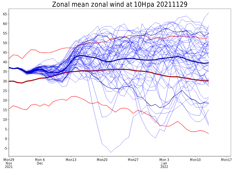
The big question will be how long does the pattern last before the next warm up and when the next warmup does happen, how long will it be? I’m very optimistic based on what I see on the long range guidance. The pattern on the models looks very similar to the types of patterns we get in our snowier La Niña years. March 2018, Jan 2011, ect. We wasted a couple weeks of December in a mild and snowless pattern, but that is not a problem at all. Even 2-4 weeks of this pattern will likely produce at least 1 if not 2 Miller B storms that bring blizzard conditions to eastern Mass. 2018 we got a blizzard early Jan, then an extended thaw, then all hell broke loose in March and we had one severe 2 foot blizzard just days after a nor’easter that gave my area 8 or so inches of snow. That pattern lasted 4 weeks. If this one lasts 4 weeks then we will have a March 2018 pattern in JANUARY. Maybe the storm around Christmas doesn’t pan out, just like the first storm didnt pan out in early March 2018 (was rain because the temps were a bit too warm), but even if it doesn’t what is important is we will have plenty of chances. Everything is lining up for a big winter, weak well coupled La Niña (likely peaks at about -.8 to -9), basin wide but biased east, so the structure of the La Niña is favorable. The MJO is going into phases 7 and 8, and the strong polar vortex that was the driving factor behind our mild first half of December is expected to stop deepening and start weakening. All great signs for not only this window, but windows of opportunity in Feb and March as well. -
December 2021 Obs/Disco...Dreaming of a White-Weenie Xmas
George001 replied to 40/70 Benchmark's topic in New England
The Canadian is showing why having blocking is so important, the 20-21st low actually misses out to sea, but due to the severe North Atlantic blocking the low cannot move, it just sits there. That gives the northern stream more time to catch up, phase with the southern low that is way offshore and hook it back in just enough to result in a big storm in new england. It may not evolve exactly that way, but it shows that there is a lot of room for error.


