

George001
-
Posts
6,885 -
Joined
-
Last visited
Content Type
Profiles
Blogs
Forums
American Weather
Media Demo
Store
Gallery
Everything posted by George001
-
 Holy shit I just looked at the snow maps and it gives the Boston area like a foot and areas just to the NW close to 2 feet where it stays all snow.
 -
To my untrained eyes the it looks like the low is going negatively tilted really early, deepening rapidly and closing off on the 500 mb just a little bit too far NW for something really big (it’s still a nice storm regardless). Great run.
-
Yeah it’s no guarantee but this reminds me of last December where Binghamton NY was forecasted like 2-4 the night before and ended up with 40. It’s a different pattern so it won’t get that far north and even jackpot areas aren’t even getting half that, but I’m still optimistic that it can get far enough north to give my area a plowable snowfall. I do still think Friday will be the bigger storm, and that one looks like it will be the opposite, farther north areas do better with rain snow lines being an issue for coastal areas.
-
I still think Boston is getting more snow than DC from this one. Im convinced we see another big north shift tomorrow, the trough looks like it’s more neutral than the guidance currently had it. That is a really good sign.
-
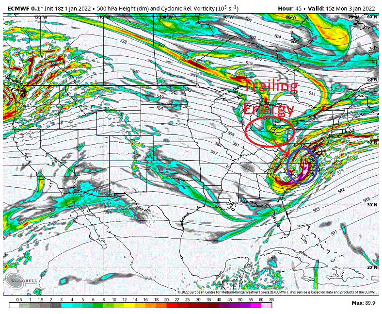
The models at 500 are getting closer and closer to a phase with the northern stream, which would drastically increase the ceiling of this storm if it happens. The extremely powerful southern energy is already producing a big storm farther south on its own, but if the northern stream phases in? That would cause the low to undergo rapid cyclogenesis, and the low would indeed move north and west as it deepens, in my opinion more than any model is projecting. This close in I’m looking at the obs, and it looks like the precip out west is more expansive than the models suggested, which indicates possible initialization errors, with the models underestimating the strength of the southern low. This is why I don’t think even areas as far north as southern NH and Maine are out of the woods just yet (for a couple inches, not a big storm, due to fast flow there would be a limit). The earlier than expected deepening of the southern low and the slightly slower progression of it would give the northern stream a little bit more time to phase in, which would cause the trough to go negative, and cause the precip shield to expand more over all of eastern mass. This would result in many areas expected to get a coating or even nothing getting hammered with heavy snow, possibly over a foot. It is no guarantee, but I do think the probability of an earlier phase is much higher than the models suggest right now based on obs and the pattern in place. All it would take is one 30-40 mile adjustment north, which isn’t much at all.
-
That’s a good comparison, the euro and Canadian guidance look similar to that one. Also looks similar to the storm the week before the massive blizzard in mid March 2018, I got about 8 inches in both of those.
-
True, but the upper levels are frigid and the surface temps are mid 20s during the height of the storm. I would think ratios would be more like 15:1 or even 20:1 in some areas, that would increase the range to like 6-12 in areas getting 15:1 and areas getting 20:1 (likely north and west) would be 8-16.
-
The Canadian and gfs look to have switched places. Canadian whiffed and gfs was a big storm at 12z and now it’s the other way around. In my eyes that is a step in the right direction, I love to see the Canadian on board. One step close to having the entire big 3 (Euro, Canadian, Navy) on board.
-
Yes, the La Niña has increased in strength even more and has crossed the moderate threshold. It crossed the -1.0 threshold about a week ago in the 3.4 region, -1.3 in the enso 3 region, -1.6 in the enso 1.2 region, and -.4 in the Enso 4 region. One thing I learned from reading the mid Atlantic forums is they often get screwed in la ninas, even when things look good just a couple days out. Even last year, in that big December storm it started with the lower mid Atlantic getting hammered and us being on the northern edge. Then just a few days out, it started trending north, and just kept trending north right up until it started snowing. That storm must have moved like 400-500 miles north on the models in just 3-4 days, we went from the southern edge to the northern edge, and the bullseye which was intially modeled to be in the lower mid Atlantic ended up being in upstate NY, with some areas getting over 3 feet. My area got about 15 inches or so. I don’t think it trends that far north since it’s only 2 days out, but even 100 miles north would be enough to bring a major nor’easter to eastern mass.
-
Especially in a raging La Niña, climo favors this to jump north.
-
I live near Patriots place, so you guys are in a better spot than I am for this threat based on current model guidance, but even in my area I am keeping in eye on a last minute NW trend. It has already been moving north the last few runs on most guidance, enough to make this go from sliding harmlessly out to sea by like 200 miles to a very near miss (50 miles or so). The blocking is starting to weaken some and we are in a raging La Niña, plenty of room for this one to come north.
-
I saw an interesting image on another forum, the 18z euro is a miss to the south, but it moved NW about 40-50 miles from the last run and more importantly it is very close to being something much bigger if that northern stream phases just a little quicker. This is so close to being something big even in new england. We have a storm missing us like 50 miles to the south on most guidance 2 days out with a raging La Niña in place….
-
This may sound crazy but I’m still keeping an eye on Monday for a last minute 50-100 mile NW jump, I like seeing the RGEM and long range HRRR on board but would like to see the NAM, euro, and Canadian guidance move NW before I jump on board. Low probability, but worth keeping an eye on the potential for a surprise nor’easter on Monday, that southern stream energy is really powerful. Then we have the bigger storm threat Friday (looks like a miller b to me), the strength of the low keeps increasing on the models with each run for that one.
-
Eh, while this won’t be a blizzard of 78 redux or anything crazy like that, it could still be a really big storm. In my area I’m more worried about getting screwed by ptype than the pattern being too progressive and quick moving. Even a 10-12 hour quick moving bomb can easily produce over a foot. If the low gets down to the 970s or 960s like some of the ensembles are hinting at, areas that stay all snow could possibly even approach or exceed 2 feet. The pattern was fairly progressive in Feb 2015, didnt stop my area from getting 3 storms with 12+ inches of snow and blizzard conditions.
-
That looks like 2014-2015, downright epic.
-
Looks really good, I hope it’s right
-
If the eps long range forecast is correct I’m optimistic that we make up for lost time fast and end up well above average snow. I was starting to get nervous about this winter a couple weeks ago once the trough out west kept deepening and refused to go away. I hate seeing a trough out west, that’s never good for us even if there is North Atlantic blocking. However, now that there are signs of the trough out west not only going away but being replaced by a massive ridge, I believe this January will be epic. February usually warms up in la ninas but this one is more east based, and Ray from the New England forum has mentioned how east based ninas tend to be more backloaded than central based ones. Hopefully that bodes well for Feb and March, but we will need to see how the polar vortex looks.
-
Winter doesn’t really start until late December at least where I live. We have really only lost a week of winter in my eyes, and in our best winters we lose an entire month or more. 2014-2015 sucked until late Jan, didn’t stop it from being the snowiest winter on record. March is a winter month, we have 3 months of winter. Jan, Feb, March. The Jan 7th threat is real, it wouldn’t take much for that to turn into a Miller b nor’easter. Winter is nowhere near over, and from what I’ve seen the long range actually looks pretty damn good. I won’t give up, and am going to stick to my guns. I called for 70-85 inches of snow in the Boston area, and I’m sticking to it. Yeah, the last week of December didn’t pan out but I think we are going to make up for it really quickly Jan-March.
-
Yeah that is trending in the right direction, it looks really good on the european guidance. Canadian isn’t there yet but it still has a really big storm.
-
I see that the trough out west is going away on the models. Unfortunately the North Atlantic blocking is expected to go away as well, but if there is a big ridge out west like the long range Canadian guidance shows we won’t need much North Atlantic blocking. 2014-2015 had hardly any North Atlantic blocking but due to the ridge out west the pattern was really good, and we got buried. I still think there is a path to getting the 70-85 inches of snow i forecasted in the Boston area, and I’m not ready to give up. Plenty of winter left.
-
There’s 3 months left…. Way too early to give up. 2014-2015, 2012-2013 both started slow.
-
We need a weak nino not a big one
-
December 2021 Obs/Disco...Dreaming of a White-Weenie Xmas
George001 replied to 40/70 Benchmark's topic in New England
Wow that looks really good -
December 2021 Obs/Disco...Dreaming of a White-Weenie Xmas
George001 replied to 40/70 Benchmark's topic in New England
A week ago, I forecasted severe blizzard conditions in eastern mass due to the North Atlantic blocking in place. Today is the day I forecasted the blizzard conditions to occur, it is raining outside right now. -
December 2021 Obs/Disco...Dreaming of a White-Weenie Xmas
George001 replied to 40/70 Benchmark's topic in New England
Nope, my forecast busted again. I do think we get a couple of blizzards later in the winter though. The pattern change is getting delayed more than I thought.


