SnowenOutThere
-
Posts
5,462 -
Joined
-
Last visited
Content Type
Profiles
Blogs
Forums
American Weather
Media Demo
Store
Gallery
Everything posted by SnowenOutThere
-
One benefit of the warm weather is that my plan to wake up and take pictures of the sunrise is a lot less chilly for tomorrow. Otherwise, its been a dry heat which is better than a humid one... though, any temperatures above 80 this time of year aren't ideal.
-
I would recommend using Tropical tidbits with the NAM model selected. (Here is a link https://www.tropicaltidbits.com/analysis/models/?model=nam3km®ion=us&pkg=mslp_pcpn_frzn&runtime=2026040712&fh=0) It will show the same thing as the previous tool. Of course, you could also change models to some other ones to help as well.
-
Wedge had been gone since 9am in Charlottesville.
-
Hmmm, some boundaries appear to be draped W-E across Reston. Other boundaries are from the Potomac moving west. Could see something interesting things happen.
-

2026 Mid-Atlantic Severe Storm General Discussion
SnowenOutThere replied to Kmlwx's topic in Mid Atlantic
Severe warned storms down around Roanoke. Seems more active than forecasted so far.- 311 replies
-
- 1
-

-
- severe
- thunderstorms
- (and 7 more)
-
Nope, mind posting?
-
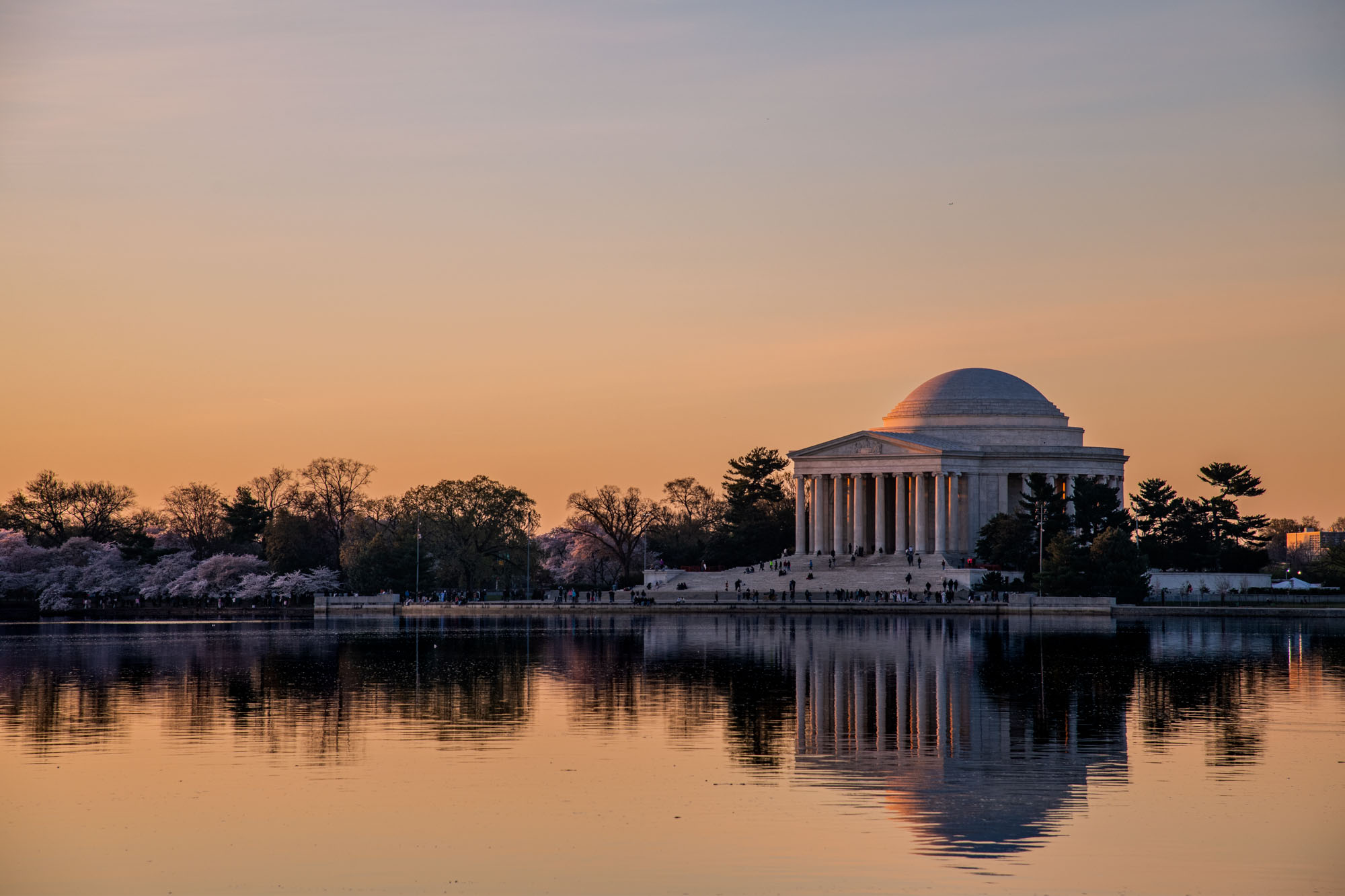
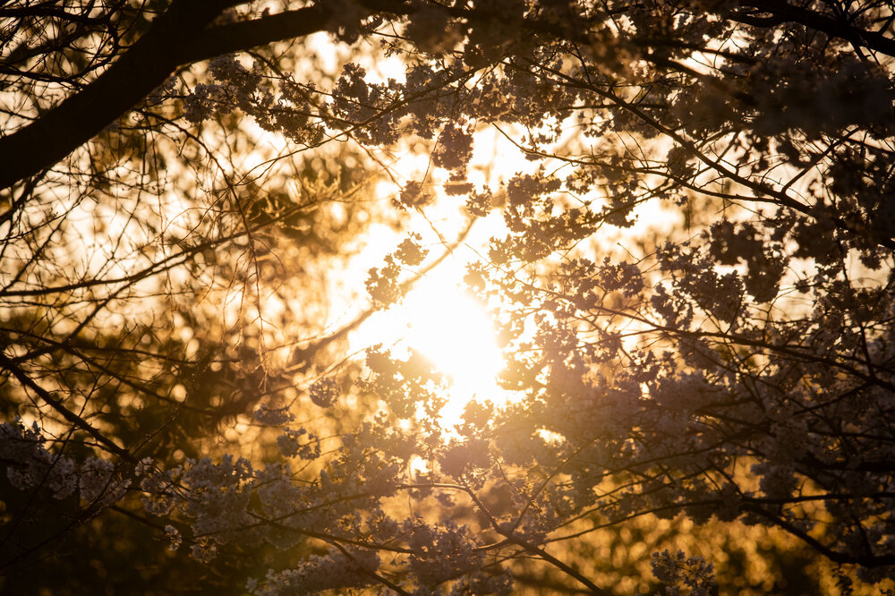
Highly recommend going out and doing this at least once in your life. While I think the cherry blossoms are otherwise overhyped and overdone; if you manage to get there early in the morning to watch deep night fade into morning's glow it is a magical experience.


-
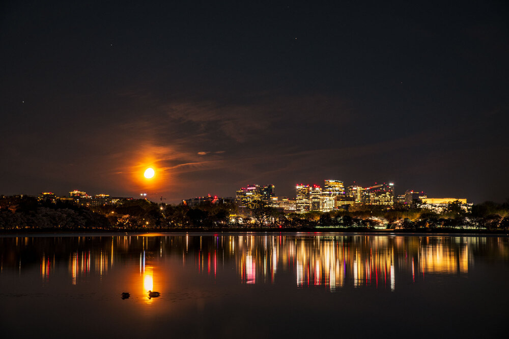
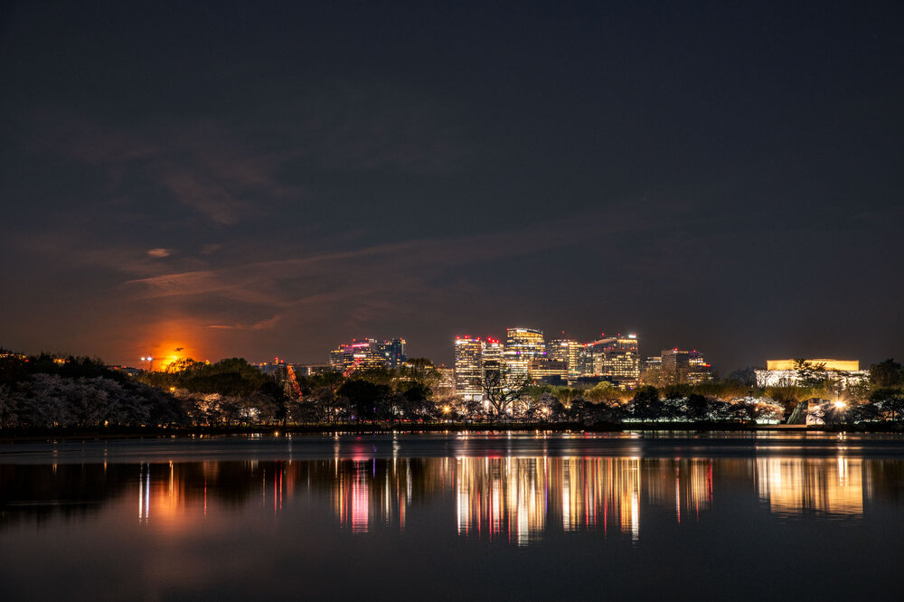
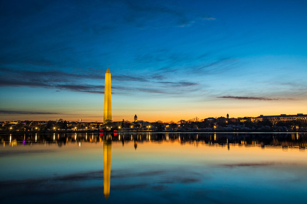
Went on an adventure to see the cherry blossoms last weekend in DC. Started by waking up at 3am to get there early enough to get shots of the moon sinking over the horizon, of which, I couldn't be happier with. By 5am first light started to appear and with it the crowds. Pulses of people streamed onto the walkways. I went around the loop for sunrise. Got some shots along the way, and arguably my best ones of the day. Finally, the sun began to breach the DC skyline. At the end I was out of DC by 8am. Great experience, and huge thanks to my Dad for driving me in and finding parking.
- 567 replies
-
- 18
-
-

-

-

-
Start. The. Bus. Up.
-
Don't know how long its been like this but we hit 1 million posts in our forum!

-
2026 Mid-Atlantic Severe Storm General Discussion
SnowenOutThere replied to Kmlwx's topic in Mid Atlantic
Could tomorrow be a possible severe weather day? We have strong low level lapse rates, good CAPE and some turning of winds with height - though next to no increase with height. Seems like some sort of thunderstorms should be likely along anything that could trigger forcing. -
75 degrees and partly sunny with wind.
-
Oh I got an idea. So do most climate scientists
-
START THE BUS BACK UP BABY. MARCH SNOW ON SNOW IS INBOUND!!!
- 408 replies
-
- 10
-

-
-
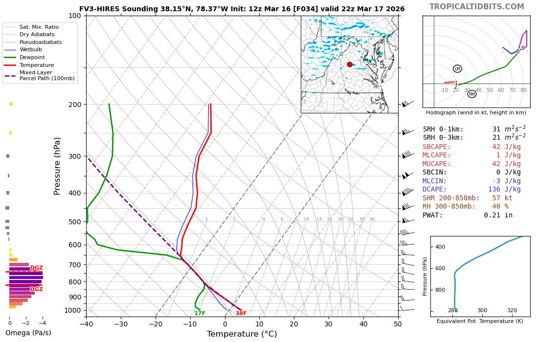
Do you think part of the issue with why we couldn't get any storms to really build was that second area of CIN? Seems like we managed to get storms to begin development but struggle to get past the shower stage so maybe that's the reason why.
-
Yeah, when you see the sounding from Monday without any of the wind profiles it becomes painfully clear that we were cooked with our thermal profile if we wanted severe. Had two different CIN areas and horrific lapse rates with next to no CAPE. Also hope this pen-paper diagram brought back some memories for our mets.
-
In my Atmo/Weather lab we're analyizing the soundings from this monday and making a scew T chart.
-
-
I think this is a fair take for nova and areas that got the final line. However, I’m in central VA and that second line had nothing to work with so for areas around where I was it really was a slight risk in practice. I do think the core of this issue might be the new system. When the SPC issues a 4/5 risk for wind I think it should call for something more than what occurred Monday. While it was a legitimate severe day for parts of the region, I wonder what happens if we get a storm that fulfills a slightly higher risk? Do we say it’s a 5/5 risk? That seems unfair when I think a true 5/5 risk should be a plains deracho with swaths of 90+ mph winds. These 4/5 and 5/5 events should feel rare and exceptional and are labeled as such to spur the public to action.
-
Love the SPC, but wondering how many of those reports occurred with the ending squall line which went through after they dropped percentages. I think they were completely justified in their 4/5 risk (and twitter/public mets retroactively throwing them under the bus suck) but its also fair to say that while justified the forecast failed. A failed forecast is not necessarily a bad one though. You have to warn for the high end in case it happens, hopefully people don't think next time its a boy cry wolf situation.
-
Anyone else tracking the potential snow showers this afternoon? HRRR seems insistent some make it over the mountains
-
Don't know if this is the appropriate place but some snow squalls making it over the mountains looks possible tomorrow. Anyways, if someone gets caught in one it might put down a quick coating based on the soundings

- 1,093 replies
-
- 1
-
-
- severe
- thunderstorms
- (and 1 more)
-
Results from my first ever (severe) storm chase! Good learning experience even if I didn't get to see anything warned (tornado or thunderstorm). Was some low level rotation but fell apart quickly and clearly had no momentum to do anything. Though, the flowers were pretty, and VA pediment is beautiful as always.


- 1,093 replies
-
- 24
-
-
-
- severe
- thunderstorms
- (and 1 more)
-
All I remember about tornado warnings in schools is that I would try to tell the teachers they were wrong.
- 1,093 replies
-
- 6
-
-
-
- severe
- thunderstorms
- (and 1 more)
-
We had more than enough spin for a tornado to occur. I mean every single shower showed a couplet of some intensity. Just couldn’t ever get anything to take advantage of it. Wasn’t cape either for a bit. The initial stuff had surface cape of 500+, just never built up into the upper atmosphere.