vortex95
-
Posts
729 -
Joined
-
Last visited
Content Type
Profiles
Blogs
Forums
American Weather
Media Demo
Store
Gallery
Everything posted by vortex95
-
I was torn between this song and "Working On It" by Chris Rea!
-
-
-
-
Yes, talk to him in the third person! CoastalWx gets what CoastalWx likes, ALL HAIL WINTER!!!!
-
Hold!!!!
-
"We can do this?" 11 days and he is hopeful? LOL

-
-
Quite an impressive stretch you have to admit since Jan 27 w/ widespread lows in the single numbers in New England w/ many cold spots below zero. ORE has been as low as -18 F and OWD -16 F. And this going to continue right trough Fri, a break Sat, then Sun-Tue again. CoastalWx *should* like this cold b/c it preserves his "white gold." LOL.
-
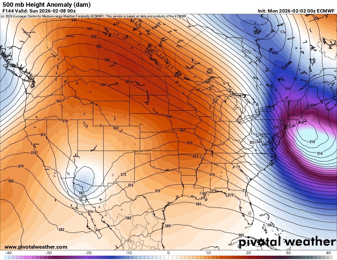
I can hear CoastalWx from here, "why can't the mean trough position be just 150 mi to the W!!!" But maybe PT action from the NORLUN the 00z ECMWF is explicitly showing, which is pretty amazing it is showing it so far out. Given the 500 low lagging the sfc low so much, this scenario is not unreasonable. And we may have a great line of TSW+ when the strong cold front moves through initially.

-
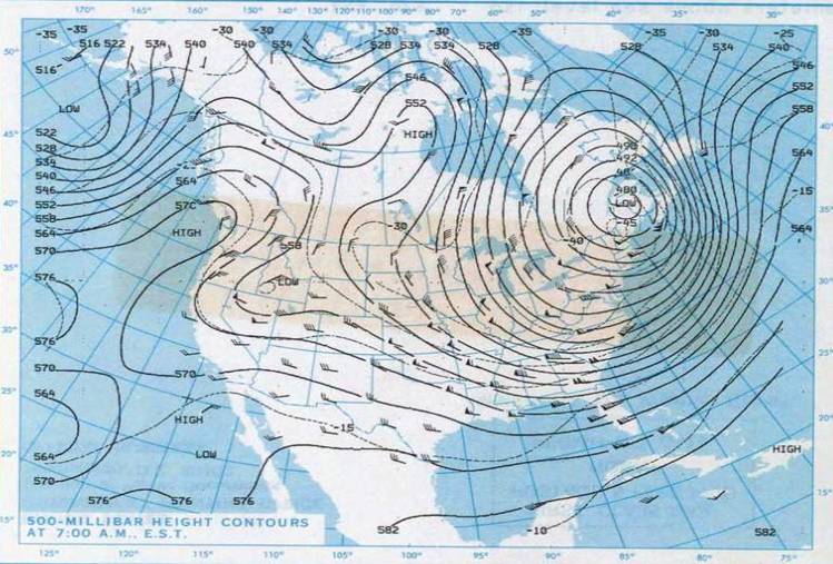
That would be close to record low 500 heights for the NEUS. I attached the 500 from Jan 21, 1985. Just below 480 dm at 500 over CAR, which I think is the record. But no weenie snowstorm for a 6 year old CoastalWx (no 4-8" in the backlash ). Also, there is a KU case from the 1960s where you had 400 m + height falls in 12 hr in the NYC area. 498 dm 500 low right over NYC!
-
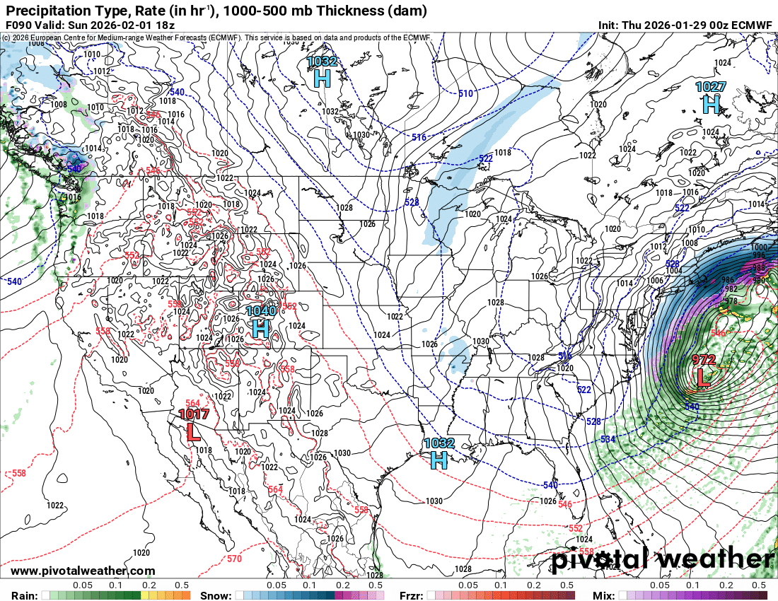
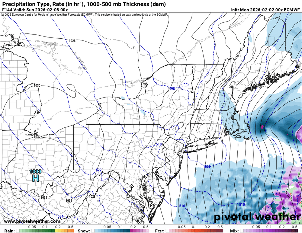
Possible coastal storm centered on Feb 1 2026.
vortex95 replied to Typhoon Tip's topic in New England
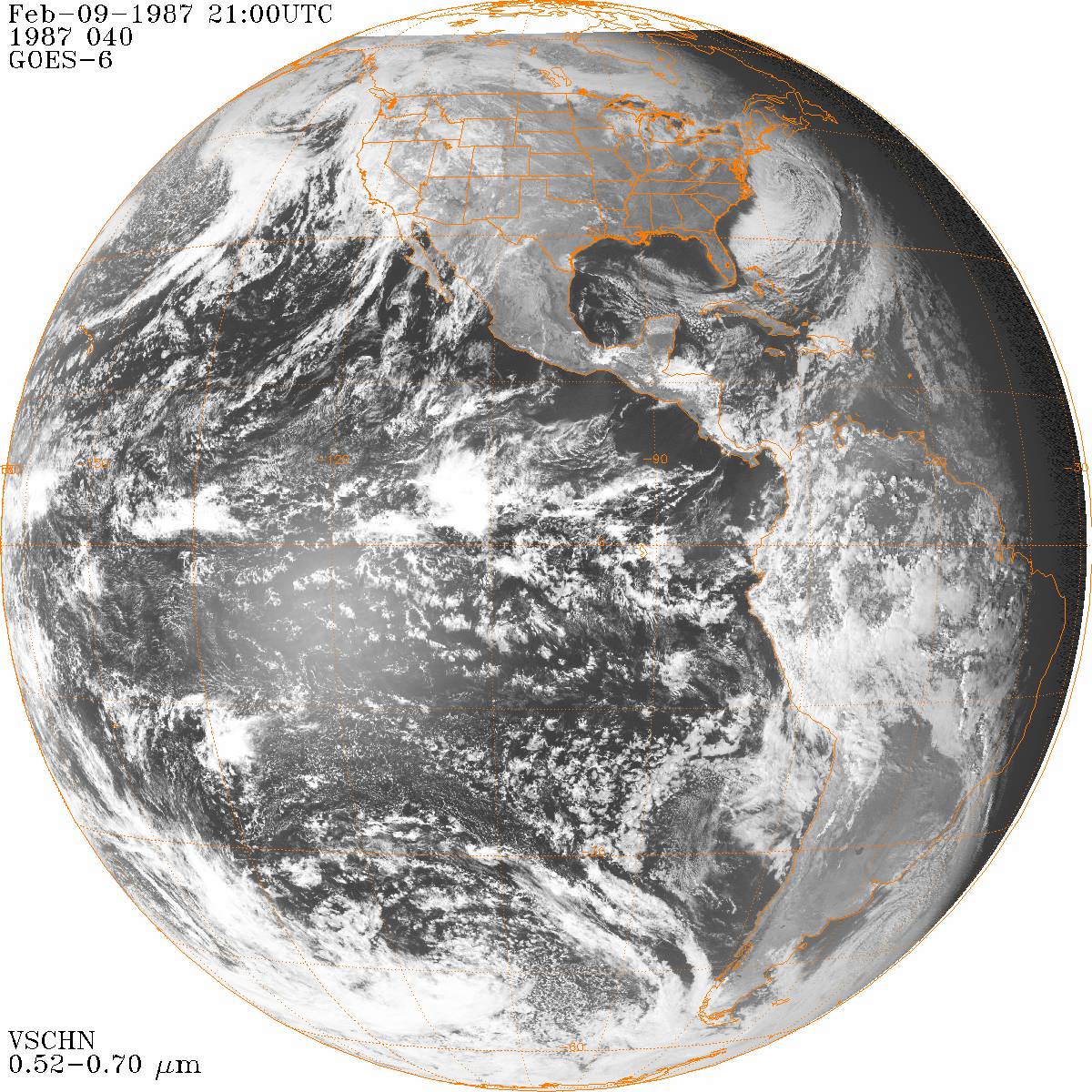
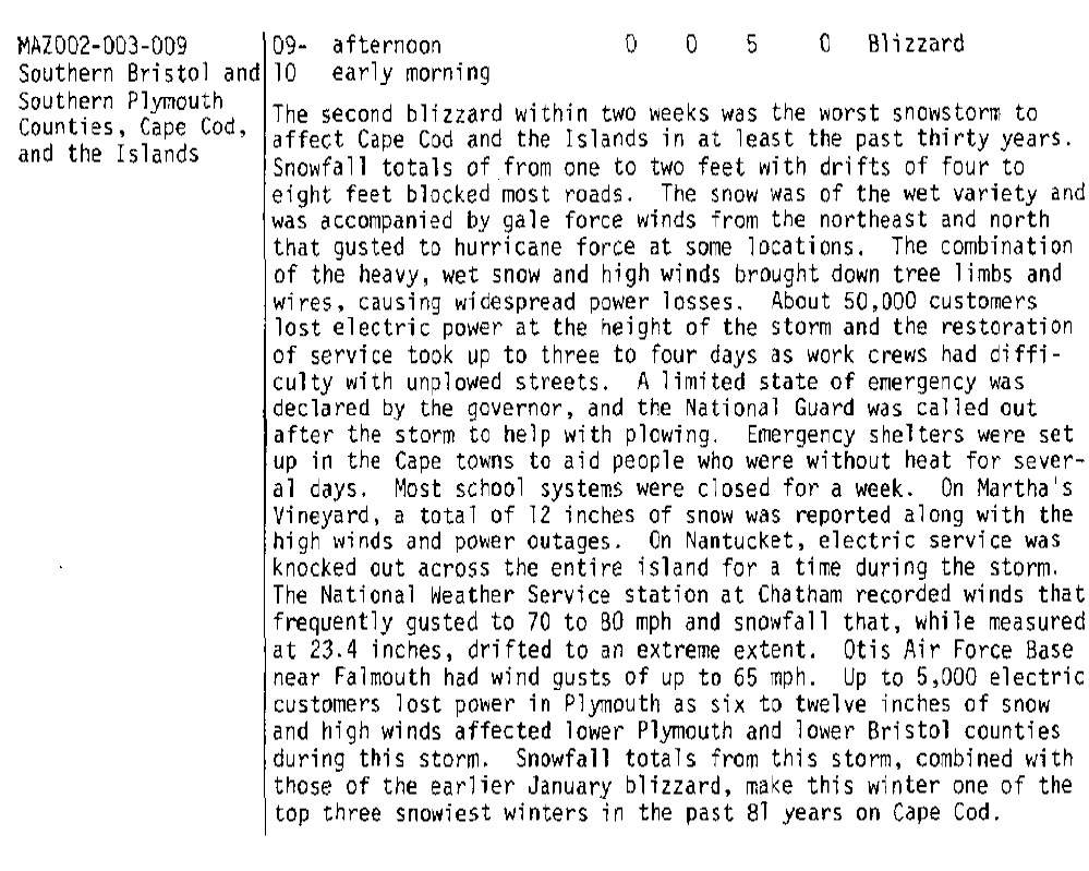
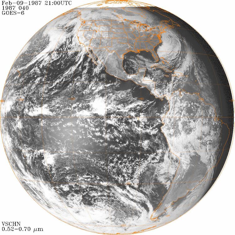
An atypical thing about this storm, it deeply occludes rather far S for a coastal storm (~35N) and has multiple low centers strung out SW to NE, so you will have a huge swath of heavy precip NW of the center, pivoting slowly. How much this pivot is obviously is key (pivotal!?). It can be one of those things, once you are in it, you are in it for awhile, yet not to far NW, just internment flakes in a dry stiff wind. So very sharp snowfall gradients as possible. Among the best snowfall gradient storm for eastern MA occurred 2/9/1987. I got 2" in Woburn MA w/ no real wind, and CHH had 23.4" w/ frequent gusts 60-70 kt. Second Cape Cod-only blizzard in two weeks! A 7-year old CoastalWx was NOT happy! But I was not either, even though 1986-87 was a good winter (only one from 1984-85 to 1991-92), it could have been *much* better!

-
More like PARADISE CITY! Take me home!
-
WE WEENIE!!!
-
catwrestle.mpg
-
"if it doesn't make 24" where I live...BUST!" LOL.
-
See what is developing and moving in right now? Wild turkey surprise????
-
January 2026 regional war/obs/disco thread
vortex95 replied to Baroclinic Zone's topic in New England
At 150 hr, the GFS gets the 1000-500 thickness of 516 dm just into NE FL and the -5 C at 850 to MIA. That's Jan 1977 caliber stuff (snowed in MIA). -
Go to bed. Enough for one day! LOL.
-
Ruin his chance to have the most in SNE given the HRRR crushes coastal MA tomorrow with weenie OES bands!
-
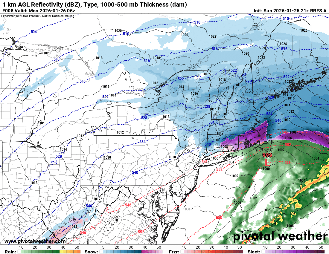
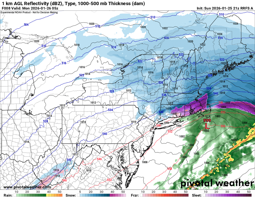
Haven't look at all posts, so sorry if this has been already mentioned WTH is this thing that crosses SNE around late this evening on the RRFS? You can trace it back to WV. Gravity wave? Notice it flips the S to IP over CoastalWx's area. A strong gravity wave occurred from the Mid-Atlantic ti SNE on 1/4/1994. Here is my summary I made long ago when I worked at WSI. A major coastal storm was in progress across the Mid-Atlantic states and northeastern U.S. Elkins, West Virginia recorded 6 inches of snow in one hour and Syracuse, New York had 5 inches of snow in a hour for two consecutive hours. Syracuse measured 18 inches for the storm. Other big snowfall totals included 20 inches at Renovo, Pennsylvania and 18.5 inches at Tully, New York. As the storm passed off the New Jersey coast, a gravity wave was induced near Allentown, Pennsylvania. The barometric pressure plunged 22.4 millibars from 997.7 to 975.3 in just 45 minutes at Allentown, and then rebounded almost as much in only 15 minutes. The gravity wave propagated northeastward and produced similar pressure fluctuations in New England. Boston, Massachusetts recorded a wind gust to 66 mph.
-
https://www.facebook.com/reel/1432097551619087
-
I was referring to CoastalWx's temp in Marshfield and the Marshfield Airport. BOS was a reference point as it was warmer there than the 17 reported in Marshfield.
-
17? How can that be? 25 at KGHG and 23 BOS. Slant sticking the temp! LOL.
-
So is KGHG going to make this a blizzard officially from its often questionable AWOS observations? Really it should be more than a single location to call it a blizzard or not. That reduces chances of bad observations or malfunctioning equipment contaminating things. Coastal front though BOS!