vortex95
-
Posts
2,211 -
Joined
Content Type
Profiles
Blogs
Forums
American Weather
Media Demo
Store
Gallery
Everything posted by vortex95
-
Far too much focus on SSTs -- column TPW (and by extension instability) and shear is what it is all about. All the anomalously high SST/OHC is meaningless if the atmosphere does not cooperate. Something that seems to elude many -- "but the ocean is SO hot!!!" TCs are more tenuous that the MSM thinks. A lot has to line up for one to form, and even more for one to get intense. SSTs are more than warm enough around the globe in much of the tropics and subtropics year-round to support strong TCs, and how many named storms form each year and how many get intense? And formation is confined to distinct parts of the year in each basin, again showing how what goes on in the atmosphere dictates things. Of all the 3 primary factors, SSTs are least important. You can get hurricanes up to Cat 2 status w/ SSTs below the 26 C threshold, and min hurricanes as low as 20 C as long as the TPW and shear are favorable. But if the wind shear is high and/or the column is dry, you get nothing to even develop in the first place, despite torch SSTs! You don't need to do research or run a model to see this, Empirical observations alone over time clearly show this. That's a sig problem these days, some are so caught up in "what the models say" they forget to look at what actually happens in the real world, currently and in the past. Empirical. real-world observations override what models say every time. Basic common sense and logic!
-
Yah, but maybe we can get a grazing PRE like Arthur from July 2014!
-
"But, but, the ECMWF is now at least showing a disturbance that recurves!" @CoastalWx needs to be reminded this is a "home grown" type of hurricane season. Last 'cane to hit New England was a super El Nino based on RONI 1991-92 -- no, not the Bobby Brown song! LOL.
-
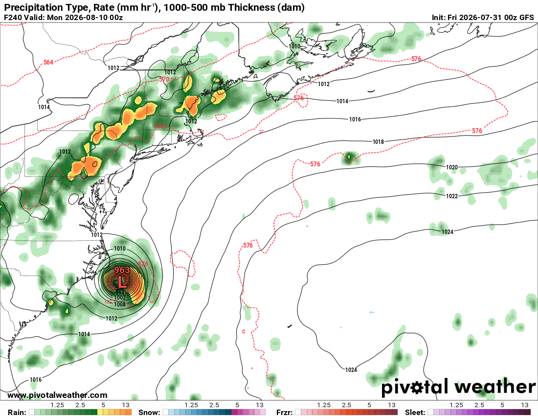
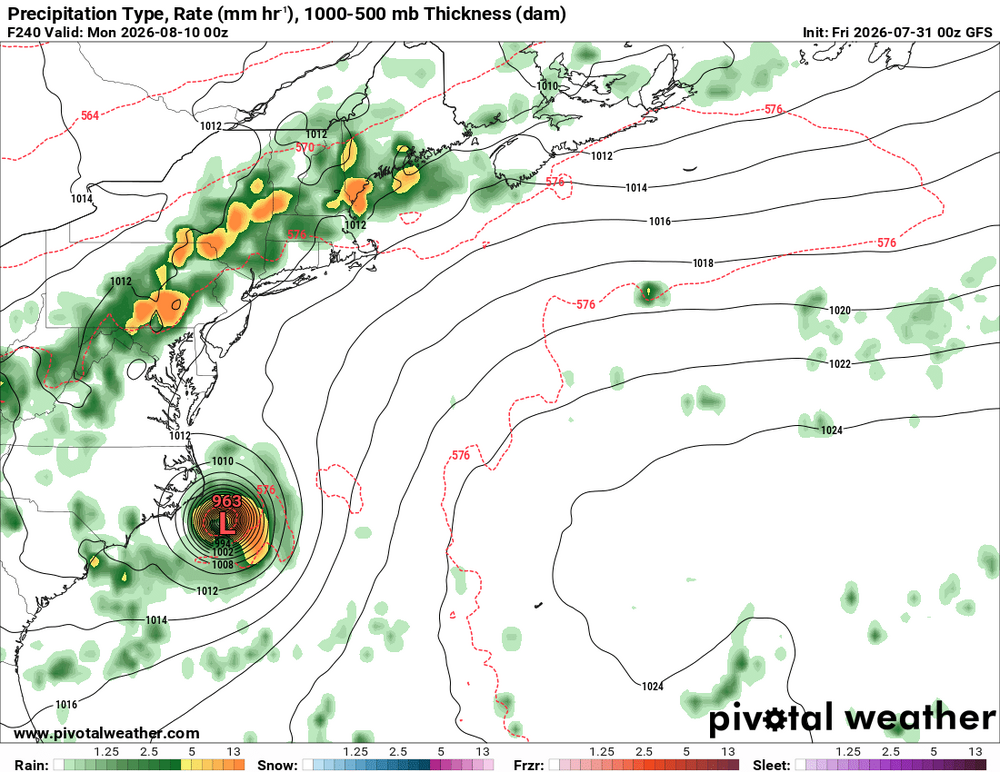
GFS has been persistent in showing this thing for many days now, but that mean little b/c it is the GFS and it is beyond a week. However, the recent ECMWF runs now show a distinct wave moving W S of the subtropical ridge and then recurving offshore. But @ineedsnow *only* cares about this I bet from the 00z GFS! "It's just GOTTA come up!"
-
Fell just short. 12.33" Unless they happen to get TRW+ today.
-
@ineedsnow wants this!
-
I used to go to McDonalds. But I can not go there out of good conscience b/c of the ridiculous prices. Funny, Taco Bell and Little Caesars, there prices have not gone up much at all over the last 5 years. So I do not want to hear inflation or min wage mandates excuses.
-
Don't get me started on 1-in-X year events! There is a fundamental misunderstanding of what they say. The reference points/periods for climo to calculate such a stat for any given location and wx parameters are fluid/relative, to say the least. But never let such details get in the way of hype or a narrative! Event return periods that extend beyond our period of record are curved to fit our period of record based on numerous statistical assumptions. This means just one extreme event can drastically alter return rates, giving a false sense of what actually has changed. If you divide whole world into county warning areas like what is done in the U.S., then you would have about 394,000 zones. So a 1-in-a 1000 yr flood would happen many, many times a year. It is not exactly 394x as the math would suggest due to non-linear factors, but it is still a lot, relatively speaking, and this is just for one type of wx event. How many are there out there to measure/quantify? And this is just choosing CWA for spatial, you can play games w/ numbers forever, slicing and dicing down location areal coverage to a single point for any wx parameter/measurement, and create any scenario as to frequency and trends to your hearts consent! This goes back to "how to lie (or exaggerate) w/ statistics" notion. The law of large numbers and averages results in many 1-in-X year events every day all over the world. It is similar to winning the lottery, odds are astronomically against, but many ppl each year win despite these odds b/c so many ppl play, and many repeatedly, so this *guarantees* there will be winners! It is a big planet and the atmosphere has endless combinations that in are high flux all the time, and it is going to split out big/record wx events at times w/ their frequencies waxing and waning over various time cycles naturally.
-
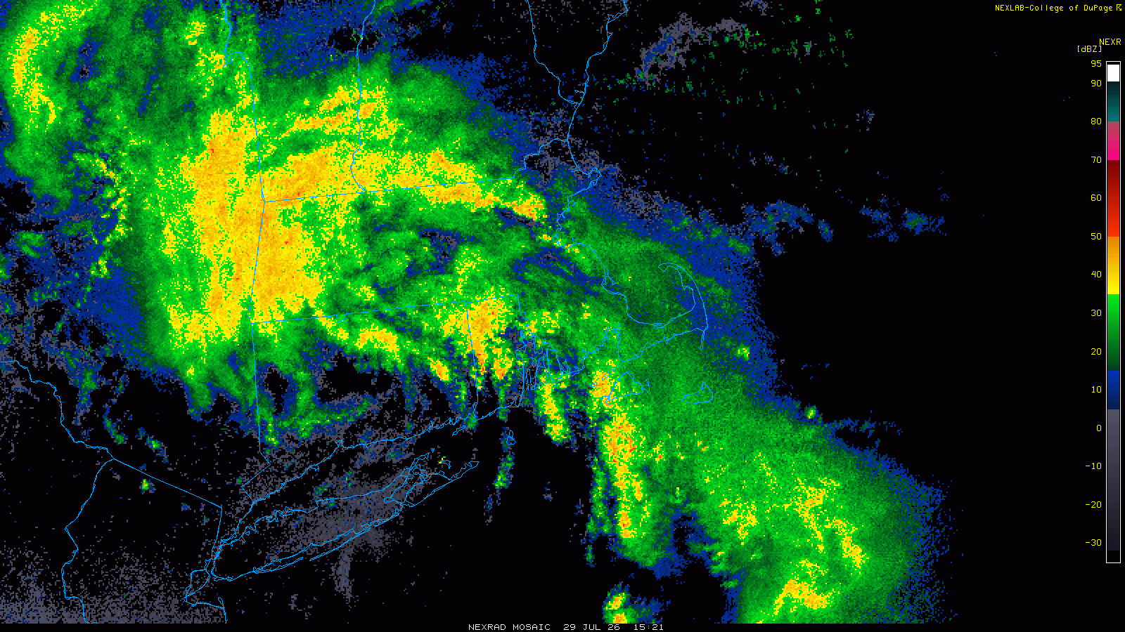
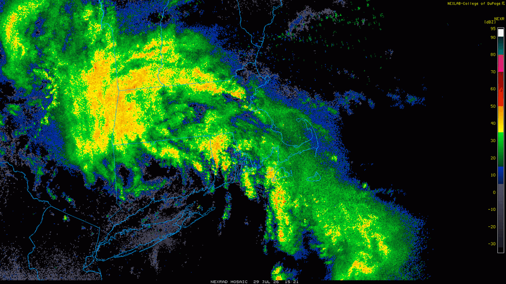
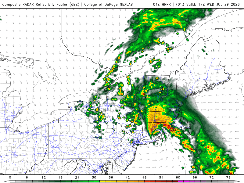
So nothing ended up happening from a "Scott Spinner" POV. However, look at the radar at 1521z 7/29 attached. The HRRR fcst radar nailed this configuration w/ the flared cells E of the low center. One could easily think this was a TS landfall in SNE! Actually the fact it slowed and stalled near the MA/NY border and then drifted E reminded me of what TS Henri in 2021 (several spinners from that!). So why no spinners? I don't know but all the ingredients were there. However, as we know, just b/c all the ingredients are there does *not* guarantee sensible wx results one would expect (or wants to in @CoastalWx case!) occurs. And this happens a *lot* for spinner setups! How many times do the SCP and SIGTOR look great on paper, and nothing happens beyond run-of-the mill svr cells, barely mesos? These parameters only account for some of what is going on the atmosphere, so you have to use w/ caution. And the line between no tor and tor, or a bunch of meh QLCS spin-ups and honkin' long-tracked, intense tors is rather narrow. *One* thing off and it can be "ruined!" So in hindsight, I'd make the same exact fcst for potential spinners for this past event. And really how often do you get a discrete, compact sfc low that is non-tropical "make landfall" over LI and CT in the warm season? Not that often! Yes, a summer Nor'easter in a sense but things are much different this time of year, owing to much higher PWATs and more CAPE available superimposed on synoptic-scale lift! And the fact that low pressures in the summer are smaller and not as strong as their cool season counterparts actually favors more rain and higher flood risk, b/c things tend to move slower and the synoptic forcing does not overwhelm the mesoscale, so you can get weenie RW++ stationary boundaries like we had in ern NY this past event!
-
Yes, acclimation can be in a very short period. I recall one big cold period in New England in the late 00s I think, and for several night in a row, when I went out to my car to go to work, it was 0 F. Then it "warmed" to 20 F the next night, and it felt really good! My avg yearly in Woburn MA for days w/ thunder is 23. It gets up around 30 in western parts of the region. Most I know of for a single location in New England is 42 days in ASH in 1988 (15 days in July alone - MQE also had 15 days that month for an all-time record!). @weatherwiz and @ineedsnow snow would faint in ecstasy if that happened to them! @CoastalWxwould still be like MEH!
-
9 tors in WV on 7/21 confirmed now. That is the second most in a day for the state on record, behind the 10 on 4/2/2024. Now 13 tors for 2026 in WV. They had 20 in 2024 for a yearly record. WV I always thought as a gap for tors since avg per year 1991-2010 was only 2 and a lot less than all the surrounding states. But I think the advent of mobile device cameras and static cameras everywhere by the late 2000s, along w/ the dual-pol radar upgrade in the early 2010s has changed things to reveal what is really going on and this has closed the gap as to the fact that much of WV is so rural.
- 2,604 replies
-
- 1
-

-
- severe
- thunderstorms
- (and 7 more)
-
Highest global ACE TCs 1) Ioke 2006 85.3 2) Freddy 2023 83.3 3) San Ciriaco 1899 73.6 4) John 1994 70.6 5) Ivan 2004 70.4 5) Paka 1997 70.2 6) Irma 2017 64.9 7) Isabel 2003 63.3 8) Rita 1972 62.9 9) Fico 1978 62.8 10) Fengshen 2002 61.2 Bavi's ACE from this year ACE is 51.4.
-
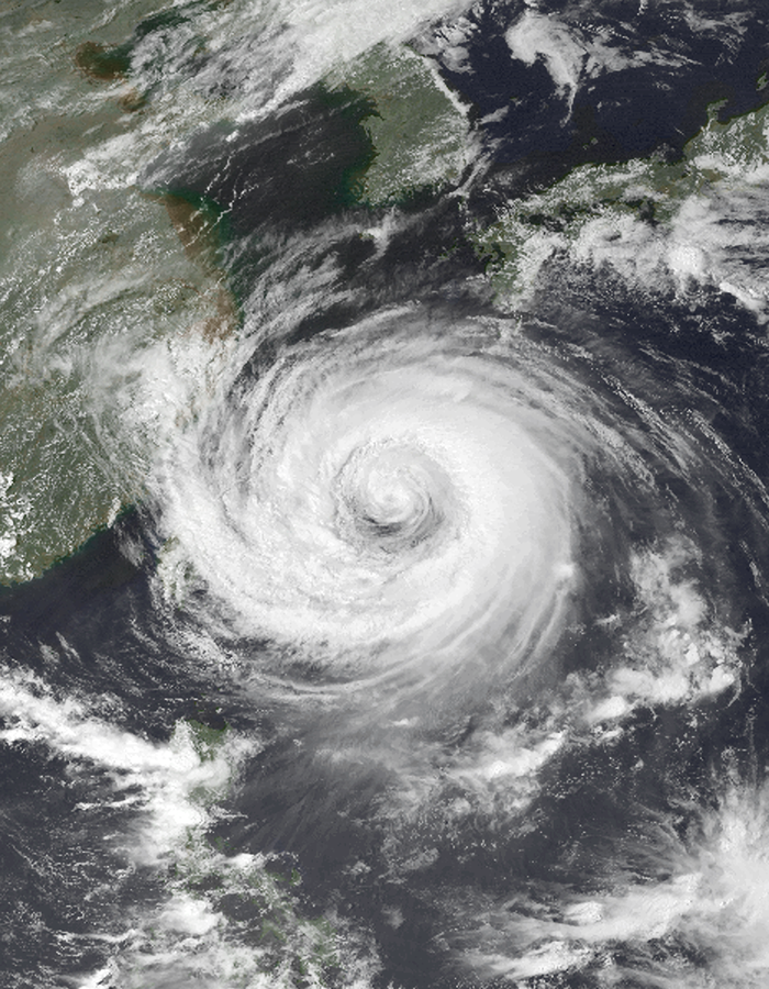
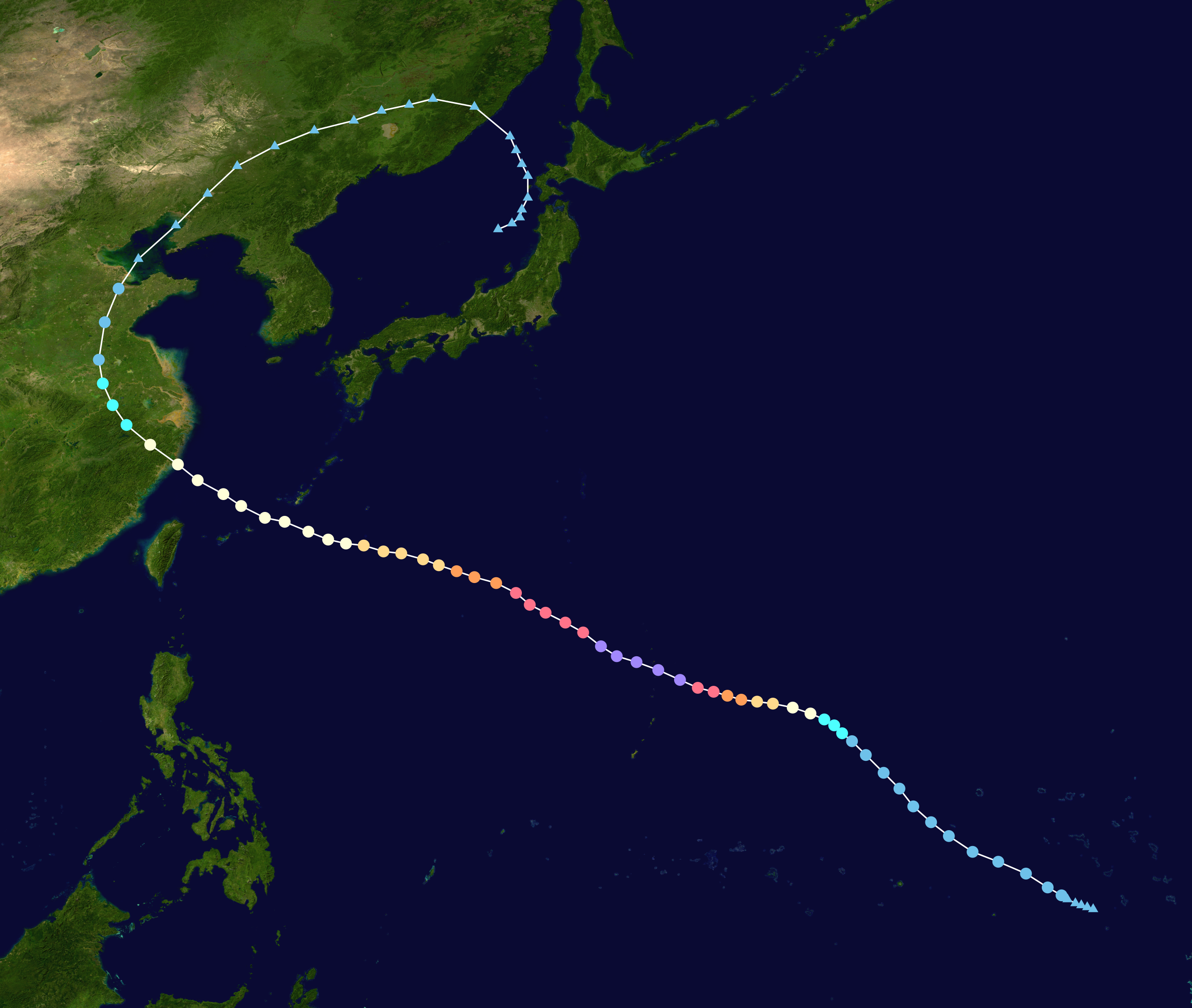
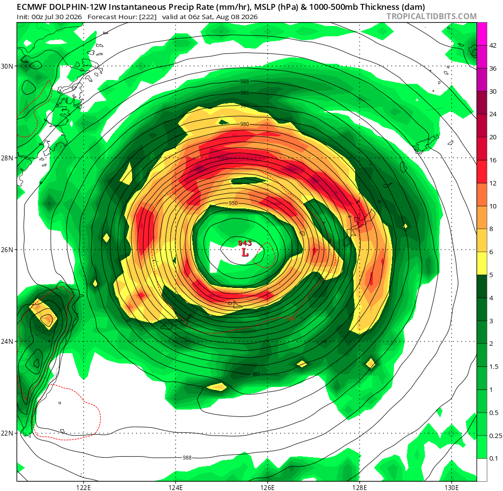
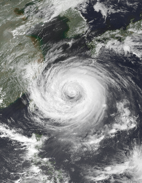
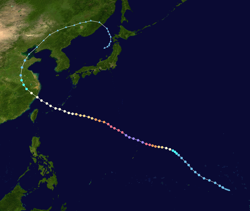
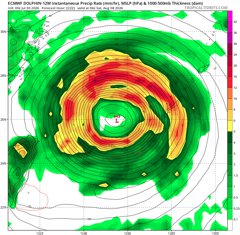
Since Dolphin has already peaked twice and another ERC imminent it seems, the storm will continue to expand in size overall, and it may undergo another ERC. All along, it is slowly gaining latitude. What this means is that despite the very low pressures shown once it gets to the RODN and ZSSS areas, the storm will almost certainly expanded even more w/ a very large eye. The ECMWF shows this well. Take a look at its 222 hr (yes, I know this is way out, but model agreement is excellent as to the large-scale pattern as to Dolphin's track). The eye is about 120 nm in diameter! This is not unreasonable and has happened many times for long-tracked TC in the NWPAC. STY Winnie in 1997 is among the most classic examples. It had a 200 nm eye when it approached China! See attachments. The point being once a TC has maxed out in the deep tropics, it is very difficult for it to attain that same kind of intense status again b/c 1) ERCs expand the storm progressively, and 2) as you gain latitude, Coriolis increases which results in a decrease in max tangential wind speeds and acts to expand the TC. So the TC often has the same net energy as a Cat 5, but it is much more spread out, so winds may only be Cat 3. Also, Dolphin may become an annular hurricane, which is a stable status where the eye is quite large, and there is almost no banding. It looks like a truck tire w/ stark symmetry. https://en.wikipedia.org/wiki/Annular_tropical_cyclone TC Winnie 1997 https://x.com/WxPatel/status/1416591836504862720
-
Upslope not nearly as big factor this time of year, simply b/c low-level winds from the SE, E, or NE are not as strong, and fetch is much less. Ever notice summer low pressure areas are smaller than the cool season counterparts? Well, there is reason for that and thus you can't treat things synoptically all the same in the summer. Convection plays a much larger role in the summer, so that messed w/ things are well. Swaths from training regardless of topography.
-
I did not want to bring up the "feels like" temp, as that is out of control as to abuse, but it can be of use b/c "the door swings both ways!" Once you get below 57 or 58 dew point, the heat index is actually lower than the air temp! I would bet not many mets know or actively realize this. I did not know until about 10 years ago! I've spoken to ppl deployed in the Middle East, they can get perspective! After in that sauna for a few months, coming home, 95 feels great! Acclimation I think is underrated. When I moved to DC, it took me a few summers to get used to the more 90 temps and the more persistent high dew point, which get into the upper 70s more common here. By my 3rd summer, I not longer noticed it. I adapted. However, the flip side is that I am not as tolerant to cold. This past winter was by far the coldest here since I moved here, and I noticed! I think from the general public POV, they think MT is "cold." Most have zero idea what continental climate is like, and MT is the best state for temp swings in the CONUS. It is the only state in the Lower 48 that has had sig snow at lower elevations (I am talking Great Falls proper) in August (happened in 1992). It's even worse for AK. Ppl are shocked to learn AK highest temps is 100 F, and that they get a lot tstms (all squeezed into J-J-A). Some locations get 30 days w/ thunder, more than a lot of New England! And of course, tornadoes. We had that one earlier this month, but I would bet good $$ there are 3-5 tornado in AK each year, just it is so large and sparsely populated, it precludes detection.
-
EF0 passes close to ineedsnow house will make it EPIC!
-
W/ that sat imagery I bet it was stronger than 125 kt. Pinhole eyes often suggest higher, but Dvorak has nothing to account for eye diameters or tight systems, esp. when the inner core is tiny. We generally underestimate the most intense TCs and small TCs from satellite estimate.
-
More ern NY currently!
-
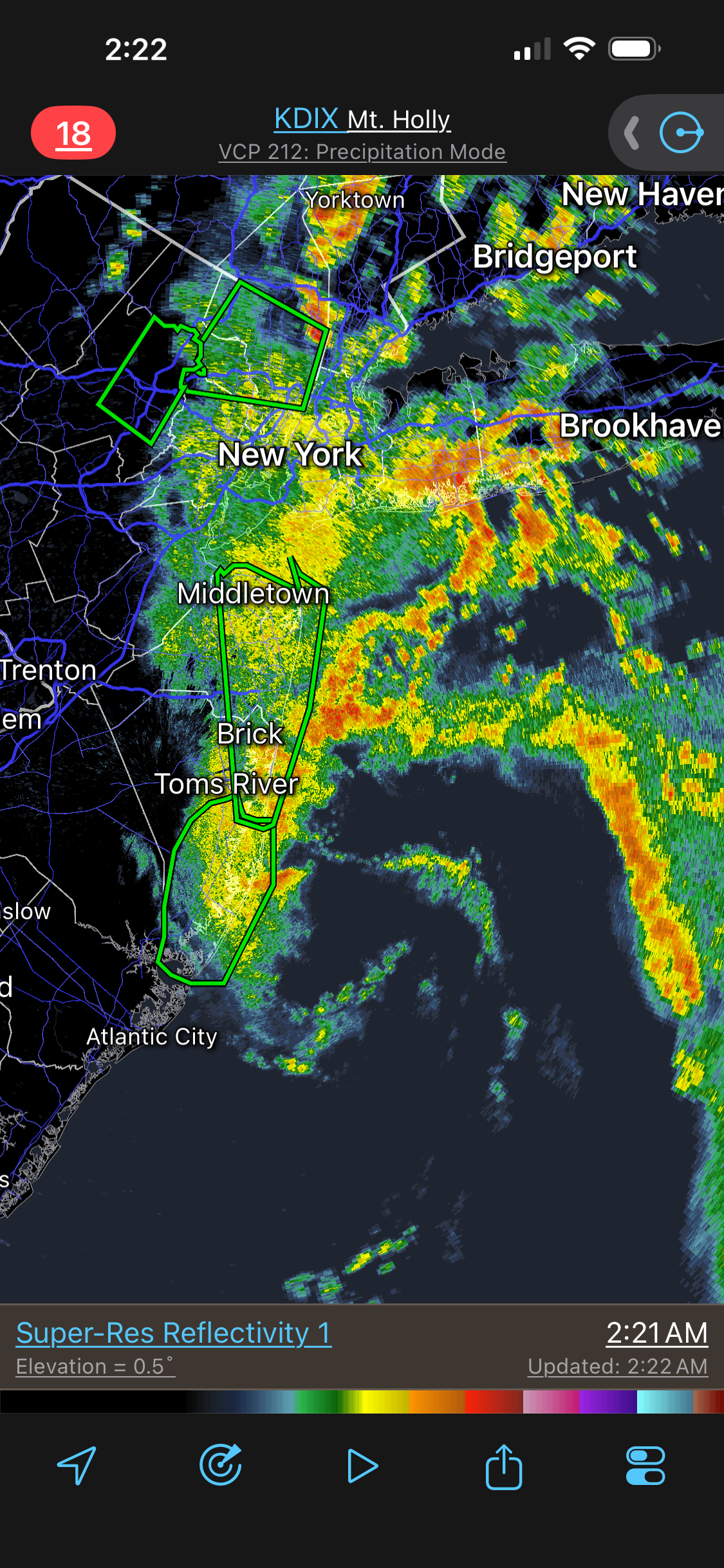
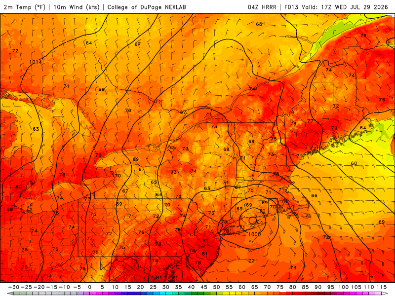
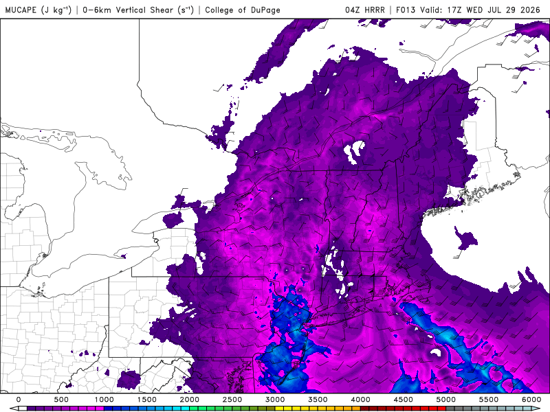
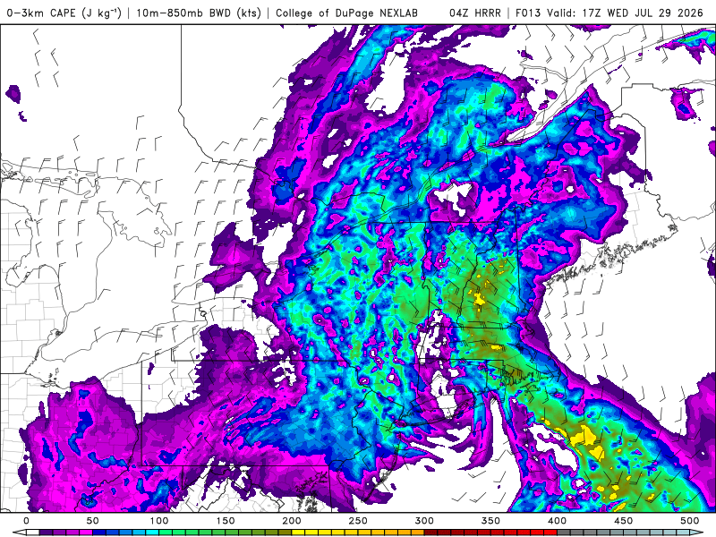
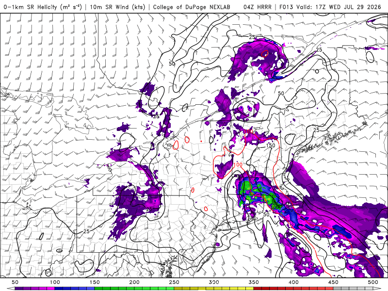
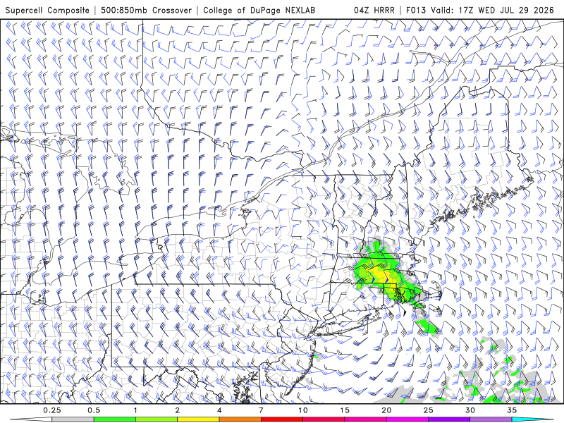
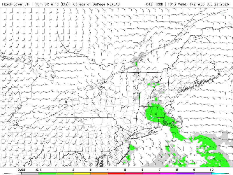
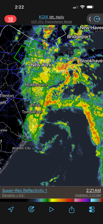
04z HRRR rides a 996 mb low into cntrl CT (makes "landfall") later this morning. This is how the BDL F4 occurred on 10/3/1979. Sfc low from S of LI came up from the S and moving right over cntrl CT. Did WxWiz even get a hint of this before going to bed? I know CoastalWx did not, and now be like, "HUH????, where did this come from?! I was focused on all the rain!" Sooo...has anyone looked at the svr wx parameters? They are sneaky impressive. From 04z HRRR: 1) CAPE values NE of the sfc (meso?) low. 500-1000. That's more than enough when low-level shear is solid (see below). 2) 0-3 km CAPE - areas of 200+ CT/RI border to srn NH - again, more than enough (75 or more is good). 3) Now this is where it gets interesting. 0-1 km SRH NE of sfc low, large area of 200 w/ a max of 447 at 17z over NW RI! That is crazy and no reason this is spurious given the set up and evolution here. 4) SCP and SIGTOR area are there. Not honkin' but that's due to low CAPE largely. Low CAPE/high shear can do some amazing things! 4) Sim radar shows discrete cells in an arcing line NE of the sfc low. NE of sfc lows (synoptic, meso, or tropical) are prime areas for spinners. You have low CAPE in the column, but its more than enough for stout convective updrafts, 0-3 km CAPE is high so there is your low-level vortex stretching, and 0-1 km SRH is excellent. SPC 06z outlook has gen tstms only for the NE. I don't know about that. And yes, the small low pressure is already there off the NJ coast (radar attached).
-
996 mb for a coastal low is quite impressive for July here. And it's tight little sucker! Going see some big rain from this esp. since CAPE are 500-1000 over srn New England for most of the event. Those are ideal values for max rainfall rates and warm rain processes.
-
Things turned out close to what the models where showing, at least for the DC area Plenty of wind reports, some hail, and one tor so far. Odd, a lack of svr reports in the RIC area and much of cntrl VA, where the highest tor probs were initially. I had a quick 1.00" even of rain (WxU site just up the street) and it got quite windy, but no damage in my immediate area. Kind of avg for a storm.
-
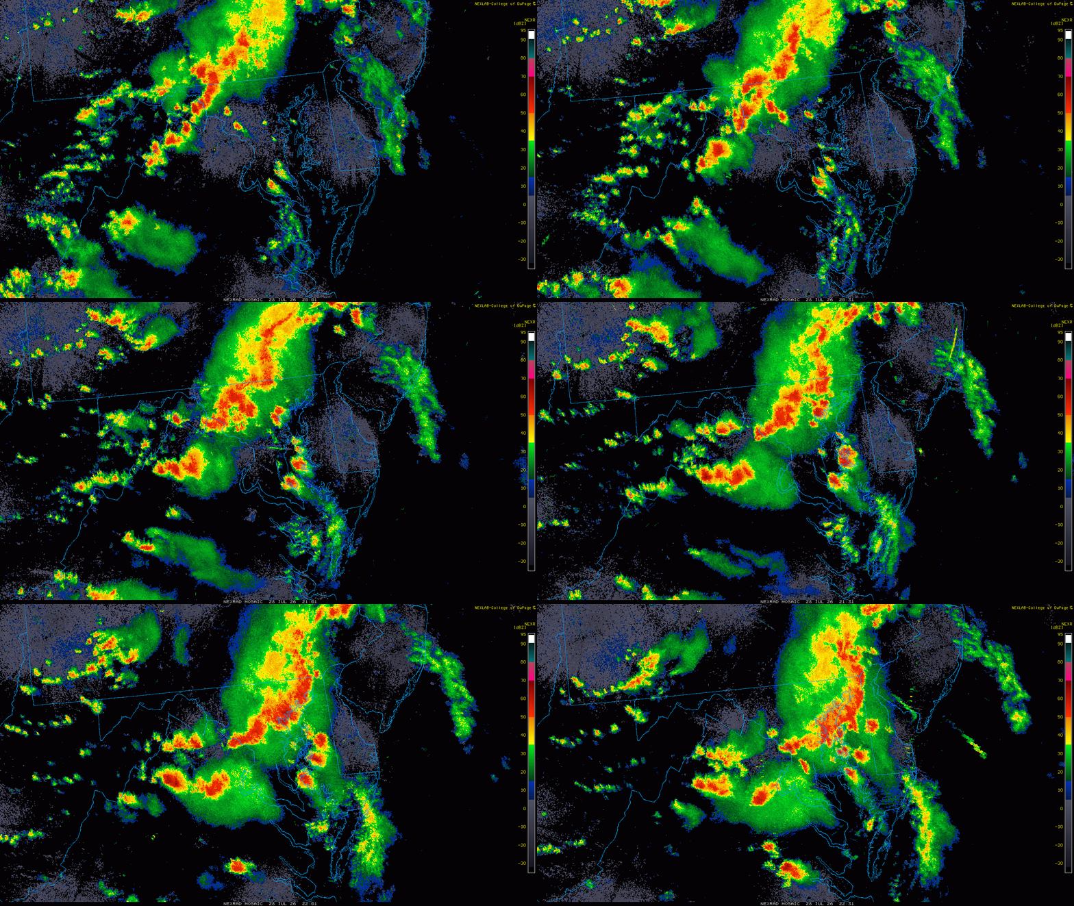
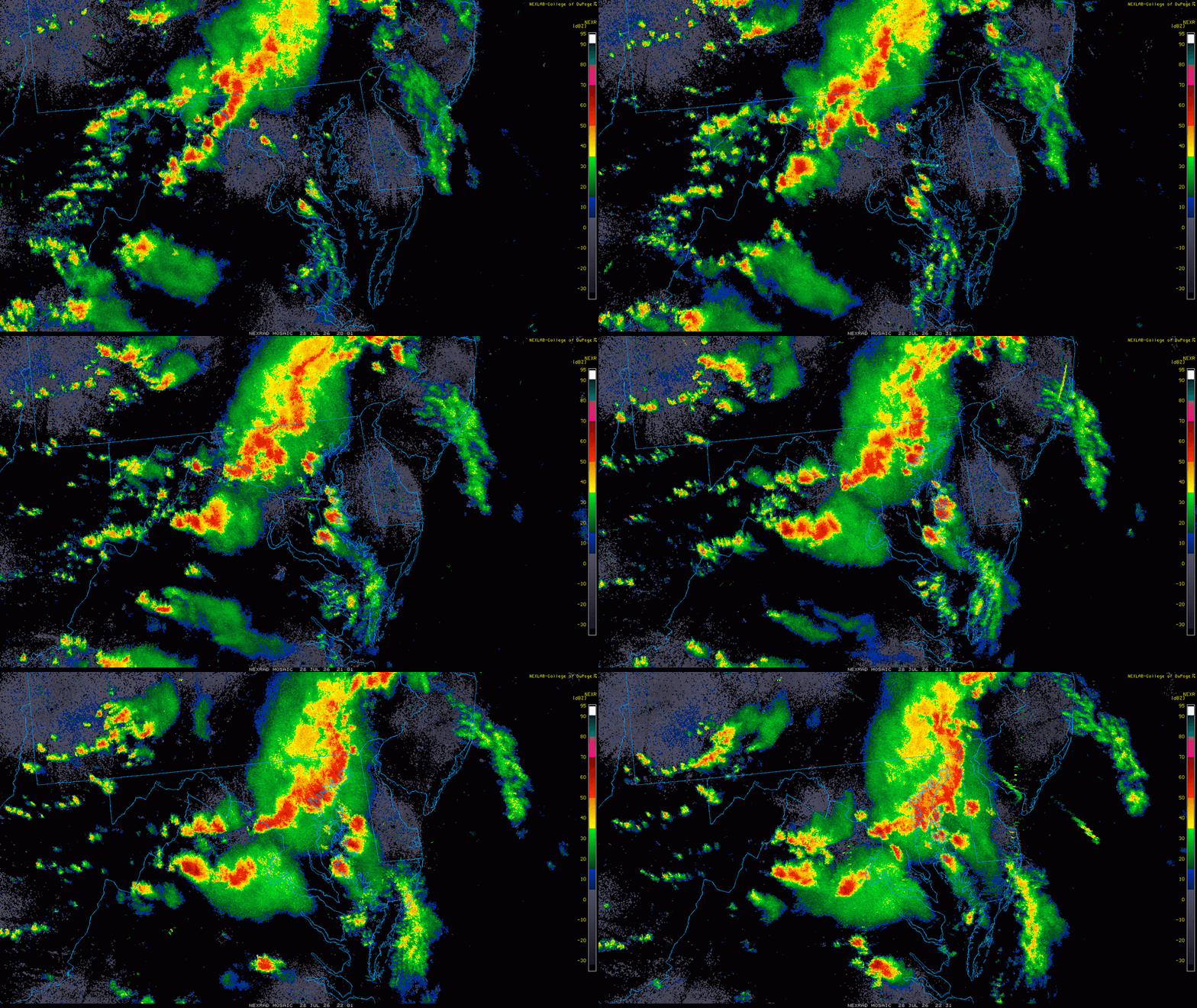
Radar loop from 2000 to 2230z here. You had a line w/ the pre-frontal trof moving SE and isolated storms moving NE ahead of it, and some were supercells, esp. those ones just E of the bay. One clearly split and one produced the tor in Trappe.
- 2,604 replies
-
- 4
-
-
- severe
- thunderstorms
- (and 7 more)
-
What about the warm front position!!!! You were all over that and dogmatic last event! LOL.
-
Or in "Team America: World Police!" F-yeah!!!!