vortex95
-
Posts
2,211 -
Joined
Content Type
Profiles
Blogs
Forums
American Weather
Media Demo
Store
Gallery
Everything posted by vortex95
-
Yes, I figured that is what happened, and you confirmed it. I work w/ fire and smoke detection and mapping where I work. Here is our main product. https://www.ospo.noaa.gov/products/land/hms.html#maps Gets reset every day around 6am, and fire points and smoke areas are added in real time both automatically and manually during the day through late evening. Wind by *far* is the biggest factor in wildfire spread and intensity. And w/ the passage of a cold front you are going to get drier air advected in as well, so smoldering or low-level fires suddenly can get a massive boost. This also happened in central Quebec last summer or the summer before. Smoldering fires ignited by lightning and held at bay by rain occurred, and then the cold front passed, and all at once, you saw multiple fires erupt in sync across the region w/ big smoke plumes. This is was due to strong winds behind the cold front. Some think, "but it just raining a lot, how could things burn so much?" Well, that's a disconnect that exists. Things are a lot more complex than led on. There is a reason why fire wx has it own branch in meteorology, and the nuances and idiosyncrasies are rife and not what you'd expect! It is pretty amazing stuff. The sheer amount of training modules on MetEd/COMET is impressive, so that shows how big and complex this field is. And despite what MSM constantly pushes, drought or hot temps have little or nothing to do w/ wildfires. High winds are low RH are *everything*. You can have the wettest month on record, and then get fire wx warnings not days later. Recall March 2010 how wet it was in SNE, esp. RI? Well, a few days after a big flood event events, fire wx warnings were put up for the region This b/c windy conditions and low RH will dry out grass and shrubs in short order (called 1-hour fuels). Also, being spring, it's all still dead vegetation that burns easily. Open grasslands in the Plains are the same. Massive wildfires occur when no drought is present, again b/c it is largely 1-hour fuels. And in places like CA? Well, you have the wet season, and then the dry season by default, so most everything that sprouts/grows during the wet season, dies and decays in the dry season for a prime fuel load, and the wetter the wet season, often the worse that wildfire season later in the dry season. Couple that w/ Santa Ana winds, and drought conditions are irrelevant. You are going to get dried out and desiccated vegetation for lots of wildfire fuel no matter what every year.
-
Quite the tree damage I am told Springfield VT to Claremont NH. I-91 was closed for a time. Saw this report: "You can see the path just south of mile 48. I-91 is a debris field for a quarter mile. Twisted trees snapped off that were more than a foot in diameter."
-
Yes, good point referencing history. Something that gets ignored all too often these days b/c if interferes w/ hype or a narrative. Large wildfires in Canada have a cycle of 50-80 years. The dark days here in the 18th century have been traced to large wildfires in Ontario from paleoclimatology IIRC. This is the problem w/ these days, the media and politicians prey on recency bias and short memories and act like what is happening now is unprecedented or not supposed to happen. We are wired to think in human lifetime frames of reference, but that is nothing compared to climate and geological frames. Wildfires are so endemic, some species of plants have evolved to only to germinate w/ fire present The seeds of many plants in fire-prone environments need fire, directly or indirectly, to germinate. These plants produce seeds w/ a tough coating that can lay dormant, awaiting a fire, for several years. So summarily demonizing wildfires is misguided and narrow-minded. Yes, their impacts can be devastating, but that is no different that say hurricanes and tornadoes as to the natural order of things. Fire has a natural role in the environment/ecosystem and it was established long before humans existed.
-
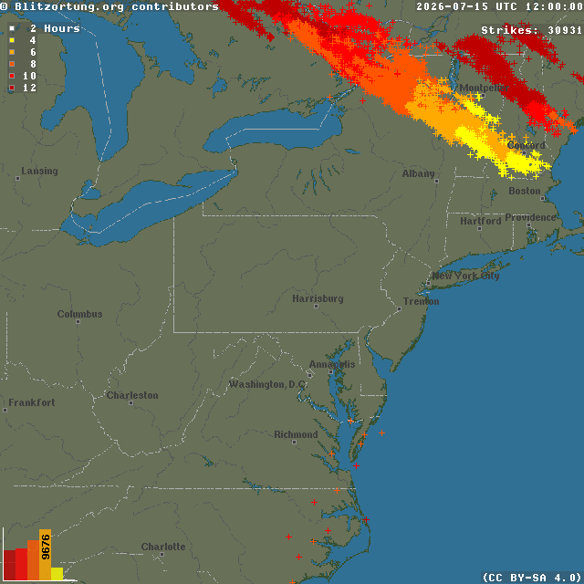
8pm-8am CG plot.
-
See, you are already thinking ahead and abstract. How can I use this experience to be a better uber weenie svr wx forecaster going forward?
-
Exactly what the HRRR fcst Tue eve.
-
Yes, so I do not want to hear this is a complete bust! The daylight hours were and the smoke is the likely cause of the bust here, but again, there is far too much focus on what did *not* go right rather than what did! I can count on one hand how many times in the last 30 years that anywhere in New England has had golf ball sized hail between midnight and noon. Bona fide supercells between midnight-noon in New England are rare. And even thought the models overdid the overnight convection, it all quickly dissipated once near the MA border by 10z, which is exactly what the HRRR showed Tue eve. So is the above just to be discounted? Sometimes events do not work out at fcst, and I can't tell you how many times in the Midwest/Plains/Southeast on paper everything looks awesome for svr wx parameters and a HIGH risk is issued, and under-performs. Things do not change meteorologically just b/c this is the NEUS. Sure, volatile atmospheres like this are uncommon here, esp. a strong EML, but that is irrelevant as to if it works out all as fcst or not. This is an excellent opportunity to learn from our mistakes, model shortcomings, and conditional factors that can crop up at the last minute (e.g. thick smoke). I for one will be investigating/researching the role of wildfire smoke on convection now. It was already mentioned earlier about how it impacts +CG frequency. And just b/c the smoke was a determinant to convection this time, does not necessarily mean it always is. You need to ask, does it matter if it is thin or thick smoke? Does the height and vertical depth of the smoke layer matter? Not all smoke particulates are the same, so that does matter as to things like CCN (CoastalWx should appreciate this b/c he is big on sea salt CCN for OES! ). Turn an experience that was not good or did not work out into something positive. Experience is what you get when you don't get what you want/expect, and thus you are that much better off going forward!
-
Playing catch-up and just checking things now after a busy first part of the day. Working from the posts last evening first. Scott's just mad there was svr winds and tree downed on Rt 16 and in West Ossipee and he wasn't up at the lake!
-
Trajectory is solid ESE and that would put it eventually into cntrl VT. "
-
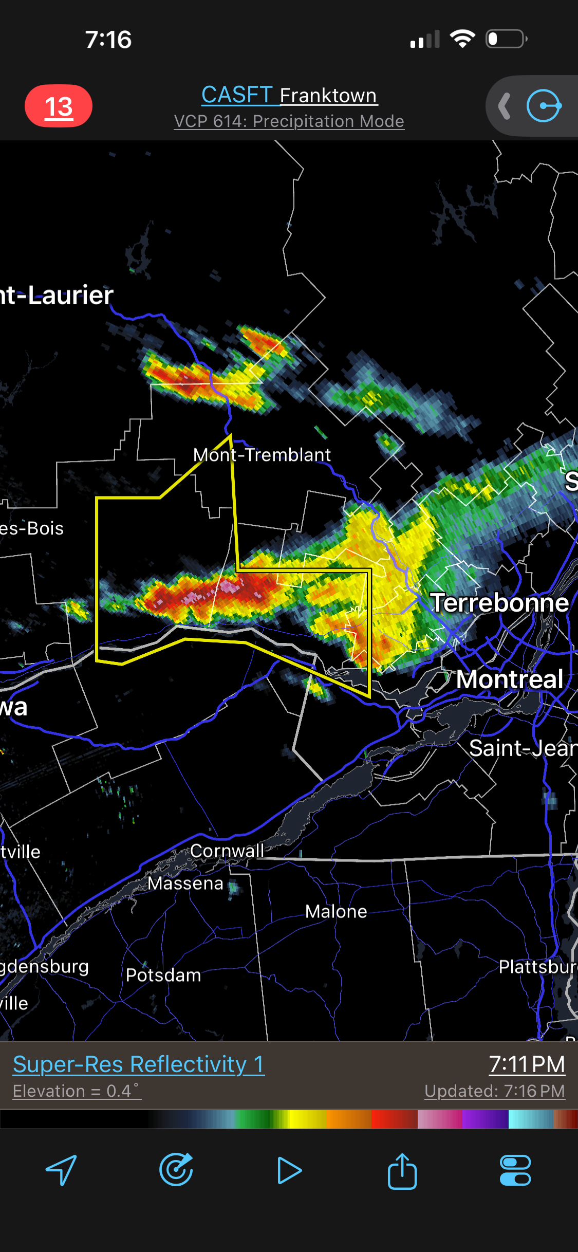
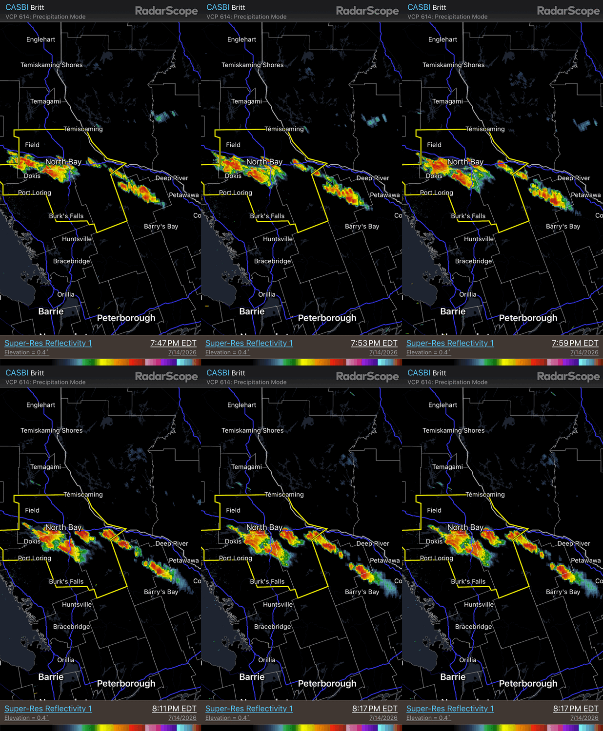
There is more upstream going in Ontario as well. Looks like some supercell splits here.
-
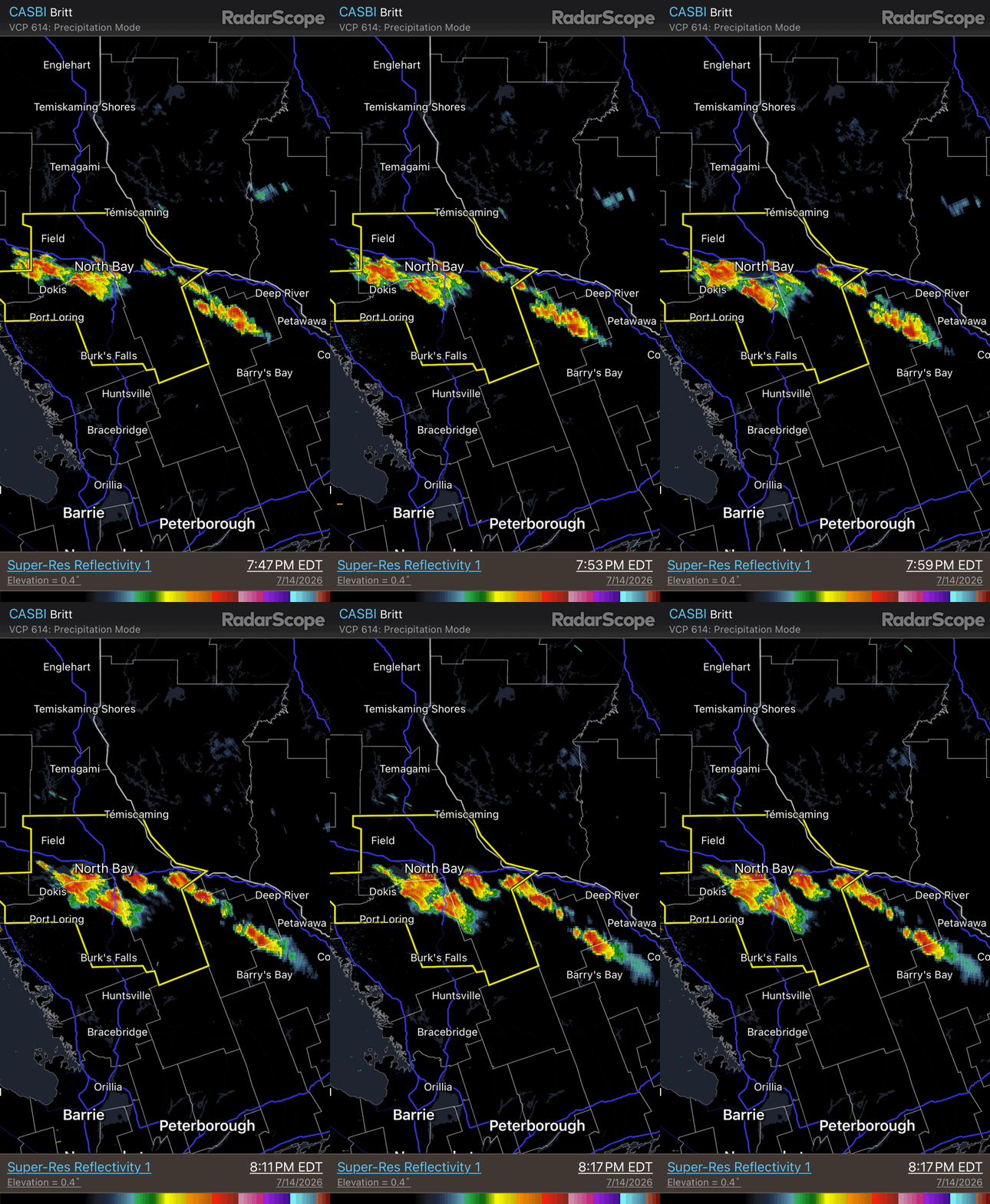
Bust in ME? The main show storms were always going to be late in NNE -- 7pm or later, including ME. Just delayed a bit now, either by smoke reduced max temp or just a bit slower forcing overall. The word "bust" is used *far* too often and early when things do not go *exactly* as fcst.
-
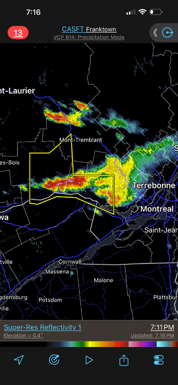
Now finally storms w/ some meat!
-
Never turn you back on an EML in the evening/overnight, esp. when storms fall during the day. This happens countless times in the Plains/Midwest. EML is an EML, doesn't matter where you are.
-
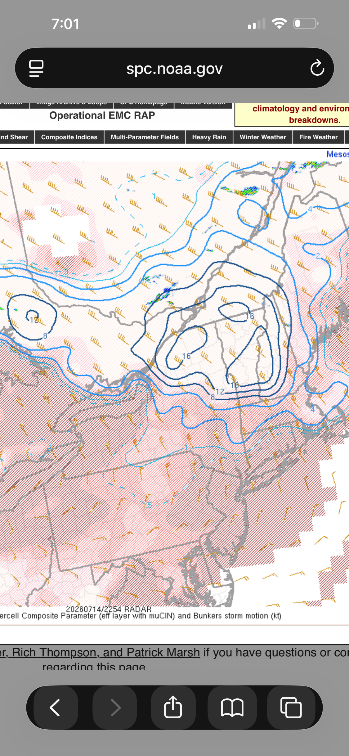
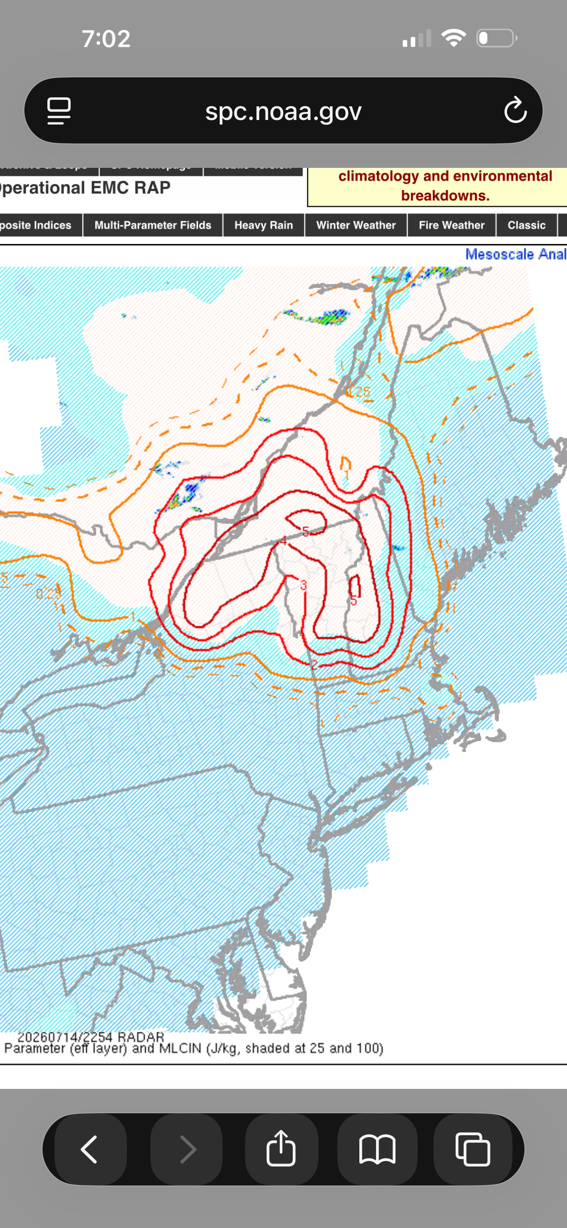
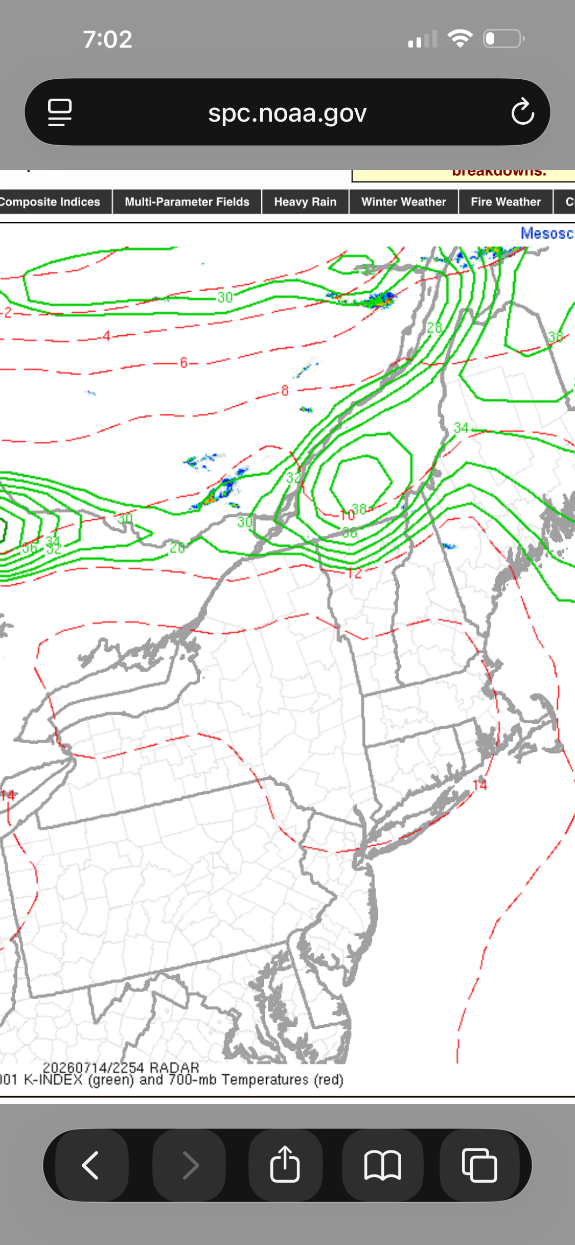
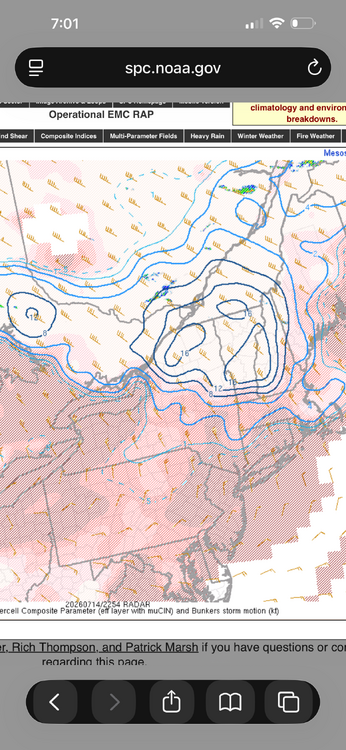
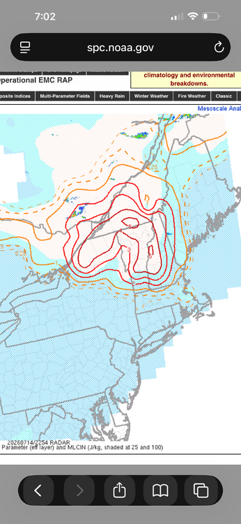
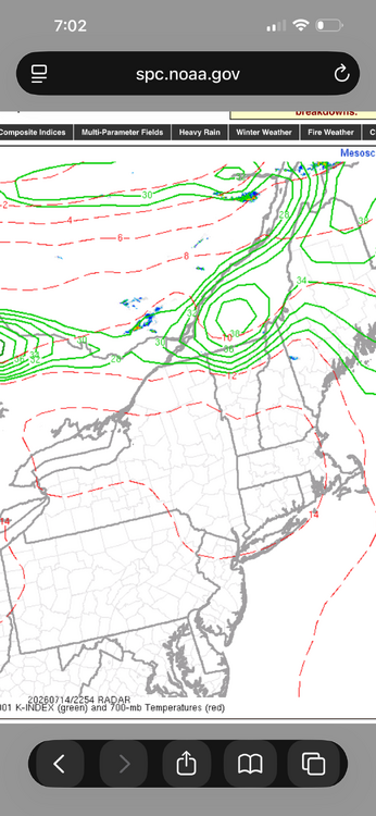
Yes. The thing is its not like there have been no storms at all in srn Quebec and NNE so far, so the convective temps has been reached. And those storms that did develop laid down boundaries to provide focus for other storms. I am just surprised the storms that developed have not been supercells b/c the enviroment is primed. Any updraft should rotate quickly, and then mesocyclone feedback makes the updraft stronger, and you get a solid supercell. Look at the SCP and SIGTOR values currently! And the K-index. There is a focused band of 850/700 moisture and obvious boundary near the border. Maybe nocturnal effects such as the strengthening LLJ and BL decoupling need to come into play here. The models clearly showing the 925 and 850 winds ramping up this evening. This happens a lot in the Plains/Midwest and you still get nasty tstms. Tor potential is typically limited though as MCS clusters/lines are more common.
-
Blast furnace w/ BOS now G32kt?
-
Having the Doppler radars now in Canada really helps for NNE radar coverage, esp. since CXX is practically useless ern semicircle. It still amazes me that the NWS was not allowed to put the CXX radar on a mountain top when it was installed in the late 90s. This action thumbs its nose at protection of lives and property, and should override anything else in this case. Was that due to VT State Regulations about towers on mountain tops? It wasn't always that way, right? Mt Mansfield has communication towers.
-
Wow, great reports! "Leaf salad," LOL. It is amazing how efficient large hail is shreding trees very quickly!
-
WxWiz will do his best to apply "english" to the risk areas to nudge them closer to CT!
-
The watch now would not be for the big stuff later I think. Marginal svr is psbl this aftn in cntrl/nrn ME. The tor box would be later for far nrn VT/NH, and NW ME.
-
Dual pol makes it easier w/ the TDS. It really narrows things down and gives confidence, so the NWS may be more inclined to send a survey to the area(s) despite the remote location, And now we have drones to scout out areas that are not accessible by road/foot. And I think at times if a strong TDS is present in a very remote area, the NWS will count that as a tor even if no survey or ground reports.
-
Stranger things have happened! How about this from July 1987? I think I will be a 2.5 mi wide F4 and cross the Continental Divide! https://www.tornadotalk.com/teton-wilderness-wy-tornado-july-21-1987/
-
Wait, no or yes? This is the first time for a ME 10% tor risk you mean?
-
Neither has VT. NH only one is the Sep 1821 event.
-
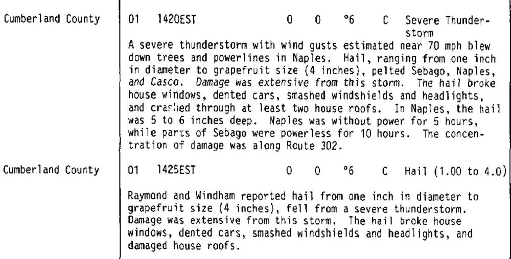
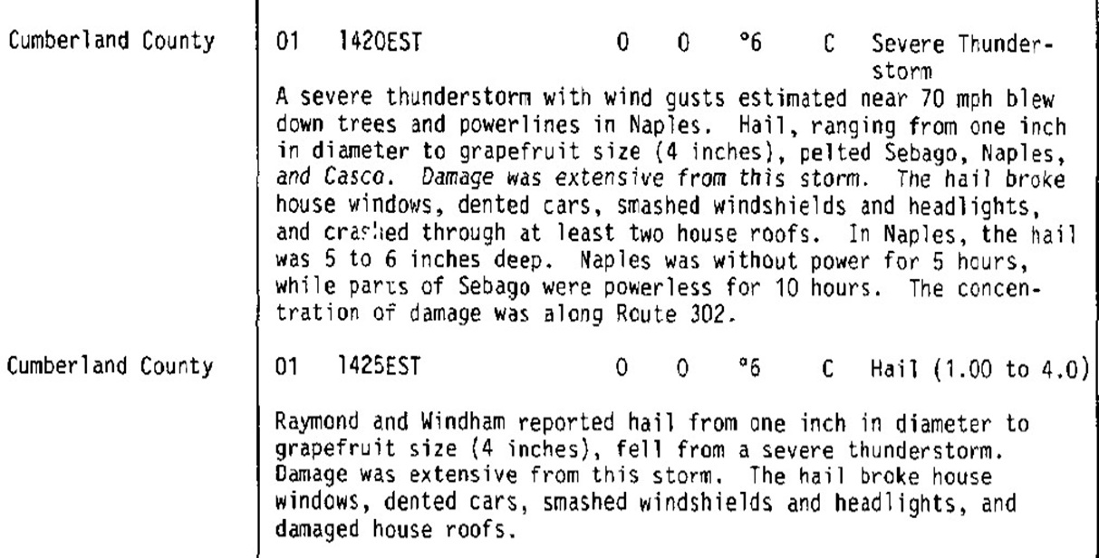
For reference, the biggest hail in New England is 4" in SW ME on 6/1/1986. Here is the Storm Data entry.