MN Transplant
-
Posts
17,948 -
Joined
-
Last visited
Content Type
Profiles
Blogs
Forums
American Weather
Media Demo
Store
Gallery
Everything posted by MN Transplant
-
Big Heat (and storms?) Week into July 4th Weekend
MN Transplant replied to yoda's topic in Mid Atlantic
Just drove up to the Fredrick MD area. Car thermometer noticeably tracked the mesonet, with lower temps in the slightly higher elevations of MoCo, and then back up over 100 going down towards Frederick. -
Big Heat (and storms?) Week into July 4th Weekend
MN Transplant replied to yoda's topic in Mid Atlantic
Noon obs: DCA: 97 BWI: 97 (has been to 98) IAD: 93 -
Big Heat (and storms?) Week into July 4th Weekend
MN Transplant replied to yoda's topic in Mid Atlantic
95.4 so far at home. The flyovers have begun and apparently I’m on the flight path!
-
Big Heat (and storms?) Week into July 4th Weekend
MN Transplant replied to yoda's topic in Mid Atlantic
84 at DCA! All-time record tied. IAD falls one short at 78. -
Big Heat (and storms?) Week into July 4th Weekend
MN Transplant replied to yoda's topic in Mid Atlantic
We'll see in 15 minutes or so whether some all-time records have been tied. ================================================================== *** ALL-TIME RECORD WARM LOWS *** ================================================================== Baltimore 83 (set on Aug 05, 1930 + 2 other times) Washington 84 (set on Jul 24, 2011 + 2 other times) Sterling-Dulles Airport 79 (set on Aug 08, 2007) Baltimore Downtown 88 (set on Jul 22, 2011 and Jul 10, 1993) Annapolis 92 (set on Jul 07, 1994) Hagerstown 86 (set on Jun 15, 1899) Martinsburg 86 (set on Jul 21, 1930) Charlottesville 85 (set on Aug 07, 1918) -
Big Heat (and storms?) Week into July 4th Weekend
MN Transplant replied to yoda's topic in Mid Atlantic
3rd highest 850mb sounding temp on record is extremely impressive. -
Big Heat (and storms?) Week into July 4th Weekend
MN Transplant replied to yoda's topic in Mid Atlantic
Feels like a night where we put up 82 for a low at DCA -
Big Heat (and storms?) Week into July 4th Weekend
MN Transplant replied to yoda's topic in Mid Atlantic
BWI 101 -
Big Heat (and storms?) Week into July 4th Weekend
MN Transplant replied to yoda's topic in Mid Atlantic
98.4 has been my high. Related to the contest, Salisbury is getting into the heat game with 97. Richmond is only 95, but they are hanging onto the upper 70s DPs while we are down to low to mid 70s for the most part up by DC. -
Big Heat (and storms?) Week into July 4th Weekend
MN Transplant replied to yoda's topic in Mid Atlantic
They’ll get a late kick out of the west and push them over the top. -
Big Heat (and storms?) Week into July 4th Weekend
MN Transplant replied to yoda's topic in Mid Atlantic
BWI wins the race to 100 -
Big Heat (and storms?) Week into July 4th Weekend
MN Transplant replied to yoda's topic in Mid Atlantic
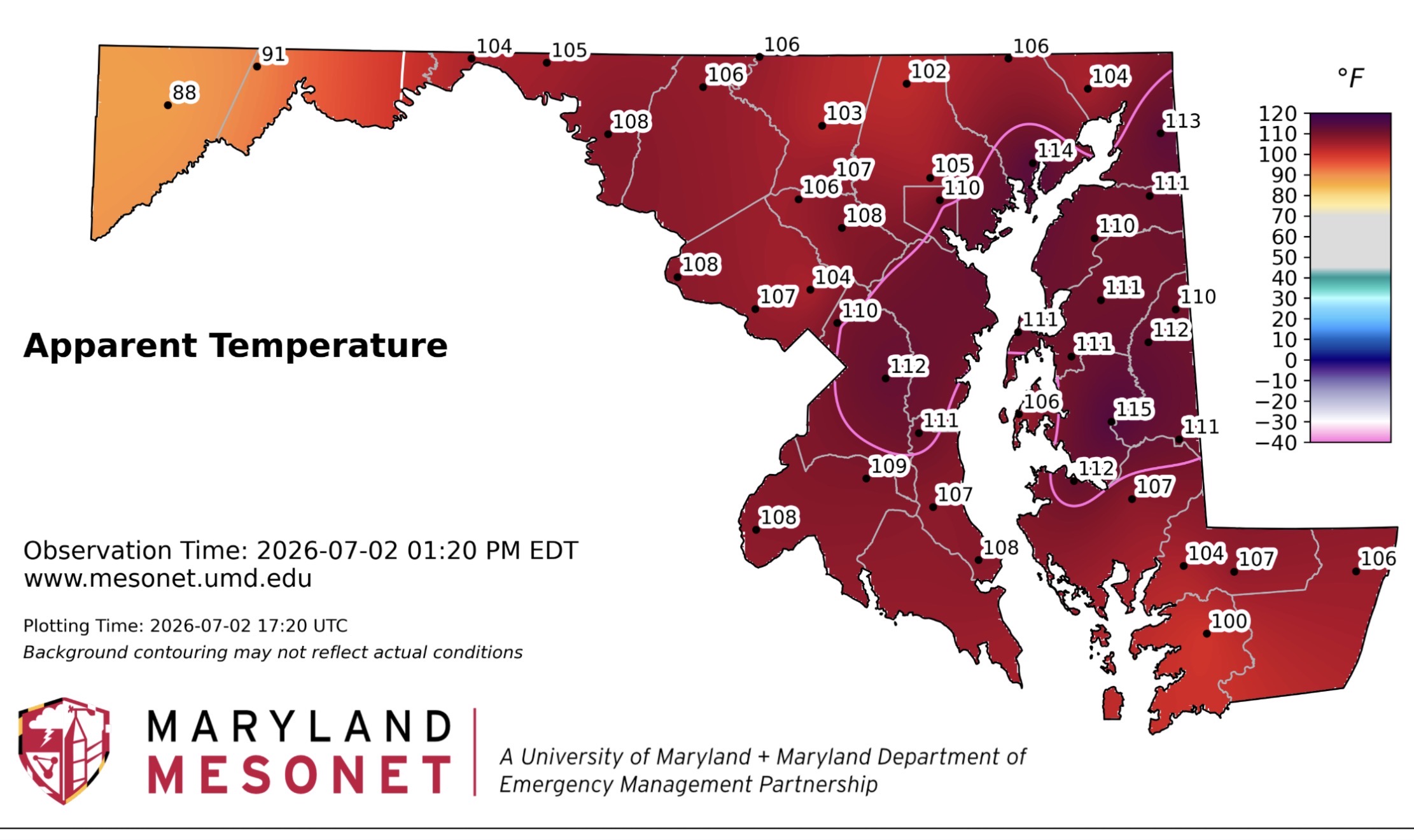
Yikes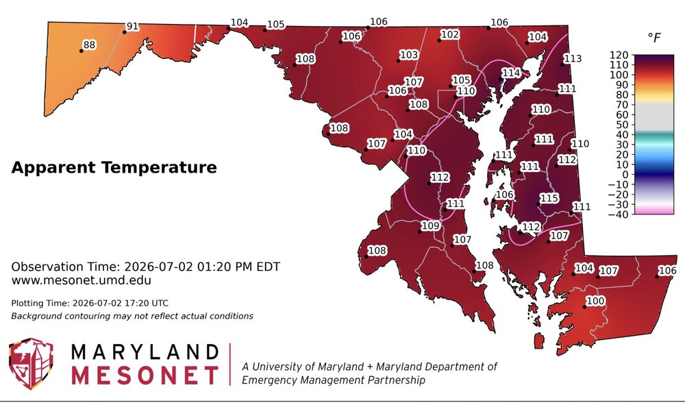
-
Big Heat (and storms?) Week into July 4th Weekend
MN Transplant replied to yoda's topic in Mid Atlantic
I was assuming that we were looking at more of a 2024 or 2010 like heat where the focus wasn’t on the humidity, but this is damn near 2011. -
Big Heat (and storms?) Week into July 4th Weekend
MN Transplant replied to yoda's topic in Mid Atlantic
IAD is almost certainly going to get their record daily high today. This airmass isn't historic enough to challenge all-time highs, but daily records at any time in July is impressive. And the lows will challenge records too. -
Big Heat (and storms?) Week into July 4th Weekend
MN Transplant replied to yoda's topic in Mid Atlantic
10:30am and we have our first couple of mesonet sites hitting 110 HI. -
Big Heat (and storms?) Week into July 4th Weekend
MN Transplant replied to yoda's topic in Mid Atlantic
One good thing that I'm seeing is that the new RRFS seems to be handling this a lot better than the HRRR. The HRRR is out of control with mixing out the boundary layer, with places like Fredericksburg with something like 108/55 tomorrow. Conversely, the RRFS is a reasonable 102/69 for tomorrow. -
Big Heat (and storms?) Week into July 4th Weekend
MN Transplant replied to yoda's topic in Mid Atlantic
My annual warning for reading the 5-minute obs. Because of rounding, a 5-minute reading of 99 could mean 98 or 99. A reading of 100 is 100. -
Big Heat (and storms?) Week into July 4th Weekend
MN Transplant replied to yoda's topic in Mid Atlantic
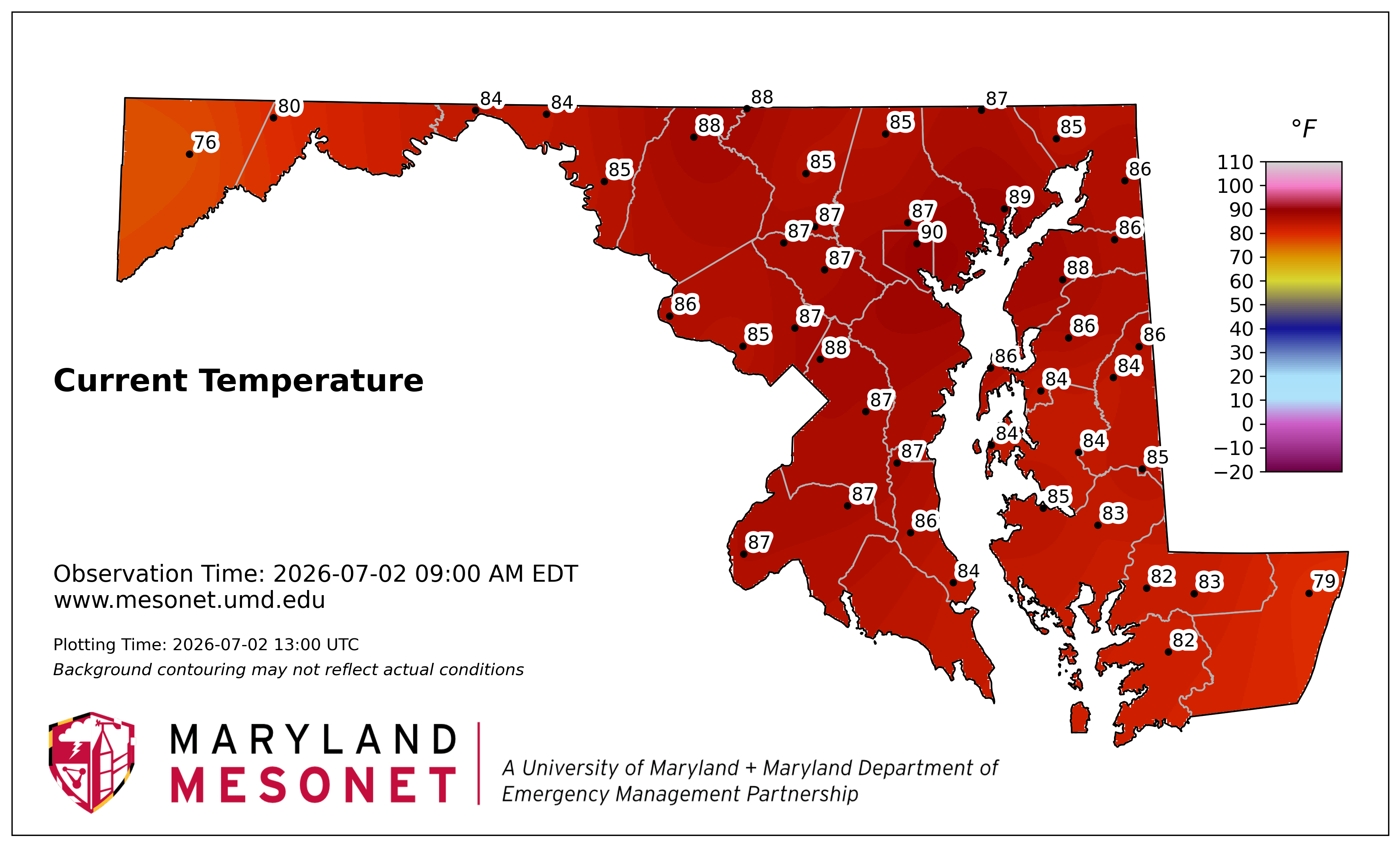
9am temps. DCA: 88 IAD: 87 BWI: 89 88.3 at home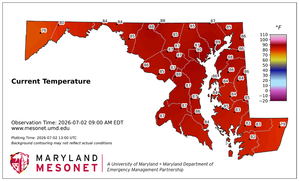
-
Big Heat (and storms?) Week into July 4th Weekend
MN Transplant replied to yoda's topic in Mid Atlantic
Immediately as there was a west wind -
Fireworks Heat Contest W 7/1 - S 7/4 for Five MA Airports
MN Transplant replied to nw baltimore wx's topic in Mid Atlantic
You and I have to be feeling good about staying on the low side for SBY. -
Big Heat (and storms?) Week into July 4th Weekend
MN Transplant replied to yoda's topic in Mid Atlantic
The max on the mesonet was 97 and IAD/BWI were also in the 97 range. I think we generally were not quite there yet with the overall environment and the DPs didn’t help. Feels like tomorrow and Friday are likely triple digits though. -
Big Heat (and storms?) Week into July 4th Weekend
MN Transplant replied to yoda's topic in Mid Atlantic
I like the pink lines for 110+. Color gradient gets tough at that point. -
Big Heat (and storms?) Week into July 4th Weekend
MN Transplant replied to yoda's topic in Mid Atlantic
105 HI on the first day of a heat wave with a river wind is something else. -
Big Heat (and storms?) Week into July 4th Weekend
MN Transplant replied to yoda's topic in Mid Atlantic
Temps are running on the low side of (the crazy) guidance but that is being overwhelmed by the DPs being higher. -
Big Heat (and storms?) Week into July 4th Weekend
MN Transplant replied to yoda's topic in Mid Atlantic
I was hoping the drought would help keep the DPs down. That is not happening. 91.4/76