MN Transplant
-
Posts
17,845 -
Joined
-
Last visited
Content Type
Profiles
Blogs
Forums
American Weather
Media Demo
Store
Gallery
Everything posted by MN Transplant
-
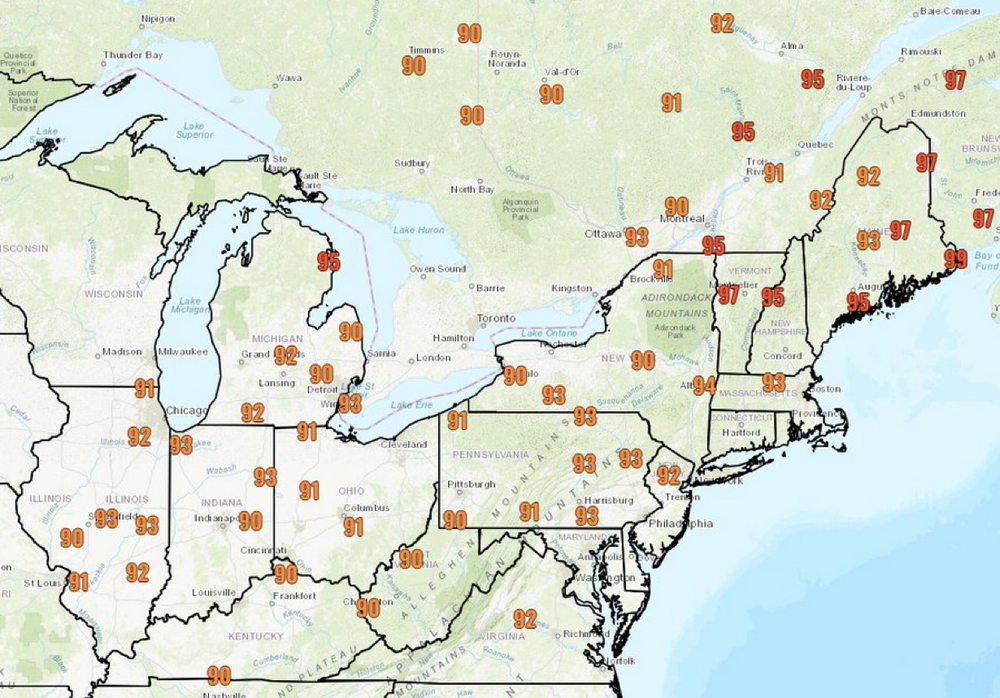
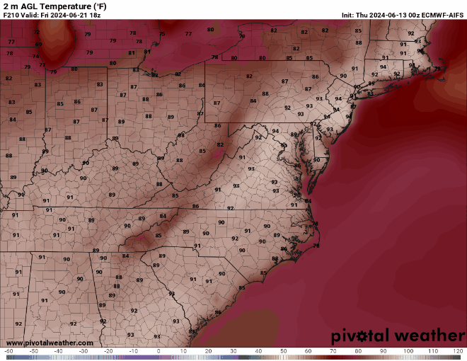
GFS, Euro, HRDPS, and HRRR all support 100 around DC on Saturday, with the NAM being a significantly outlier. The ICON joins the other globals for Sunday.
-
The heat wave was always going to be focused north of us during the middle of the week, and then collapse down onto us for the weekend. 90/65 is hot, but not that bad. When we go to 97/98 this weekend it'll be more noticeable. But the sudden-onset dry conditions have certainly helped us out in terms of feels-like weather.
-
On cue: https://twitter.com/capitalweather/status/1803595486609256511?s=46&t=bA1Os5w_10i9PfsurY28aw
-
Even 90 at home. All the spots in the shade at the pool were full.
-
My worry is that we get a lagging El Nino summer like 2010, where the heat is continuous.
-
One of the seemingly few days so far where DCA has outperformed IAD/BWI.
-
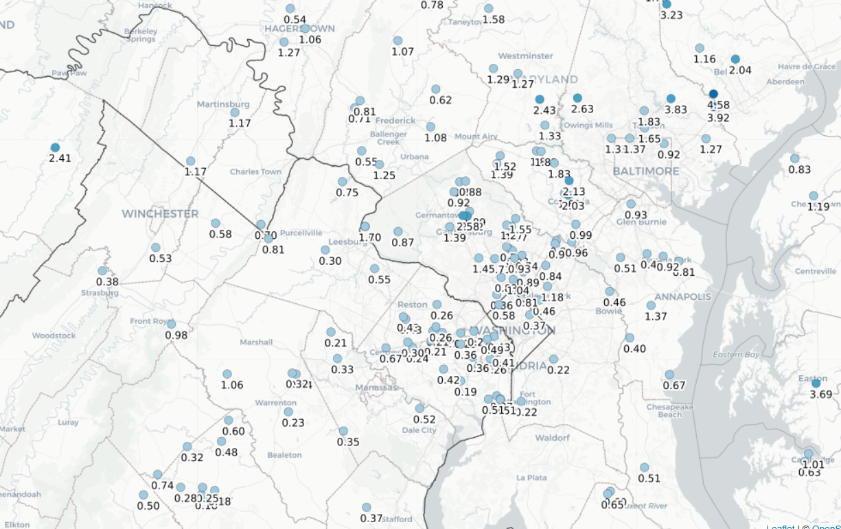
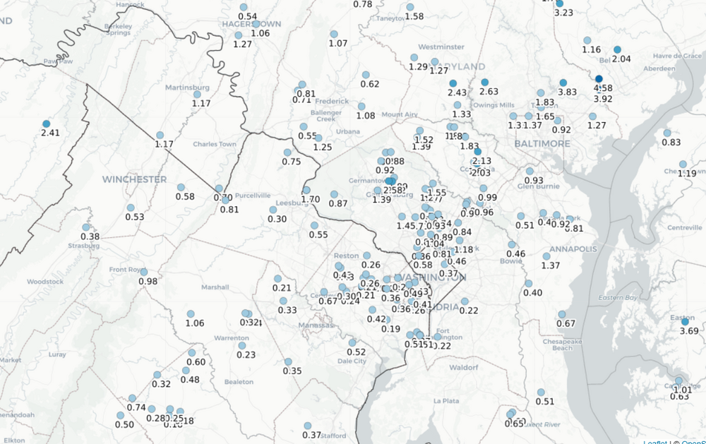
Tough June so far in northern VA. 0.23" here. Shows that it doesn't matter in the least what the precip was before summer. Once you get a couple of weeks of dry and sunny, everything without deep roots struggles.
-
The more impressive anomalies will be well north of us. Despite some of the awful Euro runs, this was always just a normal summer heat wave for us. Could grab a record high at IAD if things break right.
-
It was really the Euro, which is completely broken at this point for long-range temps.
-
0.01”. We were on a heater and it absolutely shut off once the calendar turned to June.
-
Severe warning out by Cumberland. Dews in the low 60s around the metro areas.
-
It really is broken.
-
DCA: 99 IAD: 101 BWI: 100 RIC: 99
-
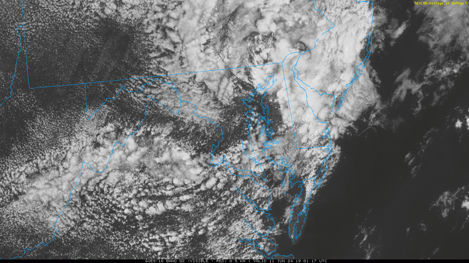
Interesting little curl NW of Baltimore in the loop

-
I'm at 74/75 and in and out of sun. Y'all are crazy, this is perfect!
- 928 replies
-
- 10
-

-
I'm not interested either.
-
1984 isn’t 40 years ag…oh, no.
- 928 replies
-
- 10
-

-
-
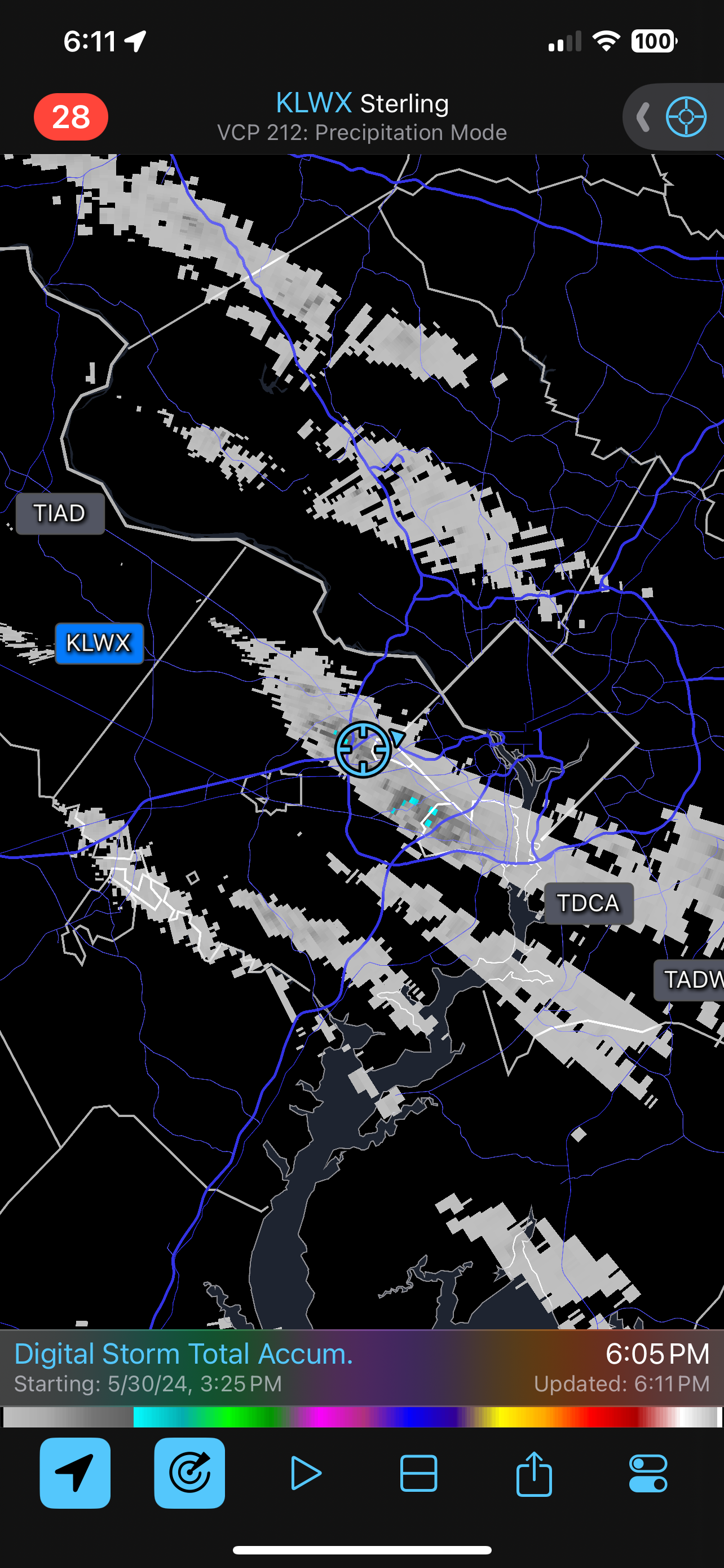
I think I’ve had six individual cells this afternoon

-
And now it is hailing
-
The HRRR and NAM had this as of this morning. I don’t know what the official forecast was but it shouldn’t have been 0 POP. Third little cell incoming to my house.
-
And…raining
-
100%. 2011 was absolutely terrible in early June with three records at DCA, but this time period has otherwise consistently been one of the nicest times of the year.
-
Broke the string with about 0.4”.
-
Thursday and Friday look spectacular, too, but I’m still up for some storms this afternoon.
-
4 consecutive days of rainfall between 0.15" and 0.30".