

Kmlwx
-
Posts
13,431 -
Joined
-
Last visited
Content Type
Profiles
Blogs
Forums
American Weather
Media Demo
Store
Gallery
Everything posted by Kmlwx
-
Some sort of line appears to be forming between Culpeper and down to the Bowling Green area.
-
Does seem there could be a brief few hour period when Wind Advisory criteria is met in a more widespread area than the advisory currently covers. We'll see what LWX does this morning. Overall duration should be short, however.
-
-
PEPCO already up to 5K outages. Been a fairly steady rise this morning. East wind is the enemy of trees around here.
-
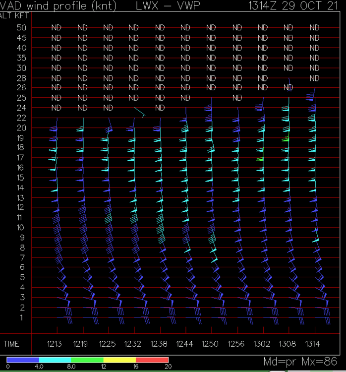
VAD winds from LWX
-

What is the Biggest Snowstorm That is Theoretically Possible For Us
Kmlwx replied to SnowenOutThere's topic in Mid Atlantic
Probably around 3ft in the more populated areas (not including south and east of the fall line). -
39.9 showing on my cheapo thermometer.
-
Would like to add - I am *not* brave enough to fall out of an airplane. Was pooping myself and considering asking the instructor to just take me back down in the airplane the entire way up. I jumped second - and watching that first woman go was eye opening. Apparently everyone else got to slide to the door on their butts - my instructor made me stand and essentially shoved me out. Can confirm - even after this I am still afraid of bugs.
-
Did this today up in Harford County. What an experience. Would recommend to anyone who is brave enough to fall out of an airplane.

-
2021 Mid-Atlantic Severe Weather - General Discussion
Kmlwx replied to Kmlwx's topic in Mid Atlantic
For this event he wont' even meh - he simply won't show up. -
2021 Mid-Atlantic Severe Weather - General Discussion
Kmlwx replied to Kmlwx's topic in Mid Atlantic
Not even any signs really of development on visible satellite either. -
2021 Mid-Atlantic Severe Weather - General Discussion
Kmlwx replied to Kmlwx's topic in Mid Atlantic
Clearly it was Thor arriving -
2021 Mid-Atlantic Severe Weather - General Discussion
Kmlwx replied to Kmlwx's topic in Mid Atlantic
Already some showers in MoCo. Could inhibit instability I guess. -
2021 Mid-Atlantic Severe Weather - General Discussion
Kmlwx replied to Kmlwx's topic in Mid Atlantic
All I'm hearing is "That activity is going to lay down some nice boundaries and we are going full on derecho mode" -
2021 Mid-Atlantic Severe Weather - General Discussion
Kmlwx replied to Kmlwx's topic in Mid Atlantic
12z HRRR is rolling in and it likes Fairfax County and then the Bay and Eastern Shore. Pretty much meh in all other areas. I'm tempted to say the fat lady is singing for places from Loudoun/Frederick, MD and west. Right now I'd probably draw a polygon for best chances running from Baltimore proper WSW back to Gaithersburg, SSW to Fairfax and then perhaps down to EZF and then including everything south and east of that line. -
2021 Mid-Atlantic Severe Weather - General Discussion
Kmlwx replied to Kmlwx's topic in Mid Atlantic
I think even my area (just north of DC/Silver Spring in Eastern MoCo may even look okay for right now. I might be right on the edge of the better stuff - but somebody will probably get a cool surprise today. Hail isn't one of the things we normally do well - there's a select few cases in the records of days when hail is an elevated threat even over wind gusts. Going to be an afternoon of radar watching. Have zero desire to drive through hail with my semi new car - but had plans to head to Annapolis this evening. -
2021 Mid-Atlantic Severe Weather - General Discussion
Kmlwx replied to Kmlwx's topic in Mid Atlantic
10z and 11z HRRR looked decent. Again, best chances south and east - but looked a little better perhaps for DC proper. But yeah - that 6z NAM nest run was pretty meh. We'll see. -
2021 Mid-Atlantic Severe Weather - General Discussion
Kmlwx replied to Kmlwx's topic in Mid Atlantic
Yep - was going to say this as well. HRRR and NAM nest have been pretty consistent with the threat being south and east. The Bay area could be positioned nicely. -
2021 Mid-Atlantic Severe Weather - General Discussion
Kmlwx replied to Kmlwx's topic in Mid Atlantic
Yep - just looks rainy to me now. -
Wonderfully pink.
-
2021 Mid-Atlantic Severe Weather - General Discussion
Kmlwx replied to Kmlwx's topic in Mid Atlantic
18z NAM nest was pretty aggressive with a severe threat in the metro corridor for Thur afternoon. Looks like a small window - but it's definitely there. -
2021 Mid-Atlantic Severe Weather - General Discussion
Kmlwx replied to Kmlwx's topic in Mid Atlantic
We always seem to end up getting a squally threat - or some sort of high shear/low CAPE event later in Oct/Nov as well. Something with a very strong cold front that has a thin tongue of 50-60 dews ahead of it. But yeah - perhaps the last of the warm season style severe potential. -
2021 Mid-Atlantic Severe Weather - General Discussion
Kmlwx replied to Kmlwx's topic in Mid Atlantic
Not to mention the plentiful other factors like how much sunshine we get, lapse rates - so many ways to fail around here. Some of it is probably anecdotal as you mention. I think for a day like the June 2012 derecho - you're absolutely right - that HOT, stagnant airmass fueled the maintenance of the storms as they plowed east. -
2021 Mid-Atlantic Severe Weather - General Discussion
Kmlwx replied to Kmlwx's topic in Mid Atlantic
Radar is pretty empty other than the stuff approaching the Northern Neck. Seems the guidance had stuff kind of later than usual for us (0-2z). May be waiting for an MCD for a while. -
2021 Mid-Atlantic Severe Weather - General Discussion
Kmlwx replied to Kmlwx's topic in Mid Atlantic
Would think it's not just about wind speed - but more important wind direction. Consider a breezy south wind bringing in humid/unstable air with a warm front passage. That would be an indicator of potentially higher severe potential versus a stiff NE breeze bringing in a wedge in the cool season or spring/fall.


