

Kmlwx
-
Posts
13,549 -
Joined
-
Last visited
Content Type
Profiles
Blogs
Forums
American Weather
Media Demo
Store
Gallery
Everything posted by Kmlwx
-

2021 Mid-Atlantic Severe Weather - General Discussion
Kmlwx replied to Kmlwx's topic in Mid Atlantic
NAM is solid for the Fred remnants. -
2021 Atlantic Hurricane Season Tracking Thread
Kmlwx replied to WxWatcher007's topic in Mid Atlantic
A little further east could bode well for impacts up here I'd think. -
2021 Mid-Atlantic Severe Weather - General Discussion
Kmlwx replied to Kmlwx's topic in Mid Atlantic
My questions are - how much of a defined center will remain - and whether it will pass too far to the west for any severe threat. -
2021 Mid-Atlantic Severe Weather - General Discussion
Kmlwx replied to Kmlwx's topic in Mid Atlantic
Prior to the last day or so - KLWX was blue like that but all the TDWRs were grey and wouldn't return any data. Can confirm it's not due to a GR update as both machines were on 2.92 before and after it popped up.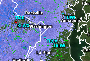
-
2021 Mid-Atlantic Severe Weather - General Discussion
Kmlwx replied to Kmlwx's topic in Mid Atlantic
Either something changed with my data feed or they finally lit up the TDWRs on GR2AE (I use the IA State feed). But they had been greyed out for me until yesterday. -
-
Backlick Run is showing at flood stage now.
-
Raining pretty good here now. May be shorter lived than the stuff @H2O went through. Radar is a bit more splotchy right now.
-
Credit to the folks at LWX. They saw the potential and went with the decision to issue the watch earlier. Certainly seems to be verifying.
-
It's been patchy - but this past week or so has been pretty wet in parts of the area. We just keep tacking rainfall onto the totals. Could be ugly if something of tropical origin comes through with extra moisture in the coming weeks.
-
-
Strike anything? We've had two houses get hit with fires in MoCo in the past week (maybe more).
-
Light rain is knocking on my doorstep now - with the heavies under 2 miles. Still looks to be continuing creeping north. LWX will probably need another layer of the FFW as it looks like the rainfall is going to start getting outside of the two existing warnings.
-
Four Mile Run at Alexandria is already at action stage and rising.
-
Stuff is still south of me - but I'm getting some pretty good rumbles of thunder the last 10 minutes or so. Still seems that the activity may be trying to push a bit more north. We'll see if it makes it! Stay safe for you guys in the warnings!
-
Still waiting here in the Silver Spring/Colesville area. Looks like some signs of life around Warrenton (other than the ongoing activity NW of Frederick and out in the mountains)
-
L:atest HRRR actually seems to focus the bulk north of most of the watch - maybe starting around 1-2z.
-
HRRR and NAM nest do fire activity and kind of throw it back NW into the FFW area.
-
2021 Mid-Atlantic Severe Weather - General Discussion
Kmlwx replied to Kmlwx's topic in Mid Atlantic
Yeah it hasn't been very good with this pulse stuff. Not sure that's even just it - the NAM nest has been off as well. I think it just has to do with how pulsey things have been. No way for even a mesoscale model to figure out exactly where the first storms will pop and then getting outflow right is even tougher. That said - I do think south of DC is where I'd rather be for storms today. The front is around - so if you're on the right side of it that'll help as well. DCAPE is substantially lower in most of the area today as well. -
2021 Mid-Atlantic Severe Weather - General Discussion
Kmlwx replied to Kmlwx's topic in Mid Atlantic
12z HRRR is lame for DC. Will see what the NAM nest shows in the next hour or so. The 0z FV3 hires was decent enough. -
2021 Atlantic Hurricane Season Tracking Thread
Kmlwx replied to WxWatcher007's topic in Mid Atlantic
If it can get going quicker than forecast - it will probably go a little more poleward versus the current cone. -
Storms have knocked me all the way back to 74 degrees. It was a bit toasty in my bedroom last night without any cooling storms.
-
2021 Atlantic Hurricane Season Tracking Thread
Kmlwx replied to WxWatcher007's topic in Mid Atlantic
At the very least we should cash in on remnants. Getting something beefy to our area is always a long long long shot. -
2021 Mid-Atlantic Severe Weather - General Discussion
Kmlwx replied to Kmlwx's topic in Mid Atlantic
A severe thunderstorm is 58mph wind or hail to quarter size or higher (or both) OR tornado. -
2021 Mid-Atlantic Severe Weather - General Discussion
Kmlwx replied to Kmlwx's topic in Mid Atlantic
Good cluster of damage reports near Damascus/Woodfield from earlier. LWX is going warn-happy today again. Active day in the books! Seems mainly a rain threat for MBY now.


