

ORH_wxman
-
Posts
93,094 -
Joined
-
Last visited
Content Type
Profiles
Blogs
Forums
American Weather
Media Demo
Store
Gallery
Everything posted by ORH_wxman
-
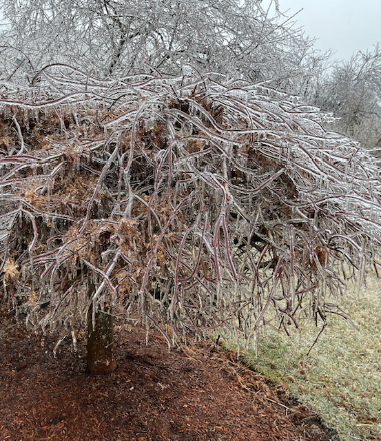
Mid-30s during mid-morning definitely feels like spring in New England....the snow pack this deep does not.
-
The cynic would look at that confluence up near Labrador and imagine that verifying a bit south....
-
06z OP Euro
-
Sunday could be an inch or two....we'll see. Beyond that next week it's kind of a disaster on model guidance....I could see another decent SWFE if things eject right, but it could also just end up as shredded mess or warmer if everything is delayed....hard to say. We definitely need to watch the Quebec highs....they've been undermodeled much of the winter in the medium range. That is no guarantee they will continue to be under modeled, but it's something to keep in the back of our minds.
-
"Don’t do it" 2026 Blizzard obs, updates and pictures.
ORH_wxman replied to Ginx snewx's topic in New England
Correct...when you are ripping 4" per hour, you are gonna have to some fluff factor even if there are winds. Sometimes the extreme rates can stabilize the winds a little in the heart of the banding....the snow itself acts a drag on it....which also helps ratios. -
Looks pretty bleak right now....though the 06z Euro did hit us on Mar 3-4 with a solid advisory/low end warning type event. But we need a lot more agreement on that.
-
Those general upslope areas seem to have done ok which makes sense given the number of clippers and northwest flow disturbances we’ve had…but once you are further east out of the upslope spots, its def been pretty dry.
-
Not sure but 4seasons map earlier in this thread is as good or better than the NWS ones anyway. I hope the NWS one still updates though because I hate when incorrect data floats around.
-
Stein has really infected NNE…seems worse the further north you go.
-
You can def get them late in the season Feb 28-Mar 1, 1995….had a lesser one but still decent on 3/2/07. And the below is from 3/23/24. Just two years ago in ORH. Most of that was midday too which is amazing that late.
-
The Quebec highs have been relentless this winter so having that trend like that wouldn’t surprise me. Gotta get through the next week first and see how anything prior shakes out . We’ll see.
-
Kevin’s long lost icestorm showing up on GFS for next weekend?
-
Lol that OP GFS shows like 3 straight days of 70s to start the second week of March. Unlikely that verifies but the longwave pattern is definitely getting a warmer look at that point.
-
Clipper Fires In Wednesday Feb 25 Disco/ Obs
ORH_wxman replied to Damage In Tolland's topic in New England
Can’t remember the last time we had this many C-2” type events. I’ll have to run the numbers but it feels like the highest this decade at min. -
Clipper Fires In Wednesday Feb 25 Disco/ Obs
ORH_wxman replied to Damage In Tolland's topic in New England
Just shoveled quickly. Sun will melt anything else that falls. About 1.5” refresher…can’t complain…was expecting C-1”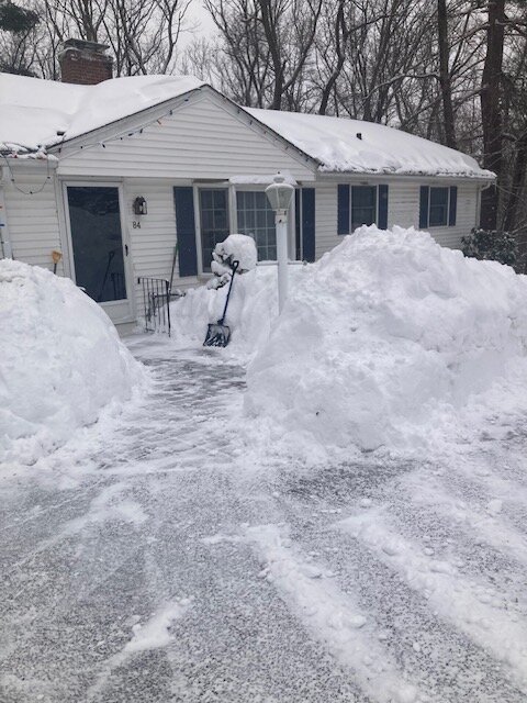
-
"Don’t do it" 2026 Blizzard obs, updates and pictures.
ORH_wxman replied to Ginx snewx's topic in New England
That was part of it, but most of the snow in these tends to fall within a 18-20 hour period....the stall prob adds another half foot or something like that. Someone very lucky gets more in the stall, but usually the precip starts to get pretty banded after a time when it stalls. If you push that arc of convective snows well inland, you're gonna get crazy widespread totals....think April '97 with maybe a bit less total QPF (we wouldn't have gotten quite the juicy WCB like that one had....which fell in a lot of areas as rain) and colder of course so the net result is basically '97 with the 30"+ stuff over a larger area. But who knows for sure since we didn't see it. I agree that the current jackpot area would've gotten less if it tracked 50 miles NW, but my guess is still easily 20-30"+. -
Clipper Fires In Wednesday Feb 25 Disco/ Obs
ORH_wxman replied to Damage In Tolland's topic in New England
Eyeballing an inch with one more solid band to move through....would be awesome if we could get to 2". -
That map isn’t quite final. Still has BOS at 16.9
-
Clipper Fires In Wednesday Feb 25 Disco/ Obs
ORH_wxman replied to Damage In Tolland's topic in New England
Starting to pick up now. Borderline moderate with good growth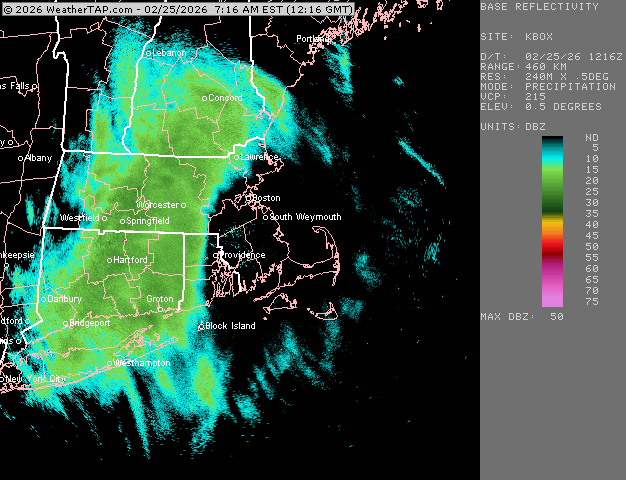
-
Clipper Fires In Wednesday Feb 25 Disco/ Obs
ORH_wxman replied to Damage In Tolland's topic in New England
Def feels like an over performer here looking at radar. Steady light snow but picking up quick. Temp wetbulbing down to 16F. Was kind of skeptical of this one but seems like we got enough southerly flow juicing this a bit into the low level cold dome. -
Clipper Fires In Wednesday Feb 25 Disco/ Obs
ORH_wxman replied to Damage In Tolland's topic in New England
Snow commencing here. Temp 17F. Don’t think we’ll have many BL issues until it’s out. -
"Don’t do it" 2026 Blizzard obs, updates and pictures.
ORH_wxman replied to Ginx snewx's topic in New England
April ‘97 only jackpotted ORH because it was classic late season elevation enhancement. The QPF maxes were southeast but they wasted a bunch of it on rain. That wouldn’t be the case in late February. That’s why it would truly have been amazing to try and see it. Once you introduce that type of instability aloft into a nuking Nor’ Easter, it takes it up to another level….from merely HECS type stuff to generational top 5 stuff. -
"Don’t do it" 2026 Blizzard obs, updates and pictures.
ORH_wxman replied to Ginx snewx's topic in New England
I remember posting in the lead-up to this event that the arc of convective snows was really catching my attention since it gave some of us instant flashbacks to April ‘97. It’s just a Firehose of convective snow streaming in from the ESE. But once the whole system trended a bit SE, the orientation changed enough to put far SE MA and much of RI in the cross hairs. We got the snow rates…it doesn’t take much imagination to think how this might have performed if it was 50-100 miles northwest like many runs had shown until the last 18-24 hours leading into the storm. That monster firehose being enhanced by convective elements would have been shot across a much larger chunk of SNE. Probably a more zonked system overall too if it was further NW. Still a great storm overall but that’s why those region-wide all-timers are so rare. You need things to line up. This one was so close though. -
"Don’t do it" 2026 Blizzard obs, updates and pictures.
ORH_wxman replied to Ginx snewx's topic in New England
Ginxy has the same longitude as ORH but far enough inland and elevated to avoid a lot of the SE CT flatland problems with marine intrusion. Def a solid spot. He prob only averages a hair less than N Foster coop just up the road and a little higher. -
Yeah the west slope gets probably on averages a solid 8-10” less per year than equivalent elevation on the east slope of ORH hills. The events you clean up really good in are those westerly component flow events at the sfc. They just aren’t super common. The SWFEs are always fun for most since they remove a lot of the orographic effects and it’s usually just latitude/longitude.


