

ORH_wxman
-
Posts
93,099 -
Joined
-
Last visited
Content Type
Profiles
Blogs
Forums
American Weather
Media Demo
Store
Gallery
Everything posted by ORH_wxman
-
"Don’t do it" 2026 Blizzard obs, updates and pictures.
ORH_wxman replied to Ginx snewx's topic in New England
Here come the really heavy bands starting to rotate in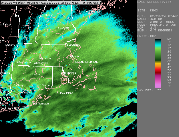
-
"Don’t do it" 2026 Blizzard obs, updates and pictures.
ORH_wxman replied to Ginx snewx's topic in New England
Seems like the short term guidance is finally picking up the unfolding Firehose over southeast areas…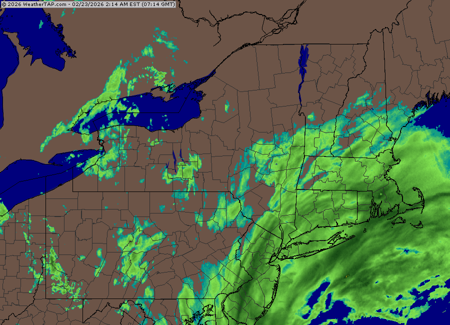
-
"Don’t do it" 2026 Blizzard obs, updates and pictures.
ORH_wxman replied to Ginx snewx's topic in New England
Pounding in this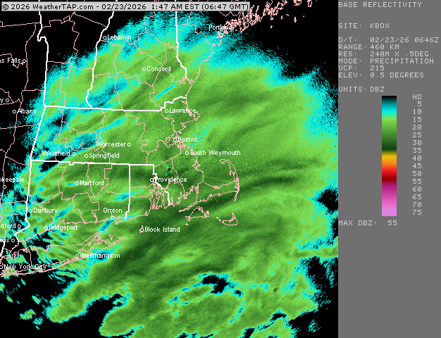
-
"Don’t do it" 2026 Blizzard obs, updates and pictures.
ORH_wxman replied to Ginx snewx's topic in New England
Pounding in this right now. About 2” eyeballing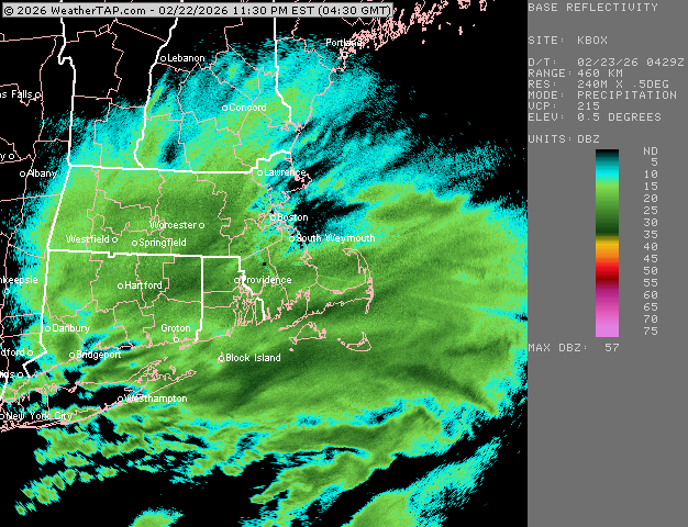
-
"Don’t do it" 2026 Blizzard obs, updates and pictures.
ORH_wxman replied to Ginx snewx's topic in New England
1.5”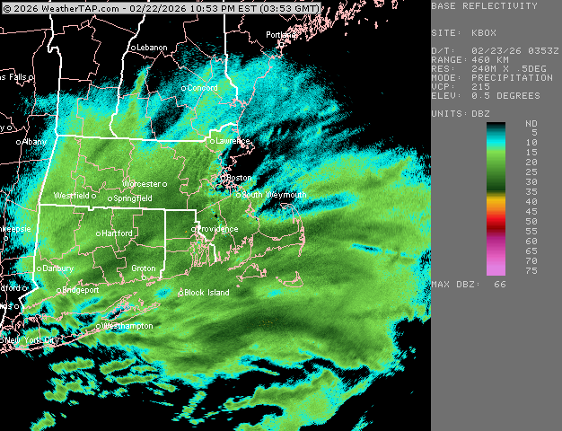
-
"Don’t do it" 2026 Blizzard obs, updates and pictures.
ORH_wxman replied to Ginx snewx's topic in New England
Def heavy now. No doubt, even in the dark. -
"Don’t do it" 2026 Blizzard obs, updates and pictures.
ORH_wxman replied to Ginx snewx's topic in New England
Starting to really nuke now in this. We’re borderline heavy (little tougher to tell vis at night). Radar looks excellent for a lot of people right now.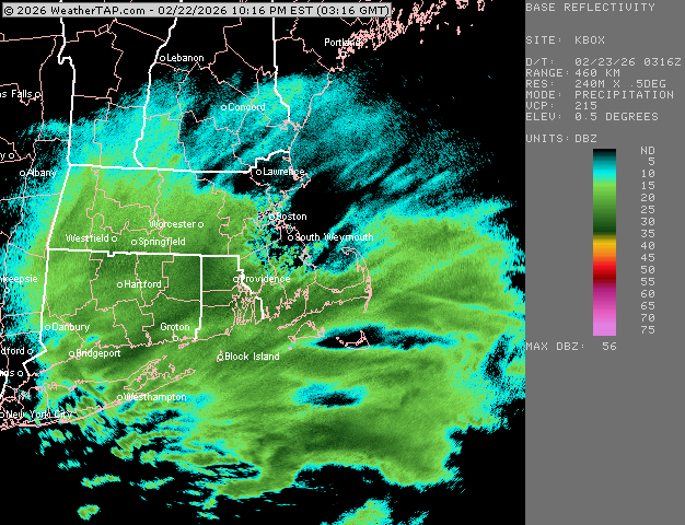
-
"Don’t do it" 2026 Blizzard obs, updates and pictures.
ORH_wxman replied to Ginx snewx's topic in New England
Moderate snow with excellent snow growth right now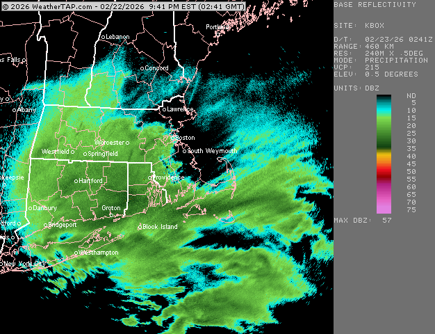
-
"Don’t do it" 2026 Blizzard obs, updates and pictures.
ORH_wxman replied to Ginx snewx's topic in New England
Incoming for @Ginx snewx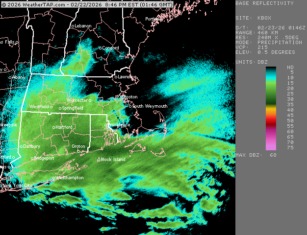
-
"Don’t do it" 2026 Blizzard obs, updates and pictures.
ORH_wxman replied to Ginx snewx's topic in New England
Really starting to get steadier and heavier. Wouldn’t call it moderate yet but it’s right there. Def 3/4 type stuff. -
"Don’t do it" 2026 Blizzard obs, updates and pictures.
ORH_wxman replied to Ginx snewx's topic in New England
Seems a little pessimistic looking at verification right now. -
"Don’t do it" 2026 Blizzard obs, updates and pictures.
ORH_wxman replied to Ginx snewx's topic in New England
Bryce got into Dad’s scotch. -
"Don’t do it" 2026 Blizzard obs, updates and pictures.
ORH_wxman replied to Ginx snewx's topic in New England
Weenie flakes here. -
“Cory’s in NYC! Let’s HECS!” Feb. 22-24 Disco
ORH_wxman replied to TheSnowman's topic in New England
This won’t have near the duration of ‘78 either. -
“Cory’s in NYC! Let’s HECS!” Feb. 22-24 Disco
ORH_wxman replied to TheSnowman's topic in New England
MAUL means “Moist Absolutely Unstable Layer”….it is usually an area of steep lapse rates aloft that can enhance upward lift (like in a thunderstorm)….its why Scooter was joking about an EML getting advected in aloft. When you see that, it increases the chances of thundersnow and very heavy rates. -
“Cory’s in NYC! Let’s HECS!” Feb. 22-24 Disco
ORH_wxman replied to TheSnowman's topic in New England
GFS did its job. Gave us 7 great innings, but it’s gassed now. Bullpen (mesos) can bring this one home. -
“Cory’s in NYC! Let’s HECS!” Feb. 22-24 Disco
ORH_wxman replied to TheSnowman's topic in New England
That 3k NAM was ridiculous. Not a whole lot left to analyze. -
“Cory’s in NYC! Let’s HECS!” Feb. 22-24 Disco
ORH_wxman replied to TheSnowman's topic in New England
Dude’s been chasing thundersnow for 30 years now, lol….i still remember his first one in ORH in Dec 1996. -
“Cory’s in NYC! Let’s HECS!” Feb. 22-24 Disco
ORH_wxman replied to TheSnowman's topic in New England
Interior SE MA is my vegas bet for the jackpot but can’t rule out either upper cape or maybe further northeast on the coast near Scooter….upper cape is warmer but if they get more prolonged convective snows than elsewhere, it might not matter. -
“Cory’s in NYC! Let’s HECS!” Feb. 22-24 Disco
ORH_wxman replied to TheSnowman's topic in New England
South shore anywhere from very upper cape to interior SE MA is def gonna be the regional jackpot. There will be another smaller jackpot out further northwest where the pivot point is…don’t know exactly where yet. -
“Cory’s in NYC! Let’s HECS!” Feb. 22-24 Disco
ORH_wxman replied to TheSnowman's topic in New England
Maybe 4-8” and lots of wind. -
“Cory’s in NYC! Let’s HECS!” Feb. 22-24 Disco
ORH_wxman replied to TheSnowman's topic in New England
Yep…5-8am…maybe as early as 4am for far SE MA…is when the convective stuff rips into eastern MA. -
“Cory’s in NYC! Let’s HECS!” Feb. 22-24 Disco
ORH_wxman replied to TheSnowman's topic in New England
Imagine if you had a place to go that was going to get 3"+ of qpf and 70+ mph wins? That would be something We’re gonna be ribbing MPM for years if he buys a place in Mattapoisett and then misses a top 3-5 storm there all time. -
“Cory’s in NYC! Let’s HECS!” Feb. 22-24 Disco
ORH_wxman replied to TheSnowman's topic in New England
That arc of convection getting entrained very early tomorrow over SE MA is gonna be crazy. That’s where we could see thundersnow and the rates getting over 3”+ per hour. -
“Cory’s in NYC! Let’s HECS!” Feb. 22-24 Disco
ORH_wxman replied to TheSnowman's topic in New England
Looks a tick east of 06z early on. Though 06z was pretty crazy tucked down south.


