ORH_wxman
-
Posts
93,099 -
Joined
-
Last visited
Content Type
Profiles
Blogs
Forums
American Weather
Media Demo
Store
Gallery
Everything posted by ORH_wxman
-
“Cory’s in NYC! Let’s HECS!” Feb. 22-24 Disco
ORH_wxman replied to TheSnowman's topic in New England
Prob some terrain enhancement when 850 is ENE at 80 knots and 925 is out of NE at 60+ knots -
“Cory’s in NYC! Let’s HECS!” Feb. 22-24 Disco
ORH_wxman replied to TheSnowman's topic in New England
-
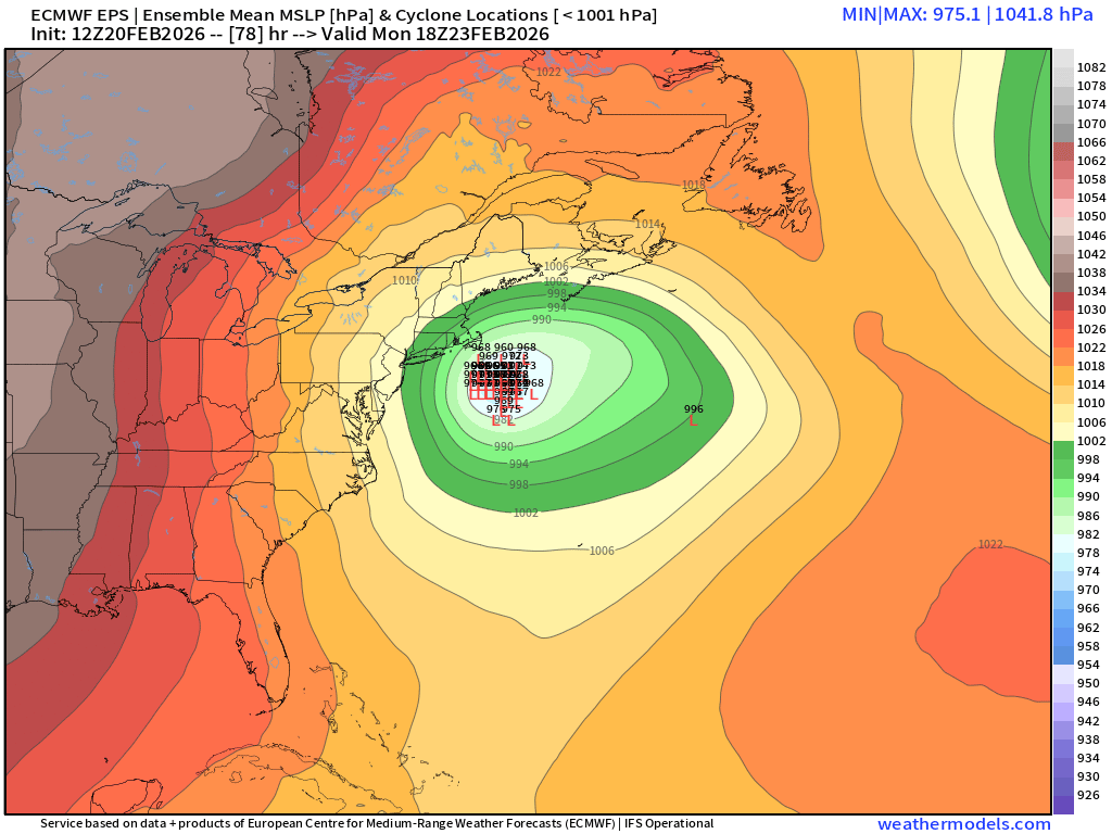
LR is showing some sneaky ridging over pole area becoming more amplified which is stretching the PV in Canada a little and pressing it south....we could have another shot of arctic cold, though obviously not as stinging as we get in January or early Feb. Also probably additional snow chances. Definite gradient pattern though...so cutters are a risk too.
-
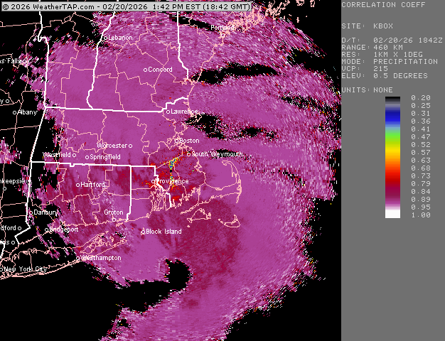
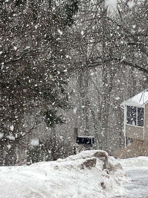
Still absolutely pounding here. About an inch so far. CC shows sleet line sort of hanging near MA/RI border at the moment
-
Poundage
-
Now we're pounding as these better echoes move in.
-
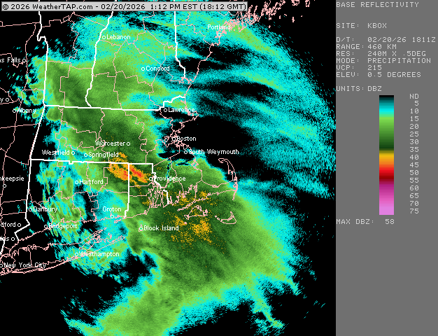
Steady snow has commence here. Light but steady. Heavier echoes about to move in, so maybe we can grab a quick 1-2"....not expecting much though.
-
“Cory’s in NYC! Let’s HECS!” Feb. 22-24 Disco
ORH_wxman replied to TheSnowman's topic in New England
I'd probably do it....but I'm sick. -
“Cory’s in NYC! Let’s HECS!” Feb. 22-24 Disco
ORH_wxman replied to TheSnowman's topic in New England
Next panel for those further N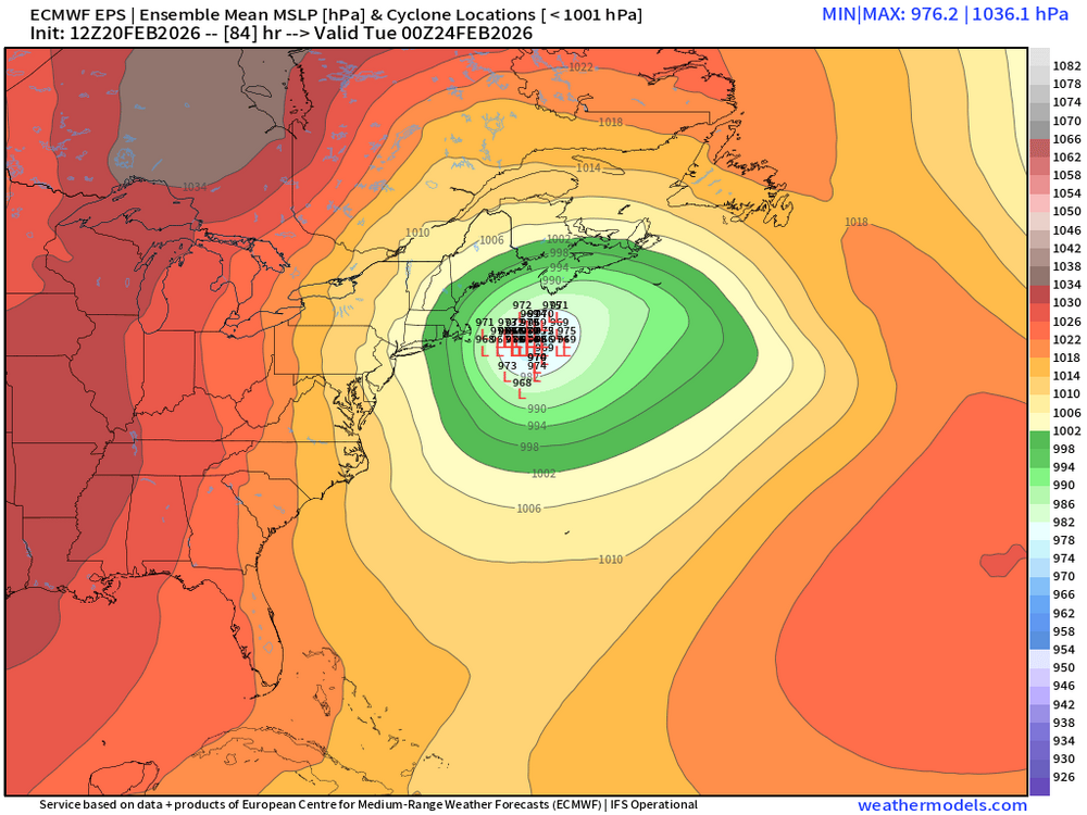
-
“Cory’s in NYC! Let’s HECS!” Feb. 22-24 Disco
ORH_wxman replied to TheSnowman's topic in New England
Regular EPS
-
“Cory’s in NYC! Let’s HECS!” Feb. 22-24 Disco
ORH_wxman replied to TheSnowman's topic in New England
Yeah and I think this is how Jan 2015 became very prolific....we were able to jack up the CCB by wrapping up instability into it. We didn't get a true WCB in that. -
“Cory’s in NYC! Let’s HECS!” Feb. 22-24 Disco
ORH_wxman replied to TheSnowman's topic in New England
If we can introduce more WCB into it, then it can go onto HECS territory, but that would def require amplifying this a bit more. -
“Cory’s in NYC! Let’s HECS!” Feb. 22-24 Disco
ORH_wxman replied to TheSnowman's topic in New England
I've always refused to call them by the TWC name. Plus, by calling it by the date, it helps everyone else not forget the year. -
“Cory’s in NYC! Let’s HECS!” Feb. 22-24 Disco
ORH_wxman replied to TheSnowman's topic in New England
Kind of looks like the Ukie...maybe a little better. Doesn't get the MECS-type QPF inland that far...maybe to 128 or BOS-PVD or so. Warnings snows back into most of SNE, but the higher end stuff is SE MA/RI. -
“Cory’s in NYC! Let’s HECS!” Feb. 22-24 Disco
ORH_wxman replied to TheSnowman's topic in New England
When the storm takes a bit of a wide turn, we often see the dry air try and advect down the valleys more efficiently with a drier ageo vector. It obivously gets overcome if you get into the CCB enough, but the areas kind of on the outer periphery should watch it. I think it affected Jan 2015 in some western areas making it even worse arctic sand than usual. -
“Cory’s in NYC! Let’s HECS!” Feb. 22-24 Disco
ORH_wxman replied to TheSnowman's topic in New England
Ukie way NW and finally a hit. 20 burger for PYM area. Prob close to a foot for BOS-PVD....rest of us are in the 6-10" range except far western MA. -
“Cory’s in NYC! Let’s HECS!” Feb. 22-24 Disco
ORH_wxman replied to TheSnowman's topic in New England
20 burgers in SE MA this run -
“Cory’s in NYC! Let’s HECS!” Feb. 22-24 Disco
ORH_wxman replied to TheSnowman's topic in New England
CCB def gets pulled a little north despite the low starting a touch east. Looks a little healthier than 06z -
“Cory’s in NYC! Let’s HECS!” Feb. 22-24 Disco
ORH_wxman replied to TheSnowman's topic in New England
Delta-Ts aren't particularly big.....esp this time of the year after the type of winter we've had....water temps are chilly. Might be some as the winds turn more northerly and if we can get 850s down to roughly -10C or so.... -
“Cory’s in NYC! Let’s HECS!” Feb. 22-24 Disco
ORH_wxman replied to TheSnowman's topic in New England
Yeah mesos are still marginal right now for utility. ICON gives a 20-burger for SE MA/Cape -
“Cory’s in NYC! Let’s HECS!” Feb. 22-24 Disco
ORH_wxman replied to TheSnowman's topic in New England
RGEM shunted east a little at the last second. Still a good hit for eastern folks but slightly less than 06z -
“Cory’s in NYC! Let’s HECS!” Feb. 22-24 Disco
ORH_wxman replied to TheSnowman's topic in New England
RGEM looks a bit more amped through 36h -
“Cory’s in NYC! Let’s HECS!” Feb. 22-24 Disco
ORH_wxman replied to TheSnowman's topic in New England
Give @ineedsnowa break, he hasn't slept since October. -
“Cory’s in NYC! Let’s HECS!” Feb. 22-24 Disco
ORH_wxman replied to TheSnowman's topic in New England
Def better than 06z and 00z....but not like the globals. It will prob be pretty ujnderwhelming run for most of us but its the NAM in clown range and it got better. -
Looks like vis got down to 1 and a quarter briefly so they might have been mostly snow for a brief time or at least a lot of large aggies mixed in to drop the vis....but it was like 10 minutes of vis under 2 miles.