ORH_wxman
-
Posts
93,098 -
Joined
-
Last visited
Content Type
Profiles
Blogs
Forums
American Weather
Media Demo
Store
Gallery
Everything posted by ORH_wxman
-
"Don’t do it" 2026 Blizzard obs, updates and pictures.
ORH_wxman replied to Ginx snewx's topic in New England
ORH was also the previous record 33.0” in the 3/31-4/1 ‘97 storm and then 32.9” in the Dec 1992 storm before that. Ironically, I think the previous 14 years, the record holder was PVD again with that 28.6 in 1978. -
"Don’t do it" 2026 Blizzard obs, updates and pictures.
ORH_wxman replied to Ginx snewx's topic in New England
I def thought you might get deformed like Mar 2018 when this was shifting a bit east. But luck of the draw sometimes in strong coastals. Too bad the ULL didn’t stay further west under E LI because then nobody gets slotted or exhaust in SNE. -
"Don’t do it" 2026 Blizzard obs, updates and pictures.
ORH_wxman replied to Ginx snewx's topic in New England
Might pick up there in a few. That band is trying to backbuild a bit into Middlesex county
-
"Don’t do it" 2026 Blizzard obs, updates and pictures.
ORH_wxman replied to Ginx snewx's topic in New England
We're trying to limp our way to a 20-burger....I'm calling it a shade over 19" right now using snow board and 2 alternate measurements in relatively sheltered areas. I could prob get away with calling it 20 given the wind/drifting, but I think that would be slightly steep. IF we can get another weenie band to intensity for an hour or two, then we can make it. Maybe we'll get a January 2022 LES type band....lol. At the end of that storm, I picked up nearly 5" during the evening in those backlash bands on NW winds....not easy to do, but it was like LES blower powder. -
"Don’t do it" 2026 Blizzard obs, updates and pictures.
ORH_wxman replied to Ginx snewx's topic in New England
Yeah impressive. Although there’s gonna be some NW to SE beam drift now and sometimes these bands can start having more bark than bite as low levels start to dry
-
"Don’t do it" 2026 Blizzard obs, updates and pictures.
ORH_wxman replied to Ginx snewx's topic in New England
Scooter getting hammered on that band
-
"Don’t do it" 2026 Blizzard obs, updates and pictures.
ORH_wxman replied to Ginx snewx's topic in New England
Yep. They still want every 6 hours at first order sites... -
"Don’t do it" 2026 Blizzard obs, updates and pictures.
ORH_wxman replied to Ginx snewx's topic in New England
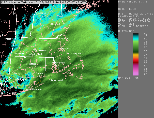
This band out near 495 is just going to town here right now. Choking dendrites on the east side of it. South shore stuff seems to be re-intensifying again a bit.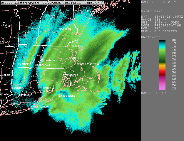
-
"Don’t do it" 2026 Blizzard obs, updates and pictures.
ORH_wxman replied to Ginx snewx's topic in New England
As a rule (I had mentioned this before the mega SWFE on 1/25-26), I try not to stray over 13 or 14 to 1 even in cold events that look “decent” in the soundings. That’s basically the cold snow climo in a lot of New England (outside of the upslope zones). Unless you have overwhelming model consensus on strong crosshair sigs in an event that isn’t super complex or long-duration….that might be the exception. -
"Don’t do it" 2026 Blizzard obs, updates and pictures.
ORH_wxman replied to Ginx snewx's topic in New England
We continue to rip in this stuff. It’s not the stuff of PVD lore and SE MA but been lucky enough to stay in it when a little further NW sucked on exhaust for a few hours. Consistently 1-2” per hour stuff. was just outside snow blowing and we had about 5” new from when I last did it and had 13”. So we’re past 18” at this point. 20+ is a lock.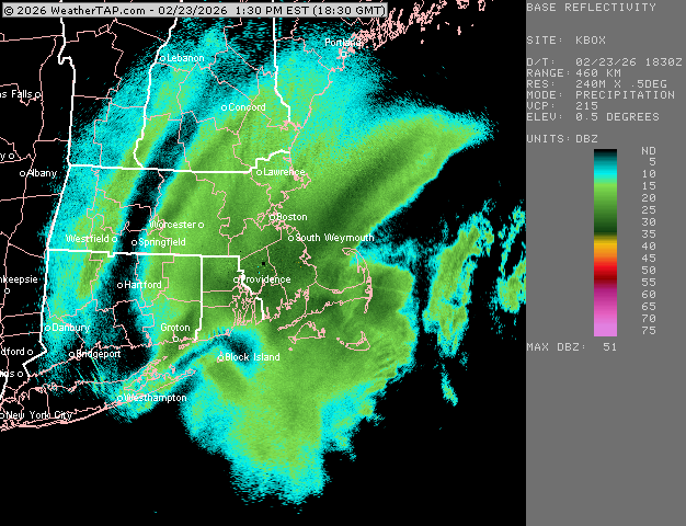
-
"Don’t do it" 2026 Blizzard obs, updates and pictures.
ORH_wxman replied to Ginx snewx's topic in New England
Death band losing just a bit of intensity now but still obscene. Still heavy snow here under these ~25 dbz echos.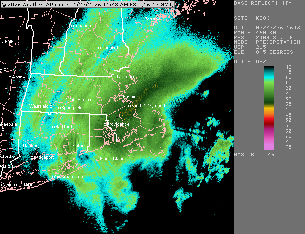
-
"Don’t do it" 2026 Blizzard obs, updates and pictures.
ORH_wxman replied to Ginx snewx's topic in New England
Seems to be congealing into a moderate to borderline heavy snow over E MA as the uber intense stuff is sinking a touch SE…but the subsidence zones are disappearing NW of 495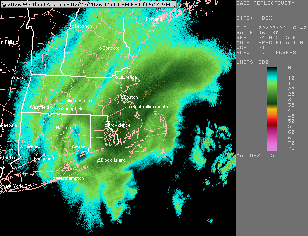
-
"Don’t do it" 2026 Blizzard obs, updates and pictures.
ORH_wxman replied to Ginx snewx's topic in New England
How does Cory have single digits? I'm at 15" minimum and north of him in Holliston -
"Don’t do it" 2026 Blizzard obs, updates and pictures.
ORH_wxman replied to Ginx snewx's topic in New England
Keep regenerating and making little surges west. We'll pulse back to moderate and then go back to whiteout 300 yard vis. Picked up here again in the past few min. Absolute destruction where you are right now and just south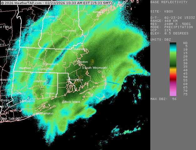
-
"Don’t do it" 2026 Blizzard obs, updates and pictures.
ORH_wxman replied to Ginx snewx's topic in New England
You visiting down in RI for this one? IF so, that's awesome....Yeah, ground zero there -
"Don’t do it" 2026 Blizzard obs, updates and pictures.
ORH_wxman replied to Ginx snewx's topic in New England
Crushed Gonna be a lot of 30 burgers in RI and adjacent SE Ma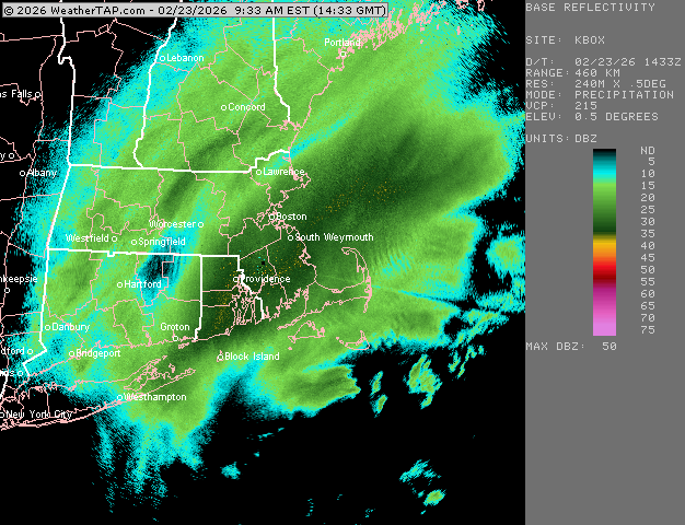
-
"Don’t do it" 2026 Blizzard obs, updates and pictures.
ORH_wxman replied to Ginx snewx's topic in New England
Making another little push west with the good stuff….almost back to pure whiteout here. We had briefly gone to perhaps borderline moderate snow but now can’t see 3 houses away…just puking snow The meat of that band has to be like 4” per hour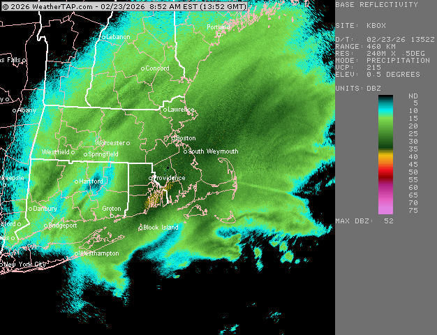
-
"Don’t do it" 2026 Blizzard obs, updates and pictures.
ORH_wxman replied to Ginx snewx's topic in New England
13” here now or so (very tough to measure but it’s def close to that. Might be more but staying relatively conservative) Epic over SE MA. Im on the northwest edge of the good stuff but nothing like RI and further SE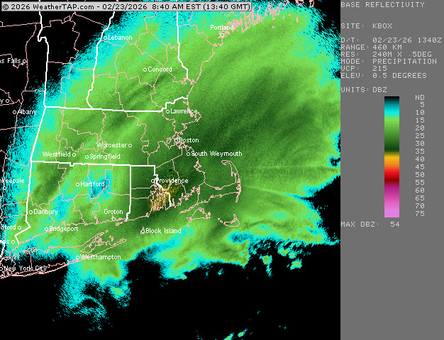
-
"Don’t do it" 2026 Blizzard obs, updates and pictures.
ORH_wxman replied to Ginx snewx's topic in New England
Prob not a whole lot more. Mignt try to nudge a little more as the storm gains latitude but it’s also fighting occlusion as we go forward in time too so it will weaken some. -
"Don’t do it" 2026 Blizzard obs, updates and pictures.
ORH_wxman replied to Ginx snewx's topic in New England
We have like 60 knots rolling in at 850-900 from the northeast so your drift at that point away from radar beam with those velocities is prob like 15+ miles. -
"Don’t do it" 2026 Blizzard obs, updates and pictures.
ORH_wxman replied to Ginx snewx's topic in New England
RI is epic right now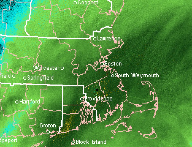
-
"Don’t do it" 2026 Blizzard obs, updates and pictures.
ORH_wxman replied to Ginx snewx's topic in New England
This is like the reverse standing wave dryslot there in March 2013. They were perpetually under 35-40dbz -
"Don’t do it" 2026 Blizzard obs, updates and pictures.
ORH_wxman replied to Ginx snewx's topic in New England
No idea what we have trying to estimate from inside but eyeballing about 10? -
"Don’t do it" 2026 Blizzard obs, updates and pictures.
ORH_wxman replied to Ginx snewx's topic in New England
Absolutely nuking outside Don’t even want to know how much it’s snowing southeast where it’s even heavier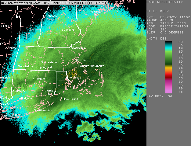
-
"Don’t do it" 2026 Blizzard obs, updates and pictures.
ORH_wxman replied to Ginx snewx's topic in New England
Here come the really heavy bands starting to rotate in