ORH_wxman
-
Posts
93,098 -
Joined
-
Last visited
Content Type
Profiles
Blogs
Forums
American Weather
Media Demo
Store
Gallery
Everything posted by ORH_wxman
-
Meltdown's R Us. What's Buried Is Seen Again...
ORH_wxman replied to Cold Miser's topic in New England
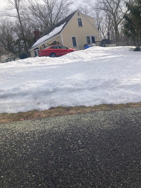
First time seeing the firepit this evening since mid January.
-
So many skeptics on that event leading into it. Models didn’t handle it well at all but the underlying theme was dumping a lot of QPF. A lot of tv stations had like 2-4” or 3-6” for interior elevated areas and I couldn’t understand it. I was going like 8-14” and I was wau too light.
-
They are up a ton since those were published. I have a spreadsheet I did that goes I think through 2018 or 2019. I’ll post the frequencies when I’m back on my work laptop. I think I did them for BOS and BDL too. I think ORH averaged roughly one 12”+ per winter in the last 30 years or so. That basically doubles the previous frequency. To be fair, that 1992 cutoff is brutal in the old averages….youre including the 1980s and those early 1990s years in there without the benefit of having those big 1990s years in there.
-
Epic.
-
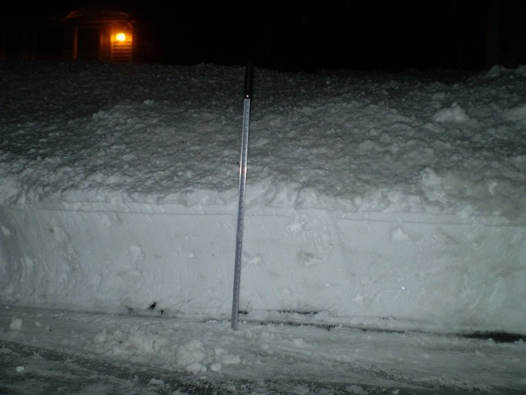
Pretty damned impressive run of double digit pack though. One of these years we’ll get a March 2001 or 2018 or 2013 on top of this type of pack…but it wasn’t meant to be this year. Early March melt-outs suck…too early to really take advantage of it unless it’s barely any pack like 2012.
-
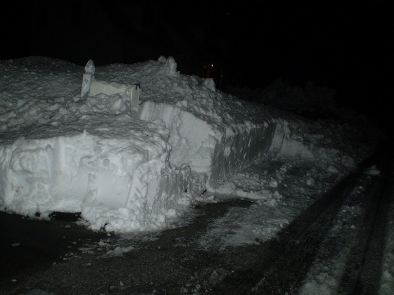
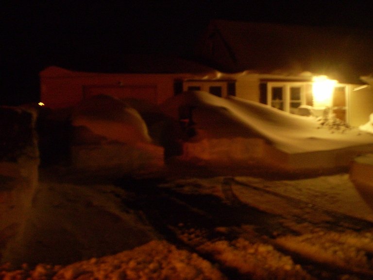
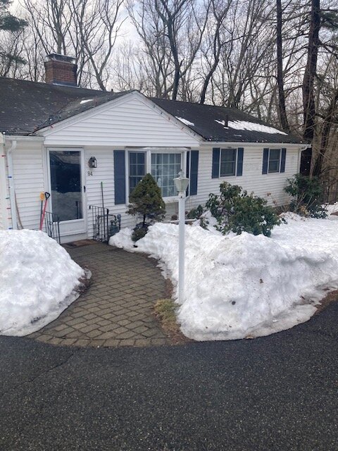
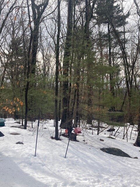
impressive meltoff there. It’s impressive here too. The last 24 hours here has been crazy. Taken an absolute beating. We still have more work to do, but for the first time in eons, the grass is showing on the edges of the snow and we can see a lot of rocks popping up in the woods out back. I hadn’t seen these huge boulders since mid January.
-
Euro Skynet has been pretty weenie-ish for several runs now. Hopefully it has the right idea. EPS gives mild support for multiple systems between the 16th and 23rd but you’d want to see it more coherent as we get closer.
-
Yep. Clinch Leatherwood was notable…he was the original Messenger on WWBB. RIP…we lost him in 2015 but his legacy lives in everytime we mention the Messenger Shuffle. I also recognize so many names that just drifted off the board over the years but were pretty consistent posters on here.
-
@The 4 Seasons
-
I think the window will be about 10-12 days. Well see if the pattern wants to try for an early April bomb too, but I think starting about the 16th is when that final period of favorability starts. I agree that the cold won’t feel that bad. There’s going to be some mild days mixed in when one of those systems cuts west.
-
We all know you’re losing it…the only question is whether it gets down into this area too.
-
All sun areas will be completely nuked but we’ll have areas that get mostly shade that are prob still totally covered I’m guessing.
-
Well yeah, it was pretty cold this winter. Top 15 at ORH airport since 1948. So that by definition means it’s not really “normal”…and in the context of post-2020, it’s obviously a shock to the system. But those warmest 2020-2024 torch winters weren’t remotely normal either even in the modern context. It was like Virginia climo. But we had back to back furnaces so I think a lot of people got over their skis in the other direction in terms of expectations.
-
I’m pretty sure nobody is expecting to be multiple degrees below the 1951-1980 climate baseline going forward.
-
Hopefully Euro skynet has the right idea for the 16th.
-
Super Nino would obvioisly be warm but if it’s regular mod/strong, I’m not too concerned. We can rock in those. Those previous winters before last year were like Virginia climo. They aren’t normal.
-
That 2010 storm before Xmas was actually a retrograde job. Backed in from almost the E or ENE. Got us a white Xmas in ORH. Cape got croaked but we had something like 2” or so.
-
Maybe. Previous few winters prior to last year were pretty damned warm. Those aren’t normal…like at all. This one wasn’t normal either but the interior averages between 55-80 days of snow cover per season so my expectations aren’t snow and then immediately torching it away. The pack longevity was definitely way more anomalous on the coast and esp south shore/Cape, so I’ll grant that.
-
54" that month and they "only" recorded 15" for 3/6-7/01....that could easily have been double that amount for a 70 burger month.
-
The squalls on New Years were crazy too...had like 3" from that event with over 2" from the squalls alone.
-
We also had a white Xmas west of 128....12/26 wasnt bad here either, about 4-4.5"
-
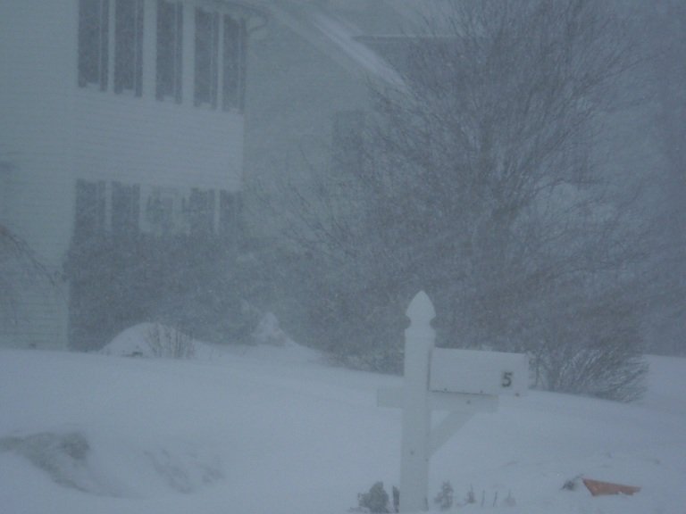
Wednesday is gonna turn into a winter wx event if we're not careful
-
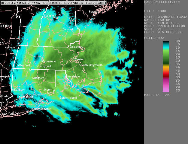
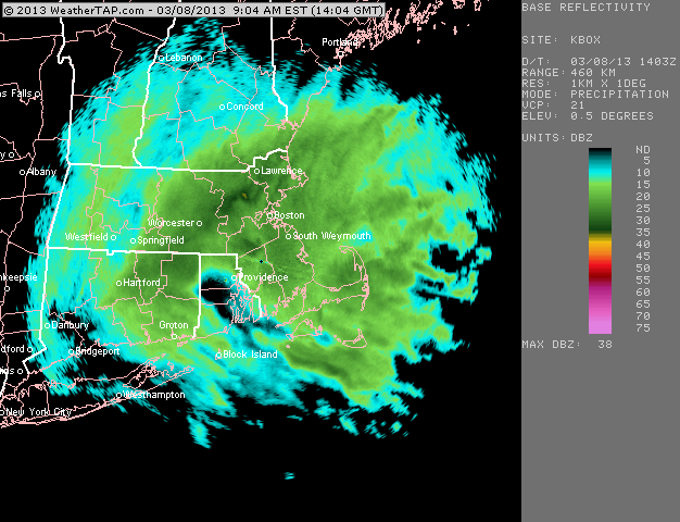
The 3/30 event was crazy. The gradient was even tighter than your map shows…lack of data doesn’t help. It was like 3” at ORH airport and 6-8” by the time you were in Holden center. Then by the time you got to WaWa easily a foot-plus. Some of the N ORH county towns saw their highest depths all winter after that storm. 40”+ that month. I don’t remember a lot about the 3/26-27 storm. There was another nuke on 3/22-23 but it was barely too warm in most of interior SNE but up into interior NNE they got destroyed at elevation with a lot of snow.
-
That was the 1/18-19 storm. Hopefully we can grab one more decent sized event. (Like a warning event) Would be a nice finish to the cold season.
-
Everything is too far west initially…almost looks like some of the garbage western trough patterns we had in recent winters…but I think once we get to the 16th or so we’ll have a few chances as the mean trough moves pretty close to us over the apps.