

ORH_wxman
-
Posts
93,099 -
Joined
-
Last visited
Content Type
Profiles
Blogs
Forums
American Weather
Media Demo
Store
Gallery
Everything posted by ORH_wxman
-
Dec 5/6th major coastal/ west Atlantic cyclogenesis ...?
ORH_wxman replied to Typhoon Tip's topic in New England
I had forgotten that the edh1981 map didn’t have any of New England on it. -
Dec 5/6th major coastal/ west Atlantic cyclogenesis ...?
ORH_wxman replied to Typhoon Tip's topic in New England
-
Dec 5/6th major coastal/ west Atlantic cyclogenesis ...?
ORH_wxman replied to Typhoon Tip's topic in New England

-
Dec 5/6th major coastal/ west Atlantic cyclogenesis ...?
ORH_wxman replied to Typhoon Tip's topic in New England
I also have the pic of Zonties posting the yard stick upside down in the feb 2006 blizzard thinking he had 23” when it was really 13”. -
Dec 5/6th major coastal/ west Atlantic cyclogenesis ...?
ORH_wxman replied to Typhoon Tip's topic in New England
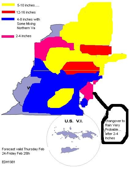
Btw I still have that ridiculous map posted by “edh1981” where he colored over all the state borders and you could barely read anything. I saved it and somehow transferred it through several computers all this time. -
Dec 5/6th major coastal/ west Atlantic cyclogenesis ...?
ORH_wxman replied to Typhoon Tip's topic in New England
Yeah that was Will from St Agatha ME...LOL. I think he moved to the UP of Michigan on the Keweena peninsula. I guess he likes to find the most brutal cold/snowy spots in the CONUS east of the Mississippi. -
Dec 5/6th major coastal/ west Atlantic cyclogenesis ...?
ORH_wxman replied to Typhoon Tip's topic in New England
Yeah the models definitely have shedded some of the extreme biases they used to have. The GFS was so bad with the southeast bias on coastals. Those threads got brutal. We definitely had some SNE posters who loved to poke the hornets nest. Fun times though looking back. I usually restrained myself though...I was always the naive optimist trying to get everyone to get along...LOL. I’d go into the mid-Atlantic threads when it looked good for them...I liked discussing the technical stuff with Wes. -
Dec 5/6th major coastal/ west Atlantic cyclogenesis ...?
ORH_wxman replied to Typhoon Tip's topic in New England
The model threads pre-subforums on Eastern were brutal. We used to troll Nikolai and Ji when the GFS was smoking the mid-Atlantic at D4-5...we’d say “about perfect spot for SNE 4 days out” and it would cause anarchy in the threads. -
Dec 5/6th major coastal/ west Atlantic cyclogenesis ...?
ORH_wxman replied to Typhoon Tip's topic in New England
I feel like you are a Red Sox fan in 2004 waiting for the final few outs knowing you are going to win the World Series and lift all the years of frustration to the evil empire. Just need a few storms to start posting pics of 3 foot snowpacks to all the SNEers who tormented you years ago. -
Dec 5/6th major coastal/ west Atlantic cyclogenesis ...?
ORH_wxman replied to Typhoon Tip's topic in New England
HRRR is trying to change BOS over to snow by 2pm. Lol. -
Dec 5/6th major coastal/ west Atlantic cyclogenesis ...?
ORH_wxman replied to Typhoon Tip's topic in New England
Didn’t take you long to think of SNE like we think of MD in winter. -
Dec 5/6th major coastal/ west Atlantic cyclogenesis ...?
ORH_wxman replied to Typhoon Tip's topic in New England
They are gonna get smoked. 495 belt is looking very strong. -
Dec 5/6th major coastal/ west Atlantic cyclogenesis ...?
ORH_wxman replied to Typhoon Tip's topic in New England
HRRR and 3k NAM don’t shut you off until like 9-12z Sunday morning. Lol. -
Dec 5/6th major coastal/ west Atlantic cyclogenesis ...?
ORH_wxman replied to Typhoon Tip's topic in New England
Nice WaWa 24-spot. Lol -
Dec 5/6th major coastal/ west Atlantic cyclogenesis ...?
ORH_wxman replied to Typhoon Tip's topic in New England
I was just looking at the rgem soundings under the death band and it has really steep lapse rates from sfc to 925mb...it’s just not credible. That should literally be isothermal under that type of precip. If 925 was a torch then it would be more believable....and as an aside, the rgem is a little warmer at 925 than other guidance but not enough to explain all the rain. It is still getting below 0C in that level. -
Dec 5/6th major coastal/ west Atlantic cyclogenesis ...?
ORH_wxman replied to Typhoon Tip's topic in New England
Yeah it’s causing it to close off more at H5 and that tends to slow it down a little bit. -
Dec 5/6th major coastal/ west Atlantic cyclogenesis ...?
ORH_wxman replied to Typhoon Tip's topic in New England
It’s literally the only storm name I can remember for a specific storm where I go “Nemo = Feb 2013”. I couldn’t tell you any others...I think Juno may have been Jan 2015 blizzard, but I always thought naming all those was so dumb. -
Dec 5/6th major coastal/ west Atlantic cyclogenesis ...?
ORH_wxman replied to Typhoon Tip's topic in New England
Well if the data goes sour for the rest of 00z, can you still change it? You got all wheel drive on that sucker or at least front wheel drive? You can always chase the band during late afternoon and early evening and then trek back to the hotel later if it looks like the best is east. -
Dec 5/6th major coastal/ west Atlantic cyclogenesis ...?
ORH_wxman replied to Typhoon Tip's topic in New England
That said...it def makes for some anxious model runs when you are on the line. -
Dec 5/6th major coastal/ west Atlantic cyclogenesis ...?
ORH_wxman replied to Typhoon Tip's topic in New England
Haha...I’m just bustin’...Henniker is still prob in a good spot. The elevation could help quite a bit. It’s not always bad to be right on the northwest edge of the heavy stuff on models...in reality you often end up in the ML fronto-deformation -
Dec 5/6th major coastal/ west Atlantic cyclogenesis ...?
ORH_wxman replied to Typhoon Tip's topic in New England
I told him to stay near the Derry/MHT line but he didn’t listen. I tried to tell him.... -
Dec 5/6th major coastal/ west Atlantic cyclogenesis ...?
ORH_wxman replied to Typhoon Tip's topic in New England
THe slower solutions have been a theme all day today. -
Dec 5/6th major coastal/ west Atlantic cyclogenesis ...?
ORH_wxman replied to Typhoon Tip's topic in New England
Yeah they are really weenieish. Unless it’s premium conditions it’s usually pretty safe to take like 75% of those numbers. Still impressive of course, but a little less obscene. -
Dec 5/6th major coastal/ west Atlantic cyclogenesis ...?
ORH_wxman replied to Typhoon Tip's topic in New England
Nice ORH airport jack there. -
Dec 5/6th major coastal/ west Atlantic cyclogenesis ...?
ORH_wxman replied to Typhoon Tip's topic in New England
I wouldn’t worry much there on small ticks given your orographically favorable location on coastals. If I was west of the whites like over toward Littleton I would probably start sweating the ticks east more. It’s easier for them to go from like 12” to 3” than your area since they rely on the midlevels a lot more.


