

ORH_wxman
-
Posts
93,092 -
Joined
-
Last visited
Content Type
Profiles
Blogs
Forums
American Weather
Media Demo
Store
Gallery
Everything posted by ORH_wxman
-
Honestly, the RGEM was probably the most accurate model down in SNE once inside 36 hours....it had the sleet line straddling the MA/CT border for several hours during the heaviest precip on like 3 different runs which is exactly what happened this morning. NAM was too warm with that battle going on more like between the pike and rt 2.
-
I should probably preface the claim with "meaningful precip".....stuff that's like 10dbz echoes will prob have some pingers in there because its shallow lift. I did have some pingers too with decent echoes for like 30 minutes, but then since then, it's been snow any time the echoes are more than about 15 dbz...when they fall below that, it's a mix of light snizzle/pixie dust/pingers.
-
NAM was awful beyond 36 hours (I think it had a couple runs punching so much sleet north that it gave Ray like 3-4"), but it was pretty good once we got down to like the final 3 or 4 runs. It was a little too warm in MA but overall it was much better down in CT/RI/SE MA than other guidance.
-
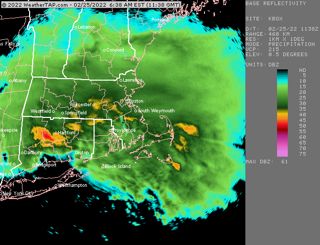
Seems like the sleet never made it past the pike save for a brief time when the mid-level dryslot hit. These echoes filling back in are all snow.
-
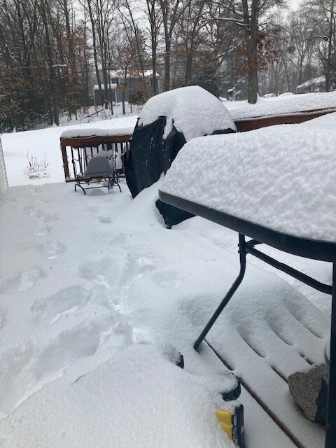
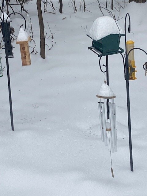
Just cleaned driveway. Snow got pretty dense..esp the stuff near the top where it started mixing. Looks like radar filling back in. Starting to get some steadier flakes again
-
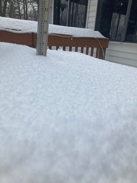
8” or so thus far
-
Hard to say....we had a period of pingers when precip lightened up about 30 min ago....they are actually still mixed in right now but it's trying to go back to snow right now as the heavier echoes move back in. We were getting absolutely lit up though for a couple hours between about 730-930....like 2" per hour stuff.
-
It's pretty close to me right now....about 5 miles east.
-
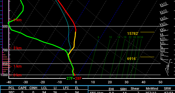
Yeah the soundings show that....we'll see if it pans out, but this kind of looks like the "puffy hooked dendrites at 1.5 mile vis" that can add up to an inch or two over 3 hours. I remember these types of "toppers" happening a few times during that Jan-Feb 1994 run of overrunning events. We'd be outside finishing up shoveling and we'd get a little fluffer topper while that was going on Here's the RAP sounding for your 'hood at 6pm this evening....you can see that trapped saturated layer under the inversion and the omega bars on the left lining up with that -10C to -12C layer near the top of the saturated layer. That could produce some cotton balls later.
-
Flipping back to snow here as these better echoes move in
-
We have pingers too now under the light echoes....It'll be interesting to see if we flip back to snow when those heavier echoes out west move in.
-
Prob not much, but there's a chance we could get 1-2" of fluff. The lift is low around 800mb, but it actually lines up well with the lower part of the SGZ....temps are like -11C at 800mb where the lift is centered. So an inch or two of blower fluff wouldn't be that surprising.
-
I had to sneak one in there. Hopefully you get something later this afternoon to top it off.
-
Glad we don't live there...
-
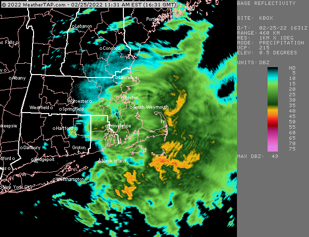
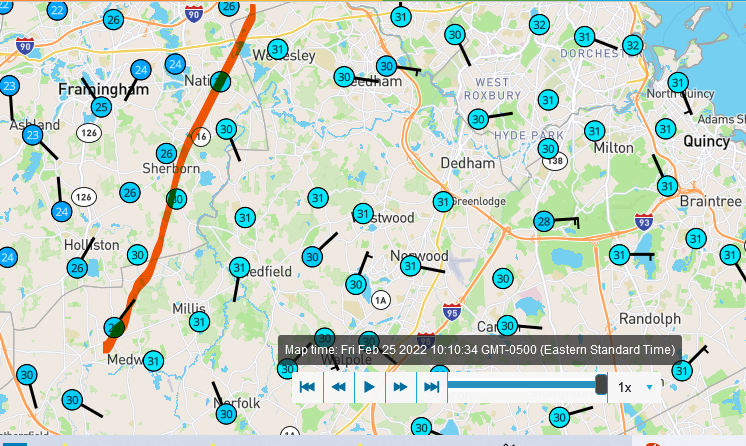
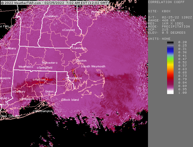
Sleet straddling the southern MA border right now:
-
Absolute crushing right now Looks like sleet line is near MA/CT border but bends further south in RI and SE MA
-
Bent back WF FTW here right now. This is really heavy stuff. Prob 2” per hour.
-
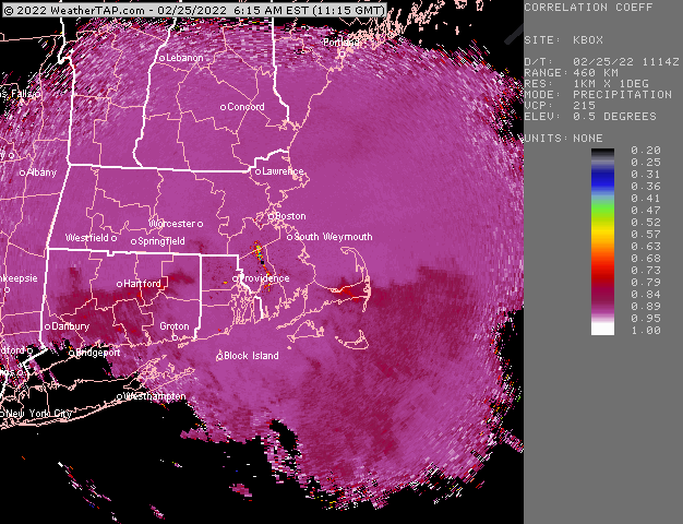
Sleet making a bit more of a push now further west near BDL
-
Yeah probably huge aggies.
-
Compromise was the way to go. RGEM’s last few runs actually might end up close. It had a very strong gradient near the MA/CT border.
-

-
He bought ginxy’s old camera at a garage sale.
-
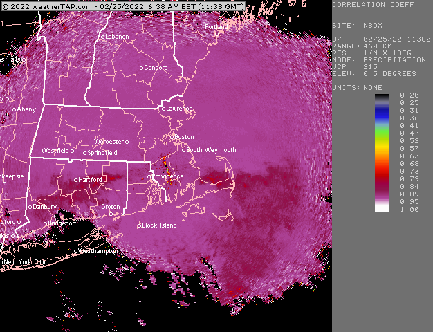
Eyeballing 5” or so. But haven’t measured yet. Getting absolutely crushed right now. Very low vis. Prob 1/8 to 1/16 mile. It’s interesting that the sleet line is actually a bit south of the initial yellow echoes
-
Sleet line is kind of stalled right now. Latest HRRR actually only brings it up to about the southern MA border between now and 15z.
-
Snow growth here is actually pretty awesome.


