

ORH_wxman
-
Posts
93,095 -
Joined
-
Last visited
Content Type
Profiles
Blogs
Forums
American Weather
Media Demo
Store
Gallery
Everything posted by ORH_wxman
-
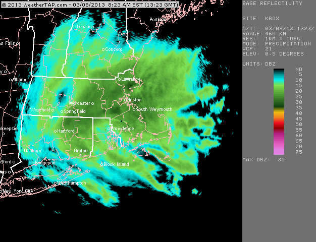
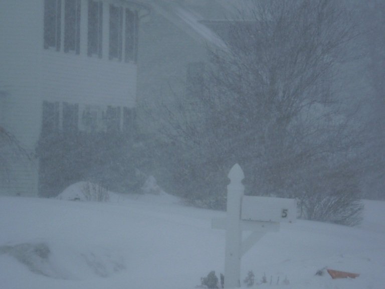
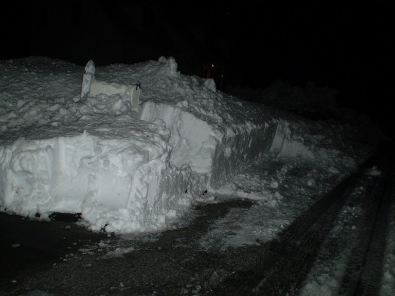
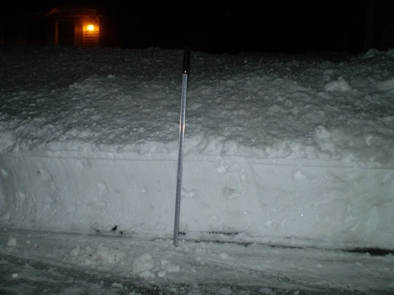
The 2013 firehose storm was great
-
March 9: Little Critter that could part 2.
ORH_wxman replied to Sey-Mour Snow's topic in New England
You're cherry picking....White Tdays are not that common. Prob once every 5+ years for you. Sure, they are great when they happen....they just don't happen that often because the snow has to fall usually the day before or very close to Tday because snow torches away so fast in November when it does fall. Regardles, the debate is a total watse of time in this thread anyway. It's going to snow tomorrow whether people want it or not. -
March 9: Little Critter that could part 2.
ORH_wxman replied to Sey-Mour Snow's topic in New England
March snow lasts longer than November snow since November is a warmer month...and it's not close either. March is like 5-6 degrees colder than November on average. You might hate the sun angle in March but November is a furnace compared to March. -
March 9: Little Critter that could part 2.
ORH_wxman replied to Sey-Mour Snow's topic in New England
You’ll get snow too. It’ll be less than CT but prob a couple inches. -
March 9: Little Critter that could part 2.
ORH_wxman replied to Sey-Mour Snow's topic in New England
06z euro looked good again. Not a big difference from 00z that I saw on my phone. -
March 2022 Obs/Disc: In Like a Lamb, Out Like a Butterfly
ORH_wxman replied to 40/70 Benchmark's topic in New England
00z euro has a really nice look for SNE on Wednesday. Nice banding look…esp from pike region into CT/RI -
March 2022 Obs/Disc: In Like a Lamb, Out Like a Butterfly
ORH_wxman replied to 40/70 Benchmark's topic in New England
Wow 18z rgem hits the pike region hard. That’s getting almost to low end warning threshold. Definitely upped the ante from 12z. -
March 2022 Obs/Disc: In Like a Lamb, Out Like a Butterfly
ORH_wxman replied to 40/70 Benchmark's topic in New England
18z NAM looked a bit south of 12z for Wednesday but the fronto sig might be a little better where the precip is. Someone from CT over to SE MA could score a little surprise with that. Maybe pike region too. -
March 2022 Obs/Disc: In Like a Lamb, Out Like a Butterfly
ORH_wxman replied to 40/70 Benchmark's topic in New England
Dec '96 prob the last time, though Feb 24, 2010 and Dec 5, 2020 were very close. October 2011 too. -
March 2022 Obs/Disc: In Like a Lamb, Out Like a Butterfly
ORH_wxman replied to 40/70 Benchmark's topic in New England
Gotta sneak in an elevation blue bomb like a week later after the WOR pounder. -
Yeah this is true...some portions of the earth have been at war for prob 5000 years and probably will be for another 5k. Also, shoving like 10-15% of some of the strongest ideological portion of the population onto a platform like twitter and lighting a match is always going to make for a clown show that doesn't really reflect reality.
-
March 2022 Obs/Disc: In Like a Lamb, Out Like a Butterfly
ORH_wxman replied to 40/70 Benchmark's topic in New England
Phin/Alex over to SR/Sugarloaf get in on it too. -
March 2022 Obs/Disc: In Like a Lamb, Out Like a Butterfly
ORH_wxman replied to 40/70 Benchmark's topic in New England
Prob an inch or so in lower elevations and 2-3" higher terrain if Euro verified. -
March 2022 Obs/Disc: In Like a Lamb, Out Like a Butterfly
ORH_wxman replied to 40/70 Benchmark's topic in New England
Well it's already trending east.... But aside from just an upper level east trend, specifically in March, you have colder SSTs plus a cryo-generated cold source to the north which acts as an inhibitor to LL WAA versus a month like December....it acts to strengthen Tip's PPT configuration coming down the coast of Maine. It's why so many "modeled" nice days in spring turn into 40F and dogshit. So yeah, I'd expect it to trend more into a 40s and rain instead of 60F unless we can really wind this up to our west and have the low track over western NY. Still possible, but right now I'm betting against the prolonged warm sector. -
March 2022 Obs/Disc: In Like a Lamb, Out Like a Butterfly
ORH_wxman replied to 40/70 Benchmark's topic in New England
It's March....you know where it's going to trend. Bury powderfreak while we get 42F and heavy rain for most of the storm. -
Stop with the politics or I'm nuking this thread faster than the sleet line moves north in a SWFE
-
It depends how much production increases. It's hard to just "turn on" production because it won't be immediate. We need to drill more and that takes some time. It would prob take 6-12 months to see differences. We actually have pretty good production right now as a result of the massive increase in fracking in the last 7-10 years (we tripled our domestic oil production between mid-2000s and 2018). The big drop in oil prices between 2013 and 2015 was much in part due to the big supply increase on the market due to US fracking. We haven't really expanded drilling though in the past 3-5 years. The low crude oil prices post-2014 (until recently) have made new drilling more cost-prohibitive. A lot of rigs that made good money when oil was $75 per barrel in 2014 became harder to make money on when crude oil dropped below $50 per barrel. So many of the oil companies didn't drill new wells when prices went down. They just continued to pump from existing wells drilled in the 2012-2015 period. You could see market prices drop though if an expected increase in production was signaled. Market forces often respond to expectations in addition to just current supply.
-
March 2022 Obs/Disc: In Like a Lamb, Out Like a Butterfly
ORH_wxman replied to 40/70 Benchmark's topic in New England
Ukie and GGEM are trying to give NNE a lot of snow for the weekend system. They are flattening it out just a bit and pushing it east before it amplifies. The Ukie even gets decent snow into the northwest parts of SNE. Not really biting on those solutions yet, but something to watch. Hopefully NNE can get this colder to help with the March skiing. -
Canada pays about a 1.25 per gallon in taxes on their gasoline whereas the United States is more like 45-50 cents....Canada also gets most of their refined RBOB from the United States despite drilling a lot of their own oil (they send to to the US refineries), so they have to pay extra transportation costs which become larger when the price of crude oil is higher.
-
Back in 2008, it was around 4-4.25 a gallon when it was noticeable in behavior changes, so probably something similar this time too except maybe a little more to account for inflation of income/wages since 2008. I'd guess when the national average hits 4.50-5.00, you'll start seeing changes. They are more visible in the summer when people travel than they would be in the spring.
-
The price of crude oil will become self-correcting....as it gets more expensive, it incentivizes oil and gas companies to spend the money for new drilling. It sucks in the short term though when the price goes bonkers like it is right now.
-
March 2022 Obs/Disc: In Like a Lamb, Out Like a Butterfly
ORH_wxman replied to 40/70 Benchmark's topic in New England
Yeah it could easily be garbage...if it's too weak, then it'll just be light snow with a coating to maybe a couple inches in the higher terrain or could even still be mostly a whiff if it trends back much weaker....but if it trends a little stronger, then it's a real system. There's still a couple days to go and it's been steadily trending a bit stronger each run the past few cycles which is why it is now getting some snow in here instead of completely whiffing like previously. -
March 2022 Obs/Disc: In Like a Lamb, Out Like a Butterfly
ORH_wxman replied to 40/70 Benchmark's topic in New England
Actually gave your 'hood 3-4" but SE MA had like 5"...might be too aggressive, but it's a nice fronto band. Sfc wil be warm at the start, but it would wetbulb quickly. This isn't one of those spring isothermal soundings. 925mb is quite cold actually (like -4 to -5C) -
March 2022 Obs/Disc: In Like a Lamb, Out Like a Butterfly
ORH_wxman replied to 40/70 Benchmark's topic in New England
RGEM is pretty solid for SE MA and RI. -
March 2022 Obs/Disc: In Like a Lamb, Out Like a Butterfly
ORH_wxman replied to 40/70 Benchmark's topic in New England
NAM gets a fronto band into SNE...could drop a couple inches.


