tiger_deF
-
Posts
614 -
Joined
-
Last visited
Content Type
Profiles
Blogs
Forums
American Weather
Media Demo
Store
Gallery
Everything posted by tiger_deF
-
The past several HRRR hourglass have been continually weakening the western low and strengthening the eastern one per the same timeframe. The overall system has also been ticcing west
-
I wonder why that is. Could it be part of a long-term oscillation in weather patterns, increased moisture/southern flow due to climate change, or a mix of both, or something else entirely?
-
Mind sharing any of your observations? Sounds fascinating
-
12z GFS seems verbatim but the right lobe is definitely more dominant, and slightly more to the West
-
These are so much better than yesterday, yet there's a profoundly melancholic atmosphere here
-
The past few hourly HRRR runs appear to have the low off the coast slightly more intense, and minor shifts to the west for that feature
-
If the convection south of Florida ends up being stronger than modeled, what would be the potential downstream effects?
-
Regardless of the outcome this is going to be a fascinating storm to nowcast, especially with the interaction of the dual lows/convection
-
Big GFS run coming up. Crossing my fingers
-
From someone still relatively new to meteorological discussion, what does H5 and H7 mean? Is it the upper level profile at varying heights, or something else
-
If we get widespread 8-12 we'll need to see models shifting uniformly as we near go time, or they'll have to bust hilariously (which is certainly less common in this day and age)
-
Except for any given model that happens to show the biggest hit
-
What we all really need is a monster shift on the 12z GFS
-
Still better than the 00z.. praying to the snow gods that the next suite of models keeps on nudging west
-
NAM is seriously elongated as of hour 42, it seems it won't give up on the battling low solution
-
I'm actually a student at Northeastern! What are the chances, I literally walked by Matthews Arena less than a half-hour ago.
-
Already far, far more impressive then Mehnri in my location in BOS. Rain has been moderate all evening but the wind has been picking up throughout the afternoon and is now sustained at 25-30 mph. Almost lost my umbrella
-
Holy shit, over 19 mph?!? Hope you've gotten everything inside, the house probably won't blow away
-
Dry in BOS but the wind has really picked up over the last hour or so. Very gusty and leaves are flying
-
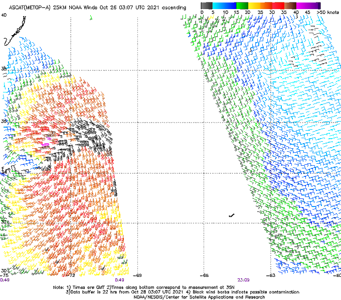
Very interesting ASCAT...
-
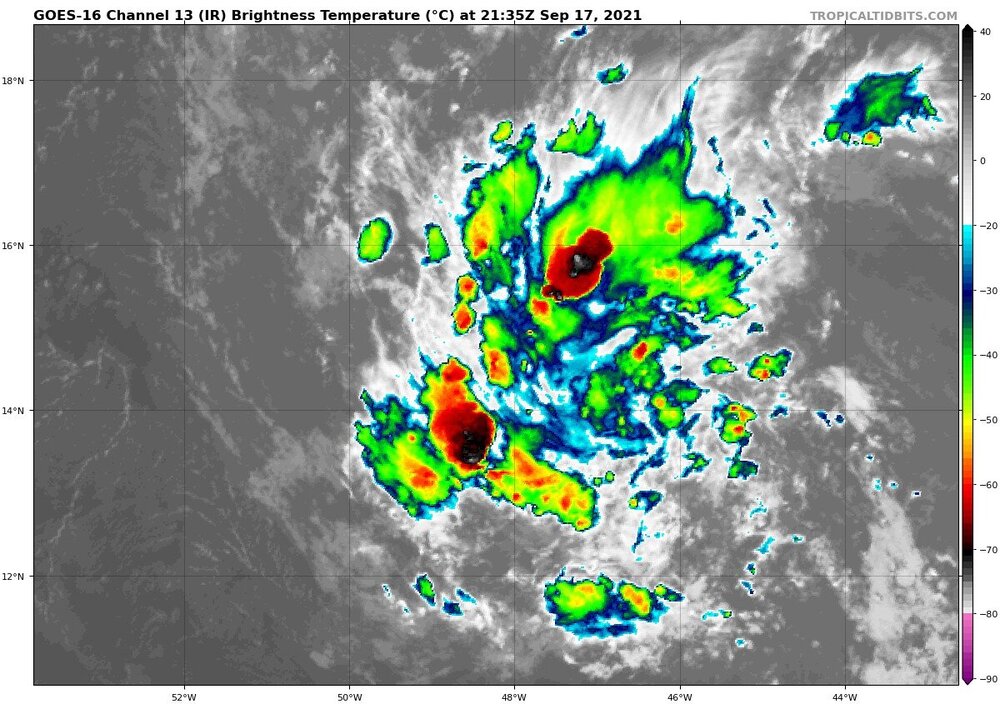
Looking absolutely juiced on IR. Shame this isn't February, or we'd be drooling over absurd kuchera maps and blizzard warnings. Should be a show regardless.
-
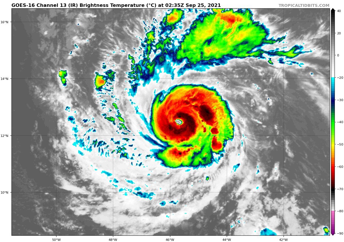
Sam's really been shedding the bands. Do we think this is just a temporary pulse down or maybe the beginning of some kind of annular transition?

-
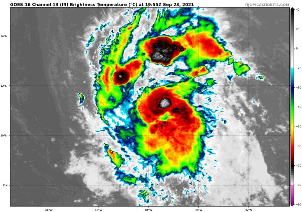
Sam sure is looking pretty good right now on IR
-
Henri may have been absolutely weak sauce, but I remember that it was similarly predicted to stay harmlessly out to sea this far out. I highly doubt there will be an impact, but we track
-
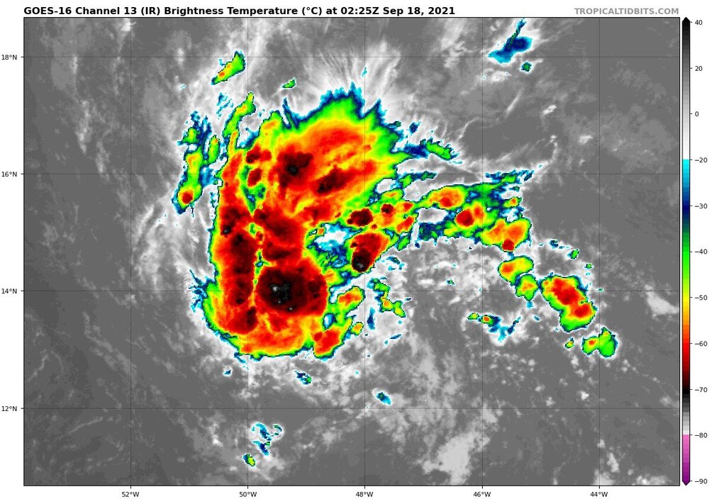
95L ~4 hours ago vs 95L now