Cary67
-
Posts
1,572 -
Joined
-
Last visited
Content Type
Profiles
Blogs
Forums
American Weather
Media Demo
Store
Gallery
Everything posted by Cary67
-
Choose your weapon.
-
Winter 2024-25 Medium/Long Range Discussion
Cary67 replied to michsnowfreak's topic in Lakes/Ohio Valley
Almost seamless transition from wad to cad -
Engage Fujiwhara snow machine.
-
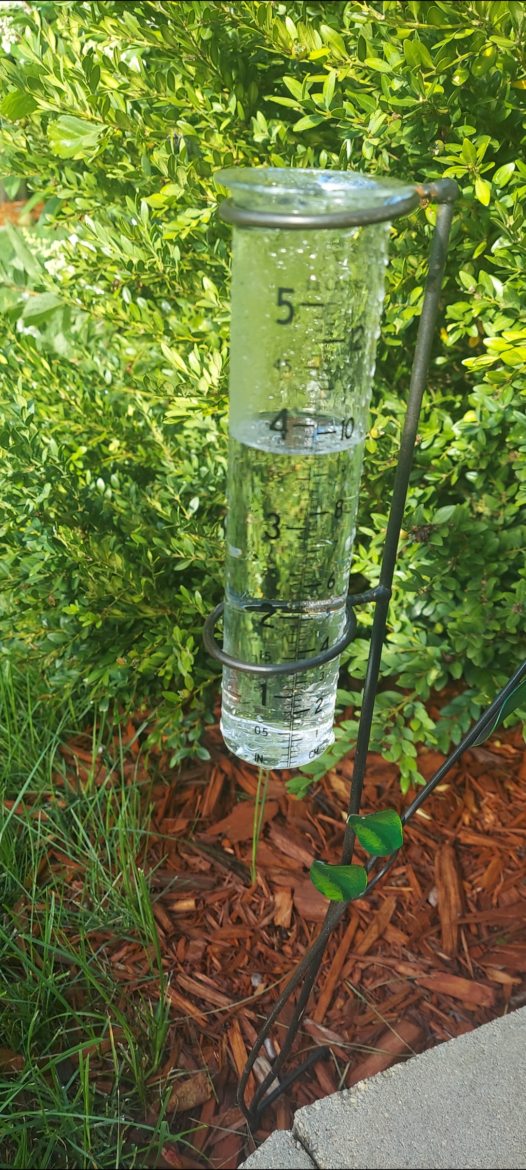
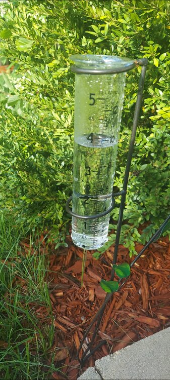
Finished with 1.90" this evening total.
-
1.3" down here. Will take it.
-
Hopefully Sunday-Tuesday we cash in on some rain. This event was DOA here
-
Another miss here..looks like other areas of metro fared better
-
Another top notch weather day. Sunny 75F/50. Wish this weather would last 10 months a year.
-
2024 Short/Medium Range Severe Weather Discussion
Cary67 replied to Chicago Storm's topic in Lakes/Ohio Valley
Hard pass on that. Loss of power no bueno -
2024 Short/Medium Range Severe Weather Discussion
Cary67 replied to Chicago Storm's topic in Lakes/Ohio Valley
-
0.70" yesterday
-
2024 Short/Medium Range Severe Weather Discussion
Cary67 replied to Chicago Storm's topic in Lakes/Ohio Valley
Meh... -
2024 Short/Medium Range Severe Weather Discussion
Cary67 replied to Chicago Storm's topic in Lakes/Ohio Valley
We were dumped on last night.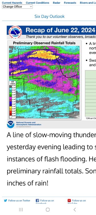
-
Finally hit on scattered tstorms here. Torrential downpour lasted 10 mins
-
Hope they hold together Edit: Nope. Probably a miss SE this afternoon also
-
Maybe a larger window of fantastic weather this spring. Usually get this from Memorial Day thru first few weeks of June before heat sets in.
-
Today is going to challenge that. May have frosty mornings upcoming week
-
Late April in the past usually signals sustained spring like weather. I typically will start planting then unless an unusual cold spell is forecast. Some wait till after Mother's Day but that's conservative.
-
My Aunt lives in Mt.Carmel will tell her your coming.
-
Will grade this out as a C+. Around 26-27" total this year which sadly is better than the last few years. Considering my area cashed in on the two weeks of winter in January and has been favored compared to the rest of LOT for other small events, better than could be expected considering the overall winter futility.
-
4/2-4/3 Significant Late-Season Snowstorm (WI/MI)
Cary67 replied to Geoboy645's topic in Lakes/Ohio Valley
Quietly those seasonal snow totals getting up there. 41.3" -
About 2-3" down here
-
For a dud winter the northern counties have maxed out on the few opportunities this year.
-
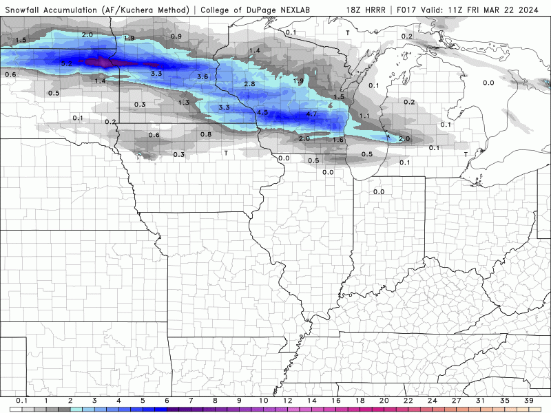
18Z HRRR slid a bit south with band
-
Can't get out totally unscathed.