Cary67
-
Posts
1,572 -
Joined
-
Last visited
Content Type
Profiles
Blogs
Forums
American Weather
Media Demo
Store
Gallery
Everything posted by Cary67
-
Winter 2024-25 Medium/Long Range Discussion
Cary67 replied to michsnowfreak's topic in Lakes/Ohio Valley
Donut hole qpf for N.IL, Iowa, and Southern Wisconsin stuck on auto pilot for the Euro -
I can't take credit. Another weather aficionado happened to be looking up the same information and gave me an easy assist.
-
Take a shot. March 4th 2019
-
Iowa will be ground zero
-
Winter 2024-25 Medium/Long Range Discussion
Cary67 replied to michsnowfreak's topic in Lakes/Ohio Valley
Erase the snow in the upper Midwest and pretty reflective of the pattern. Even shows difference in snow gradient from RFD to ORD to DTW and points SE. It's the anti 2022-23 pattern -
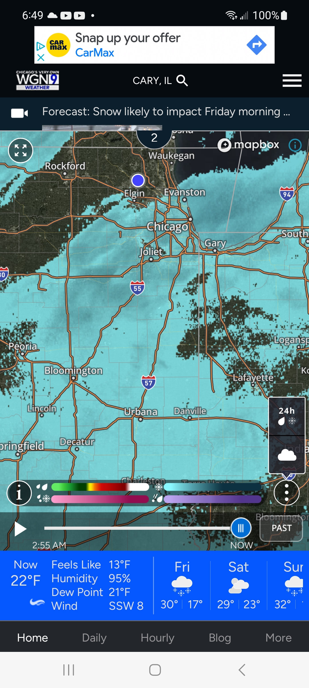
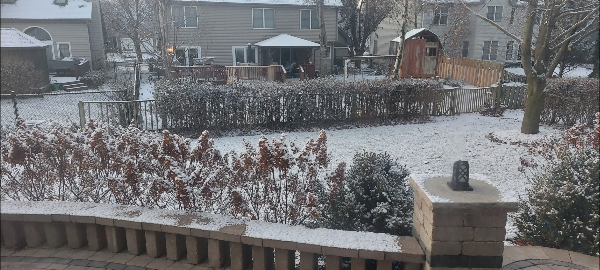
Can eyeball these now from inside. 0.4"
-
Winter 2024-25 Medium/Long Range Discussion
Cary67 replied to michsnowfreak's topic in Lakes/Ohio Valley
Finally further NW opens up opportunity for the heaviest dusting in the area -
0.4" Will start using RFD seasonal totals for reference
-
Winter 2024-25 Medium/Long Range Discussion
Cary67 replied to michsnowfreak's topic in Lakes/Ohio Valley
Have to take my daughter back to the University of Iowa next weekend. Figure that's when the hex is lifted -
Walked outside and it smelled like snow.

-
-
Winter 2024-25 Medium/Long Range Discussion
Cary67 replied to michsnowfreak's topic in Lakes/Ohio Valley
Wouldn't be surprised to see a rinse and repeat scenario like December. The eastern trough lifts out at some point in the last third of January. Allows for milder air and a warm cutter that MSP and upper Midwest cash in on snow wise. Trough digs back in in the same position for February and we ride NW flow again to effectively lock in another sub 30" seasonal total. -
Hope you get buried. Your area rarely receives big snows
-
During these days of CAD miss hardypalmguy updates on his palm trees.
-
Still not in play even with northward ticks.
-
Hope it pans out for the typically snow starved I70 corridor.
-
Been on the edge of drought cancel here
-
Winter 2024-25 Medium/Long Range Discussion
Cary67 replied to michsnowfreak's topic in Lakes/Ohio Valley
Crazy Uncle Ukie brought you a bottle of Buffalo Trace
-
Interesting I only had 2-2.5"
-
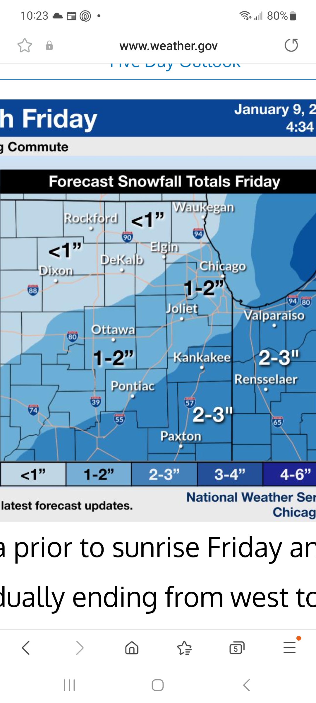
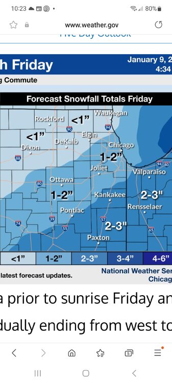
Weakened some as it pushed through here. Estimate 0.5"-0.75"

-
Winter 2024-25 Medium/Long Range Discussion
Cary67 replied to michsnowfreak's topic in Lakes/Ohio Valley
No doubt. Winters for you guys are like instant oatmeal. Instead of just add water; its cold air. -
Winter 2024-25 Medium/Long Range Discussion
Cary67 replied to michsnowfreak's topic in Lakes/Ohio Valley
Trough position been too far east. Need it to retrograde west with a touch of SE ridge to appear to get out this dry NW flow pattern -
Winter 2024-25 Medium/Long Range Discussion
Cary67 replied to michsnowfreak's topic in Lakes/Ohio Valley
Didn't someone state December hasn't been a prime winter month in Chicago area going on a decade now. Warmth return seemed inevitable. -
Winter 2024-25 Medium/Long Range Discussion
Cary67 replied to michsnowfreak's topic in Lakes/Ohio Valley
Can't recall over the past few winters bamwx having too good of a track record with long range winter forecasts. Although that's not a short list. Hopefully warmer pattern at least brings more precip chances -
Winter 2024-25 Medium/Long Range Discussion
Cary67 replied to michsnowfreak's topic in Lakes/Ohio Valley
First SSW post of the winter. Hail Mary passes are going up earlier every year