Cary67
-
Posts
1,572 -
Joined
-
Last visited
Content Type
Profiles
Blogs
Forums
American Weather
Media Demo
Store
Gallery
Everything posted by Cary67
-

-
Winter 2024-25 Medium/Long Range Discussion
Cary67 replied to michsnowfreak's topic in Lakes/Ohio Valley
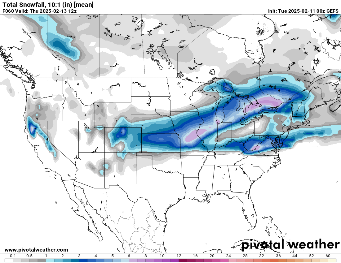
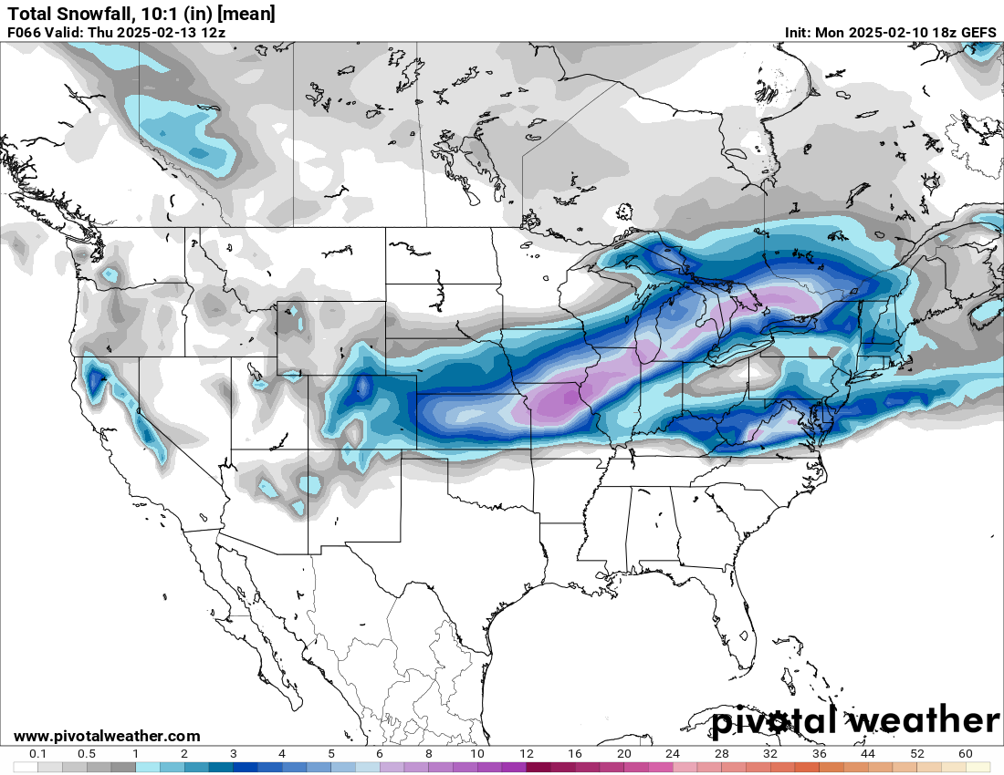
I think from Kankakee to South Bend to Detroit and points SE into OV upcoming pattern looks promising. Maybe metro Chicago gets some lake enhancement to amp up totals especially for 12th-13th system.Would like to see an amped up system moving from Terre Haute to Indy to DTW but not seeing op models show that so far. Maybe ens have some stronger solutions? -
Hopefully won't fall apart like snowstorm in Minnesota did for today
-
Just when I thought I could put the snowblower back in the shed....
-
Winter 2024-25 Medium/Long Range Discussion
Cary67 replied to michsnowfreak's topic in Lakes/Ohio Valley
BAMwx based out of Indy. From his discussion I would be excited over the next few weeks if I was in the OV from Indy SE right up into New England. Later talks about vortex dump of cold air near the 25th. Madison to Chicago area sounds like CAD watch in effect again. -
0Z GFS

-
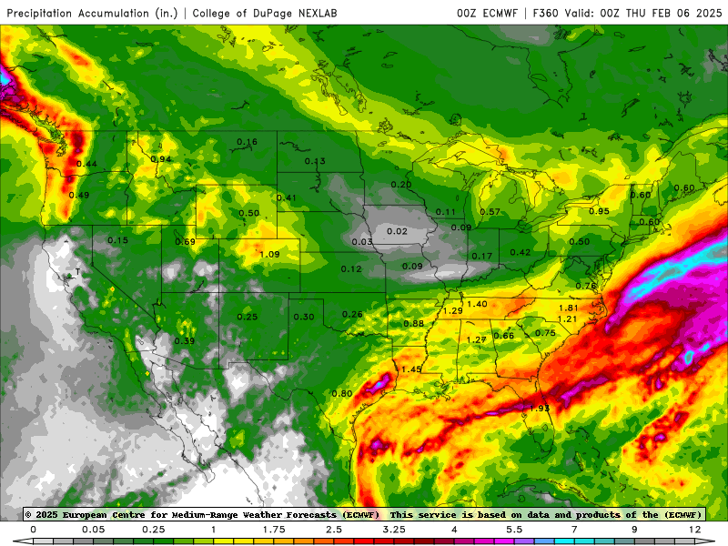
Recent model runs seem to be drying out qpf ice accumulations further north of I80. Thankfully in this case trend of weaker and/or further SE solutions continues.
-
Winter 2024-25 Medium/Long Range Discussion
Cary67 replied to michsnowfreak's topic in Lakes/Ohio Valley
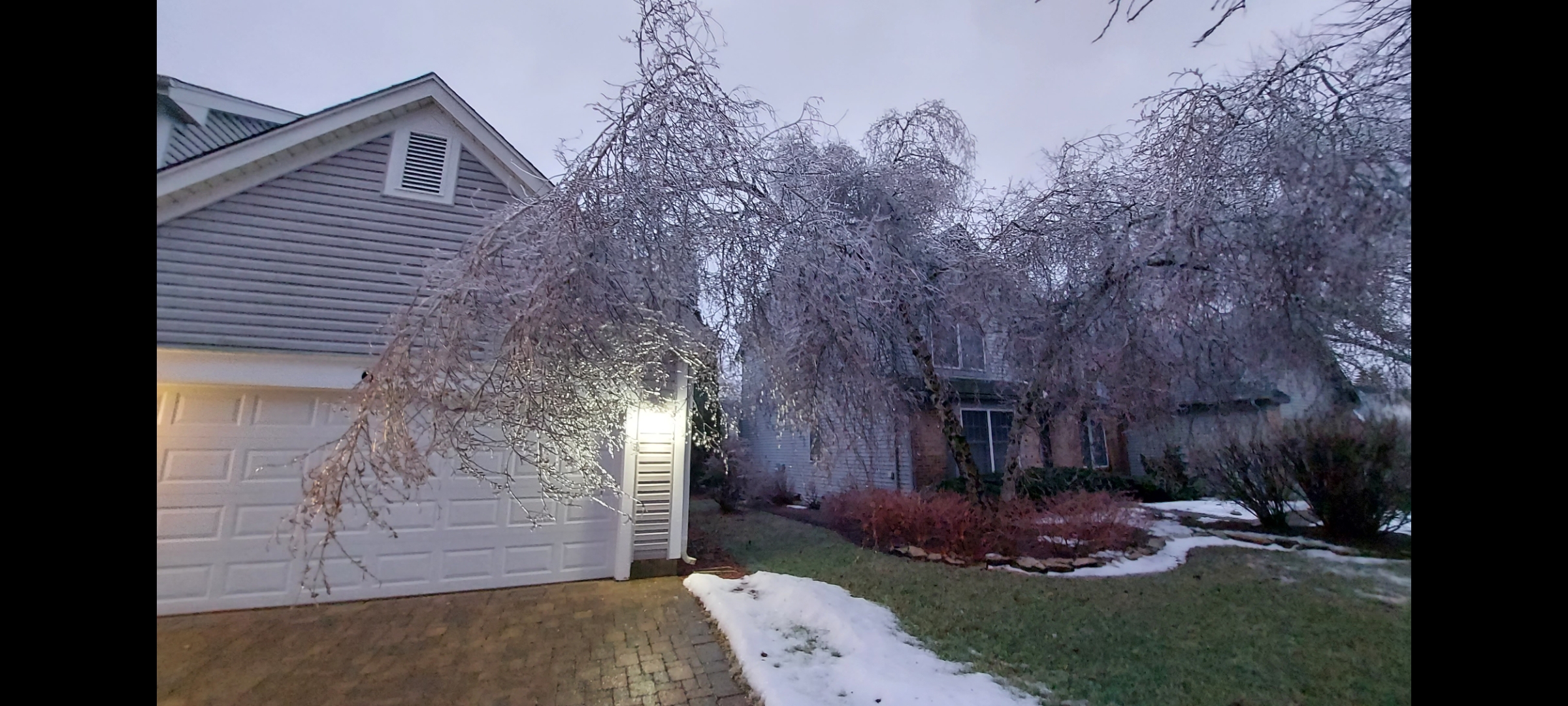
Still in play. Although didn't see ice storm on the front end. -
Winter 2024-25 Medium/Long Range Discussion
Cary67 replied to michsnowfreak's topic in Lakes/Ohio Valley
Not this again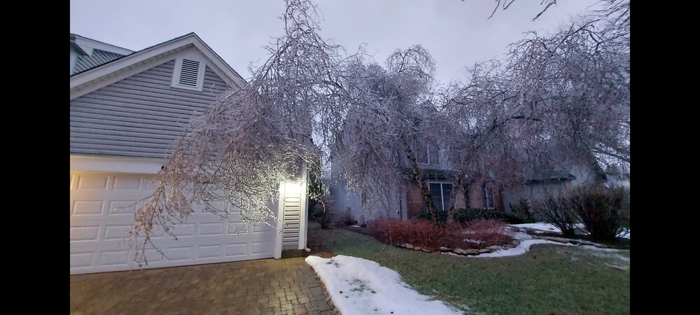
-
Was worried I might get a miss just south but pleasantly surprised so far.
-
6Z GFS looked icy. Hope that doesn't verify
-
Definitely a narrow band setting up. Receiving some decent rain this morning. Band seemed to creep a bit further north than modeled
-
Cloudy, breezy, and 47F. Disappointing. Looks like precip spreading north spoiling the warm up.
-
Winter 2024-25 Medium/Long Range Discussion
Cary67 replied to michsnowfreak's topic in Lakes/Ohio Valley
-
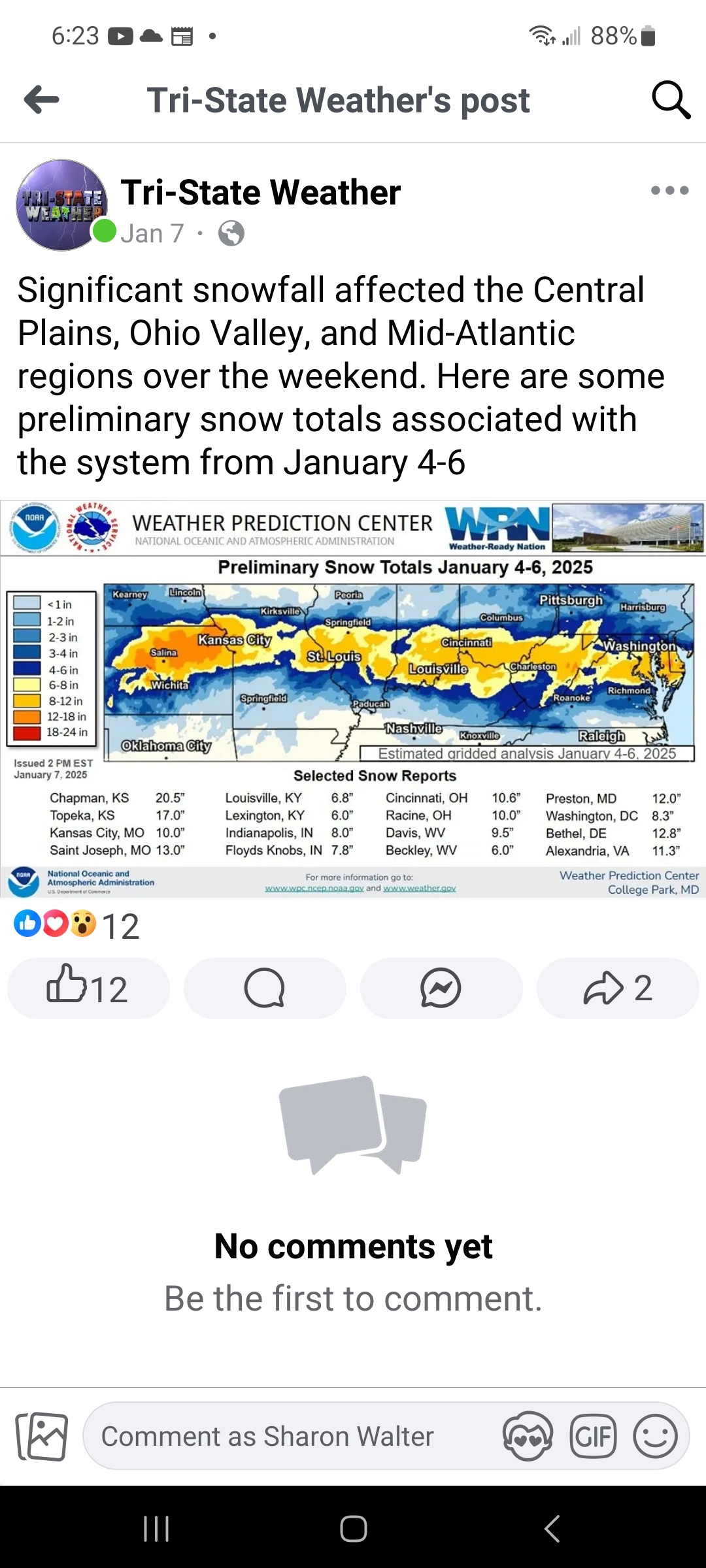
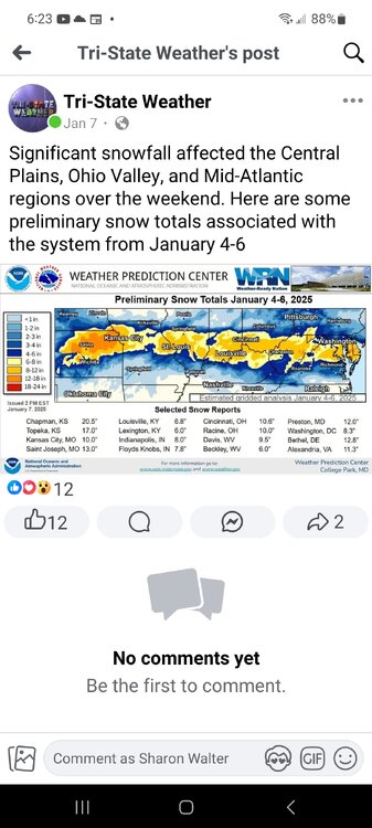
Winter of 2022-23 particularly painful ORD 20.2" RFD 35.5" MSN 71" MSP 90" NW to SE snowfall gradient tough that year About 25" that year IMBY
-
Definitely not the magnitude of the 2004 Christmas week storm but as you say they rarely get snow there anymore
-
Maybe I64 special
-
What's your seasonal total?
-
Winter 2024-25 Medium/Long Range Discussion
Cary67 replied to michsnowfreak's topic in Lakes/Ohio Valley
Euro life..gif.ee49220fa77857b1ef41288868014ee8.gif.0d72da2be8236925871bf1b0d0d0dd22.gif)
-
Winter 2024-25 Medium/Long Range Discussion
Cary67 replied to michsnowfreak's topic in Lakes/Ohio Valley
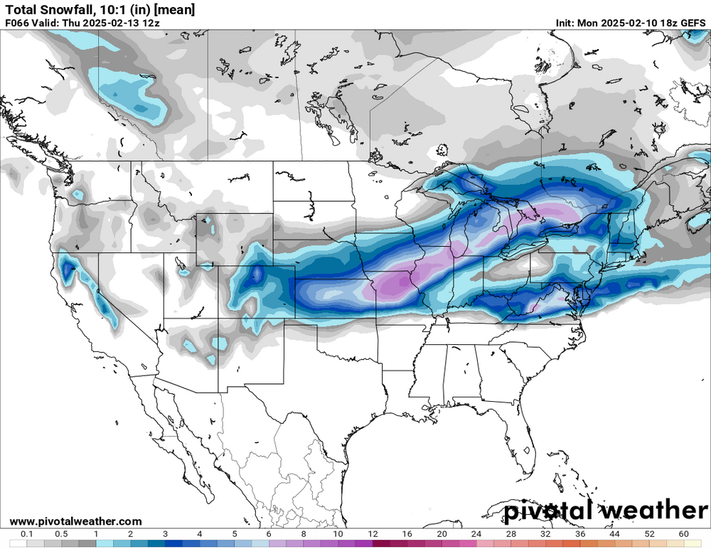
24-30" band maybe here already -
Winter 2024-25 Medium/Long Range Discussion
Cary67 replied to michsnowfreak's topic in Lakes/Ohio Valley
-
-10F
-
Winter 2024-25 Medium/Long Range Discussion
Cary67 replied to michsnowfreak's topic in Lakes/Ohio Valley
Just drove out to Iowa City. Nothing but miles and miles of bone dry prairie. -

-
Winter 2024-25 Medium/Long Range Discussion
Cary67 replied to michsnowfreak's topic in Lakes/Ohio Valley
As Eastwood says in Unforgiven," Deserving's got nothing to do with it." We will get a snowstorm at some point but it may not be this winter.