cptcatz
-
Posts
1,077 -
Joined
-
Last visited
Content Type
Profiles
Blogs
Forums
American Weather
Media Demo
Store
Gallery
Everything posted by cptcatz
-
2022 Atlantic Hurricane season
cptcatz replied to StormchaserChuck!'s topic in Tropical Headquarters
Today's 12z marks 10 GFS runs in a row with a sub-990 mb storm forming and cyclogenesis is now within a week out... Wouldn't be a good way to start off the season with a GFS bust. -
2022 Atlantic Hurricane season
cptcatz replied to StormchaserChuck!'s topic in Tropical Headquarters
GFS/GFES is really locked in on a cyclone forming in the western Caribbean. -
2022 Atlantic Hurricane season
cptcatz replied to StormchaserChuck!'s topic in Tropical Headquarters
There's been some pretty solid signal for long range development in the western Caribbean. Both GFS and Euro are sniffing it out... -
It will cover the entire global tropcis. Although I just read into it a bit more and the satellites are planned to be launched on Astra rockets in May and June... Astra has had two successful launches out of eight attempts. Not great odds for this to be ready this season.
-
2022 Atlantic Hurricane season
cptcatz replied to StormchaserChuck!'s topic in Tropical Headquarters
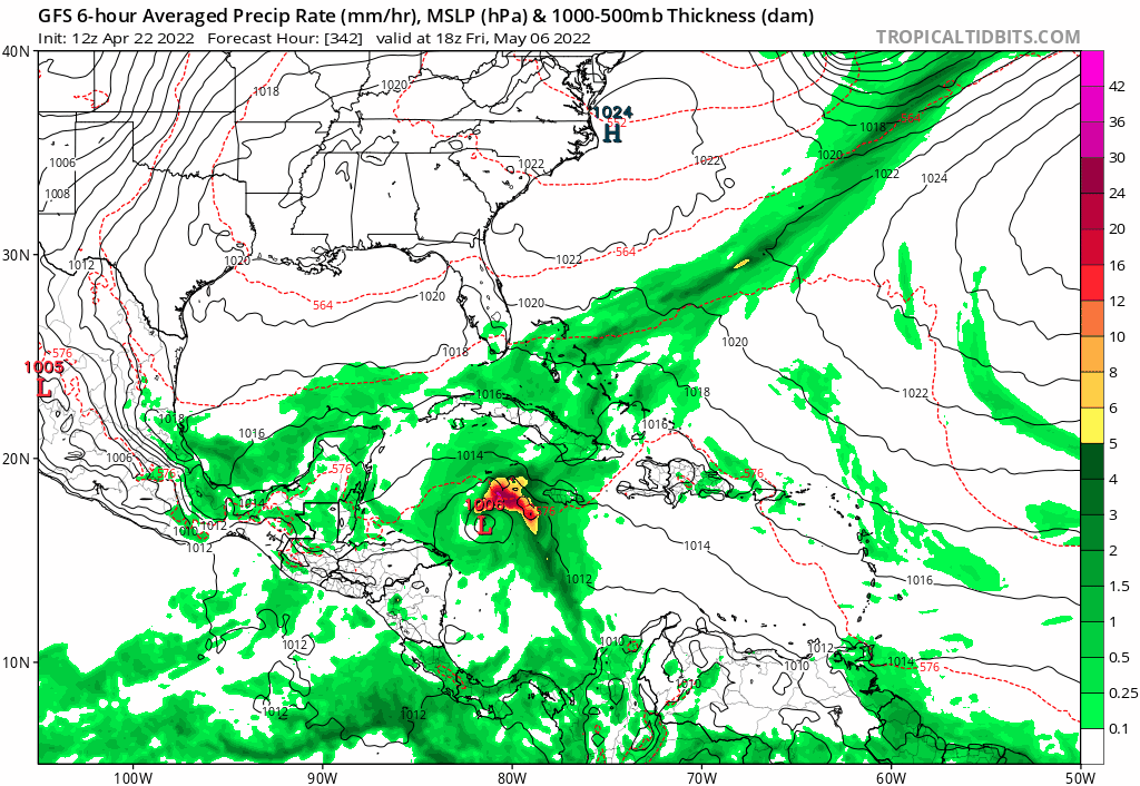
First real GFS fantasy tropical system of the season!
-
I haven't seen any discussion of this but it could provide some interesting data for this upcoming hurricane season. The Time-Resolved Observations of Precipitation structure and storm Intensity with a Constellation of Smallsats (TROPICS) mission[4] is a NASA constellation of six small satellites, 3U CubeSat, that will measure temperature and moisture profiles and precipitation in tropical systems with unprecedented temporal frequency. This data will enable scientists to study the dynamic processes that occur in the inner core of the storm resulting in rapid genesis and intensification.[5] William Blackwell of the Massachusetts Institute of Technology's Lincoln Laboratory in Lexington, Massachusetts is the principal investigator.[6][7] The constellation will be delivered to orbit on three launches in April and May 2022.[1] Mission overview[edit] TROPICS will perform very frequent measurements, similar to X-rays, that cut through the overall cloud-cover to see the storm's underlying structure. The storm structures known as the eyewall – tall clouds, wind and rain around the eye – and rainbands – the rainy parts of the spiral arms – give us clues about whether a storm is primed to intensify into a category 4 or 5 storm, something everyone in their path needs to know.[8] TROPICS will consist of six 3U size CubeSats, each about 10 × 10 × 36 cm (3.9 × 3.9 × 14.2 in) and weighing just 5.34 kg (11.8 lb),[9] that use scanning microwave radiometers to measure temperature, humidity, precipitation and cloud properties.[6] The CubeSats will be launched into three separate orbital planes to enable the overall constellation to monitor changes in tropical cyclones as frequently as every 21 minutes.[7] Each CubeSat will host a high-performance radiometer scanning across the satellite track at 30 RPM to provide temperature profiles using seven channels near the 118.75 GHz oxygen absorption line, water vapor profiles using 3 channels near the 183 GHz water vapor absorption line, imagery in a single channel near 90 GHz for precipitation measurements, and a single channel at 206 GHz for cloud ice measurements.[4] The investigation was selected from NASA's third Earth Venture Instrument competition.[7][3] Goddard Space Flight Center is the NASA Center leading the mission.[10]
-
2022 Atlantic Hurricane season
cptcatz replied to StormchaserChuck!'s topic in Tropical Headquarters
Latest ENSO showing we could have a cool-neutral scenario at peak season: Which equates to a high average ACE: Eager to see how high the forecasts will be... -
2021 Atlantic Hurricane season
cptcatz replied to StormchaserChuck!'s topic in Tropical Headquarters
Looks like the season's a wrap. So much for the La Nina late season action... -
2021 Atlantic Hurricane season
cptcatz replied to StormchaserChuck!'s topic in Tropical Headquarters
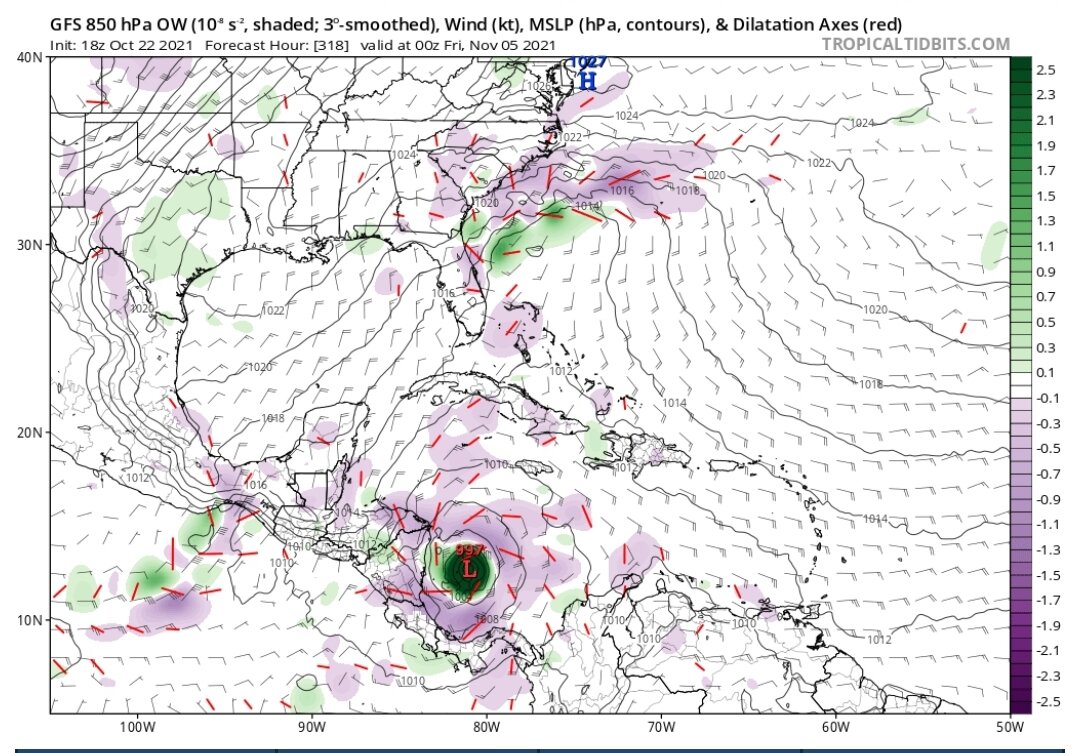
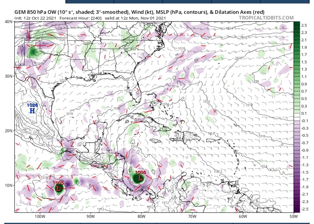
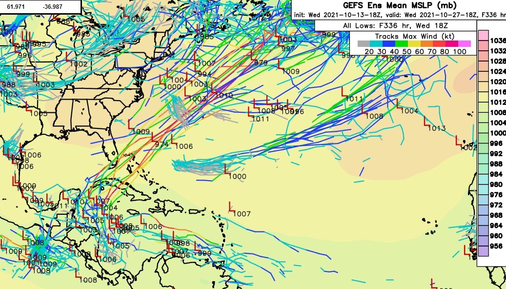
GEFS really doesn't want to give up on this Caribbean storm later this week.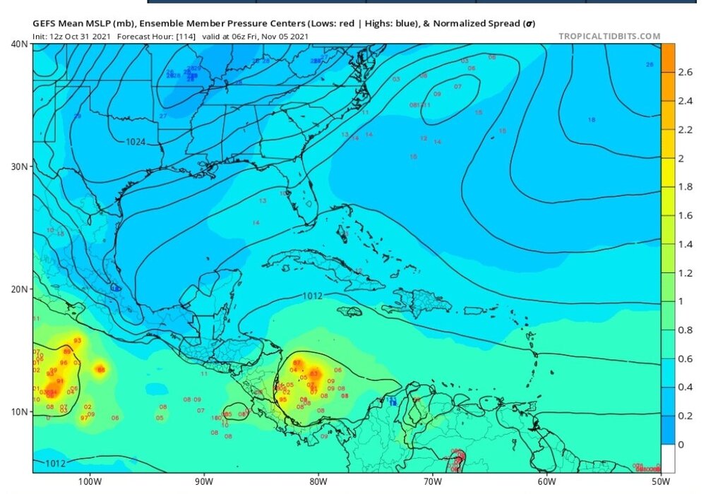
-
2021 Atlantic Hurricane season
cptcatz replied to StormchaserChuck!'s topic in Tropical Headquarters
Aaaaaand now the trifecta is complete with GFS coming in...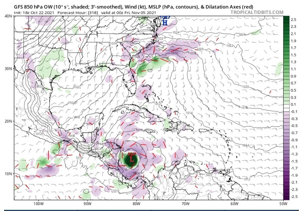
-
2021 Atlantic Hurricane season
cptcatz replied to StormchaserChuck!'s topic in Tropical Headquarters
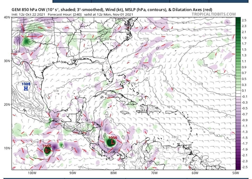
Euro and CMC now both showing low pressure at the exact same spot at the exact same time...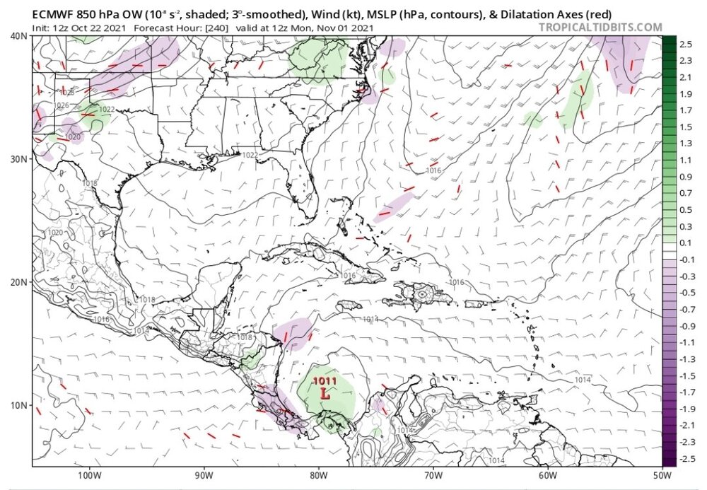
-
2021 Atlantic Hurricane season
cptcatz replied to StormchaserChuck!'s topic in Tropical Headquarters
Euro ensembles are getting on board. Seems pretty likely we'll see another hurricane next week. -
2021 Atlantic Hurricane season
cptcatz replied to StormchaserChuck!'s topic in Tropical Headquarters
Three GFS runs in a row now showing a hurricane forming near Purto Rico... -
2021 Atlantic Hurricane season
cptcatz replied to StormchaserChuck!'s topic in Tropical Headquarters
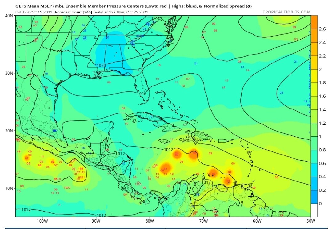
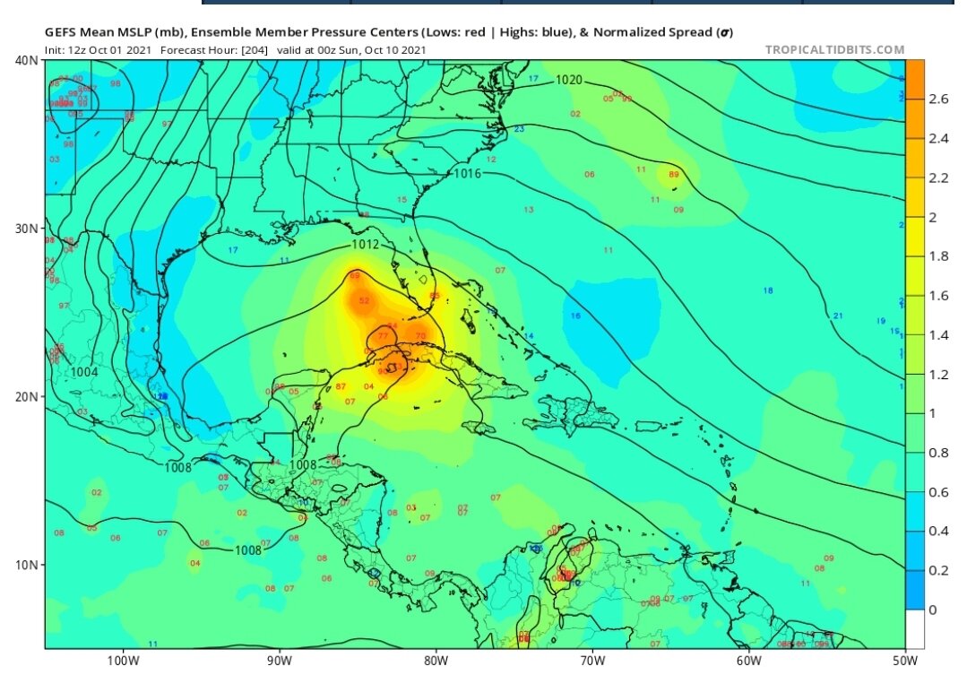
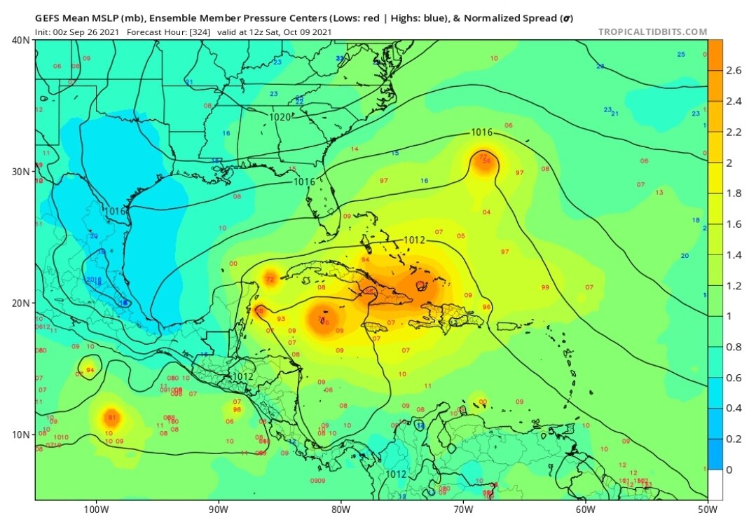
GEFS has been pretty consistent showing a wave entering the Caribbean the last week of October. Maybe this one will finally verify?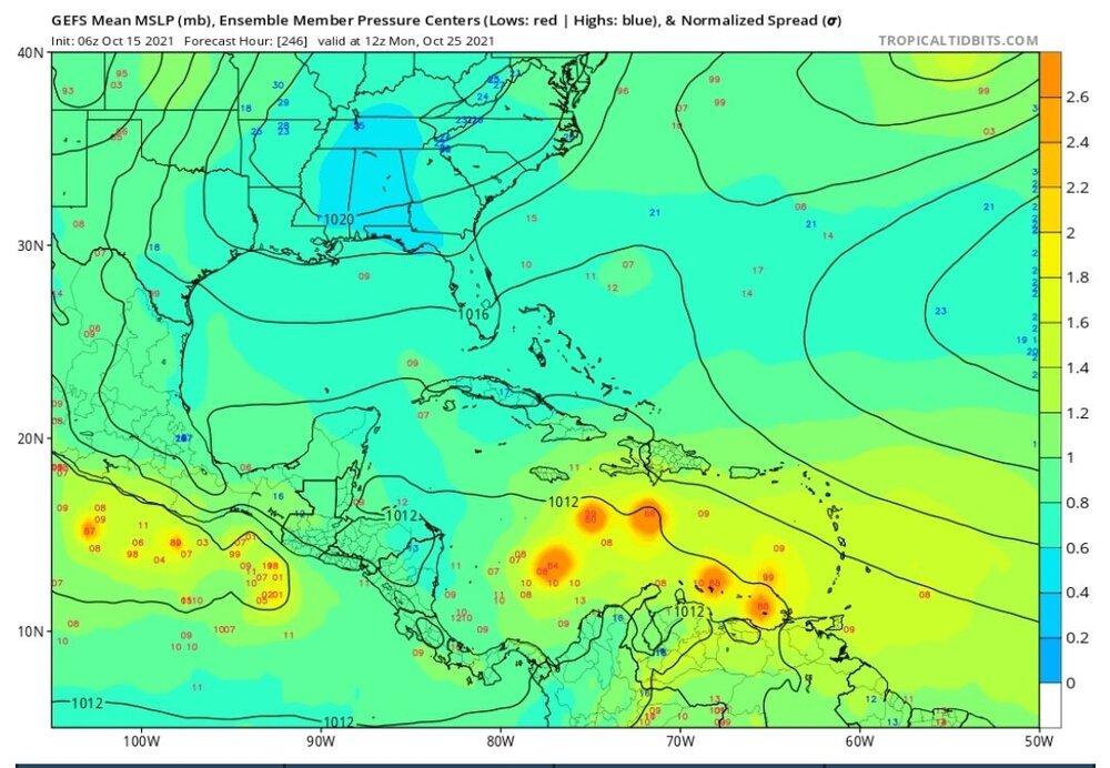
-
2021 Atlantic Hurricane season
cptcatz replied to StormchaserChuck!'s topic in Tropical Headquarters
18z GEFS has an impressive swath of strong storms heading up through the Bahamas/Florida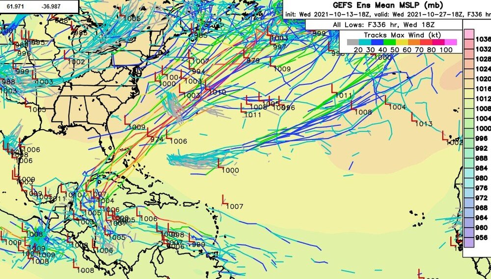
-
2021 Atlantic Hurricane season
cptcatz replied to StormchaserChuck!'s topic in Tropical Headquarters
Seems so -
2021 Atlantic Hurricane season
cptcatz replied to StormchaserChuck!'s topic in Tropical Headquarters
I mentioned I'd put 2008 in front of this year. -
2021 Atlantic Hurricane season
cptcatz replied to StormchaserChuck!'s topic in Tropical Headquarters
Interesting to think back how this season would compare to other seasons say in the past 20 years (even though it's not even over yet). In terms of US impacts, obviously 2004, 2005, 2017, and 2020 stand alone. But other than those, 2011 had Irene, 2012 had Sandy, 2016 had Matthew brushing the coast, 2018 had Michael and Florence. 2007 and 2008 destruction was mostly in the Caribbean and Central America. I can't think of any really bad US impacts in 2000-2003, 2006, 2009, 2010, 2013-2015, and 2019. With the mere presence of Ida, in terms of US impacts I'd put this season just behind 2004, 2005, 2017, 2020, and maybe 2008 in the past 21 years. Definitely wouldn't call it a dud. -
2021 Atlantic Hurricane season
cptcatz replied to StormchaserChuck!'s topic in Tropical Headquarters
12z GEFS still coming in strong. Not really concerned with no other model guidance as GFS has really been the king of cyclogenesis this year while all others have lagged behind. I'd be very surprised if nothing comes of this.
-
2021 Atlantic Hurricane season
cptcatz replied to StormchaserChuck!'s topic in Tropical Headquarters
It's cyclical and the quiet pacific shows that. The early 2010s were quiet, 2017 to present is active. In a few years it will get quiet again. The number of cat 5's and strong cat 4's is interesting though and seems to be increasing. -
Why are the 12z runs initializing such a weak storm? Euro is at 993, CMC is at 999, and GFS is at 971. We have recon data from last night proving the pressure is in the 940s and it obviously hasn't weakened. What gives? And could that affect the rest of the model run?
-
2021 Atlantic Hurricane season
cptcatz replied to StormchaserChuck!'s topic in Tropical Headquarters
I have a feeling south Florida's luck is going to quickly run out...
-
Looks like over the past few hours it's been moving due west with even a possible wobble to the south. Wonder how long it will keep that up.
-
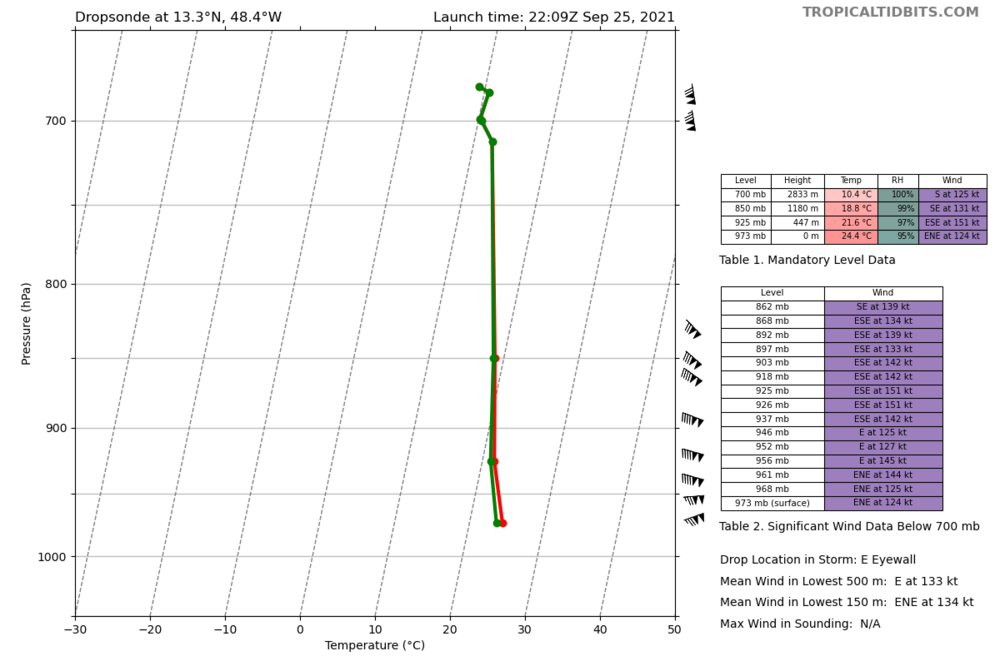
Impressive 151 knot winds 447 meters up
-
5pm: 140 mph, 943 mb It'll be interesting to see how good the NHC is at estimating wind and pressure based on satellite data as recon will give us the real numbers within an hour.