cptcatz
-
Posts
1,077 -
Joined
-
Last visited
Content Type
Profiles
Blogs
Forums
American Weather
Media Demo
Store
Gallery
Everything posted by cptcatz
-
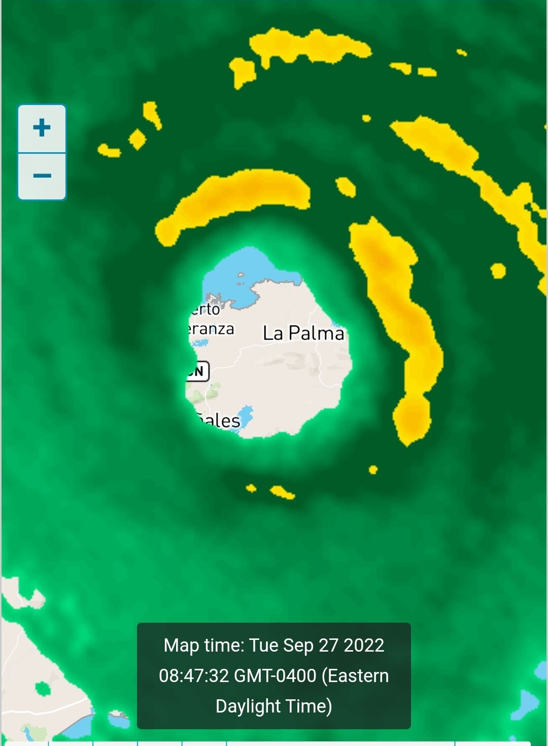
Pretty disappointing how dry and boring the eastern side of the storm system is. I was hoping to see a little more action here in Palm Beach County.
-
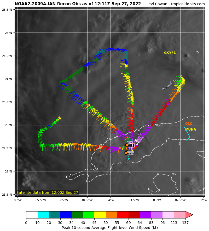
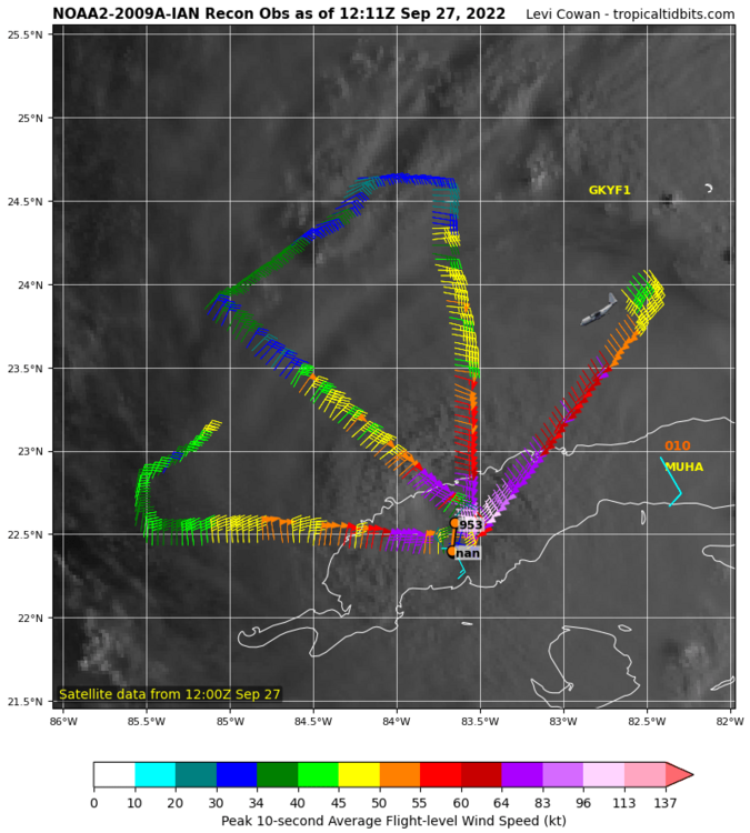
With this plane headed for the storm, can we do the intensity guessing game like we did for Eta back in 2020? That was the lolziest thing I've ever seen here. I'll start: 928 mb, 165 mph
-
933.1 mb in this pass
-
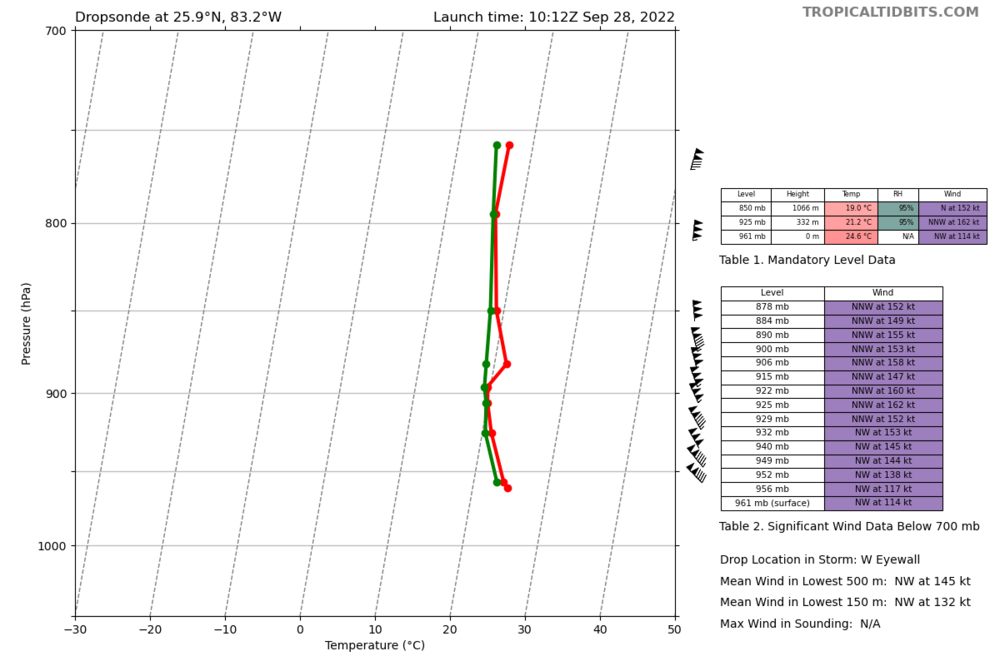
162 knot wind picked up on this dropsonde
-
This is just a total amateur guess but could be simply because of land area which allows us to know they are there. The islands are tiny compared to Florida so the odds of a tornado hitting one is very low. Maybe there were just as many tornadoes out in the water but we never knew since we had no radar or people to see them. If a tornado forms in the middle of the ocean and no one was around to see it, did it make a noise?
-
Recon just recorded 946 mb. Winds not impressive on this NW-SE fix but but should be higher in the NE.
-
Landfalling south of Naples would bring devestating impacts to the east coast, exactly like Wilma did. Dade-Broward-Palm Beach is the most populated part of the state and the eye going through there would be nearly worst case scenario.
-
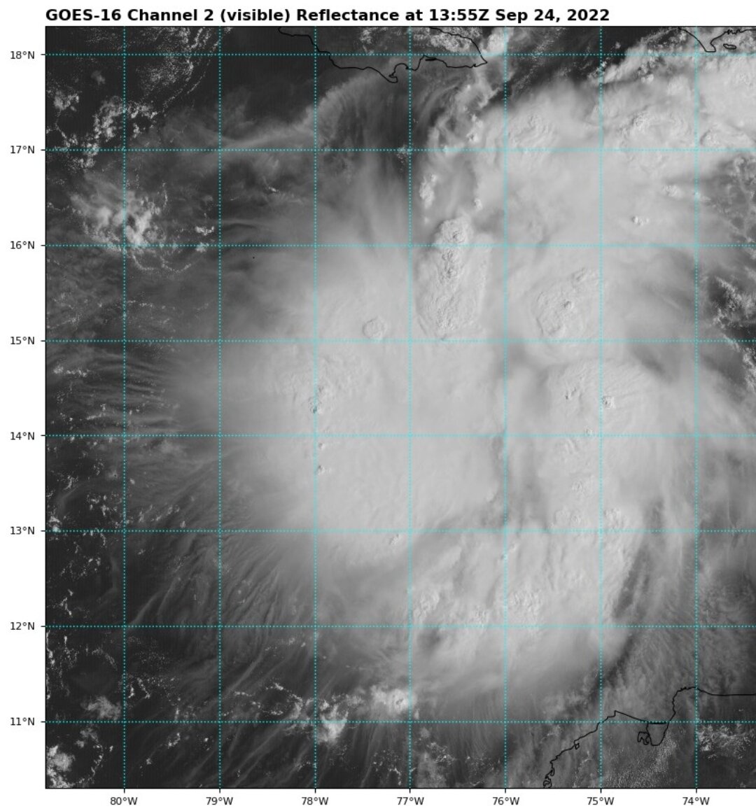
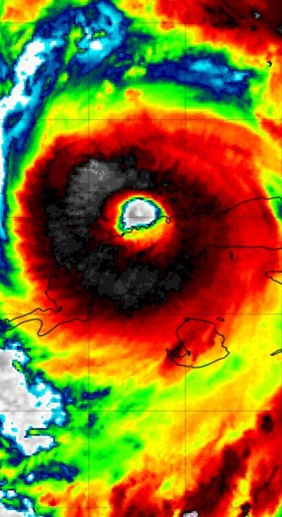
That's an amazing structure for having just crossed over Cuba. Do you think cat 5 is on the table?
-
Tampa Bay has an average depth of only 12 feet so there is relatively very little water to pile up compared to all the water that can be pushed the other way from the GOM.
-
Northern eyewall back over water.

-
Recon just did fix the center to be moving east of north although very slightly.
-
06z Euro making landfall at Sarasota/Bradenton and 24 hours later only getting to Lakeland which is only 50 miles away. Although this run initializes at 989 mb over Cuba so not sure if the wrong intensity would affect the track.
-
Did that plane fly through the eye over land? I thought they don't do that.
-
The southeast trends continue...
-
12z Icon correcting way west. That was always the eastern outlier so it looks like everything is starting to come together. Tampa could dodge a huge bullet.
-
It will still have huge surge though. Surge isn't correlated with the intensity at landfall but is a function of the size, intensity, and time over water of the entire history of the storm. All the water that the storm was pushing out in front of it will still be there. Similar situation as Sandy which was a massive storm over water for a very long time and even though it made landfall with only cat 1 winds, those other factors caused 14 foot storm surges.
-
71 knots in the NE quad. Special advisory coming with upgrade to hurricane?
-
It's a bit north and west.
-
Yep Andy Hazelton tweeted that he was on it.
-
Not necessarily. Surge would be worse in the first scenario. Look at the difference between Katrina and Ida.
-
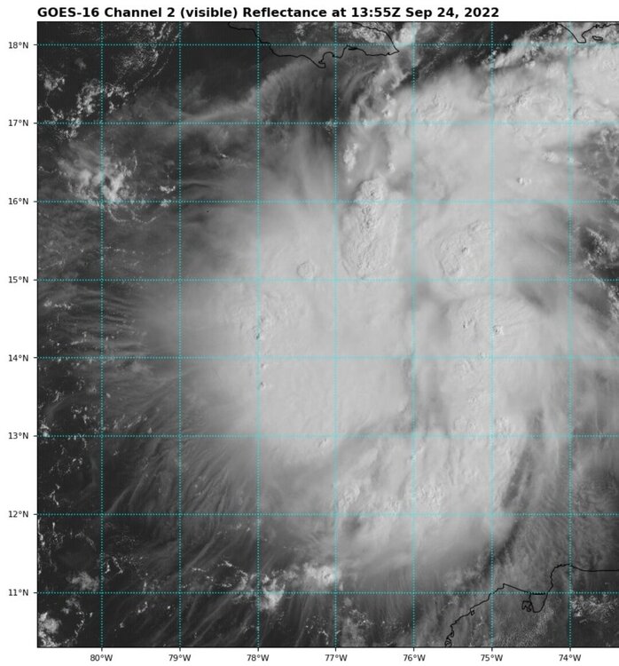
Not sure if I'm being a weenie but it kind of looks like the low level swirl is moving due north on visible. A little hard to tell through the taller clouds but that's what my eyes see.
-
I mean is this even a cyclone?
-
Looks like convection is trying to wrap around a center at 14.5N 76W. That would be a full degree north of what recon found.
-
Euro saying Miami gets hits, GFS saying Tallahassee gets hit. What a range.