Albedoman
-
Posts
1,379 -
Joined
-
Last visited
Content Type
Profiles
Blogs
Forums
American Weather
Media Demo
Store
Gallery
Everything posted by Albedoman
-
I said this Tuesday on the central pa forum The current drought is ignored in the winter as these PADEP hydrologists sit comfortably in their heated offices and never get out to see the real world. They rely on inaccurate USGS gauges during frozen conditions and other BS modeling for drought that are with unproven techniques. Tell them to go drill a monitoring well and they will always say what for? The stupidity burns my friends. The current snow pack contains snowflakes with little moisture content which does nothing for the drought. Best evidence in which the hydrologists ignore is the moisture content of the snowpack. My proof? Look how yellow the grass was even before the latest snow cover. The grass has now been covered with some low moisture fluffy snow but in these desert like humidities the last month , sublimation has literally destroy the moisture content of the snow cover and when the grass is exposed again, the grass will be even more yellow- actually brown. But they continue to sit in their offices dreaming of a flood somewhere. Thanks for agreeing with me.
-
Right now, Philadelphia is on track to set a new record for driest January on record, assuming less than 0.06" of liquid-equivalent falls before month's end (which right now, looks likely). Allentown (0.02" margin) and Mount Pocono (0.10" margin) are also in the running. The drought is not gone folks and has been made 100% worse for groundwater supplies.
-
MT Holly- temps were at -1 from midnight and actually rose to 3 degrees around 3 am until 6 am when the temps dropped again dropped to -3 after the skies cleared out. Radiational cooling is a huge factor the last few nights in the local deeper valleys. Ice fog was not as bad too.
-
I found the verification
-
I have not seen -8 anywhere at KABE. Please verify Imperial (Metric) Date Time (est) Wind (mph) Vis. (mi.) Weather Sky Cond. Temperature (ºF) Relative Humidity Wind Chill (°F) Heat Index (°F) Pressure Precipitation (in) Air Dwpt 6 hour altimeter (in) sea level (mb) 1 hr 3 hr 6 hr Max. Min. 22 15:35 SW 3 10.00 Fair CLR 19.4 -5.8 32% 30.48 0.0 22 15:15 SW 6 10.00 Fair CLR 19.4 -4 35% 12 30.48 0.0 22 14:55 Calm 10.00 Fair CLR 19.4 -7.6 29% 30.48 0.0 22 14:35 Calm 10.00 Fair CLR 19.4 -5.8 32% 30.48 0.0 22 14:15 Calm 10.00 Fair CLR 19.4 -5.8 32% 30.48 0.0 22 13:55 Calm 10.00 Fair CLR 19.4 -5.8 32% 30.49 0.0 22 13:35 Calm 10.00 Fair CLR 19.4 -5.8 32% 30.49 0.0 22 13:15 Calm 10.00 Fair CLR 17.6 -4 38% 30.5 0.0 22 12:55 NW 6 10.00 Fair CLR 17.6 -4 38% 10 30.52 0.0 22 12:35 NW 3 10.00 Fair CLR 17.6 -5.8 35% 30.51 0.0 22 12:15 W 3 10.00 Fair CLR 17.6 -5.8 35% 30.52 0.0 22 11:55 NW 7 10.00 Fair CLR 15.8 -5.8 37% 7 30.52 0.0 22 11:35 N 9 10.00 Fair CLR 14 -4 44% 3 30.52 0.0 22 11:15 N 9 10.00 Fair CLR 14 -4 44% 3 30.52 0.0 22 10:55 NW 8 10.00 Fair CLR 12.2 -4 48% 2 30.52 0.0 22 10:35 NW 7 10.00 Fair CLR 12.2 -4 48% 3 30.53 0.0 22 10:15 NW 9 10.00 Fair CLR 12.2 -4 48% 1 30.53 0.0 22 09:55 NW 8 10.00 Fair CLR 10.4 -4 52% -1 30.53 0.0 22 09:35 NW 5 10.00 Fair CLR 10.4 -0.4 61% 3 30.53 0.0 22 09:15 W 3 10.00 Fair CLR 8.6 -0.4 66% 30.53 0.0 22 08:55 Calm 10.00 Fair CLR 5 -0.4 78% 30.53 0.0 22 08:35 Calm 10.00 Fair CLR 3.2 -4 72% 30.52 0.0 22 08:15 Calm 10.00 Fair CLR 1.4 -4 78% 30.52 0.0 22 07:55 SW 3 10.00 Fair CLR 1.4 -4 78% 30.52 0.0 22 07:35 SW 3 10.00 Fair CLR 1.4 -4 78% 30.52 0.0 22 07:15 S 3 10.00 Fair CLR 1.4 -4 78% 30.51 0.0 22 06:55 SW 3 10.00 Fair CLR -0.4 -5.8 78% 30.5 0.0 22 06:15 S 5 10.00 Fair CLR -0.4 -5.8 78% -9 30.49 0.0 22 05:55 Calm 10.00 Fair CLR -2.2 -5.8 84% 30.49 0.0 22 05:35 S 3 10.00 Fair CLR -0.4 -5.8 78% 30.49 0.0 22 05:15 S 3 10.00 Fair CLR 1.4 -2.2 85% 30.49 0.0 22 04:55 Calm 10.00 Fair CLR -0.4 -5.8 78% 30.48 0.0 22 04:35 Calm 10.00 Fair CLR -0.4 -4 84% 30.48 0.0 22 04:15 S 3 10.00 Fair CLR -0.4 -4 84% 30.49 0.0 22 03:55 Calm 10.00 Fair CLR -0.4 -5.8 78% 30.49 0.0 22 03:35 S 3 10.00 Fair CLR 1.4 -4 78% 30.49 0.0 22 03:15
-
I posted this in the philly forum a few minutes ago with pics last nights low was -10 at my house in Macungie. Many areas in the deeper valleys were colder than that along Rt 222. This is the coldest temps since the infamous winter of 1994 for me at the house. That was the year my digital thermometer locked up at -25 below zero and had to trash it. But I really remember the one thing in 1994 that I have not seen but one other time when it has been this cold here and because the Little Lehigh is in my backyard ---ICE FOG--. I hope Mike Gorse reads this. This is really a rare weather phenomena here and...
-
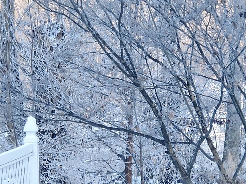
last nights low was -10 at my house in Macungie. Many areas in the deeper valleys were colder than that along Rt 222. This is the coldest temps since the infamous winter of 1994 for me at the house. That was the year my digital thermometer locked up at -25 below zero and had to trash it. But I really remember the one thing in 1994 that I have not seen but one other time when it has been this cold here and because the Little Lehigh is in my backyard ---ICE FOG--. I hope Mike Gorse reads this. This is really a rare weather phenomena here and demonstrates how cold the air really is in the riverine valleys in PA. Ice Fog forms when the skies are clear -10 below zero and colder and the stream is not frozen because the water is limestone spring fed at around 60 degrees. The warm water literally starts to steam in such colder temps. Everything within the riparian area around the stream turns into an crystallized powder on the vegetation and becomes a beautiful ice wonderland.
-
drought is ignored in the winter as these PADEP hydrologists sit comfortably in their heated offices and never get out to see the real world. They rely on inaccurate USGS gauges during frozen conditions and other BS modeling for drought that are with unproven techniques. Tell them to go drill a monitoring well and they will always say what for? The stupidity burns my friends. The current snow pack contains snowflakes with little moisture content which does nothing for the drought. Best evidence in which the hydrologists ignore is the moisture content of the snowpack. My proof? Look how yellow the grass was even before the latest snow cover. The grass has now been covered with some low moisture fluffy snow but in these desert like humidities the last month , sublimation has literally destroy the moisture content of the snow cover and when the grass is exposed again, the grass will be even more yellow- actually brown. But they continue to sit in their offices dreaming of a flood somewhere. Thanks for agreeing with me.
-
Yes, some talk about it here but it is the media that ticks me off. Too much time on sports and social issues, not enough time on water supply issues until it's too late. The snow sublimation is a humongous problem right now. Ski resorts are pumping one hell of lot water out of the ground just to keep the slopes at the proper snow depth. Why is no one mentioning that situation? The levels of streams show drought conditions now because they are frozen. Low flow conditions enable the non limestone streams to freeze longer and harder. More ice jams later? a good 18-24 inch state nowfall event would help a lot. That is not in the cards at this time. I see 2/14 to 2/20 period as the best and only shot of this happening as the dying la nina is put down with a new pattern change. However this pattern reminds of the 3 pattern before the March 93 superstorm too
-
and no rain or snow well enjoy your drought folks with the mild temps
-
Your post indicates only emphasizes one thing -CONTINUED SERIOUS DROUGHT SITUATION- and a bad one at that. Without heavy snowfalls in the next few weeks, we are in a world of hurt. As a professional hydrologist, the continued freezing temps with little to no snow melt, huge amounts of snow being sublimated and the ground water table falling because of no recharge with frozen soils and well pumping, we are in serious trouble for this spring. I hope state officials are aware of this problem because the media sure as hell does not care. They only care about the insignificant snow events and the bitter cold. and how it affects social issues and event. When peoples wells run dry, then maybe they will spend time on water supply issues.
-

-
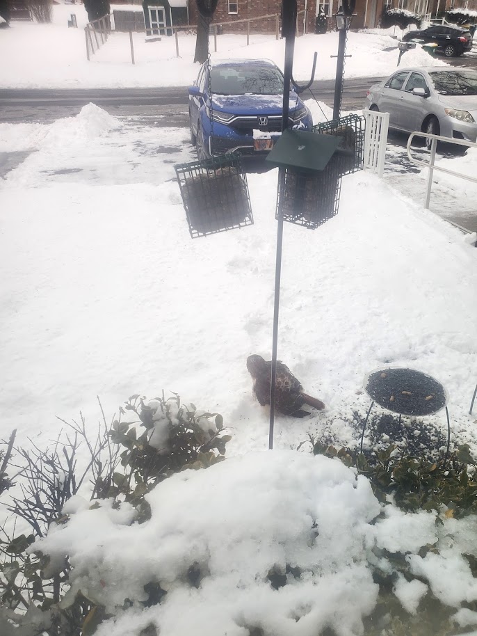
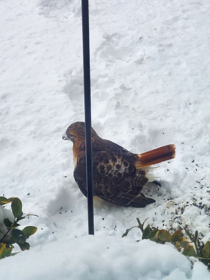
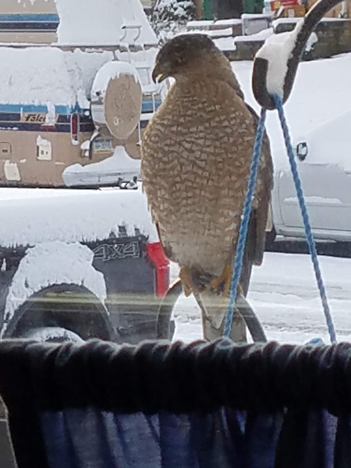
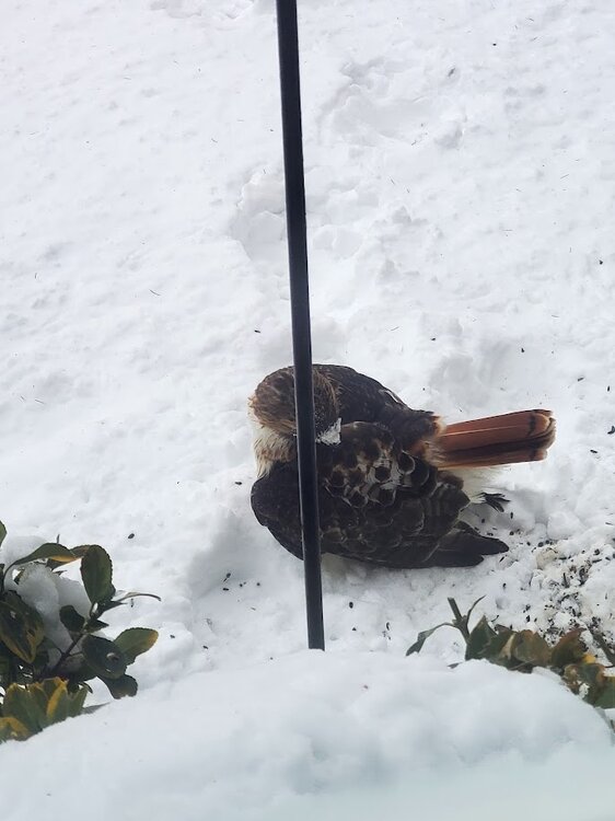
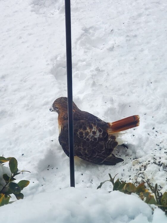
I posted a response to another's concern about birding. This just happened. A red tail hawk hit my front window and was stunned. This is getting unbelievable. Last night low was -2 here in macungie with almost 8 in of snow on the ground.
-

1/19/25 Eagles Playoff Winter Storm obs
Albedoman replied to Ralph Wiggum's topic in Philadelphia Region
Here in Lower macungie, just outside of Alburtis we had some wicked but nice localized snow banding. When the first band came through around 3 pm the flakes were pancake size and lasted for over an hour. It was snowing at 2-3 inch per hour rates for nearly 1.5 hours. The another band came through around 5 pm and dropped some more heavy snow 1 inch per hour rates but the fluff factor with the snow flake was noticeably diminished I ended up with 7.8 inches. The banding was expected and was a huge difference. The RGEM as well as final Mt Holly snow map showed the banding right over me. Below was my original forecast from days ago as stuck with the RGEM and my past experiences with these type of snow pattern events. The CMC has been holding strong and consistent this entire week for Sunday- Monday event, I find that refreshing. The GFS has been floundering and the Euro came back toward the CMC solution. The totals have been all over the place but it appears 6-8+ in may come more into line later tonight IMHO. I would post a thread later tonight after the OZ runs if the start aligning with my thoughts 0f 6-8 in. This would be a WSW event. A watch maybe needed by Sat morning if this scenario comes to fruition. The key will be the high snow ratios too. The storm may move quickly but the ratios and cold in... Thursday at 08:36 AM 1,264 replies -
1/19/25 Eagles Playoff Winter Storm obs
Albedoman replied to Ralph Wiggum's topic in Philadelphia Region
This is what I got so far 7.25 in
-
1/19/25 Eagles Playoff Winter Storm obs
Albedoman replied to Ralph Wiggum's topic in Philadelphia Region
Approaching 8 in for the Macungie area, banding still going on with low visibility and S+ snow -
1/19/25 Eagles Playoff Winter Storm obs
Albedoman replied to Ralph Wiggum's topic in Philadelphia Region
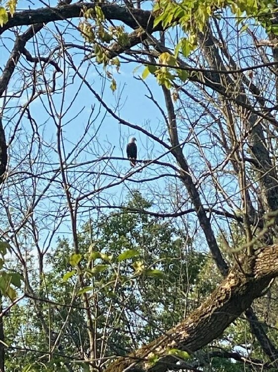
yes it is awesome birding, bald eagles , red tail at my feeders and deer with other animals up on my deck The feeder on the deck hosts, raccoons, possums, at least 6-8 squirrels at a time and hundreds of birds.jpg.9a8de2e5ca385220c475463537654709.jpg)

-
1/19/25 Eagles Playoff Winter Storm obs
Albedoman replied to Ralph Wiggum's topic in Philadelphia Region
Its puking snow right now in Macungie 3-4 inches on the ground now. Visibility cut big time - less than 1/4 mile with stiff breezes Snow ratios up to near 15:1 with the fluff factor
-
1/19/25 Eagles Playoff Winter Storm obs
Albedoman replied to Ralph Wiggum's topic in Philadelphia Region
Its puking snow right now in Macungie 3-4 inches on the ground now. Visibility cut big time - less than 1/4 mile with stiff breezes Snow ratios up to near 15:1 with the fluff factor -
1/19/25 Eagles Playoff Winter Storm obs
Albedoman replied to Ralph Wiggum's topic in Philadelphia Region
OH no, ten minutes of pixie dust size flakes are already fluffed up pretty good. Snow ratios way are already considerably higher than 10: 1 for sure as the cold air is working down through the profiles. The models indicate 10:1 snow ratios With banding , I see a 8-12 inches in places now. I ran the meteogram generator at KABE/KRDG at 20:1 ratios and its nearly a foot with the expected precip amounts without banding. The start time is a few hours ahead of schedule too. https://www.meteor.iastate.edu/~ckarsten/bufkit/image_loader.phtml?site=Kabe&nam=on&nam_mos=on&namm=on&gfs_mos=on&gfs=on&gfsm_mos=on&gfsm=on&nws=on&rap=on&obs=on&nam4km=on&con=on&ratio=20&max_t=on&cobb=on&compaction=on&mean_mt=on&max_mt=on&mean=on -
Sunday 1/19 Eagles Game Snow and Stuff
Albedoman replied to Ralph Wiggum's topic in Philadelphia Region
for the newbies: as the LP gets wrapped up, the snow ratios will go up. Looking at models 6 hours hours before this type of storm event is useless. Its all radar folks. A true meteorologist knows the historical function of past events too- just not relying on modelogy. Watch and learn. My Holly is spot on. The HRDPS and HRRR is what to be looking at if you are counting inches. Basically, where the frontogenisis banding sets up. The sweet spot for banding with a historical benchmark storm like this one for good snow banding is in northern montgomery, bucks and the LV. Lets just see how it pans out. Anyway the best part of this storm is the cold and blowing snow afterwards with a chance of thundersnow in the snow banding too. -
Sunday 1/19 Eagles Game Snow and Stuff
Albedoman replied to Ralph Wiggum's topic in Philadelphia Region
The Meso's are in play. The delayed start time is usual when trying to overcome the huge amount of dry air in place. Typically starts off as pixie dust and within the hour becomes a moderate snow. The models have a tough time ingesting this dry air for start timing and accumulations as we are in the depth of this huge arctic air mass this time around.. As the moisture and evaporative cooling snowfall overcomes the dry layers in the atmosphere, the snow ratios will increase dramatically thus the moderate snow quickly becomes heavy snow (Fluff factor). If it was windy, we would have whiteout conditions but the LP, I believe is not deep enough and too far away from the coast this time. The HRDPS model is a trusting model for this particular storm event IMHO because it shows the fragmentation of the upper air patterns as the LP lifts northward off the coast. For the LV , also reaching the benchmark usually gives a decent snowfall event so I feel good about getting over 6 inches for a winter storm warning. Banding of the snow is an issue that the meso's seem to have trouble identifying the approximate locations. Where those band setup and the progressives of the LP off the coast is the real determining factor. The storm in Macungie last Feb was a good example of this. Someone will get a lollipop of 10+ inches in the warned areas and we all hope it is over us. LOL -
this is what it could look like? https://www.facebook.com/watch/?v=1068529676892306
-
Sunday 1/19 Eagles Game Snow and Stuff
Albedoman replied to Ralph Wiggum's topic in Philadelphia Region
I have- its called the HEMP - Historical Experience Meteorological Patterns ---Model - used by us old geezers on occasion before the internet and commodore computers. LMAO Below is how I played modelogy back in the late 70's to early 80"s. they were games:---Wow how have things changed as being more serious and talk about changing from run to run every 6 hours? LMAO https://www.mobygames.com/game/174994/weather-tamers/ -
Sunday 1/19 Eagles Game Snow and Stuff
Albedoman replied to Ralph Wiggum's topic in Philadelphia Region
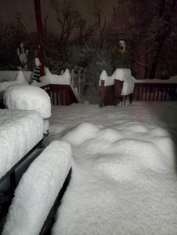
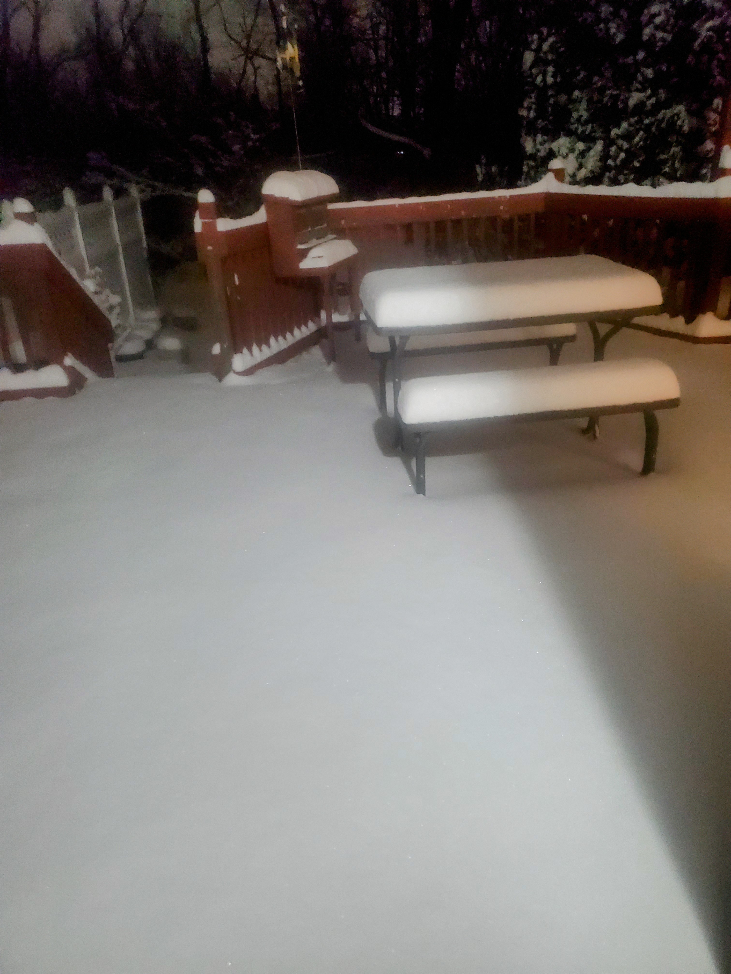
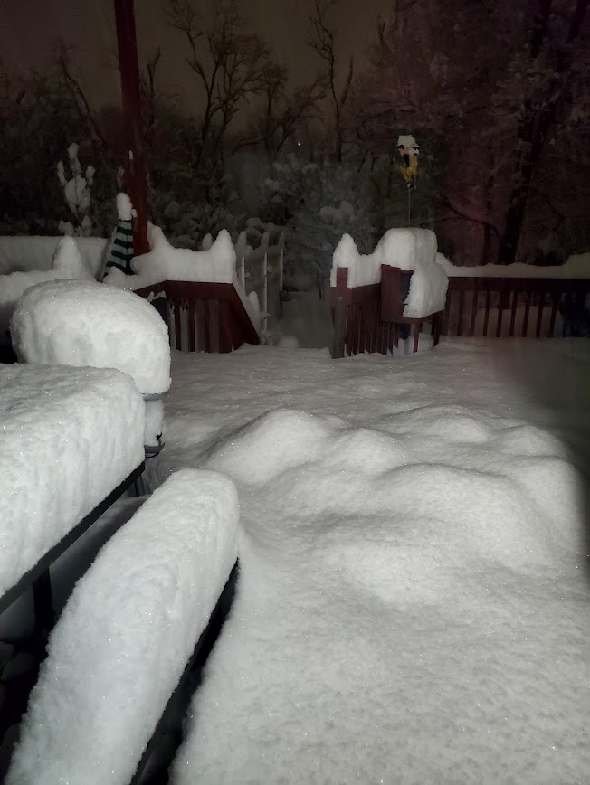
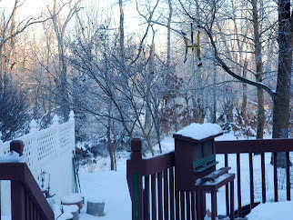
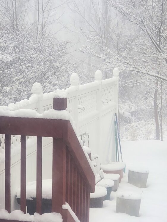
A Winter storm warning should be issued tomorrow by early afternoon for the LV. I only say that time frame because of the nuisance precip should get out of the way first but I am not Mt Holly. They could be confident enough to issue Sat morning however Its been a long time coming. Plowable snow - its about time. . This will be the heaviest snow since last year in Feb from the freak snow banding event giving us a localized snow of 15 inches or so in Macungie ( we only got warned during mid stream of last years event- not MT Hollys fault) as seen on 2/16/24 in my deck picture below. I expect Monday morning to look pretty similar with about 10+ inches. The huge difference is that this will blow everywhere by Monday evening as the snow will be very fluffy from the high snow ratios. I do expect rural plowed roads I the LV (Nazareth area) to be drifted shut if the winds pick up as I expect. Again, I emphasize the cold temps. This will be the coldest outbreak we have seen in many years. Say goodbye to many nuisance bugs for next spring. Ice jams on local rivers will become a problem in Feb should we have some moderation with these cold temps but ice jamming will become an issue in the future regardless. The typical frozen pipes, especially outside faucets that have not been properly winterized will burst. Many of drivers will burn through a ton of windshield wiper solution as the salt brine spray will become unbearable as exampled by todays quick melt off and of course car wash will be backed up with long lines on the sunny days. Do not be surprised as many car washes will close down with these cold temps next week too.