Albedoman
-
Posts
1,379 -
Joined
-
Last visited
Content Type
Profiles
Blogs
Forums
American Weather
Media Demo
Store
Gallery
Everything posted by Albedoman
-
The upcoming pattern change on the 10-12th reverts back to the SOS. This drought is really going to be bad come January. The low flows in the limestone geology streams is beginning to freeze up the normally warm spring fed streams for the lack of a good flowing base flow. The trout population is literally being destroyed. I can only imagine how low the ground water table will be in February and how wells will dry up in the middle of winter. Even with a major snow event and with the ground frozen, no recharging of the groundwater table will take place for months. The latest moderate rains only put out the the chances of wild fires and did nothing for ground water table. I hope the storm on the 12th drops 2+ of rain or we are screwed as the forecast looks dryer than popcorn fart until around Christmas
-
pixie dust fairy lives on. In the donut hole now
-
I give up. The models are so wishy washy because of the evolving new LP pattern trying to setup after the 10th. I just hope that this new pattern opens the door for some GOM /Atantic Ocean moisture to get embedded into these progressive flow LP's and be able to spin up some noreasters our way. At this point, I will be happy to settle for some rain just to get the ground wet before it really freezes. This drought will not relinquesh its ugly head. The dusting of snow only hinders wildfire production as the creek levels are really dropping now in my area. Back into the 50's and 60's next week will not help either. People will be washing their cars big time with the ton of salt being dumped on the road tomorrow for the 1-2" snow squalls. Snow squall warnings will likely be issued tomorrow and your cell phones will be banging out the audible alerts Just hoping for a new wet pattern setup after the 20th and loaded to bear with continual snow events. A nice Christmas gift after this shitty summer and fall right Red Sky?
- 1,105 replies
-
- 1
-

-
- tropics
- heavy rainfall
- (and 5 more)
-
https://www.lowermac.com/DocumentCenter/View/2157/PRESS-RELEASE--Lehigh-County-Burn-Ban
-
C'mon man give me abreak now - plz let me enjoy my 1-2 inches of snow this week LMAO while we are still under a burn ban and drought. Until the 4 corners LP's start forming we are not going to get moisture laden storms around here but just constant clipper snows. Yes, my predicted cold air has come to fruition but the moisture still is lagging for good snow production storm events. I am really hoping for a Christmas week block buster snow event. The chances appear to be real good. The Great Lakes snow machine is also helping to keep the temps down for our area as the air coming over the lakes is not being modified like last year with unfrozen Great lakes
-
woopee a dusting LOL
-
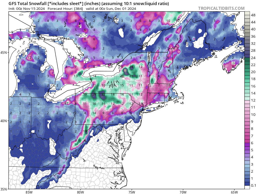
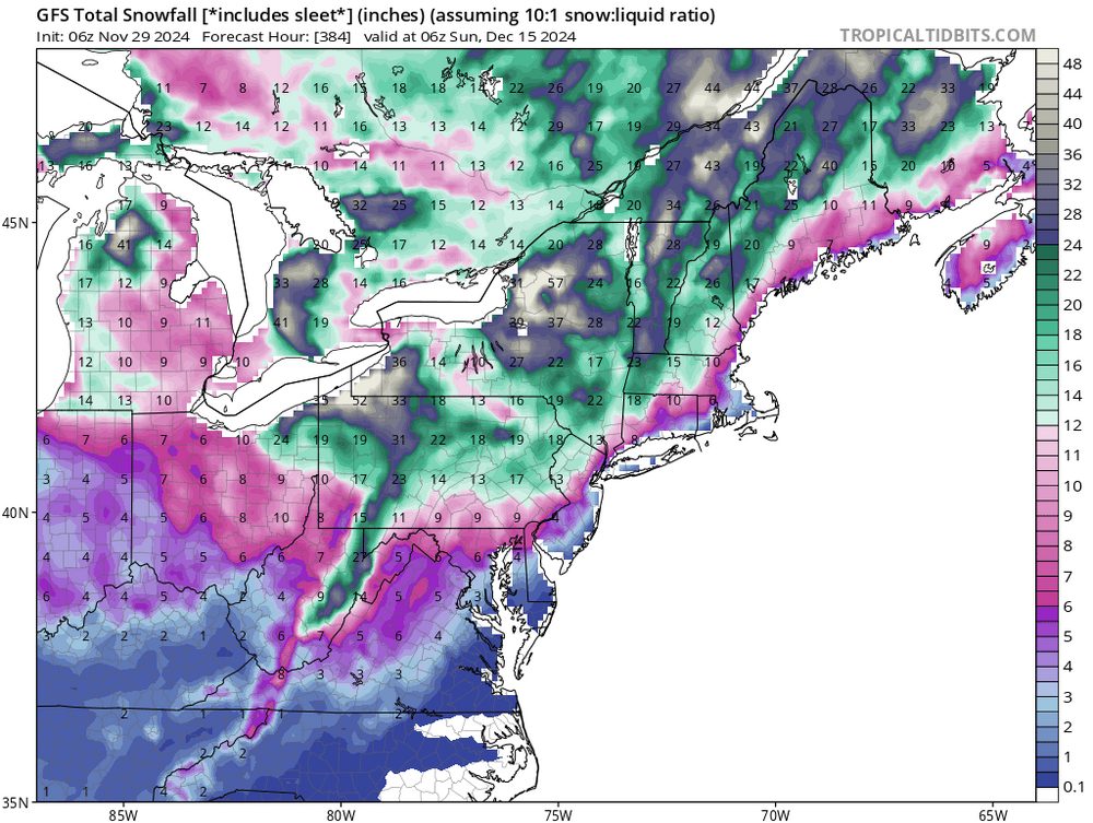
my October 13th post drought guy here- saying that this drought will be broken by Thanksgiving with a heavy rain storm followed by a light snowfall event for the LV area. After an initial few weeks of cold/rainy and maybe even snowy weather into late November, the typical rain to snow precip pattern will return by the second week in December with decent cold snaps and maybe even some polar air reaching us by Christmas. Then the flood gates will be opened for some major snow events the rest of the winter with constant refreshed clippers - similar to the winter of 2003 after a blistering drought in 2002. ... Well , this has played out very nicely for me This mornings GFS run is spot on. Hope it stays like this
- 1,105 replies
-
- 1
-

-
- tropics
- heavy rainfall
- (and 5 more)
-
NO way. I am sticking to my original forecast last month for the upcoming time period- after the moderate rainfall events this past week, with a light snow event that I predicted, the flood gates open up for a period of some nice cold air. I am still calling for a snow accumaltion event during the Pearl harbor day period 12/6- 12/9 as I reierated last week as the pattern changes and reloads. A good meterologist sticks to his original thoughts- I have been burned too many times changing my forecast on a single model run. For those who even care? My usual forecast prediction method for thew last 30+years- the 10 day GFS sniffs out the potential weather pattern changes, the Euro/CMC confirms those changes from 7- 10 days out for the potential pattern change, sometimes attached with a significant storm event. The Euro then confirms the potential pattern change/storm event it 48-72 hours out. Between 36- 48 hours, I rely on the Meso's, especially the NAM, RGEM and HRRR's with 36 hours for total precip/wind info. Chaos playtime on the models with major unreliability issues usually occurs on the GFS and Euro between 4-8 days out with upheavel and reversals sometimes noted. This is the result of unreliable and lack of data info from the few ocean buoys in the western Pacific being ingested into the models. When the potential storm event/pattern change finally comes on shore usually at 3-5 days out, the LR models tighten up and come into some type of agreement. Then its off to the races.
- 1,105 replies
-
- 1
-

-
- tropics
- heavy rainfall
- (and 5 more)
-
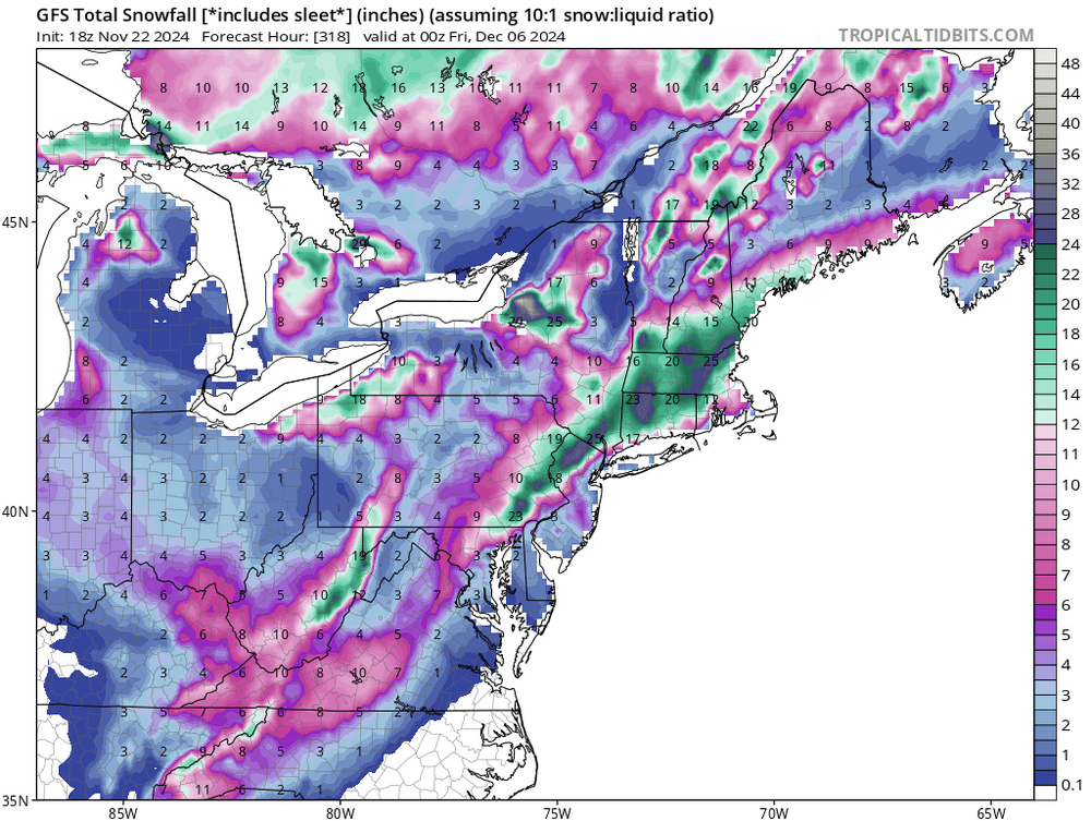
no moisture , no snow- let him honk. He is only exciting because his hometown in Ky will get snow while we still are moisture strarved The Apps and Allegany mts will suck out the moisture big time before it hits us as well as the real winner will be the lake effect snow areas. I am still counting on one small acumalating snow event by Dec 7 th and a nice Christmas day major snowstorm event
-
MY next big prediction LMAO -----Dec 6-7 first 6+ in snow for many in this region in two years . Always a Pearl harbor day snow storm event. Enjoy the sunny and 50 degree weather in the next three days- it will be short lived
- 1,105 replies
-
- 2
-
-

-
- tropics
- heavy rainfall
- (and 5 more)
-
been snowing for the last few hours here in Macungie. Sticking on the ground in the hills
- 1,105 replies
-
- 1
-
-
- tropics
- heavy rainfall
- (and 5 more)
-
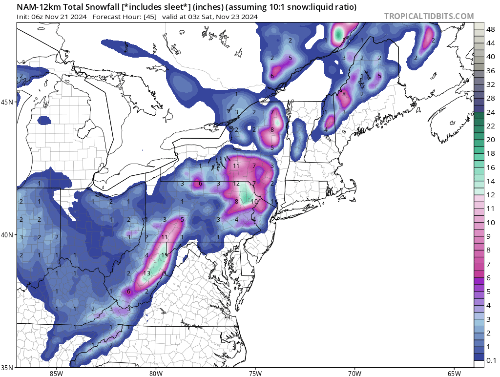
The NAM really pinpoints the elevation snowfall forecast in S. Mtn ridges in western Lehigh County and eastern Berks. Spot on again from three days ago. White rain city coming. his Afternoon Rain likely. Cloudy, with a high near 41. Northwest wind around 10 mph, with gusts as high as 20 mph. Chance of precipitation is 60%. New precipitation amounts of less than a tenth of an inch possible. Tonight A chance of rain and snow before midnight, then a chance of rain between midnight and 2am, then rain and snow likely after 2am. Cloudy, with a low around 32. Breezy, with a west wind 10 to 20 mph, with gusts as high as 30 mph. Chance of precipitation is 60%. New snow accumulation of less than a half inch possible. Friday Snow before noon, then rain and snow. High near 37. Southwest wind 10 to 15 mph, with gusts as high as 30 mph. Chance of precipitation is 80%. New snow accumulation of 1 to 2 inches possible. Friday Night A chance of rain and snow, mainly before 10pm. Cloudy, then gradually becoming partly cloudy, with a low around 31. Northeast wind 10 to 15 mph becoming northwest after midnight. Chance of precipitation is 30%. Little or no snow accumulation expected.
-
The 6Z Nam clearly depicted this as an elevation snow event for tomorrow morning and for verifying my forecast.

-
I trust my own outlook. So far spot on right now
- 1,105 replies
-
- 1
-

-
- tropics
- heavy rainfall
- (and 5 more)
-
still sticking with this as my first call 13 hours ago. The 12Z models for GFS and CMC pretty much back me up. Lots of white rain.
-
2-3 inches are my intial thoughts for the LV proper , more around S Mt area and Blue Mt areas (3-5 inches). Strictly elevation driven snow accumaltions . For example, driving through Shimerville on Rt 29 and toward Bear Creek resort , I see some good accumalting snow. Same goes with driving through Wind Gap, Lehigh Tunnel and Rt 309. Big wet heavy snow flakes half dollar size to pancake size-white rain). The streets will cave in the LV for accumalation if it snows hard enough in the early morning and toward sunrise. Poconos 12+ in around Tobyhanna a good bet. Winter storm watches issued for the Pocono area by morning Advisories everywhere else after Euro run
-
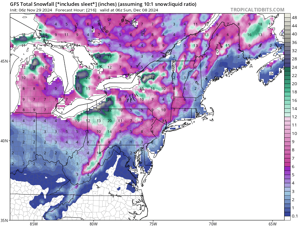
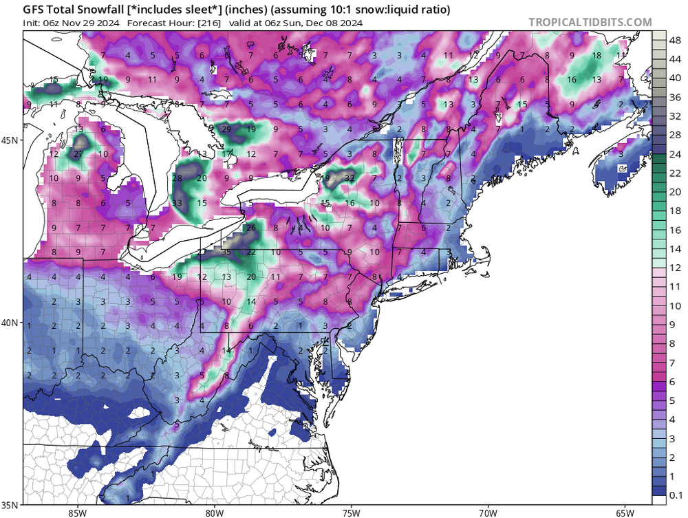
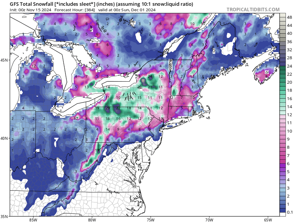
wow, the runs are even better than I thought. As I stated last month, the pattern change will usher in the deep freeze around Dec 7th after this snow event. The Christmas snow event time frame is still not dead Red Sky. Keep the precip coming , as the drought might be ended by Christmas
-
Hot damn, my 40 day forecast is coming to fruition. Moderate rains then a light snow event for Thanksgiving time frame. Whats wrong guys, have heard you naysayers lately saying how my forecast form October was a bunch of sh*t. I just hope we get the rain.
- 1,105 replies
-
- 2
-
-
-
- tropics
- heavy rainfall
- (and 5 more)
-
Right on time, as predicted in my forecast last month. I said the 15th a little early. I am still going with my original thoughts, moderate rains after mid Novmeber, a 1-3 inch snow event around Thanksgiving and then the arctic air invades after Dec 7 November 4 664 replies tropics heavy rainfall (and 5 more)
-
Thaks Mike but a case in point? what if numerous lighting strikes were around? Would that enhance the probability of rapid fire spread as well? I know red flag warnings are for high wind but what about other natural weather features like lighting have any effect on issuing a red flag warning. It almost seems that the ignition sources and their amounts must have a play in this somewhere for issuing red flag warnings.
-
from the drought guy. This a first for me guys please foward this to MT Holly. How dry is it? Enough low humidity to intiate spontaneous combustion. Red flag warnings really should be issued again MT Holly. This came as an alert to me a few minutes ago. Hello Lower Macungie Township Residents, The yard waste recycling center located at 5536 Indian Creek Road will be closed today, Friday November 15th. The mulch pile is currently emitting spontaneous flames and in order to maintain public safety, the site will be closed for the day. We sincerely apologize for the inconvenience.
- 1,105 replies
-
- 1
-

-
- tropics
- heavy rainfall
- (and 5 more)
-
Bring on the flakes for Black friday
-
The pattern will have abrupt change by Thanksgiving like I have been saying for at least a month or two. I expect moderate rains by the end of next week and then bam a nice little snow event. This mornings GFS run is in agreement. Time to shutoff the outside faucets and rake up the rest of the leaves by next Wednsday as the extreme dinural temp regime we have been in will be gone as well as the high in the 60's. I a mstill seeing a Christmas snow event too. The cold air is starting to be in place as the storms form to the SW in the models. Its a chance LOL

-
-