HeadInTheClouds
-
Posts
1,691 -
Joined
-
Last visited
Content Type
Profiles
Blogs
Forums
American Weather
Media Demo
Store
Gallery
Everything posted by HeadInTheClouds
-
 CMC well inland also.
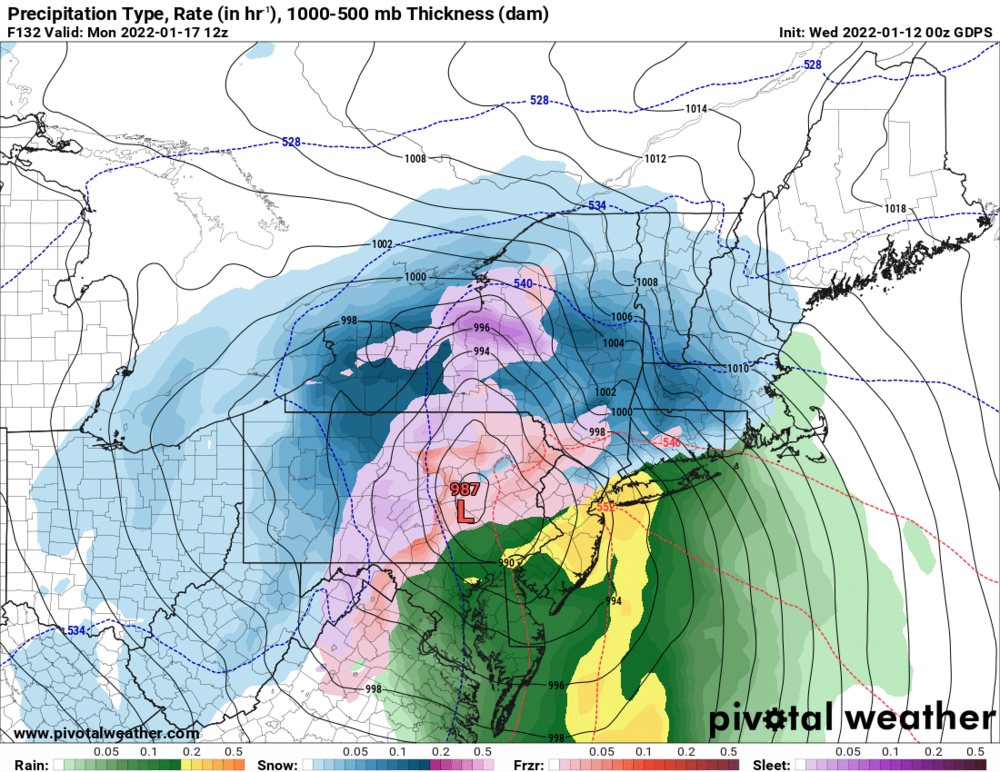
-
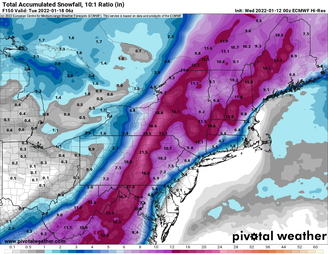
The ensembles often have individual outlier members that skew the mean. The Euro ensembles for instance have a lot of coastal huggers and inland runners so the op does have support.
-
Gfs is often on it's own. Horrible model.
-
I hate suppression more than I do cutters. At least with a cutter you may be able to get something on the front end or back end depending on setup.
-
I do but I just don't think it's going to happen. Both Euro and GFS also have the storm suppressed south. It's early but I think we may have to wait for next week. I hope things change because I have a lousy 3 inches so far this season.
-
Really think the fat lady is singing about any hope this weekend for snow. Too bad because it's going to be cold. The ocean storm and the high are just not going to let it happen. Oh well, hopefully something happens next week.
-
The CMC has shown a significant event next weekend for 4 straight cycles. It's been consistent with it.
-
32 with freezing rain/rain. Looks like things are starting to melt a little. Sheet of ice on driveway.
-
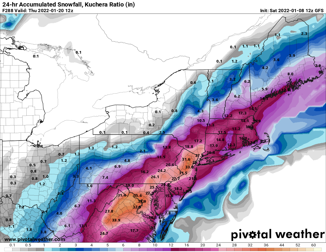
Yes, obviously. I don't trust operationals(especially GFS) beyond 72 hours. I just posted it for shits and giggles.
-
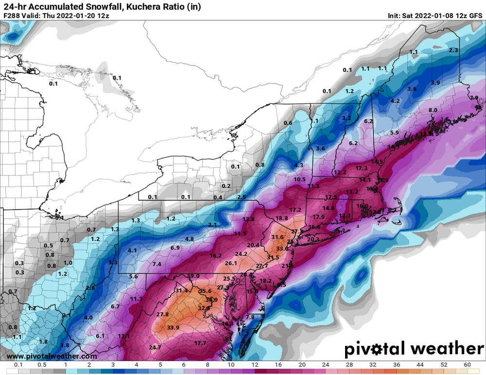
Kuchera is even more fun to look at for the GFS storm. Some eye candy.
-
But I read it was over last month.
-
Only 2 inches here 20 miles north of 84. Glad to see so many did so well.
-
29, light snow, dusting
-
Those max bands could still dump .75 to 1 inch per hour.
-
I second that. It's falling at night and especially in the HV it's going to stick. I'm thinking 2-3, isolated 4 for most on this board.
-
It's still decent. Slightly south of benchmark track. I'll take 2-4 right now.
-
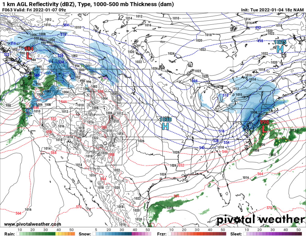
Nice 18z Nam run FWIW
-
Much better than previous run. RGEM next.
-
Good luck with that. It's ridiculous to say the GFS nailed this storm except for the QPF. Thats like saying a goalie has good form and is square to the puck but then can't stop a beachball. I understand the precip gradient was always going to be very tight but nearly every other model had it much different. GFS brought some precip up to HV. It's a lousy model.
-
The other models weren't showing anything really for NYC metro. The GFS has consistently been a poor model. For instance it has nothing for the 7th threat while other globals like Euro, CMC, UKIE have been showing a legit threat. Guess who my money is on.
-
Yes, but the QPF parameter is the most important to snow lovers. Most other models gave nothing to very little for NYC metro especially mesos. GFS is a POS.
-
Forget about any snow in Rockland. Too far north.