OrdIowPitMsp
-
Posts
2,791 -
Joined
-
Last visited
Content Type
Profiles
Blogs
Forums
American Weather
Media Demo
Store
Gallery
Everything posted by OrdIowPitMsp
-
0.25” of rain overnight. HRRR is selling a few inches of snow here this afternoon. Going to be a nowcast type of day.
-

Winter 2025-26 Short Range Discussion
OrdIowPitMsp replied to SchaumburgStormer's topic in Lakes/Ohio Valley
Miss north tonight, miss south Thursday night. The rain should do a number on what remains. Dog turds are appearing out of the ether.
-
MSP achieved a record high of 54 yesterday. This was somewhat low hanging fruit as record highs over the next week range from the upper 50s to mid 60s.
-
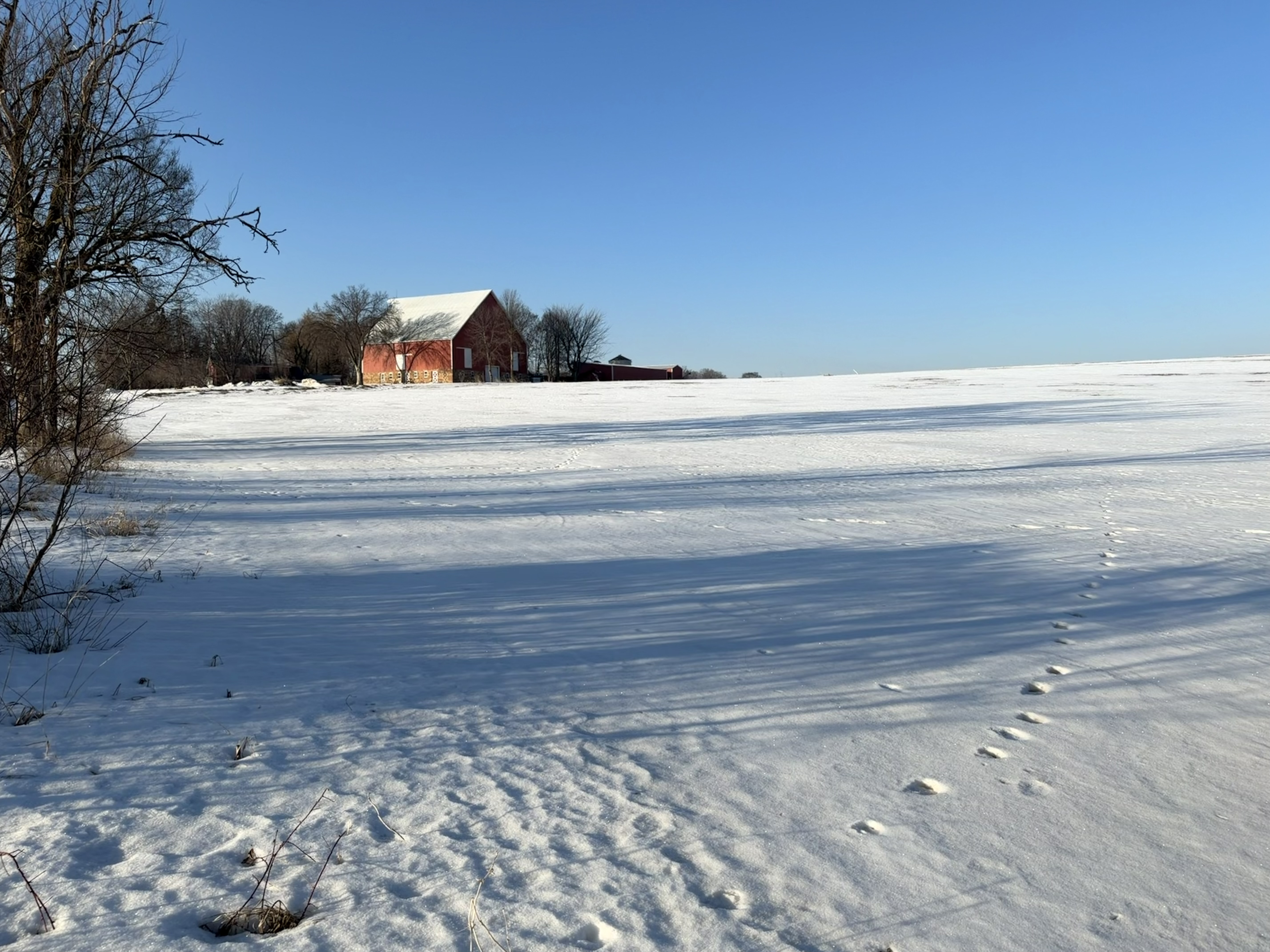
Back in Minnesota, the thaw is on. Full sun and mid 40s today was awesome. Sad seeing these old historic farmsteads turn into suburbs, but such is the pace of progress

-
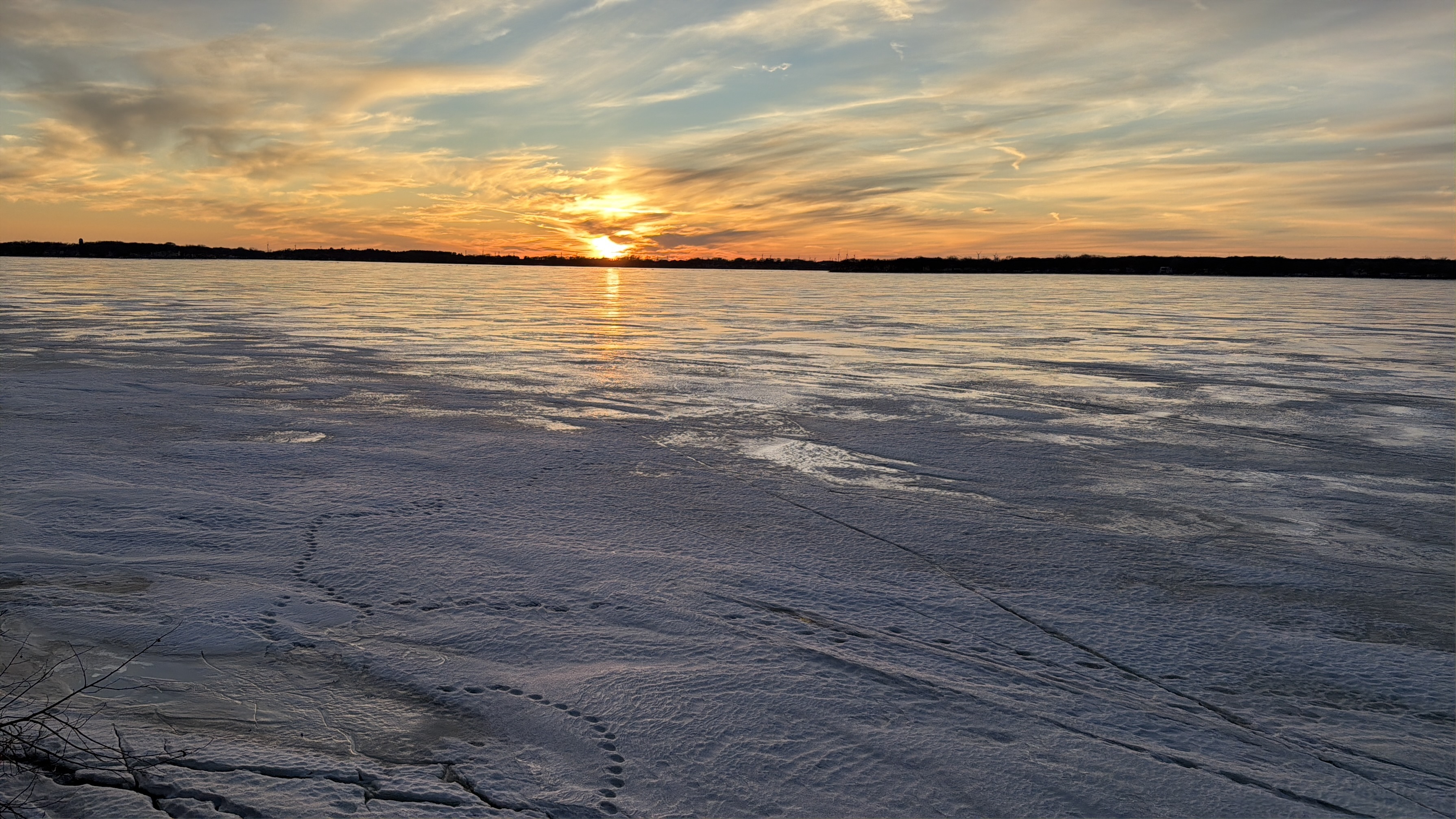
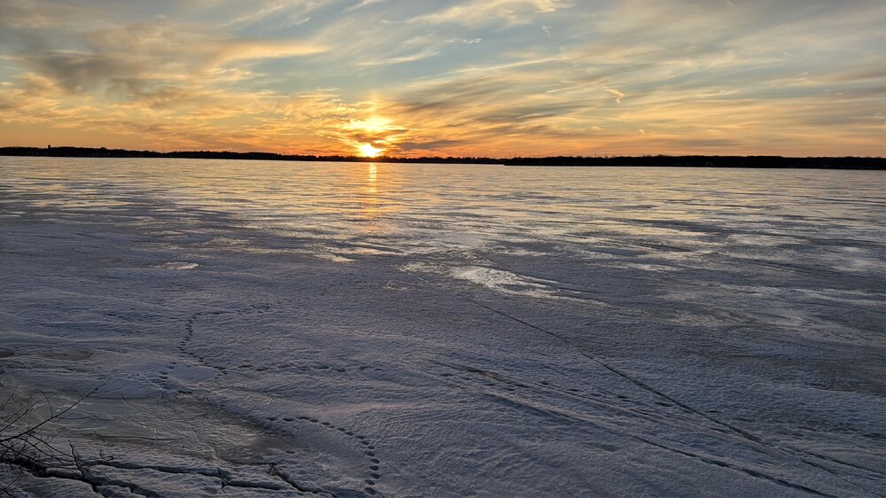
Down in Lake Okoboji Iowa for work. Beautiful office views last evening. I love working outside.
-
Winter 2025-26 Medium/Long Range Discussion
OrdIowPitMsp replied to michsnowfreak's topic in Lakes/Ohio Valley
I concur -
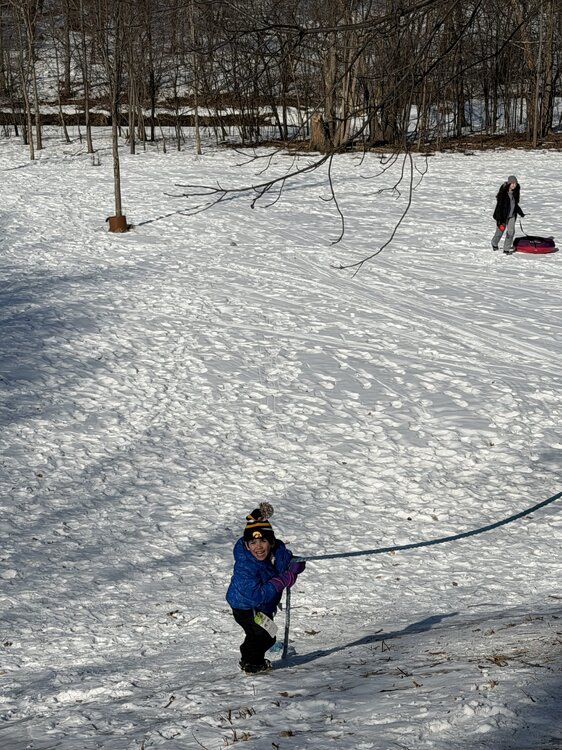
Perfect day for sledding. Kid was acting like the rope used to climb up the hill was mountain climbing. Loads of fun.
-
I was thinking about this the other day. It’s been bad across the plains. Omaha - 6.5”, Rapid City - 7.7”,
-
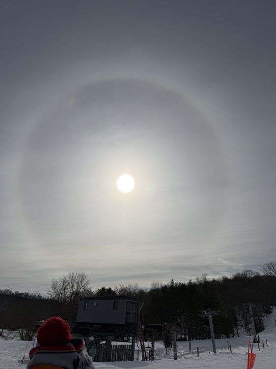
Legit Sundog at the ski hill today
-
Made it to 37 here. Was able to take the sweatshirt off for a short 10min stint today.
-
Winter 2025-26 Medium/Long Range Discussion
OrdIowPitMsp replied to michsnowfreak's topic in Lakes/Ohio Valley
Just checked. March averages the most 6” and 8” storms at MSP, and is our second snowiest month. -
Winter 2025-26 Medium/Long Range Discussion
OrdIowPitMsp replied to michsnowfreak's topic in Lakes/Ohio Valley
We sure do. I still think we are paying for winter 22/23’ but we tend to get juicy storms in Spring. -
Winter 2025-26 Medium/Long Range Discussion
OrdIowPitMsp replied to michsnowfreak's topic in Lakes/Ohio Valley
MSP is 1.6” below average and nothing on the horizon. March will be ours. -
The next week is going to feel fantastic, and likely obliterate our meager snowpack.
-
1.4” of snow at MSP today. 29.3” season to date.
-
January 2026 at MSP: Average temp 13.7F (2.5F below average) 12 lows below zero (2 at zero) 2 daily highs below zero. 4.1” of snow - 28 days of at least 1” snowcover at the airport. (Mby had continuous snowcover)
-
Little bit less then an inch here this morning to cover up the frozen dog turds and freshen up the pack. Best action here in weeks
-
Down to 0 at MSP this morning.
-
MSP eeked out a low of -1 this morning. We’ve now had a low temperature at or below zero for 14 of the past 15 days.
-
Winter 2025-26 Medium/Long Range Discussion
OrdIowPitMsp replied to michsnowfreak's topic in Lakes/Ohio Valley
I’ll bite. I enjoy it immensely. I would much rather work outside in a week of -10/+10 temps then 90+ with 70+ dews. I’m outside 80% of the time with my job so I have experience in all weather Minnesota can throw at me. I’m a diehard skier too so that’s an added reason I love deep winter. I’m ready for a pattern shakeup so we can get some fresh snow. There has only been one calendar day snowfall of 1” this month at MSP. I think it’s kinda strange how much you bitch and moan about the weather in a region you don’t frequently visit, but hey it’s a free country. -
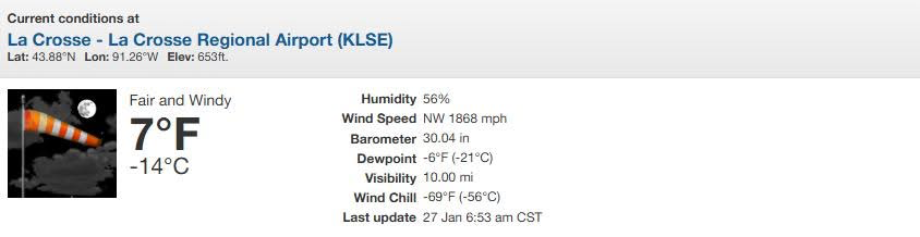
Got a little windy in La Crosse last evening.
-
MSP got to -13 last night.
-
Temp has risen to 0 at MSP. The airport was below zero for 67 hours.
-
1/24-1/25 Major Winter Storm - S. IL, IN, and OH
OrdIowPitMsp replied to A-L-E-K's topic in Lakes/Ohio Valley
MSP crew joining the fun.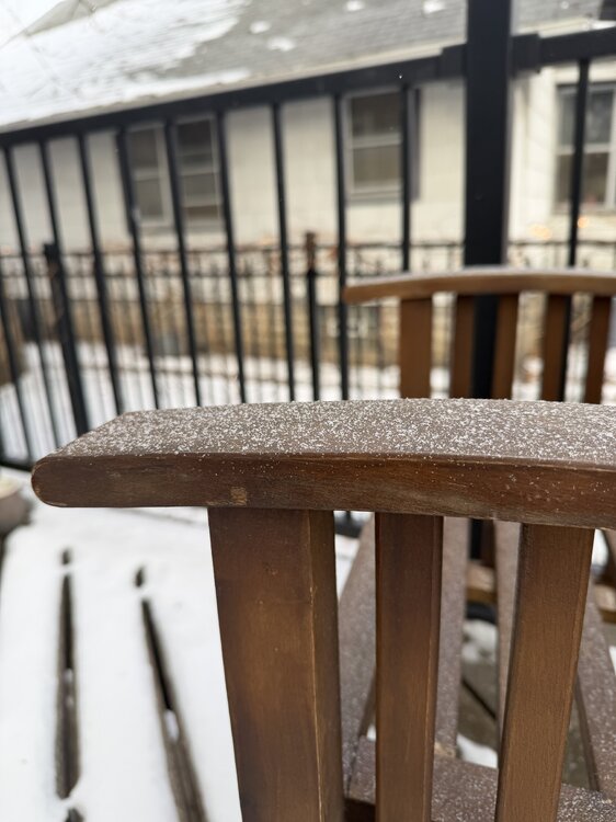
-
Getting some light pixie dust. It’s warmed up to -4 so the atmosphere is primed.