OrdIowPitMsp
-
Posts
2,791 -
Joined
-
Last visited
Content Type
Profiles
Blogs
Forums
American Weather
Media Demo
Store
Gallery
Everything posted by OrdIowPitMsp
-

Winter 2025-26 Medium/Long Range Discussion
OrdIowPitMsp replied to michsnowfreak's topic in Lakes/Ohio Valley
It’s towards the outside of its range but the 0z NAM throws down 6-8” at MSP. -
Winter 2025-26 Medium/Long Range Discussion
OrdIowPitMsp replied to michsnowfreak's topic in Lakes/Ohio Valley
Sunday afternoon/night has piqued my interest. Looks like a nice 3-5” event here to refresh the dirty old melting snowpack as strong winds usher in arctic air. -
Merry Christmas to those who celebrate. It’s an official white Christmas in Minneapolis with a snow depth of 2” at the airport. Historic odds of a white Christmas are 71% in the city but rise to over 80% in the far northern metro.
-
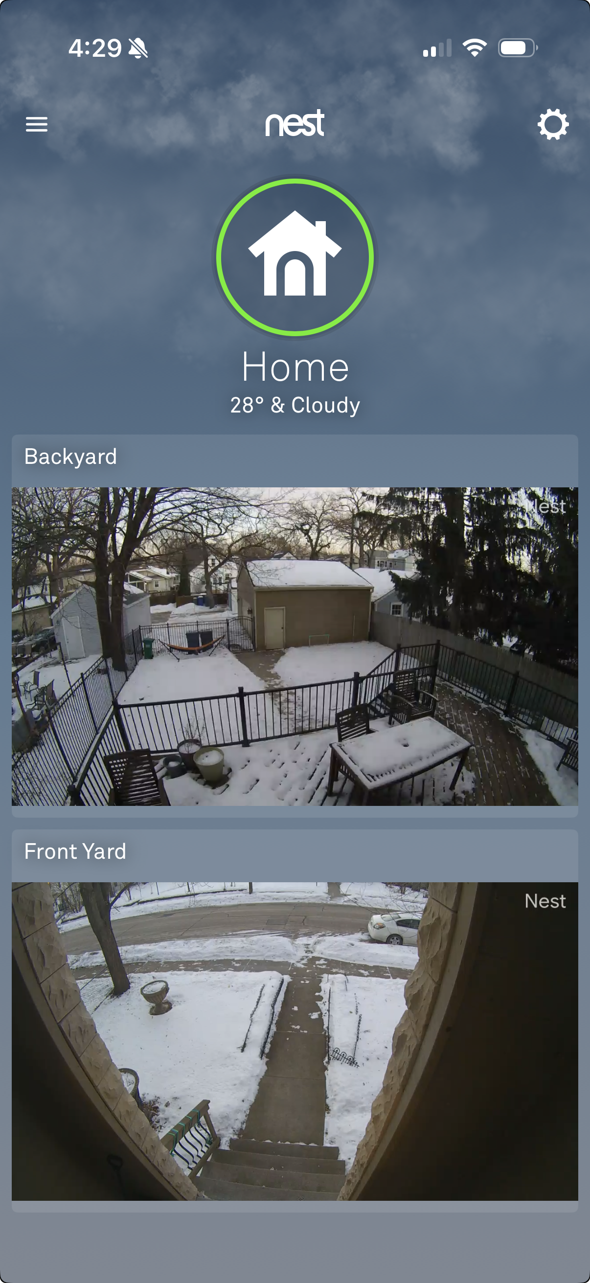
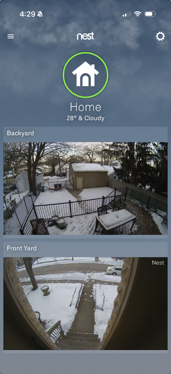
3”-4” of hard glacier with some dust on top. Here’s the front and backyard view right around sunset.
-
Morning low of 5F. Warmup begins today. Going to be a photo finish whether our snowpack survives for a white Christmas.
-
Top tier day.

- 628 replies
-
- 14
-

-
Winter 2025-26 Medium/Long Range Discussion
OrdIowPitMsp replied to michsnowfreak's topic in Lakes/Ohio Valley
22/23 was a good time at MSP 3rd snowiest winter on record - 90.3” 9th longest 1” consecutive snow depth streak - 117 days -
-3F at 6am, 42 degrees colder then 24hrs ago. 1.1” of snow at MSP yesterday. Snowdepth 4”
-
Quite the eventful weather day, we lost a good amount of snowpack from the combination of high dews, warm overnight temps and a bit of rain. Was 39F when I left for work at 6am. Temps came crashing down mid/late morning and haven’t stopped falling. Snow showers moved through this afternoon and put down around an inch, although with all the blowing it’s impossible to tell. Winds gusting between 35-40mph with the snow. Clearing now and 7F with blowing snow.
-
Torched to 43 yesterday. Lost 2” of snowdepth, now 7” at MSP.
-
We’ve gone above freezing for the first time in 22 days at MSP.
-
I’ll be working outside in a t-shirt today. High of 40. Let’s do this! 6am Snow Depth at MSP - 9”
-
-11F in the heat island. -15 to -20 away from the urban areas
-
-5F. I think it’ll be an indoors Saturday for us.
-
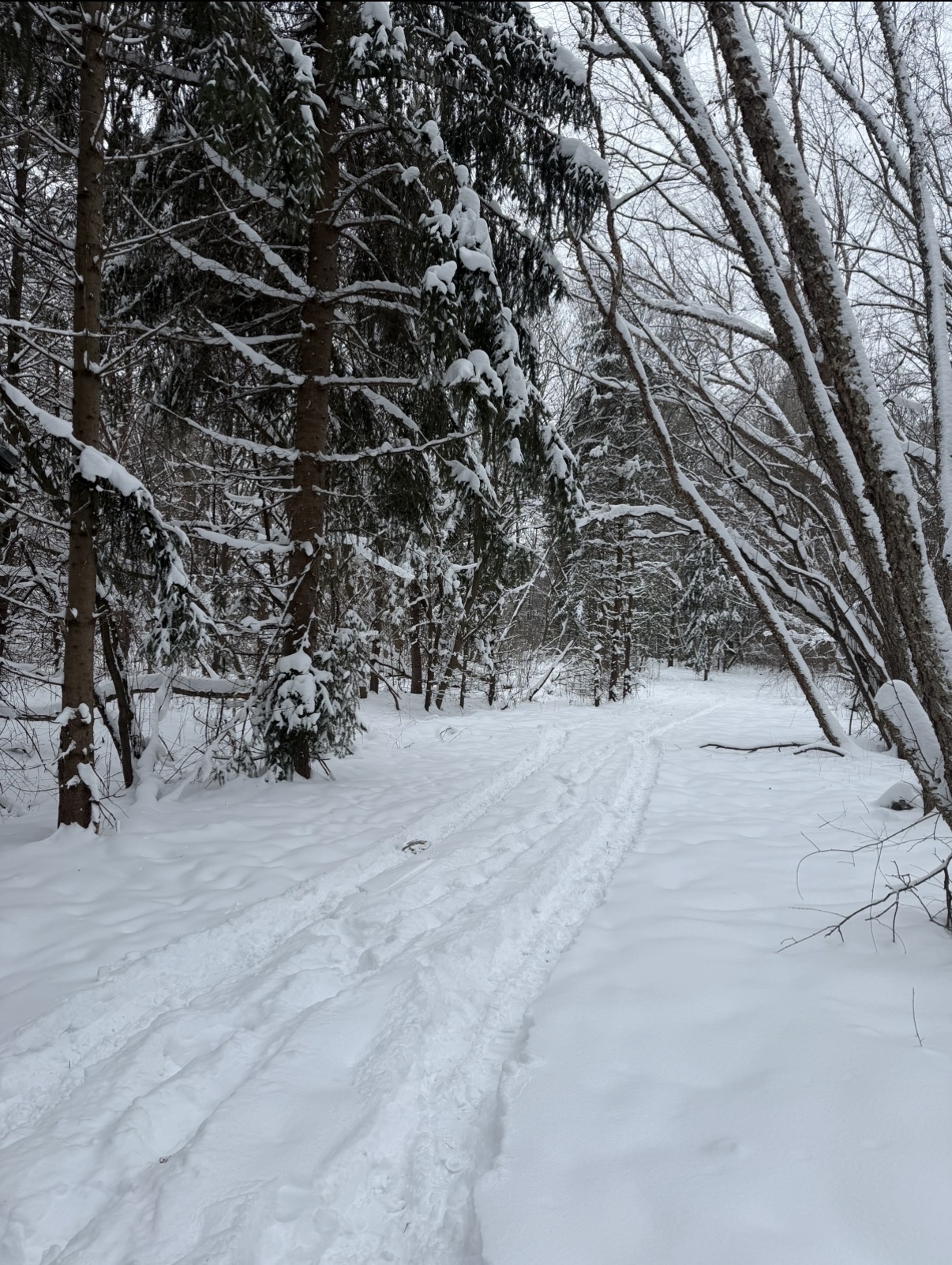
Front blasted through. Winds howling, snapped this photo at work right before all the snow was blown off the trees.

-
Morning low of 6. Getting some light snow/freezing mist now, roads got greased quick.
-
Persistent flurries/light snow from the low stratus kept temps relatively mild overnight. Only made it down to 12F
-
Adding a few tenths on the latest train car of the endless clipper train this afternoon.
-
6am snow depth 10” Season to date MSP - 15.3”
-
4.1” at MSP Scattered snow showers and another clipper tonight.
-
MSP - 2.6” @ 6pm Measured 3.75” on my previously shoveled sidewalk at 7:15pm Back edge about to push through, should see wrap around snow overnight and add a bit more.
-
My house 1.3mi due north of the runway 12L threshold. Still all snow here
-
Kinda surprised the NWS hasn’t upgraded Hennepin County to a WSW. Roads are a mess and snow covered. Still 27 at the airport, I see some heavier returns moving in from the SW maybe that is the mixing line.
-
Been awhile since we’ve had a true Nowcast event like this.
-
Flakes flying in the SW metro. Maybe we stay all snow, latest hi res guidance really upping the snow total for MSP.