OrdIowPitMsp
-
Posts
2,791 -
Joined
-
Last visited
Content Type
Profiles
Blogs
Forums
American Weather
Media Demo
Store
Gallery
Everything posted by OrdIowPitMsp
-
1.3” at MSP with the overnight clipper. Similar results likely with tomorrow’s event. Snow depth 2” Interestingly the snow-depth at MSP went down to T for a few days while I was out of town. My yard has maintained a 1-2” icepack of snow cover through the warmer period.
-
Typical January thaw unfolding. Got up to 42 today with the snowpack down to 4” at the airport. This should be the warmest day in the foreseeable future. With a few thaws and a numerous smaller events so far this winter, there are multiple frozen compacted layers, this pack is melting much slower then if it was all from one storm. We’ve now had 1” or greater snowcover for 42 consecutive days.
-
Light freezing rain here this afternoon. Roads will be a skating rink. Bit of a thaw this upcoming week but nothing unusual.
-
December 2025 in Minneapolis finished with an average temperature of 18.9F which is 3.1F below average. There were 5 morning lows below zero with the coldest being -11F on the 14th. December saw 16.8” of snowfall, and there was at least 1” of snow on the ground everyday this month, with a peak depth of 10” on the 10th-12th
-
7F with 1mi visibility and snow. What a way to kick off 2026, happy New Year to everyone.
-
Weenie band and rapidly falling temperatures. 2025 ending on a bang in Minneapolis.
-
0.4” of snow today and now we’ve flipped over to FRDZ as expected. 23.0” season to date at MSP
-
Light snow this morning with a solid coating. Snow shield is more expansive and further south then expected. Got down to 3F last night before temps started to slowly rise.
-
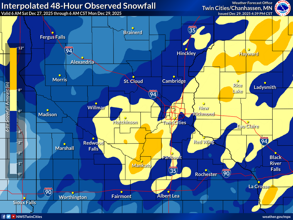
Updated map @cutlew
-
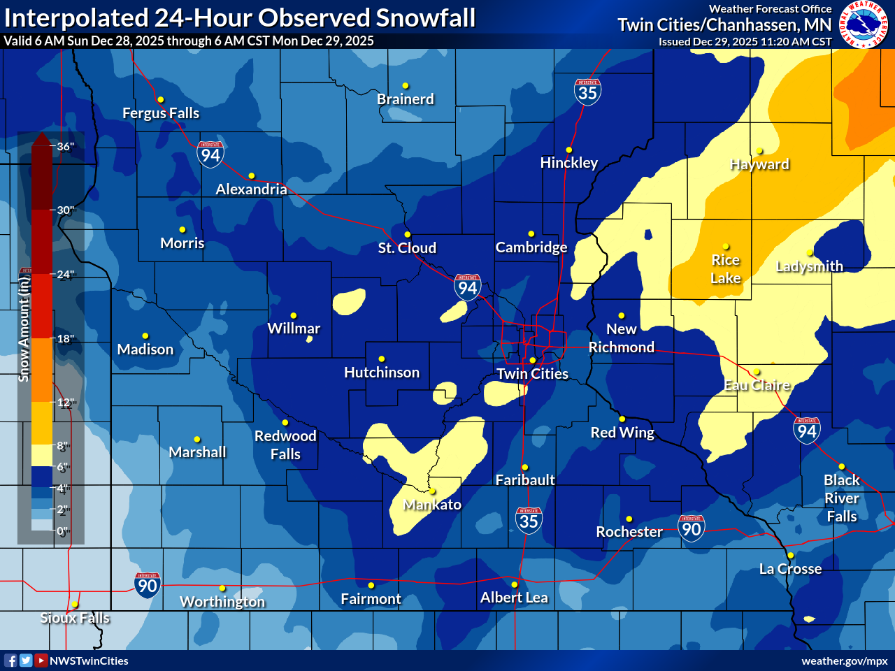
Good question I’m not entirely sure how they are made, combination of radar estimate and ground reports possibly. There were plenty of 6-7” reports around the metro that this map doesn’t reflect.
-

-
MSP recorded 5.8” of snow yesterday. Not sure how much if any was recorded after midnight to add to the final total. Roads are a sheet of ice this morning.
-
I think 6” attainable here, and a nice score given this kind of popped up in the last 48 hours
-
4.1” @ 6pm 10F Better returns are setting up SW of the metro, so totals will likely end up higher down that way. Should have light/moderate snow for another 5-6 hours.
-
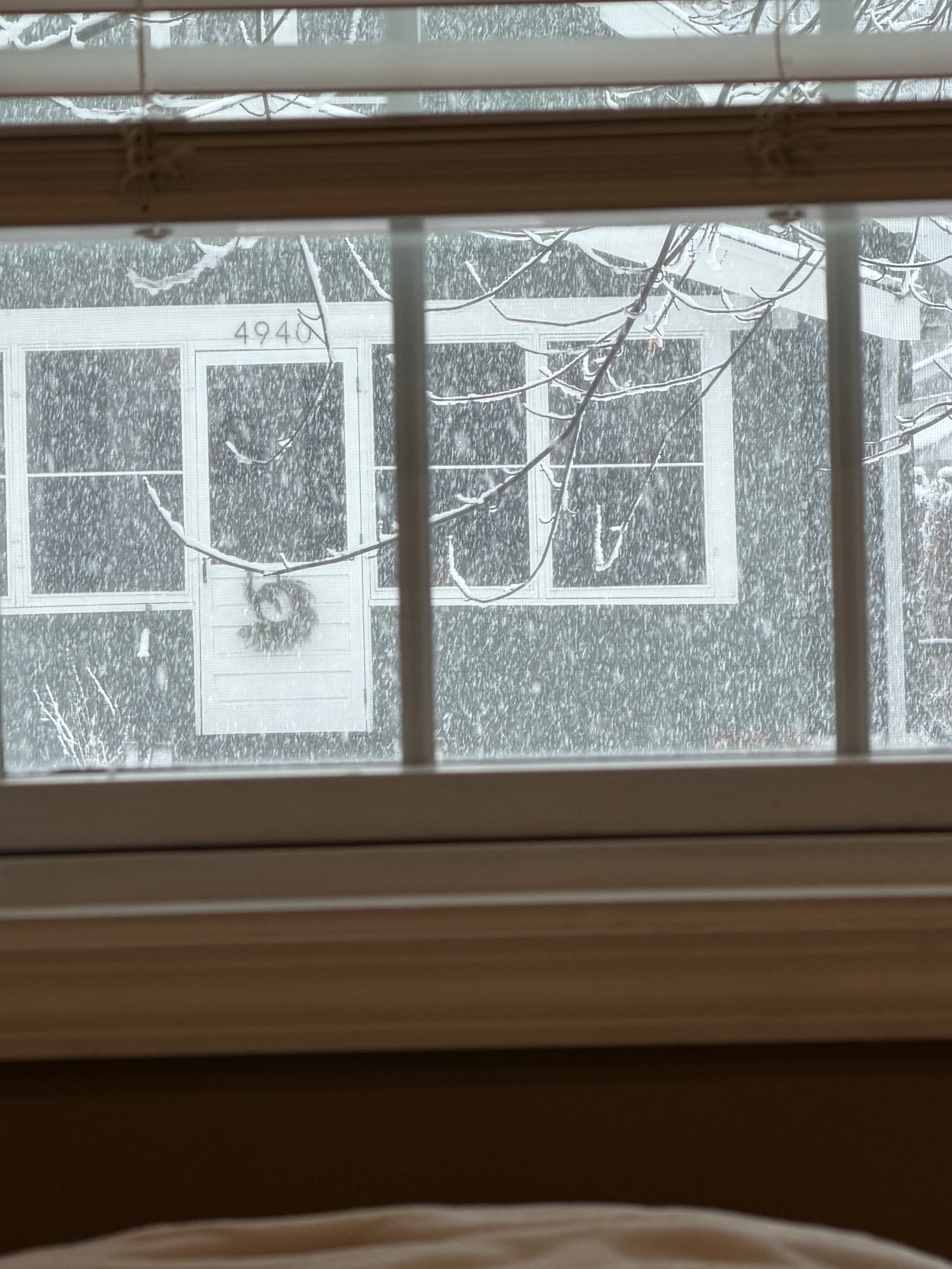
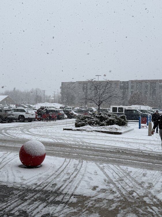
Good day to stare out the window

-
MSP reporting 2” at noon. Temps falling fast now with the next wave moving in.
-
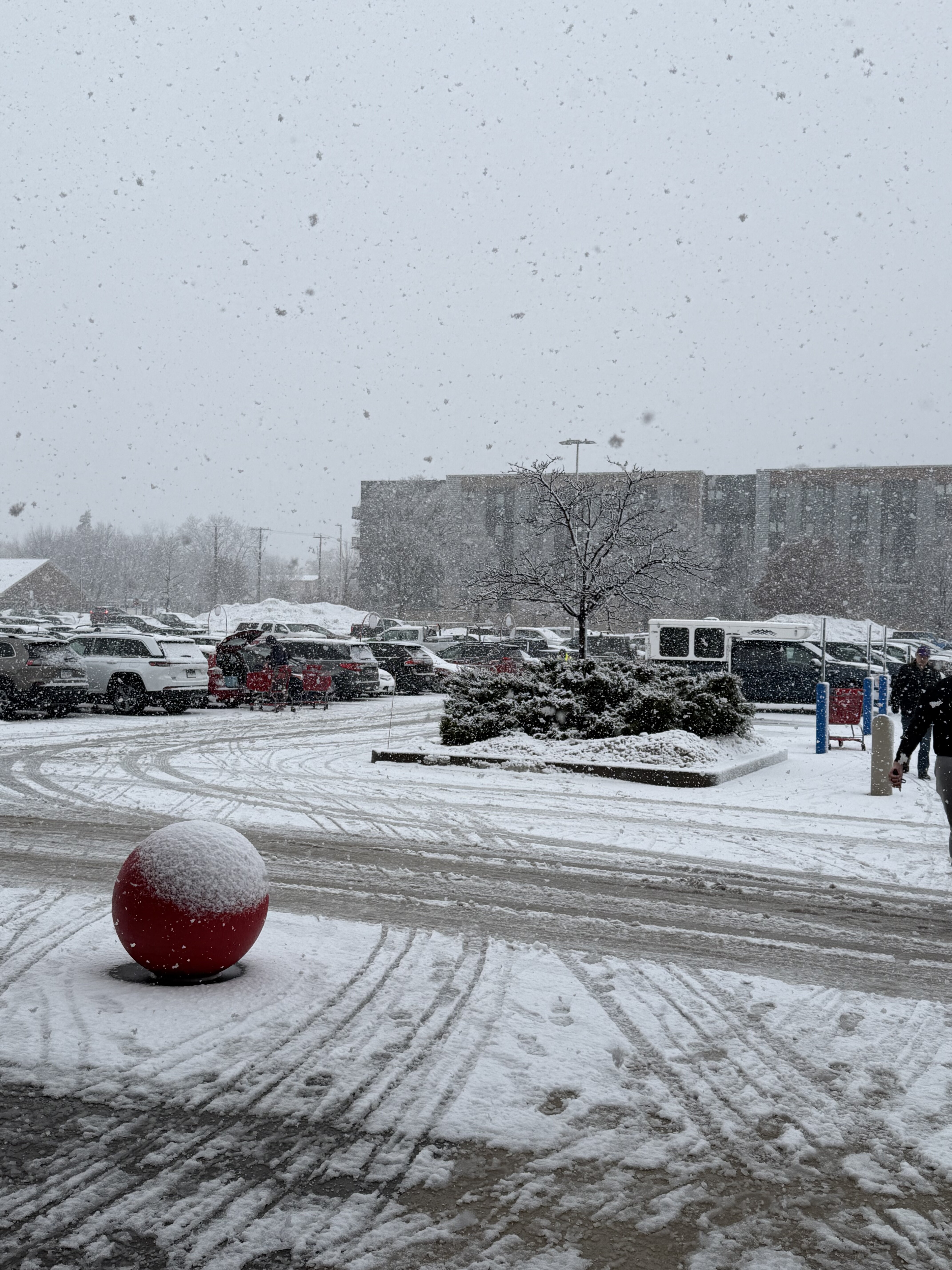
Got out of Target right as the heavy stuff moved in. Roads are already getting terrible.
-
Temps should start nose diving shortly and then we should start stacking efficiently. Solid coating on all surfaces here so far. Going to be a paste job on the trees as they freeze up.
-
Looking out my window, seems to be all snow at this point. Deck is getting slushy
-
Mixed precip just started here. Should transition to all snow pretty quickly.
-
I’m a fan of using change in snow depth maps vs Kuchera. Still puts down 7-10” across the metro.

-
I’m keeping my expectations in check with a ~6” storm, but it’s hard not to think big given model trends. NWS write up on this one will be a good read for sure.
-
Thanks, it’s other drivers who always worry me. MNDOT and the local agencies will do a fine job as always.
-
WSW for 5-8” with a blizzard warning one county west. Not much lead time on headlines, not sure how many people even know it’s going to snow tomorrow.
-
Yeah this one has really trended in our favor the last 24hrs. Bombs away