
cardinalland
-
Posts
516 -
Joined
-
Last visited
Content Type
Profiles
Blogs
Forums
American Weather
Media Demo
Store
Gallery
Everything posted by cardinalland
-
We’ll probably some 90s in the tri state area today or tomorrow. KBDL near hartford is forecast to hit 91 today
-
4.8” in new haven at 11am. flurries now
-
4.1” in new haven, still moderate snow
-
2.8” in New Haven. moderate snow
-
just hit 2” in new haven, snow has lightened up in the last 20 minutes. started at 9:30
-
I feel like usually in close range NAM is a little north and GFS is a little south, regardless. and the reality is somewhere in the middle (at least in the past few years of storm tracking) this is completely anecdotal but it gives some idea of an upper and lower bound for me
-
Interesting gradient in NYC on the models - although in my experience from when I lived in NYC, that usually doesn't hold, and a changeover to rain around JFK is usually soon followed by a changeover to rain or at least sleet in Manhattan/Bronx
-
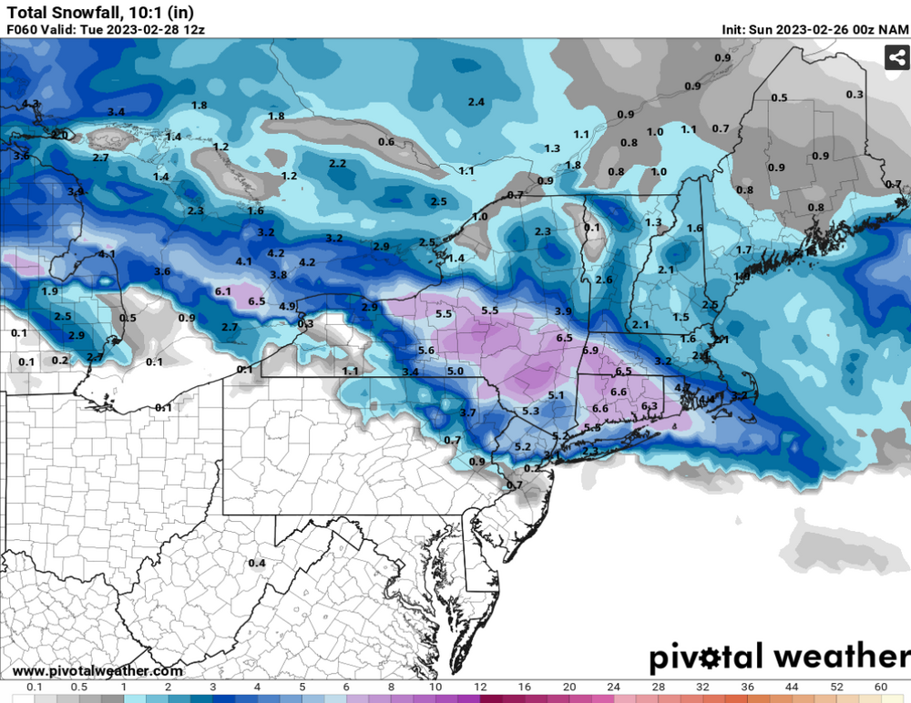
NAM at 63 hrs (rain-snow line has moved to Putnam county by this time). Totals will be lower due to mixing/low ratios near the coast
-
NAM starts with snow north of 195 in NJ (except for right on the shore), and sleet in philly
-
warmest February day on record in Bridgeport and New Haven (68F, breaking previous records of 67F at both locations)
-
Rain snow mix in New Haven
-
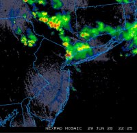
lightning and thunder in new haven
-

12/15 - 12/16 Coastal/Winter Storm & Observations
cardinalland replied to Northof78's topic in New York City Metro
looks like a lot is dependent on whether a coastal can form... if it never forms the storm will be a front end dump for those N&W while if it forms there should be more substantial snowfall N&W. Starting air mass is too warm for those near 95 though -
Yeah, I hope I am wrong though and we get crushed, but it's what I'm thinking right now
-
2.2” snow accumulation in New Haven, light flurries now
-
Light snow from about 12-2 in New Haven… it stopped for a bit but it’s picked up in the last 45 minutes, starting to stick now
-
NYC: 14" EWR: 16" MMU: 20" ISP: 14" SWF: 28"
-
If the dew point goes above 75 again I’m moving to Greenland
-
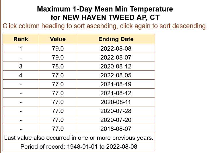
New Haven had record high nighttime lows twice in a row… currently 88/78 HI102. The dew point hasn’t dropped below 74 for over 3 days.
-
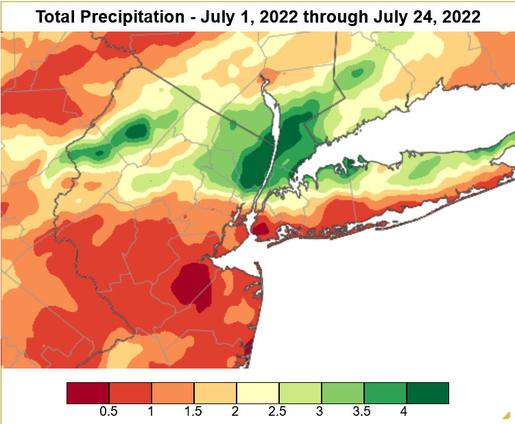
You can generate these on http://scacis.rcc-acis.org/ under Gridded Data Products/Gridded Data Maps!
-
It's a crazy precipitation gradient across NYC this month
-
Dusting already in Chelsea Manhattan on some sidewalks
-
Flakes falling in Chelsea Manhattan
-
Power went out and the basement is flooding in new haven


