George BM
-
Posts
3,051 -
Joined
-
Last visited
Content Type
Profiles
Blogs
Forums
American Weather
Media Demo
Store
Gallery
Everything posted by George BM
-
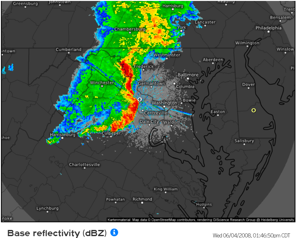
Cell north of Remington in southern Fauquier county has some very weak rotation with it. Another area of weak rotation approaching Morrisville... nothing much as of the moment just showing that there is some ll shear in place.
-
Fun times 16 years ago this moment. Let's do this again soon.

- 1,696 replies
-
- 7
-

-
- severe
- thunderstorms
- (and 5 more)
-
Welcome to meteorological/climatological summer.
-
Forecast Discussion Tuesday, August 13, 2024 11:58AM EDT A dangerous day of tornadoes is already underway. Make sure you know where your safe place is in your home (basement or interior room in the lower floor of a house or apartment). Arc of heavy rain and embedded supercells, some of which are tornadic, continues to lift north through the region and into northern/central MD with the warm front feature that has developed to the ENE of Joyce’s surface low center. With a potent shortwave trough swinging in and phasing with Joyce’s low pressure center, a mid-level dryslot has wrapped around the surface low to the east across Virginia and getting into Maryland along and south of the warm front. This is what’s allowing for some sunshine to continue to overspread the region. Dewpoints have risen into the upper 70s to around 80F south of the front and with the added sunshine temps will rise into the mid/upper 80s this afternoon. This combined with a modest cooling of mid-level temps associated with the approaching shortwave will allow for unusually large CAPE for a remnant tropical system (MLCAPE of around 2500 J/kg or so). The shortwave is also deepening the surface low so, as a result SE surface winds will strengthen across the region with 25-35 kt gusts commonplace. Hodographs will also be very large and curved with a strong 60+kt LLJ overhead resulting in effective SRH easily in excess of 400m2/s2. The sunshine combined with the ample low-level moisture will allow for large 0-3km CAPE of 250-300+ J/kg. All of this combining with 45-55kt effective bulk shear to make conditions highly favorable for a potentially significant tornado outbreak across the region. Currently some supercells which have already caused a number of confirmed tornadoes continue to move NNE into northern and central MD. To the southwest across central and southern VA along and east of the mountains arcs of low-topped supercells, some of which have ongoing tornadoes, continue to mature and strengthen with the increasing instability. As the afternoon progresses bands of supercells will move quickly through the area from SW to NE. These supercells will likely produce several strong to intense tornadoes, some long-track. The Storm Prediction Center is considering an upgrade to a HIGH risk to account for the tornado threat. Due to the slight cooling and drying of the mid-levels, these storms could also produce severe hail as large as 1 to 1.5 inches in diameter. Even if there is no tornado with a particular storm, the 2.25”+ Pwats and large CAPE combining with strong low-level flow could aid in wet downbursts/microbursts bringing severe surface wind gusts. Storms will move to the northeast and exit the area by mid evening as Joyce’s center moves across the region. By the late evening hours the cold front associated with the strong shortwave trough will move through from west to east bringing a 3 to 6 hour window of northwesterly winds gusting 40 to 50mph. A Wind Advisory is in effect for the region to account for this. Temperatures and humidity will fall sharply with this front. Winds will start to weaken towards dawn with temps bottoming out in the 50s in the Greater Metro regions with upper 40s in the far northwestern suburbs. The bottom-line is that this is the beginning of one of the most dangerous tornado outbreaks to impact this area. Please be weather aware and ready to get to your safe places the moment a tornado warning is issued. Wearing a helmet and closed-toed shoes while in your safe place is essential as well to protect from flying debris during a tornado and debris in the aftermath of a tornado. Stay tuned to the NWS for the latest updates available during this event. Forecaster Wannabe: George BM
-
23/13/6
-
Brief small CC drop with the Tornado warned storm north of Culpeper.
- 1,696 replies
-
- 1
-

-
- severe
- thunderstorms
- (and 5 more)
-
Seeing up to 70mph winds above the surface on radarscope over the Madison part of the line.
-
What analogs are they showing?
-
Yeah CAPE actually looks fairly decent later, especially towards the mountains (1500-2000+ mlcape). With modest shear in place as well a few warned storms wouldn't surprise me later... especially out that way.
- 1,696 replies
-
- 1
-
-
- severe
- thunderstorms
- (and 5 more)
-
I'm seeing the most vivid double rainbow I've seen so far in my life behind as the sun comes back out near the back edge of this rain.
-
Well it took all night but around 4:45am I noticed the skies FINALLY clear here in Herndon. I was able to see some faint vertical brushes of "not as dark" sky in the northern half of the sky with my eyes which I realized were pillars. It was like seeing faint streaks of virga. On my phone camera the pillars were a reddish/hot-pink color. It was in the nick of time too as the eastern horizon was slowly brightening throughout the 20 minutes I was outside.
-
I like how lots of folks in here have picked up on how DCA has fallen off in recent years. DCA: 108F IAD: 110F BWI: 110F RIC: 111F
-
91F at IAD breaks the record of 88F set in 2018.
-
Looks like a warm start to the month.
-
Baby Yoda: Lwxkm robbed? Forecast Discussion Thursday, May 30, 2024 10:58AM EDT Very strong and compact closed, cold-cored upper-level low will continue to move into and over the region as we go through the day. The cold front and rain/downpours associated with the front have moved east of the Bay leaving partial clearing and a rapidly cooling airmass aloft. This system is bringing in a record breaking cold-airmass for the end of May into our region. 500mb temperatures overhead will drop to around -32 to -33C w/ 850mb temps holding around -1 to -1.5C. Surface temperatures will climb a few degrees into the mid/upper 50sF for the afternoon. Now, for an airmass this cold, dewpoints will remain fairly high (around 40F or so) partially due to the compact nature of this low and higher dewpoints surrounding. This will lead to MLCAPE of 500+ J/kg by this afternoon which is, again, unusually high for an airmass this cold. In fact, the SPC has the area under a marginal risk of severe weather for today and are considering upgrading us to a slight (2 of 5) risk in the early afternoon update for wind and hail. Even during these late morning hours there are already some intense showers w/ a few lightning discharges mainly west of I-95 with some hail/graupel being reported. These will overspread the region, become more numerous and intensify as we go through the day. With the steep low and mid-level lapse rates in place combined w/ the instability in place as well as such cold thermodynamics, storms will be capable of 45-60mph wind gusts w/ torrential hailers looking likely. Some hailstones could exceed an inch in diameter (quarter-sized hail). The most intense storms could drop several inches of hail/graupel and briefly knock temps down into the upper 30s/lower 40s which will make travel treacherous for a time. By the evening the upper low will start moving to the east and showers and storms will, accordingly, taper off from west to east. Temperatures will fall into the upper 30s/lower 40s by dawn. Forecaster Wannabe: George BM Lwxkm: @Baby Yoda Good thing hail doesn't count as snowfall. While there may be graupel, I can't imagine that graupel as oppose to hail will be the main precip-type. I guess I can root for the three main local airports to get missed by today's hailers. RodSney: Nah. You've already been crowned. You won't have to forfeit your trophy. Now if some local airports get buried in graupel today causing someone else to have closer numbers, then I might make a trophy for them. But why is this even a thing we're discussing? It's practically June. Get with the program Mother Nature!
-
IAD has peaked at 91F so far breaking its daily record of 89F from 2017.
-
Just had quite a bit of dime to quarter-sized hail with that western Fairfax county storm.
- 1,696 replies
-
- 3
-
-
- severe
- thunderstorms
- (and 5 more)
-
Nonstop thunder in Herndon.
- 1,696 replies
-
- 2
-
-
- severe
- thunderstorms
- (and 5 more)
-
I noticed a fire blow up on satellite and radar SE of Fredericksburg, VA yesterday afternoon. I wonder if that could be the source?
-
Lol. A little part of me dies every time this occurs.
-
April 8th Eclipse- Last Easy One To See In My Lifetime
George BM replied to Interstate's topic in Mid Atlantic
Question for those of you who saw totality in both 2017 and 2024. I notice that the width of totality with this eclipse was larger than it was for 2017. My question is: Did this eclipse's totality seem darker than 2017s? -
April 8th Eclipse- Last Easy One To See In My Lifetime
George BM replied to Interstate's topic in Mid Atlantic
Temp dropped from 74F to 69F at IAD. -
Had two more brief bursts of frozen precip. One just ahead of the main line and one with the main line (rain/graupel) w/ 30+ mph wind gusts. Temp has dropped into the lower 40sF. IAD: 43/38
-
Now I just had a heavier shower (moderate downpour) w/ pea-sized hail/graupel.