Cobalt
-
Posts
5,216 -
Joined
-
Last visited
Content Type
Profiles
Blogs
Forums
American Weather
Media Demo
Store
Gallery
Everything posted by Cobalt
-
850s for DC and NW actually never go below 0, but it doesn't matter if the thermals are torched. Crazy how we've gone through the November-March timeframe dealing with mid 30s rainstorms
-

March Medium/Long Range Thread: The Empire Strikes Back
Cobalt replied to stormtracker's topic in Mid Atlantic
no tic tac toe ridge.. game on -
March Medium/Long Range Thread: The Empire Strikes Back
Cobalt replied to stormtracker's topic in Mid Atlantic
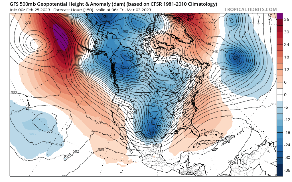
GEFS changes reflect OP for wave 1. stronger h5 low, more ridging out West, and a slightly stronger 50/50 low.
-
March Medium/Long Range Thread: The Empire Strikes Back
Cobalt replied to stormtracker's topic in Mid Atlantic
Most of our cold snaps nowadays seem to stem from a string of rainy and cloudy days that disproportionately skew high temps lower, so something like that is pretty impressive. If only that cold was there during the Dec-Feb timeframe -
March Medium/Long Range Thread: The Empire Strikes Back
Cobalt replied to stormtracker's topic in Mid Atlantic
The first 2 weeks of that month were the 8th coldest on record at the DC site. Far and away the coldest in the 2000s, and coldest since at least the 1940s. The following 2 weeks chipped away at that cold start though, resulting in May 2020 as a whole being the 42nd coldest at DCA (63.8F). May 2003 was the coldest such month in recent memory, averaging 61.7F and being the 12th coldest on record.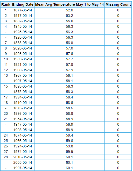
-
March Medium/Long Range Thread: The Empire Strikes Back
Cobalt replied to stormtracker's topic in Mid Atlantic

-
March Medium/Long Range Thread: The Empire Strikes Back
Cobalt replied to stormtracker's topic in Mid Atlantic
To help put things into perspective
-
March Medium/Long Range Thread: The Empire Strikes Back
Cobalt replied to stormtracker's topic in Mid Atlantic
That output is kind of ridiculous for South Dakota.. areas in the Western part of the state snow from hr90 to hr 234 without much of a break lol. Wild solution -
March Medium/Long Range Thread: The Empire Strikes Back
Cobalt replied to stormtracker's topic in Mid Atlantic
But at least if the 582dm line makes its way to our latitude then that surfer guy you were talking about is still in play for us? -
March Medium/Long Range Thread: The Empire Strikes Back
Cobalt replied to stormtracker's topic in Mid Atlantic
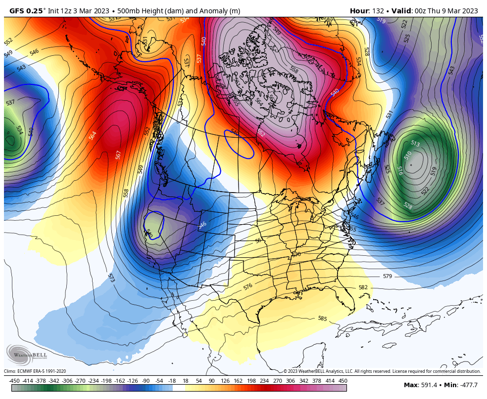
At the same time the GFS depicts a stronger block and 50/50 signature. Might not be enough to offset it but this is a ridiculous look, major-PNA or not.. but seasonal trends look to be a bit stingy.
-
March Medium/Long Range Thread: The Empire Strikes Back
Cobalt replied to stormtracker's topic in Mid Atlantic
Preferably blue on the radar w/ an AmWX storm OBS thread updating at 1 page per minute. We can dream.. -
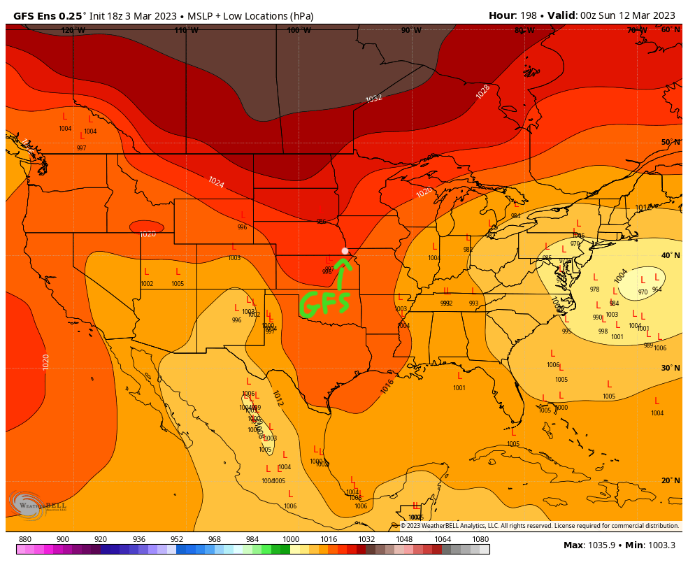
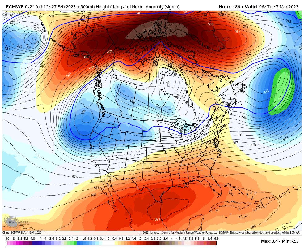
And the cycle repeats itself.. pretty nice signal though. Textbook 50/50 showing on on the panels @CAPE showed too.
-
Battle of the ridges

-
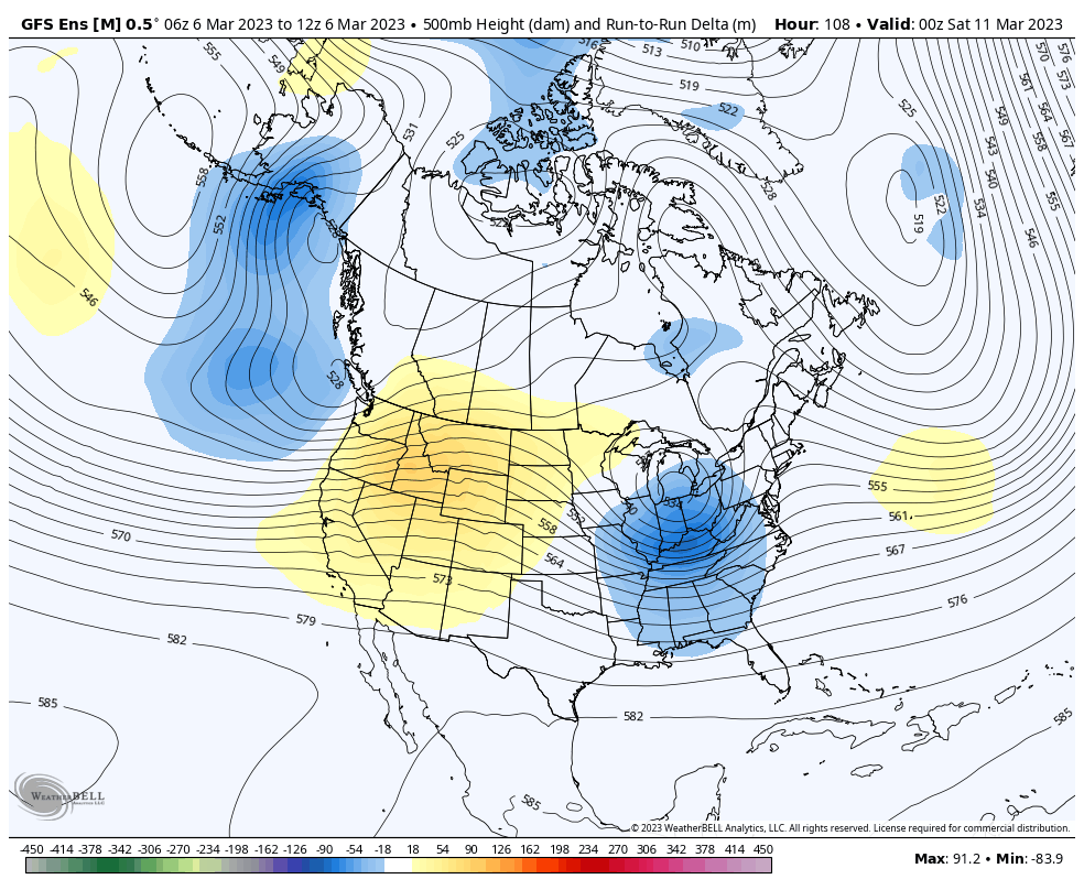
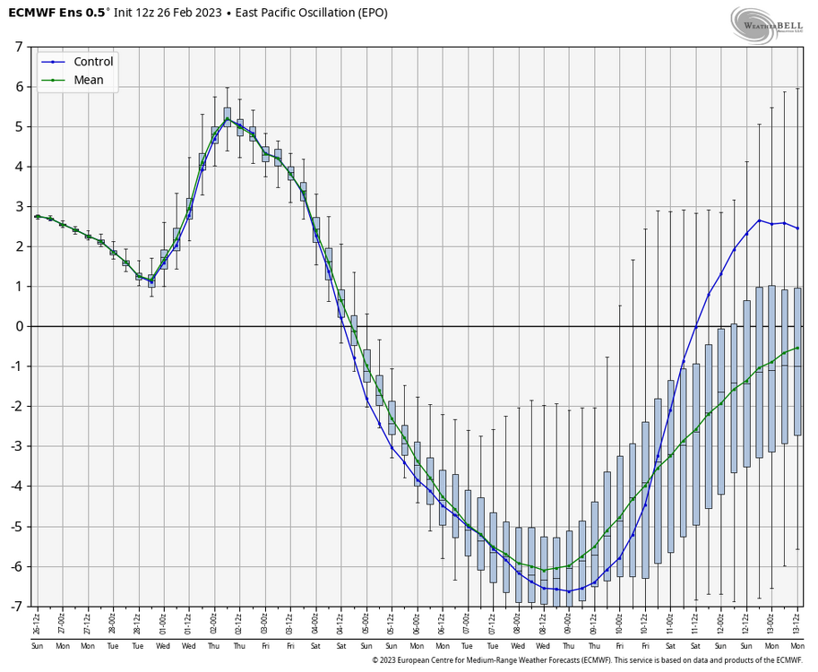
The 4th instance of a massive EPO tank so far this cold season. 1st was mid November, 2nd was mid December, 3rd was late January, and the 4th is now taking place in early March, so a return period of 30-45 days or so. Interestingly, these events have had less of a correlation w/ persistent cold in the East as the winter has gone on. Highlights the importance of the PNA, these events don't matter all too much if the west coast trough wants to dig into Baja.
-
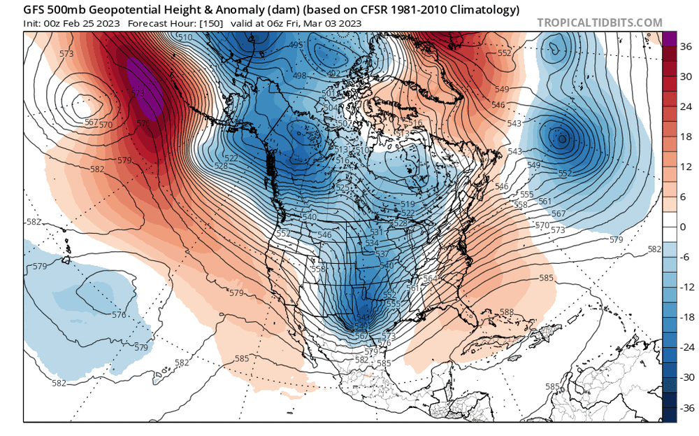
At the very least, the GFS has trended to improving the block over Greenland and weakening the WAR during the past 3 runs. Baby steps.
-
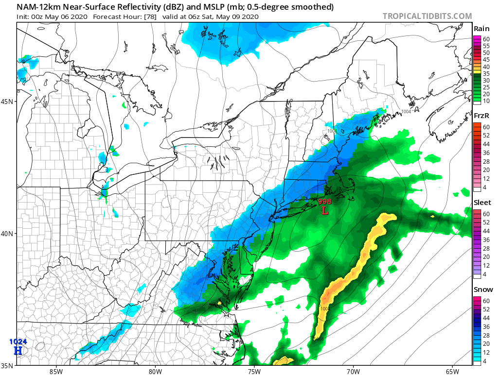
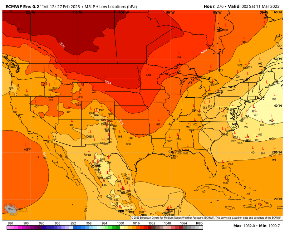
Upper levels are pretty solid on this panel, widespread -5C at 850 and -3C at 925. Surface is mid 30s though, but as depicted that's a paste bomb no doubt.
-
Cyclical or Natural Predictable Climate Change Forum
Cobalt replied to ChescoWx's topic in Climate Change
that darn UHI effect.. -
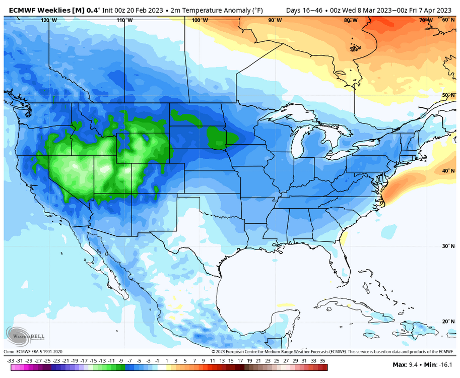
Late February will be rocking. February Long range Discussion thread
Cobalt replied to Ji's topic in Mid Atlantic
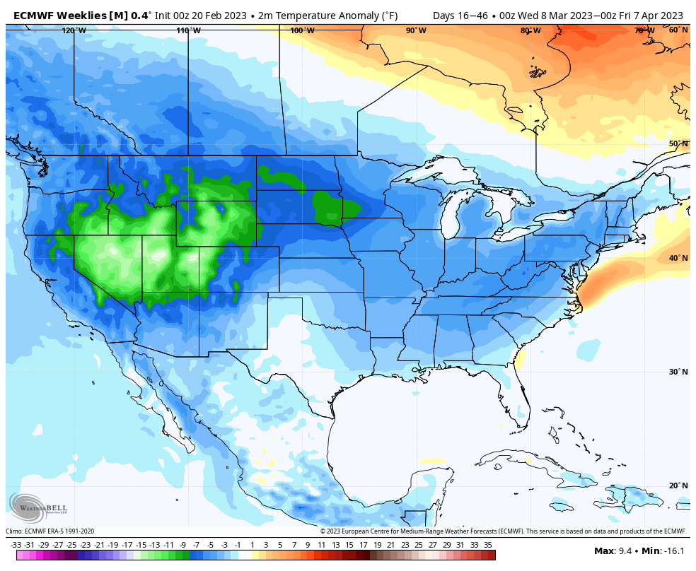
Weeklies say happy spring..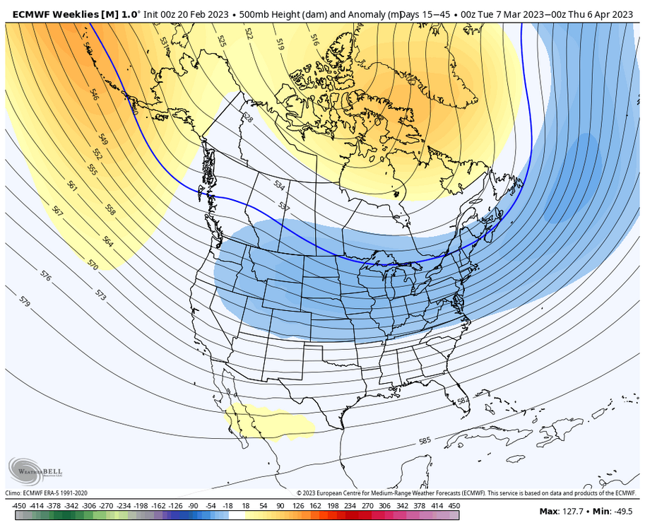
-
Cyclical or Natural Predictable Climate Change Forum
Cobalt replied to ChescoWx's topic in Climate Change
That same NOAA found no conclusive evidence on the idea that offshore wind developments have contributed to excess whale deaths. No other coherent theory has been put forth to explain ongoing warming better than explaining the link between human-caused emissions and the rapid changes in our global climate. Not for a lack of trying either, as the trillion dollar fossil fuel industry has done their own research and has come across the same conclusion. In fact, they've been quite accurate at predicting the rise in global temperatures as a product of human-caused fossil fuel emissions. https://www.houstonchronicle.com/us-world/article/Study-Exxon-Mobil-accurately-predicted-warming-17714068.php?utm_source=twitter.com&utm_medium=referral&utm_campaign=socialflow Can you explain to me how despite there being trillions in incentive to find evidence that disproves AGW, none of the major fossil fuel firms have ever presented such evidence? Can you link to the papers that predicted these things? I could not find the papers that would have discussed the predictions you mentioned.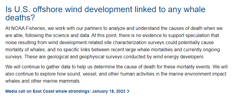
-
Cyclical or Natural Predictable Climate Change Forum
Cobalt replied to ChescoWx's topic in Climate Change
Yet another fallacy perpetrated by the AGW denier group. Offshore windmills are not causing excess whale deaths, there is no evidence for it. As for the "every single doomsday prediction", which such predictions are you referring to? -
Late February will be rocking. February Long range Discussion thread
Cobalt replied to Ji's topic in Mid Atlantic
The one positive that's persistently showing up from like the 24th onwards is that monster 50/50 low that looks to have some staying power w/lower heights in that region. That area has had persistently AN heights for months now, so maybe signs of a change? -
There were a few in the 17-18 winter, and I believe one (or two) in late Jan/Early Feb 2019. Still very rare.
-
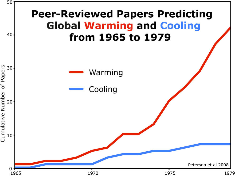
This is a common myth, during the 1970s the amount papers discussing global warming far exceeded those that mentioned the potential of the Earth cooling. This is also around the same time when Exxon's own scientists produced research predicting the future of AGW, which ended up being remarkably accurate. https://news.harvard.edu/gazette/story/2023/01/harvard-led-analysis-finds-exxonmobil-internal-research-accurately-predicted-climate-change/#:~:text=Specifically%2C Exxon projected that fossil,has been proven largely accurate.
-
Late February will be rocking. February Long range Discussion thread
Cobalt replied to Ji's topic in Mid Atlantic
Apparently so
-
Late February will be rocking. February Long range Discussion thread
Cobalt replied to Ji's topic in Mid Atlantic
Every dud winter has some sort of gut punch suppressed snow bomb..