Cobalt
-
Posts
5,216 -
Joined
-
Last visited
Content Type
Profiles
Blogs
Forums
American Weather
Media Demo
Store
Gallery
Everything posted by Cobalt
-
Which will be the warmest 30 year normals of our lifetimes until.. the next 30 year averages
-
There is zero accountability in the climate denial/downplaying space. I have yet to see a CC downplayer apologize for wrongly claiming global temperatures had peaked with the "1998-2012 temperature pause", or for using the Antarctic sea ice peak in 2014-15 to tout the "more ice than ever" headline.
-
I'm falling victim to greenskeeper's one gimmick but I would pay money for a worded explanation of each weenie reaction. The Chesco mention of the highest sea ice to-date since 2009 didn't warrant a weenie, but the opposite example does? We need a synopsis on greenskeeper weenie methodology
-
Where's that one post by Chesco touting the "highest sea ice to-date in 15 years" stat back in January? That has aged poorly.
-
What's the source for this?
-
What did he say about sea ice this past Spring?
-

Phoenix Experiences its Hottest June on Record
Cobalt replied to donsutherland1's topic in Climate Change
What’s your takeaway from the above headline? It seems that Phoenix has had quite the marked increase in temperatures as of late. -
This seems to be in response to Don’s first 4 answers. What was your takeaway from his other answers to the questions? I find that his response was incredibly well-written.
-
He had to go out of the official NWS data range to find a hotter example? Impressive
-
Oh wow, so 5 of the warmest starts to the year have occurred in the past 24 years? That's concerning.
-
It seems like that temperature dip was necessary for human life to come around and flourish in the first place. What's true in the present day is that humanity can't support itself in an ice-free world. 2 billion people rely on glaciers for drinking water, power, and agriculture.
-
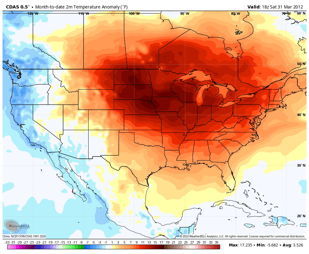
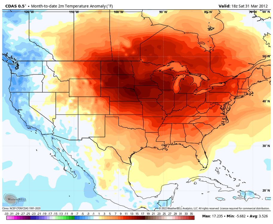
The entirety of the area depicted, averaged out, depicts a positive anomaly against the 1991-2020 averages. The red very obviously takes up more space on the map than the limited blue hues.
-
Yeesh, so many recent years in those charts.
-
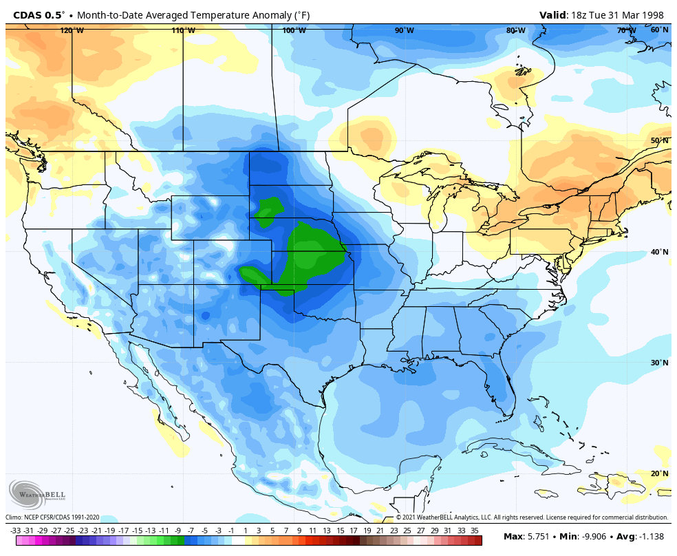
It looks like this is referring to daily temperature records for one location, which feels way less statistically significant than a 31 day temperature average. That stripe of 1998 on the East coast might've been hit on a particularly warm day, but the month on a whole is no comparison to a March like 2012. I feel like that is worth mentioning in your post.

-
Crazy how the late February HECS loading pattern very quickly became the 2025-2026 winter loading pattern instead
-
Moderate (non-accumulating) snow atm. 2/24 storm confirmed
-
2024 Valentines Day Who the Hell Knows - Comeback Thread
Cobalt replied to DDweatherman's topic in Mid Atlantic
Georgetown snow shield working overtime -
Oh. What about the other 90%? Where does that come from?
-
That’s the one signal that hasn’t wavered. Been on the guidance since the Mesopotamian model was the go-to.
- 2,509 replies
-
- 2
-

-
- weenie fest or weenie roast?
- weenies got roasted
- (and 2 more)
-
Oh, that is definitely interesting. Has sunspot activity gone up along with the recent warming, or is it just a temporary blip unrelated?
-
Hello, I watched this video and believe I got the key points, but I was wondering, what were the key takeaways/points/arguments from the video, for you? Just making sure I'm on the same page with what you and dseagull gathered from this video. Thanks!
-
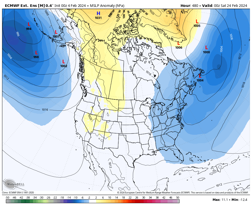
Weeklies from today are maintaining that potent storm signal centered at the 23rd/24th. From what I can tell, that signal has been there in some form on the weeklies since it was 30 or so days out.
- 2,509 replies
-
- 8
-

-
- weenie fest or weenie roast?
- weenies got roasted
- (and 2 more)
-
Jan/Early Feb Medium/Long Range Discussion Part 3
Cobalt replied to WinterWxLuvr's topic in Mid Atlantic
probably connected.. fridge doing its magic -
Low of 1F, up to 11 degrees now.