Newman
-
Posts
2,500 -
Joined
-
Last visited
Content Type
Profiles
Blogs
Forums
American Weather
Media Demo
Store
Gallery
Everything posted by Newman
-
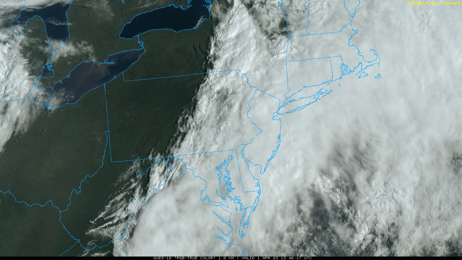
There will definitely be smoke coming through tonight. It might linger into the morning. It won't be as bad as tomorrow evening though. You can see it on the visible satellite moving south from New York
-
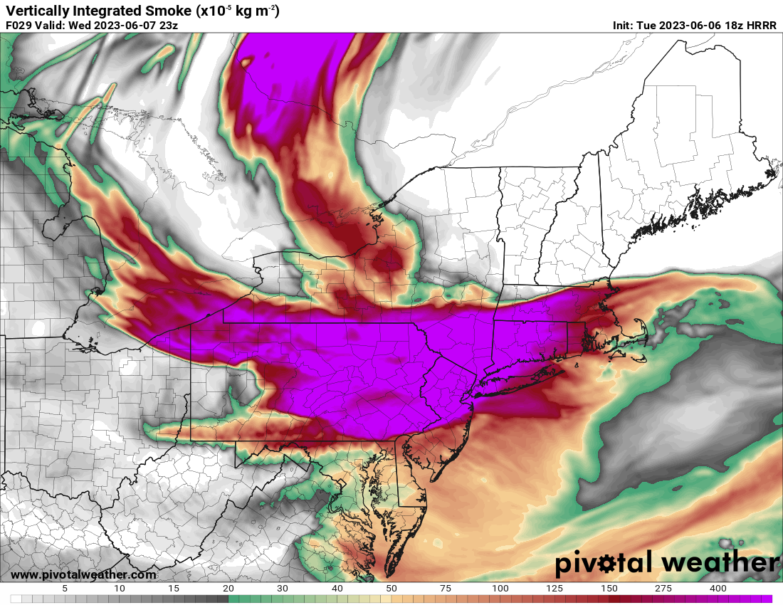
Tomorrow evening most likely, the HRRR has some very thick smoke around sunset tomorrow

-
That storm heading towards Philly is warned for Ping Pong ball sized hail
-
Was just about to say you're gonna get a good one yourself!
-
About 0.3" of rain from that storm. 3x the amount received in May LOL
-
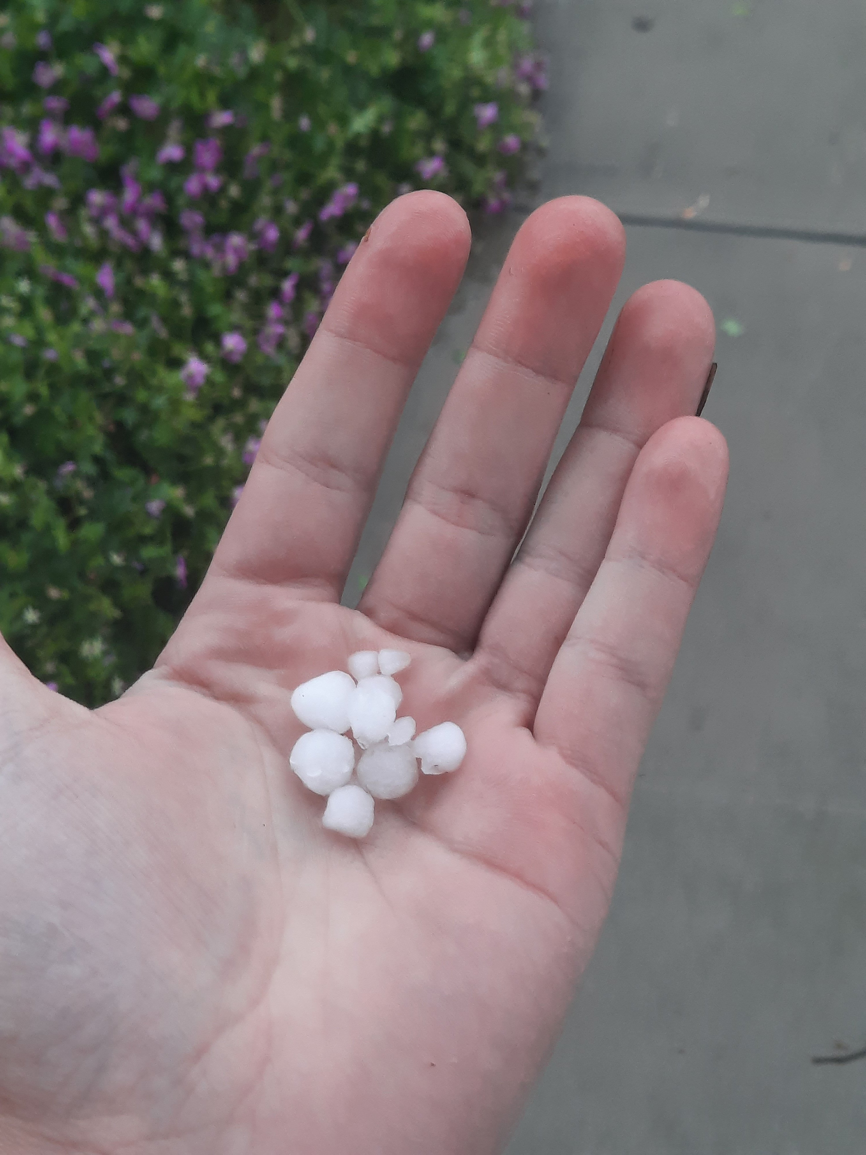
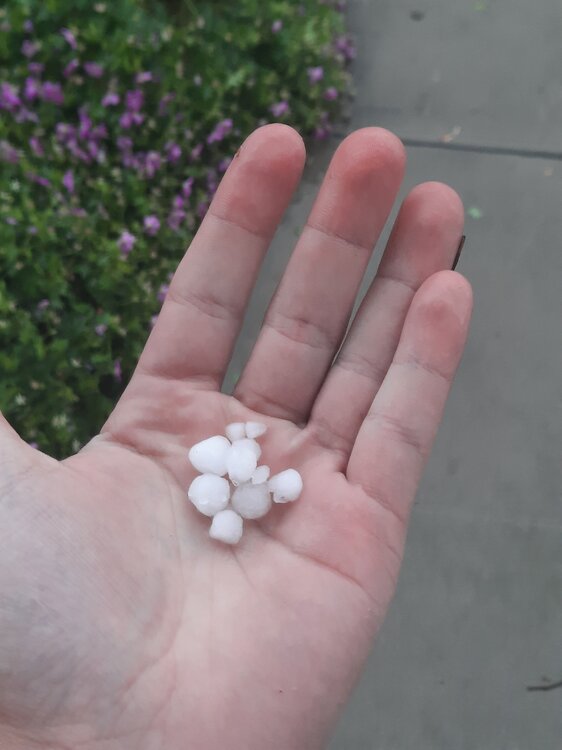
Just sent in a report to the NWS. Was a great storm here. Gusty, drenching rain, and got hail cored. Saw the VIL radar and knew there had to be something, was expecting pea size (0.25" but got up to 0.5")
.thumb.jpg.091f194be9b3bc1fbdebaf4742b93c6b.jpg)
-
Hail storm here! Just had 0.5" hail pass through. Started to accumulate in areas. Sick storm.
-
Storm heading through eastern Berks county right now. Finally about to get some rain! First drops incoming in over 3 weeks
-
Had about 4 drops earlier, but everything fell apart or split me
-
I'm expecting some storms this evening and tonight, first rain in weeks at my locale!
-
-
 14/5/2
 -
The look for much of the latter half of this month has been the high geopotential heights across SE Canada and low heights across the SE. Stuck in the middle is weak flow and generally seasonable temps. Occasionally we'll get a disturbance to ride the ridge north of us and bring a glancing blow of showers and a brief cool down. That's what we can expect this Friday evening and Saturday as a disturbance and cold front moves through. So, hopefully we get some showers this weekend
-
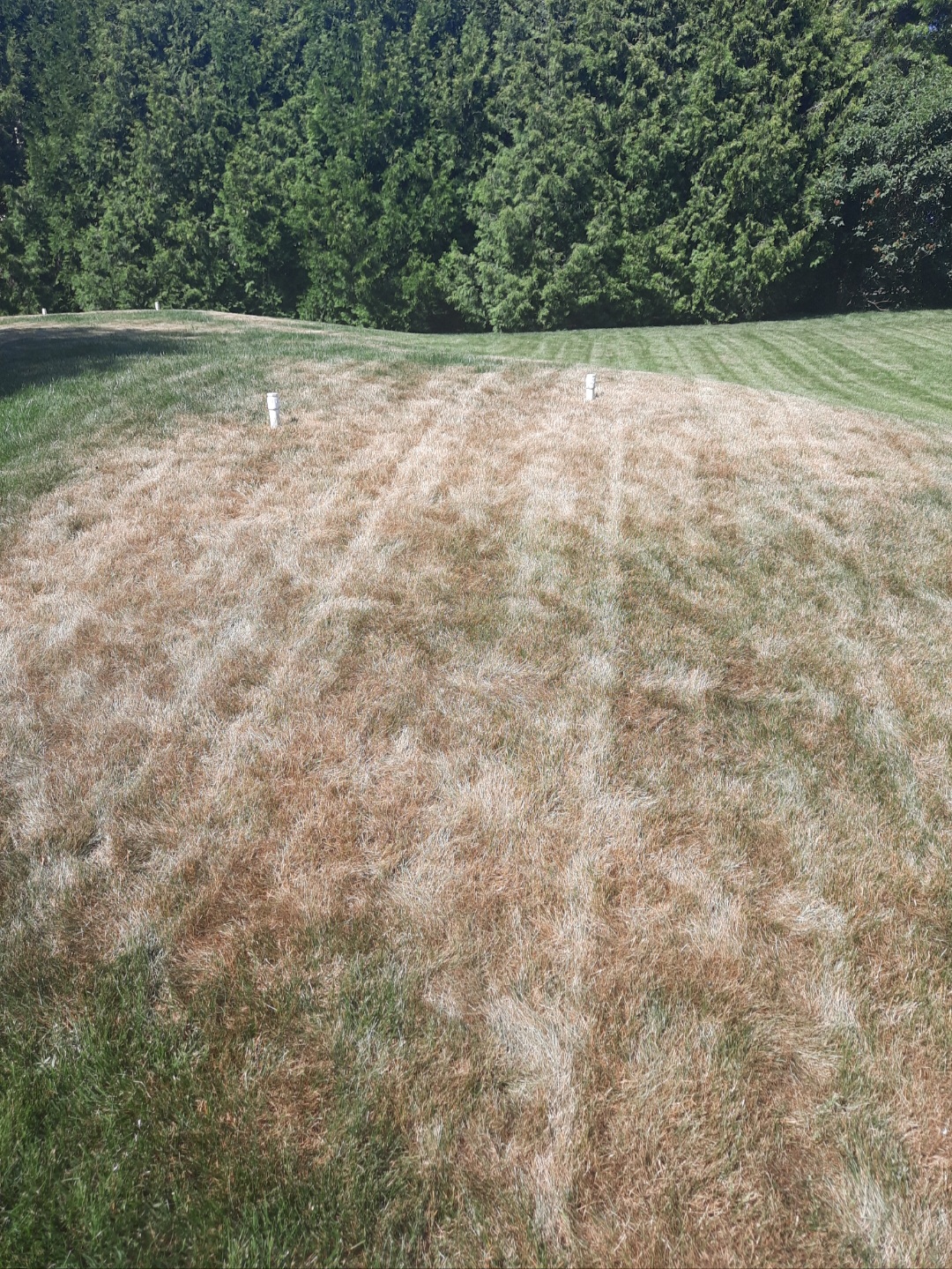
The current scene from the desert of Berks County, a browning and crunchy grass that has expanded across parts of the yard

-
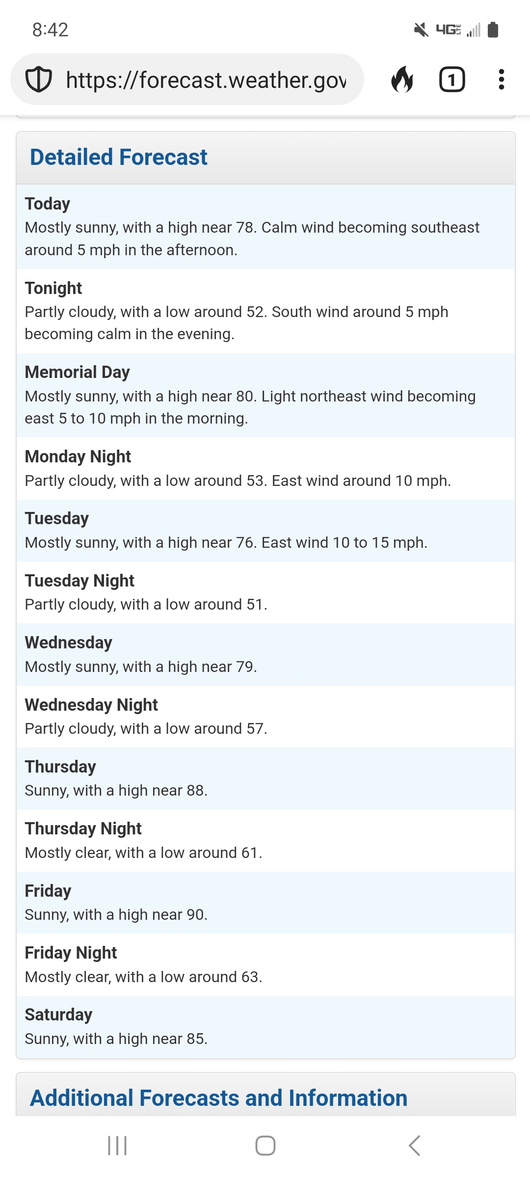
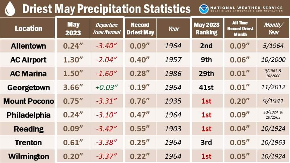
Dry for the next week, near or at 90 on Thursday and Friday. Drought!
-
My at home station has recorded 0.0" of rain this month. Not sure how accurate that is, but KRDG only has 0.09" so it might be legit. Next week is high and dry too. Likely a shutout month
-
Made it to 33° in Fleetwood last night
-
Just finished up my undergrad meteorology degree at Millersville in PA. Will be moving to Laramie, WY come late July to settle in for grad school at UWYO. Excited to be apart of the Mountain West and to join y'all
-
Also, we recorded about 7.5" of snow in Fleetwood this winter. Which somehow beat out three winters ago, 2019-2020, when we only got 7.1". Millersville only received 0.9" of snow this winter, absolutely destroying the old record of around 4.5". You almost can't believe to receive that little snow in a winter, but somehow we did.
-
Expecting widespread frost and freeze to kill off some plants tonight. On another note, I'll be an official red tagged meteorologist in less than two weeks time
-
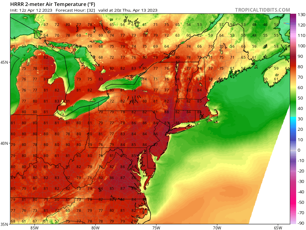
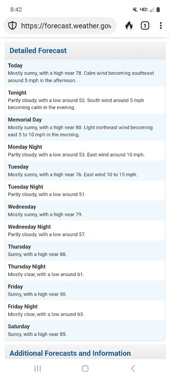
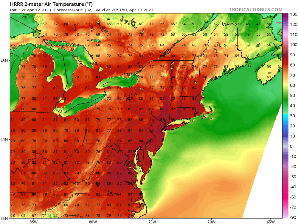
The 12z HRRR takes NYC to 90 tomorrow
-
April showers bring May flowers but April droughts bring May _______??
-
What a beautiful week we have ahead. No rain, 70s and 80s, straight to summer
-
The Ides of March end of Winter 2023
Newman replied to paweather's topic in Upstate New York/Pennsylvania
There is ample clearing behind the first wave of rain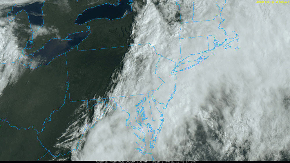
-

.jpg.dc301bdca84eede3c60c449cf89404f5.jpg)