Newman
-
Posts
2,500 -
Joined
-
Last visited
Content Type
Profiles
Blogs
Forums
American Weather
Media Demo
Store
Gallery
Everything posted by Newman
-
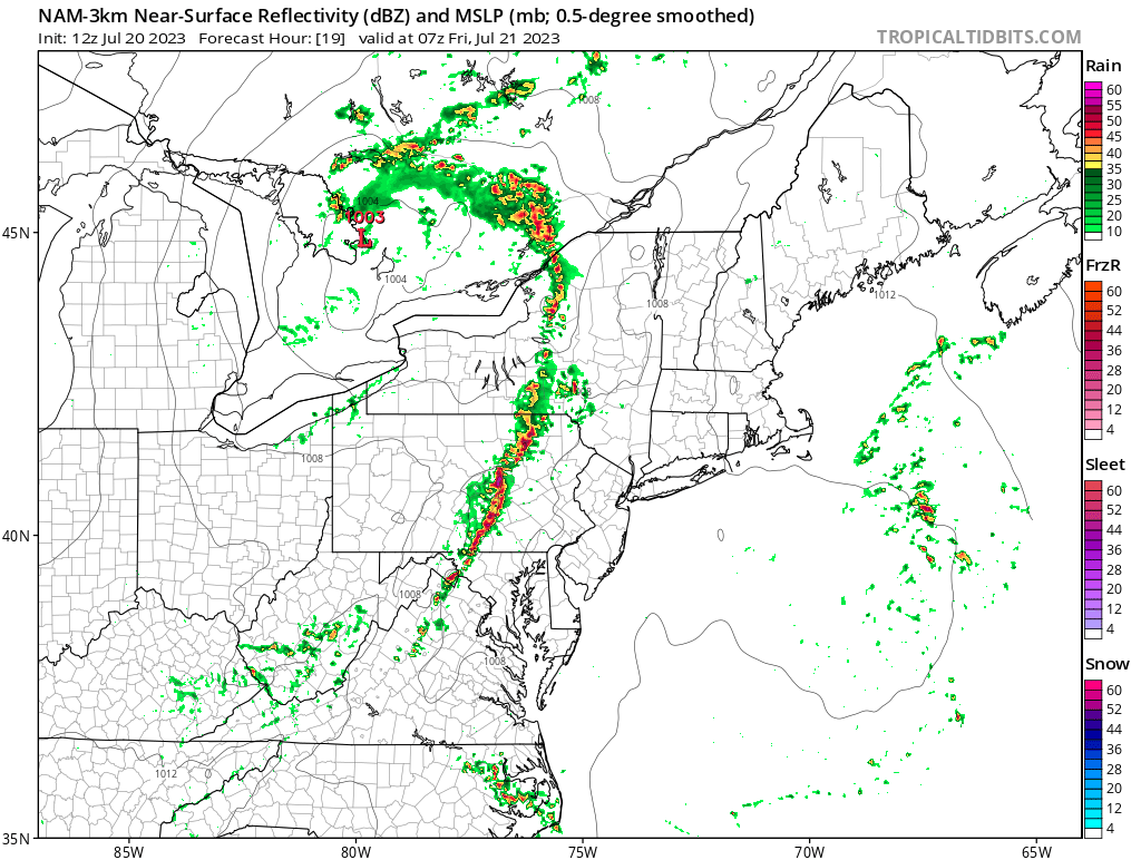
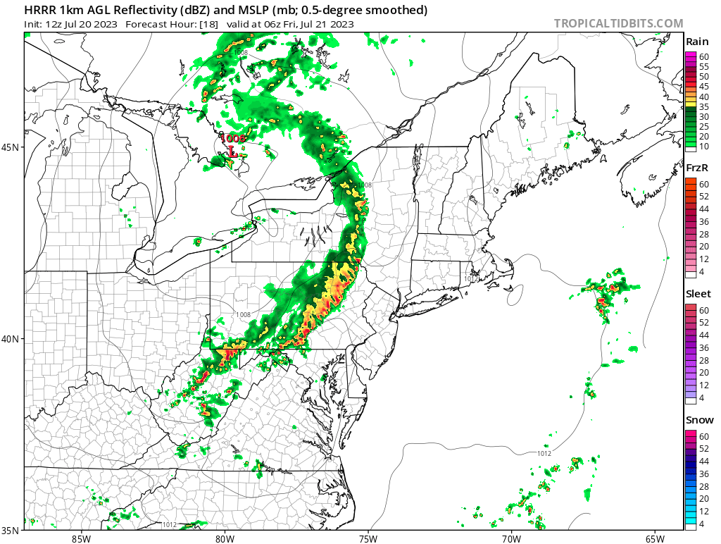
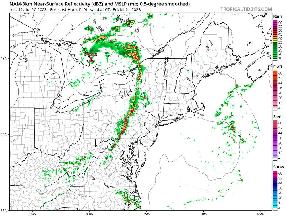
Some big time storms tomorrow. SPC expanded the 5% tor risk north and put up a 45%(!) wind probs risk over DC and far southern LSV. I think somewhere just south of the PA border would be ideal. The big question is if morning cloud cover inhibits afternoon sunshine. NWS and SPC discussion highlighting the likelihood of a bow echo and MCV forming hence the wind threat
-
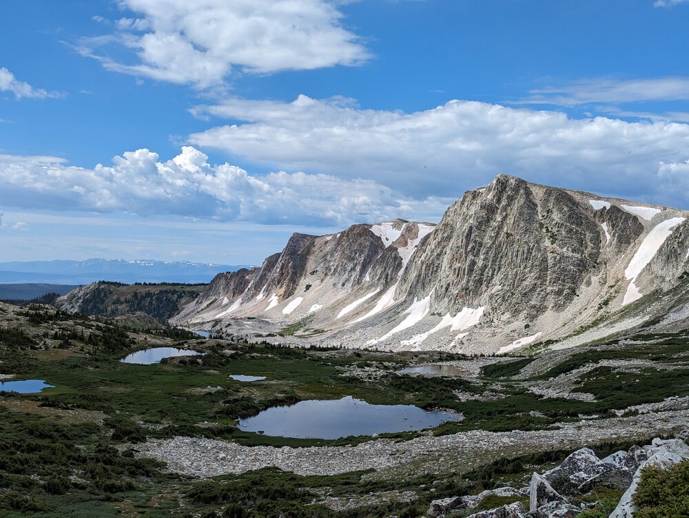
The picture is from a hiking spot about 45 miles outside of town, but speed limits here are 70-80mph so its not too far haha. I visited in April but this is my first time "living" out west. The peak of the rock cliff/mountain you see is 12,000 feet and the trail leads up that way, I was surprised to not get altitude sickness
-
Looks like the weather is quite comfortable back east in PA! It's been a rainy week since I've been here in Wyoming. Chances of storms/showers every day with a SW Pacific flow into the region. Was able to visit a local hiking spot this past weekend. I think I'm gonna like it here...
-
The SPC expanded the severe watch south to cover the entire LSV
-
SPC just extended the Severe watch for much of the CWA
-
-
Could be a wild late night tonight with a line of storms rolling through between 1-4am. SPC has expanded a slight risk into the area for tonight's threat with mention of all hazards. There's a potent shortwave moving through north of us and we'll have a strong low level jet to sustain the squall and advect moisture/warmth overnight. NWS State College also highlighting a likelihood of severe level storms overnight

-
A couple trees down across York city according to some SPC storm reports
-
Quarter size hail reported in Lebanon with that storm that rolled through
-
Just got home from a backpacking trip near Williamsport. Left on Sunday and the last text I got from my parents before losing phone service was "Rain won't let up, been pouring for hours". Can't believe I missed a historic flood in my area.
-
There's a few wunderground stations with 3" of rain in and around Reading
-
Radar estimates of 1-2+ inches over Berks county over the last hour. Flash flood warning, PWATs through the roof
-
Made it to around 92 here in Fleetwood. Some slow moving pop up storms forming over the coastal plain and Philly. Weak steering flow, humid/moist atmosphere, and convective T reached means you get these typical summer time pop ups. Not widespread in nature today On another note, I will finally be moving to Wyoming in less than 3 weeks to continue my education and get my PhD. It's been a pleasure to be apart of the Philly subforum here, I don't think I'll be back east any time soon! But I'll still be posting here occasionally, can't escape your home roots
-
Getting real foggy out there now, dew points up into the mid-70s. Like we're in the Amazon rainforest
-
I chased that storm in Kutztown and near Allentown that was tornado warned earlier. I was basically under the core of the rotation, just SE of it in a safer location. There was some scud clouds and maybe a little bit of visible rotation, but no funnel. Regardless, still a wild storm and crazy with the multiple tornado warnings and confirmed reported funnels/tornados today. Not entirely surprised though. Some of our best setups are when we have MCVs move through to the north, like today, and you get some pretty strong directional shear that storms can tap into
-
There's been a solid hook on that storm for awhile. Not surprised we have such a robust looking supercell. Often times on the leading edge of these MCSs that move through in the summer is where you have transient supercellular storms. And the VIL values are off the charts, very high dbz in the core
-
Severe watch up
-
Just about to head out to mow the lawn and the sun is out. Dripping in sweat thinking about this humidity
-
Feels like a nor'easter coming in. Chilly, very breezy with a ENE wind, rain on the doorstep
-
Really strong line of storms heading into southern Lancaster and Chester counties. Severe warned
-
Picked up ~1.5" here
-
Currently 64/48 split and I'm walking around with a hoodie on. Perfect cool weather
-
I just wanna see blue skies again
-
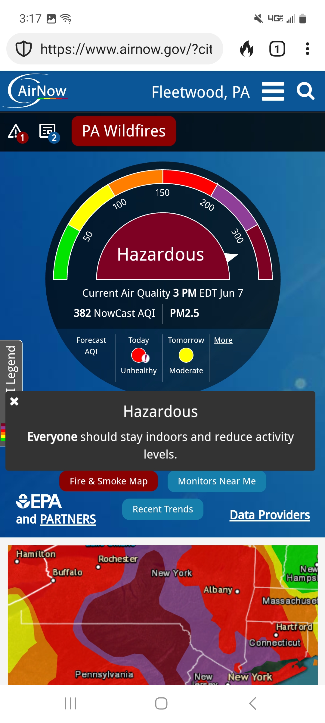
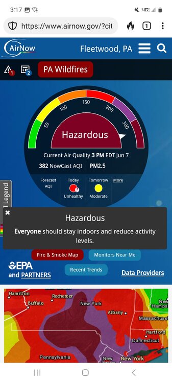
AQI is currently almost near 400 in Fleetwood and is "Hazardous" 6/6 on the scale. Stay inside
-
Was driving home from somewhere and as soon as I stepped out of my car it was unbearable. Really bad here