Newman
-
Posts
2,484 -
Joined
-
Last visited
Content Type
Profiles
Blogs
Forums
American Weather
Media Demo
Store
Gallery
Everything posted by Newman
-
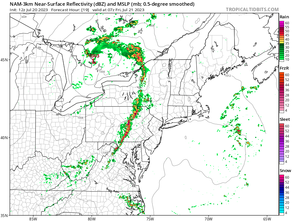
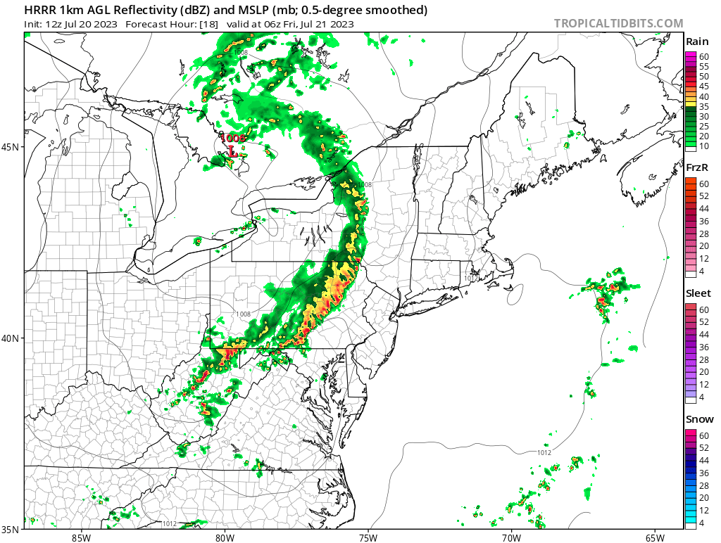
Big time bow echo pushing towards Philly, warned for 70mph winds
-
Line is really bowing out in Lancaster county, 70mph winds
-

2023 Mid-Atlantic Severe Wx Thread (General Discussion)
Newman replied to Kmlwx's topic in Mid Atlantic
That warning heading towards Leesburg has a classic QLCS kink- 2,785 replies
-
- 1
-

-
- severe
- thunderstorms
- (and 3 more)
-
Yeah Harrisburg might get completely skunked. That discrete cell entering southern York is the real deal and has been tracking for awhile
-
The line entering Franklin is starting to bow out, warned for 70mph winds currently
-
You can see the squall line beginning to take form
-
Tornado warning for state college
-
Man those cells coming up into Franklin county are nasty. The VILs are huge and the hail cores have gotta be over golf ball size
-
Big discrete cell heading into southern Franklin county. Definitely some 1"+ hail in that I'd think
-
Could there be any worse time for the CCX radar to be down?
-
2023 Mid-Atlantic Severe Wx Thread (General Discussion)
Newman replied to Kmlwx's topic in Mid Atlantic
60% probs for 2 or more tornados (Mod), 30% probs of 1 or more strong tornado- 2,785 replies
-
- 1
-
-
- severe
- thunderstorms
- (and 3 more)
-
2023 Mid-Atlantic Severe Wx Thread (General Discussion)
Newman replied to Kmlwx's topic in Mid Atlantic
The SPC MCD clearly says that the wind profiles should improve into the mid-atlantic over the next few hours in response of the rapidly approaching strong upper level and soon-to-form low level jet streak. Tornadoes are definitely a threat, though clearly wind is the biggest and everyone should know that.- 2,785 replies
-
- 11
-
-

-
- severe
- thunderstorms
- (and 3 more)
-
One of the most intense severe weather days predicted in like 10 years. Wish I was back east to experience it. Y'all are in for some wild weather today. Enjoy it and stay safe
-
.gif.c1606da9f75842991e33d965d9857c99.gif)
-
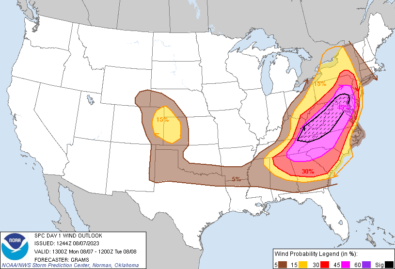
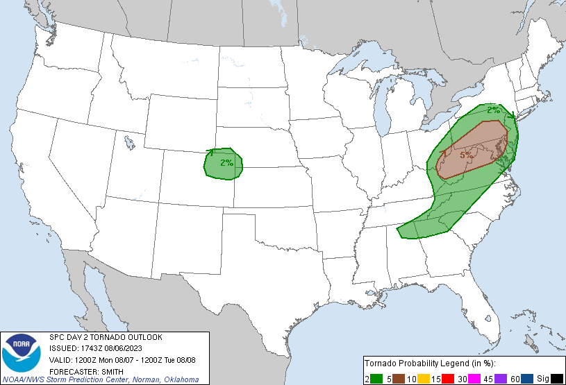
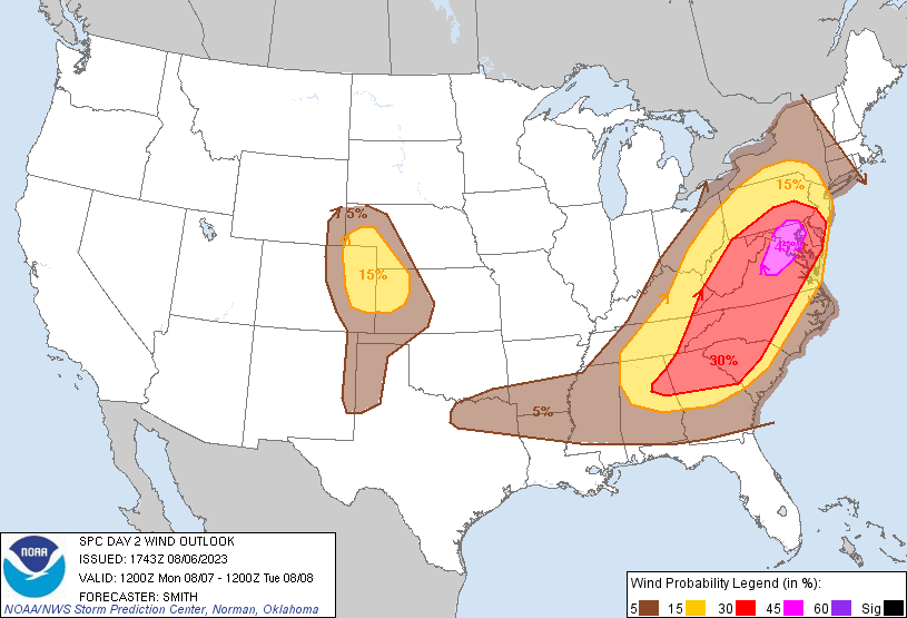
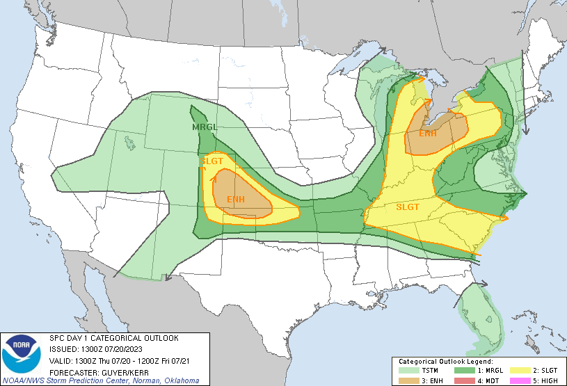
Some big time storms tomorrow. SPC expanded the 5% tor risk north and put up a 45%(!) wind probs risk over DC and far southern LSV. I think somewhere just south of the PA border would be ideal. The big question is if morning cloud cover inhibits afternoon sunshine. NWS and SPC discussion highlighting the likelihood of a bow echo and MCV forming hence the wind threat
-
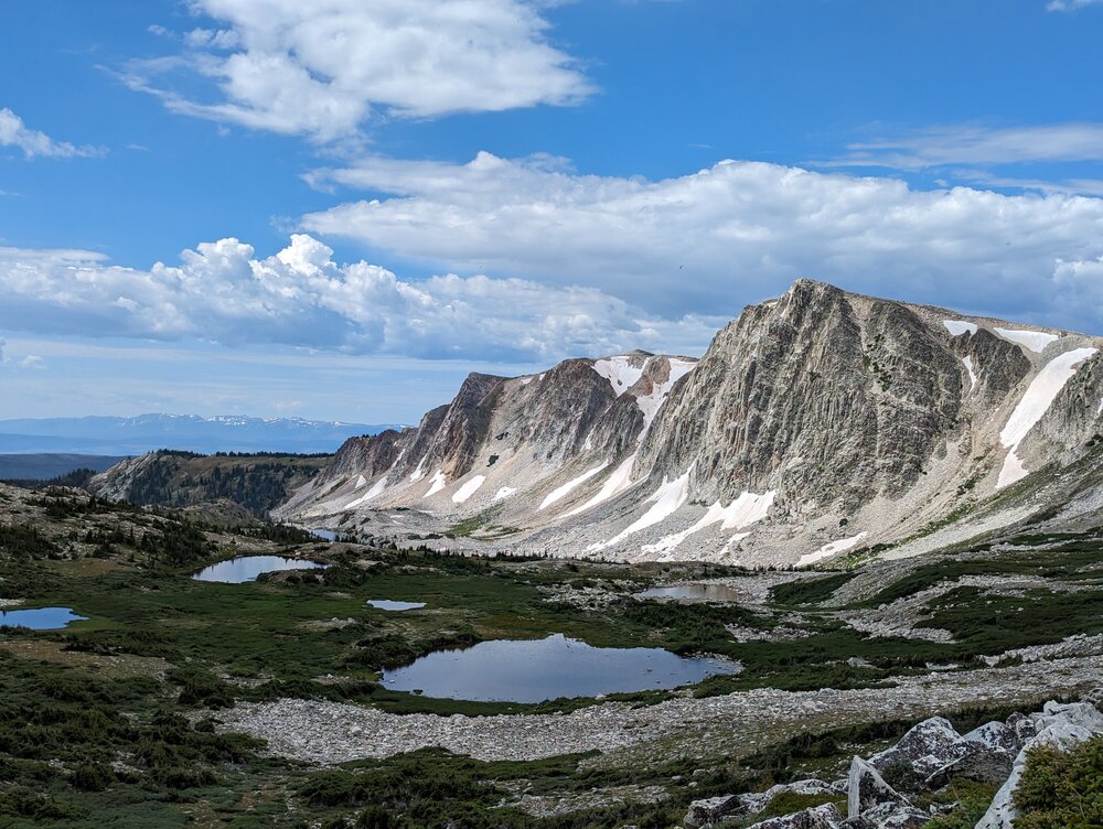
The picture is from a hiking spot about 45 miles outside of town, but speed limits here are 70-80mph so its not too far haha. I visited in April but this is my first time "living" out west. The peak of the rock cliff/mountain you see is 12,000 feet and the trail leads up that way, I was surprised to not get altitude sickness
-
Looks like the weather is quite comfortable back east in PA! It's been a rainy week since I've been here in Wyoming. Chances of storms/showers every day with a SW Pacific flow into the region. Was able to visit a local hiking spot this past weekend. I think I'm gonna like it here...
-
The SPC expanded the severe watch south to cover the entire LSV
-
SPC just extended the Severe watch for much of the CWA
-
-
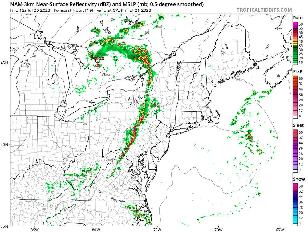
Could be a wild late night tonight with a line of storms rolling through between 1-4am. SPC has expanded a slight risk into the area for tonight's threat with mention of all hazards. There's a potent shortwave moving through north of us and we'll have a strong low level jet to sustain the squall and advect moisture/warmth overnight. NWS State College also highlighting a likelihood of severe level storms overnight

-
A couple trees down across York city according to some SPC storm reports
-
Quarter size hail reported in Lebanon with that storm that rolled through
-
Just got home from a backpacking trip near Williamsport. Left on Sunday and the last text I got from my parents before losing phone service was "Rain won't let up, been pouring for hours". Can't believe I missed a historic flood in my area.
-
There's a few wunderground stations with 3" of rain in and around Reading