Newman
-
Posts
2,500 -
Joined
-
Last visited
Content Type
Profiles
Blogs
Forums
American Weather
Media Demo
Store
Gallery
Everything posted by Newman
-

Central PA Winter 2022/2023
Newman replied to Blizzard of 93's topic in Upstate New York/Pennsylvania
-
Central PA Winter 2022/2023
Newman replied to Blizzard of 93's topic in Upstate New York/Pennsylvania
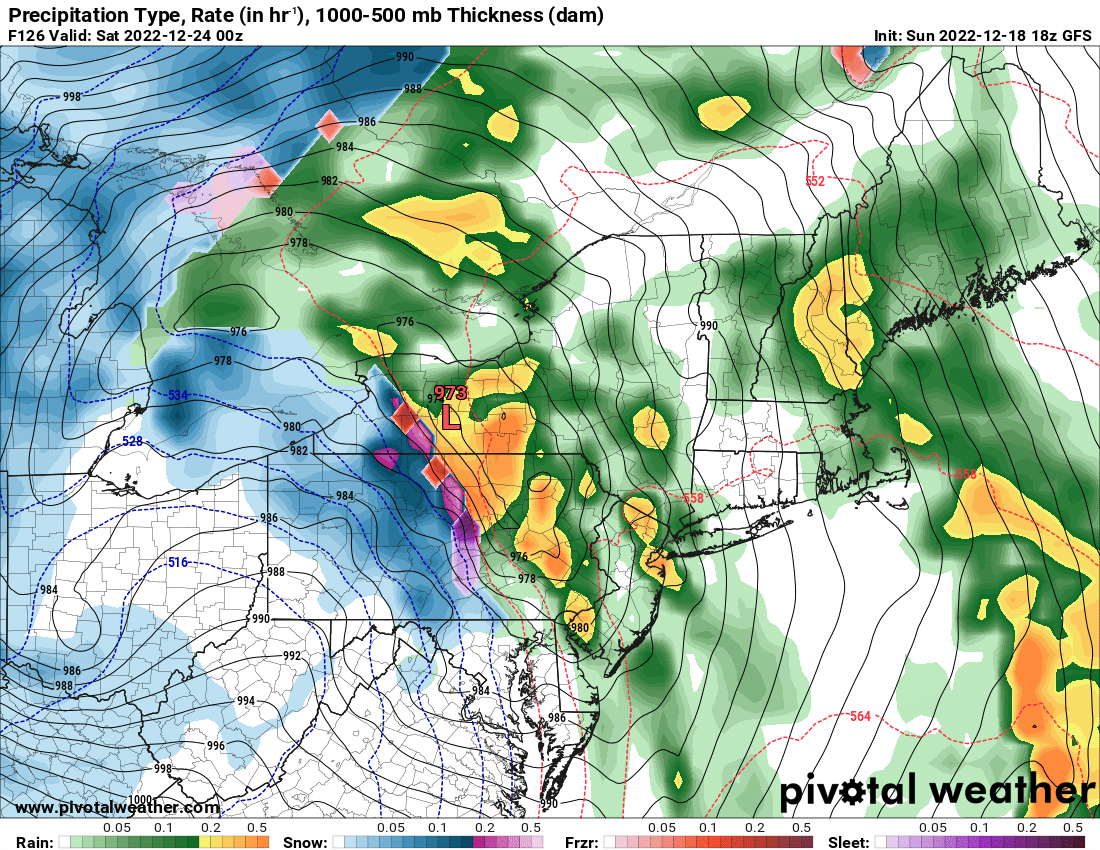
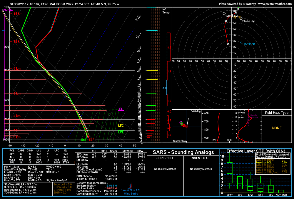
The FV3 would be one potent squall with the frontal passage. -
Central PA Winter 2022/2023
Newman replied to Blizzard of 93's topic in Upstate New York/Pennsylvania
12z 3k -
Hey Walt, here is the definition for a flash freeze from the glossary of meteorology. https://glossary.ametsoc.org/wiki/Flash_freeze
-
Central PA Winter 2022/2023
Newman replied to Blizzard of 93's topic in Upstate New York/Pennsylvania
-
E PA/NJ/DE Winter 2022-2023 OBS Thread
Newman replied to Ralph Wiggum's topic in Philadelphia Region
-
E PA/NJ/DE Winter 2022-2023 OBS Thread
Newman replied to Ralph Wiggum's topic in Philadelphia Region
Seasonal totals thus far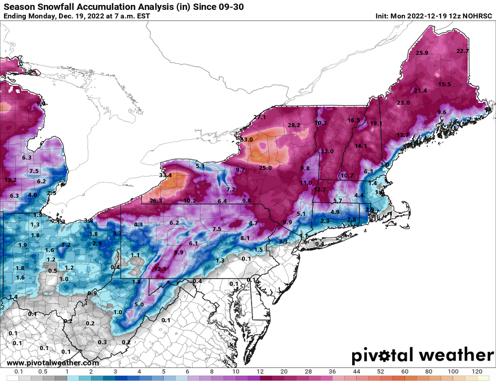
-
Central PA Winter 2022/2023
Newman replied to Blizzard of 93's topic in Upstate New York/Pennsylvania
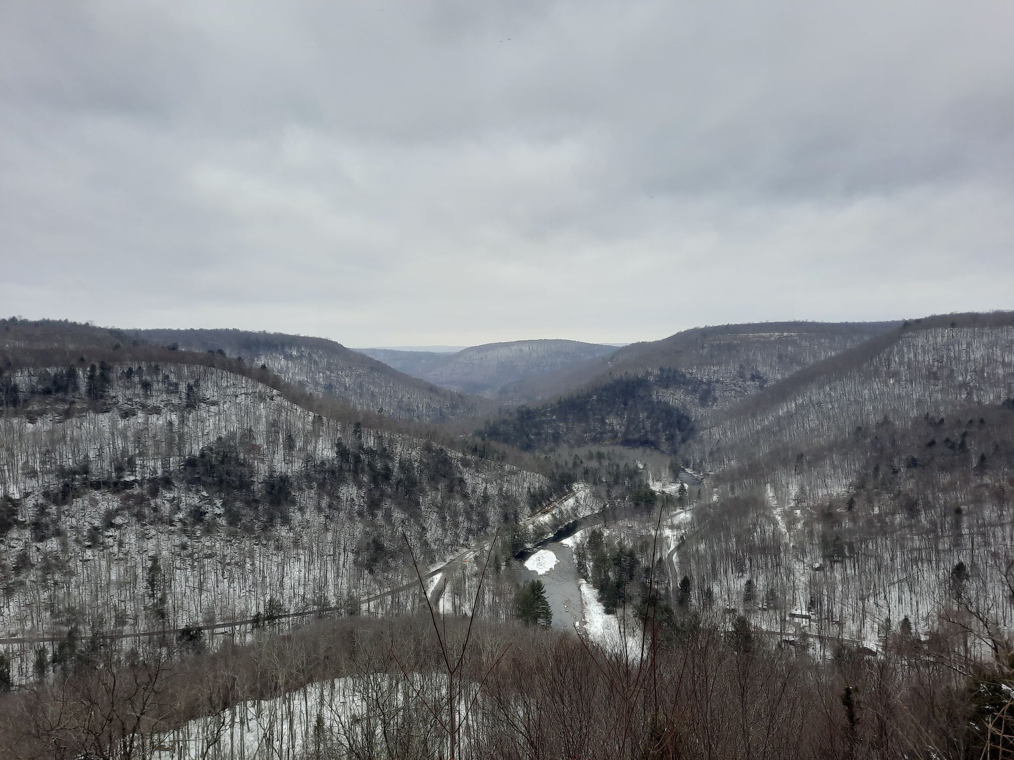
Treated myself to a birthday hike today in the snow up at World's End State Park. Probably one of my favorite overlooks in PA. I definitely missed the snow, about 4-5 inches of packed snow there. Needed my micro spikes to get up the mountain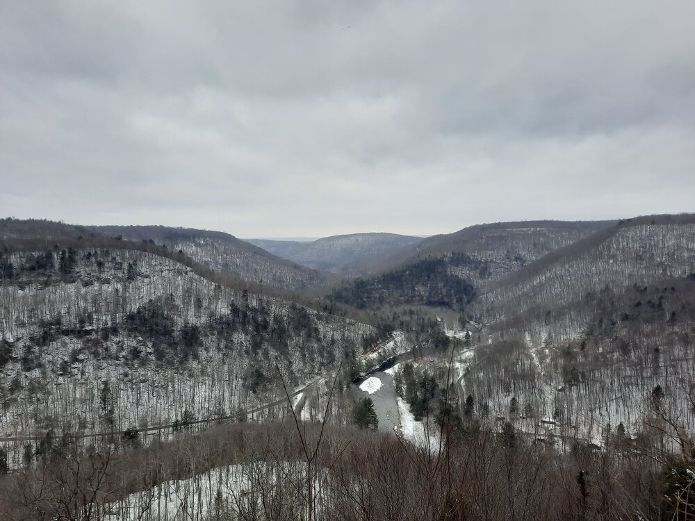
-
Central PA Winter 2022/2023
Newman replied to Blizzard of 93's topic in Upstate New York/Pennsylvania
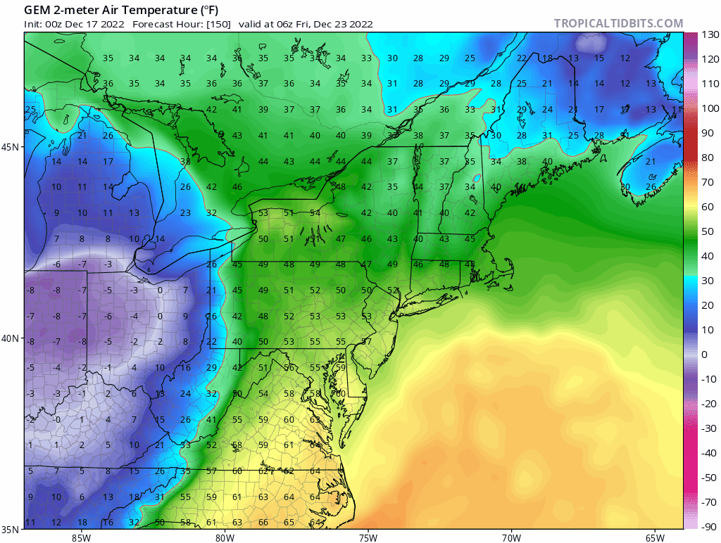
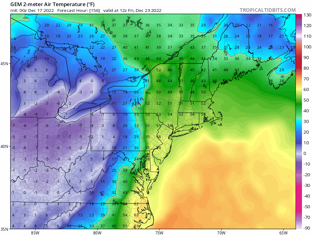
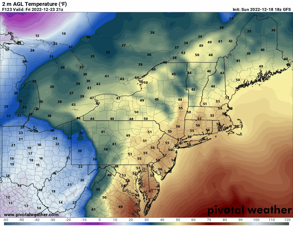
58 to 12 in HBG in 6 hours!!!
-
E PA/NJ/DE Winter 2022-2023 OBS Thread
Newman replied to Ralph Wiggum's topic in Philadelphia Region
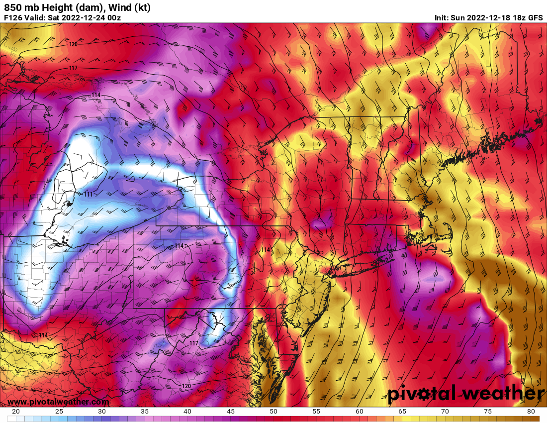
Dreaming of a powerless Christmas? Strong LLJ Friday evening with the passage of the squall line over eastern PA with no sign of a surface inversion to limit mixing. Will need to watch this one, could be similar to the 2020 grinch storm where some lost power.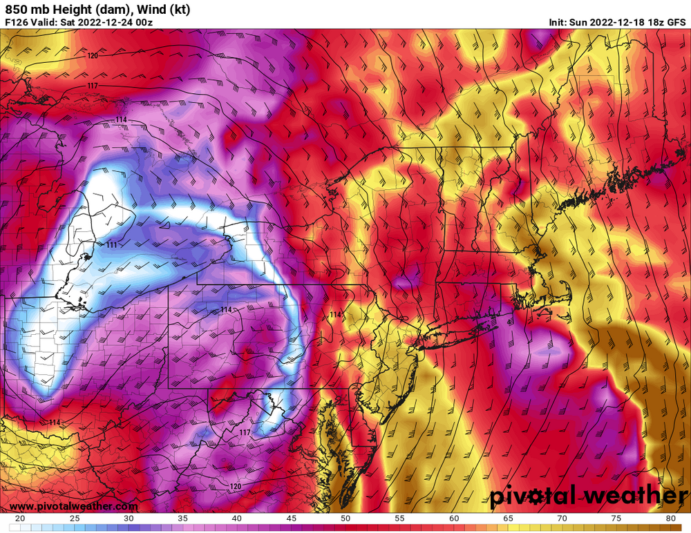

-
Central PA Winter 2022/2023
Newman replied to Blizzard of 93's topic in Upstate New York/Pennsylvania
I don't see how there won't be a flash freeze Friday evening/night with the passage of that strong arctic front. As long as winds don't blow too hard (which they might) and things don't dry out too much, the puddles and rain will freeze the roads. -
Central PA Winter 2022/2023
Newman replied to Blizzard of 93's topic in Upstate New York/Pennsylvania
-
Central PA Winter 2022/2023
Newman replied to Blizzard of 93's topic in Upstate New York/Pennsylvania
-
E PA/NJ/DE Winter 2022-2023 OBS Thread
Newman replied to Ralph Wiggum's topic in Philadelphia Region
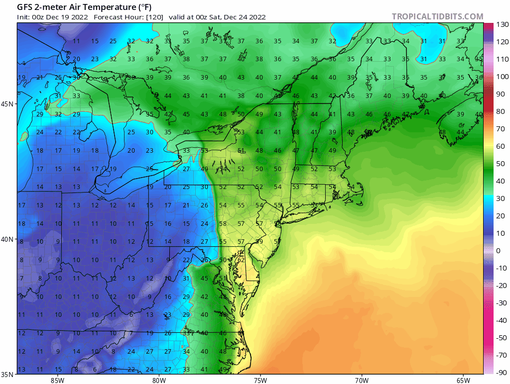
Christmas doesn't even look all that brutally cold anymore -
Central PA Winter 2022/2023
Newman replied to Blizzard of 93's topic in Upstate New York/Pennsylvania
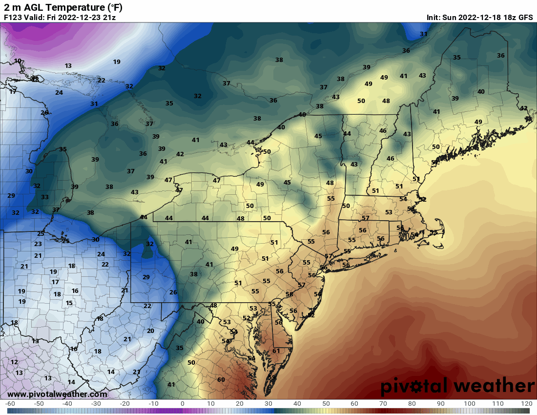
Now this would be one hell of a front on the CMC. Even though it's a rain storm, the puddles would freeze up in an instant lol. Of course flash freezes rarely work out, but it's fun to look at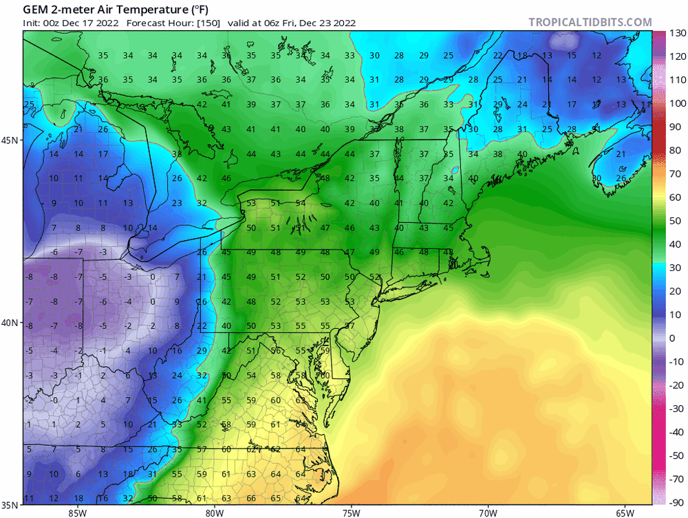
-
E PA/NJ/DE Winter 2022-2023 OBS Thread
Newman replied to Ralph Wiggum's topic in Philadelphia Region
Although rain, this would be one hell of a front on the Canadian. 55 to 16 in 6 hours here LOL
-
E PA/NJ/DE Winter 2022-2023 OBS Thread
Newman replied to Ralph Wiggum's topic in Philadelphia Region
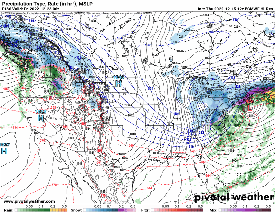
CMC is unfortunately another huge cutter. But I agree, I did get Jan 2000 vibes with it too. Verbatim, it's pretty strung out and disorganized which actually helps out because heights don't rise too much. It also doesn't close off until at or north of our latitude on the GFS. I said yesterday I was chasing the big dog, but I might have to walk back that statement. It doesn't look nearly as ideal as it once did, so right now I'm chasing a white christmas -
E PA/NJ/DE Winter 2022-2023 OBS Thread
Newman replied to Ralph Wiggum's topic in Philadelphia Region
GFS coming in with lots of changes. I won't speak to what the outcome is gonna be, but i think it'll be more positive for the coast -
E PA/NJ/DE Winter 2022-2023 OBS Thread
Newman replied to Ralph Wiggum's topic in Philadelphia Region
This is a good start to the 0z suite. Grasping here, but the ICON is drastically improved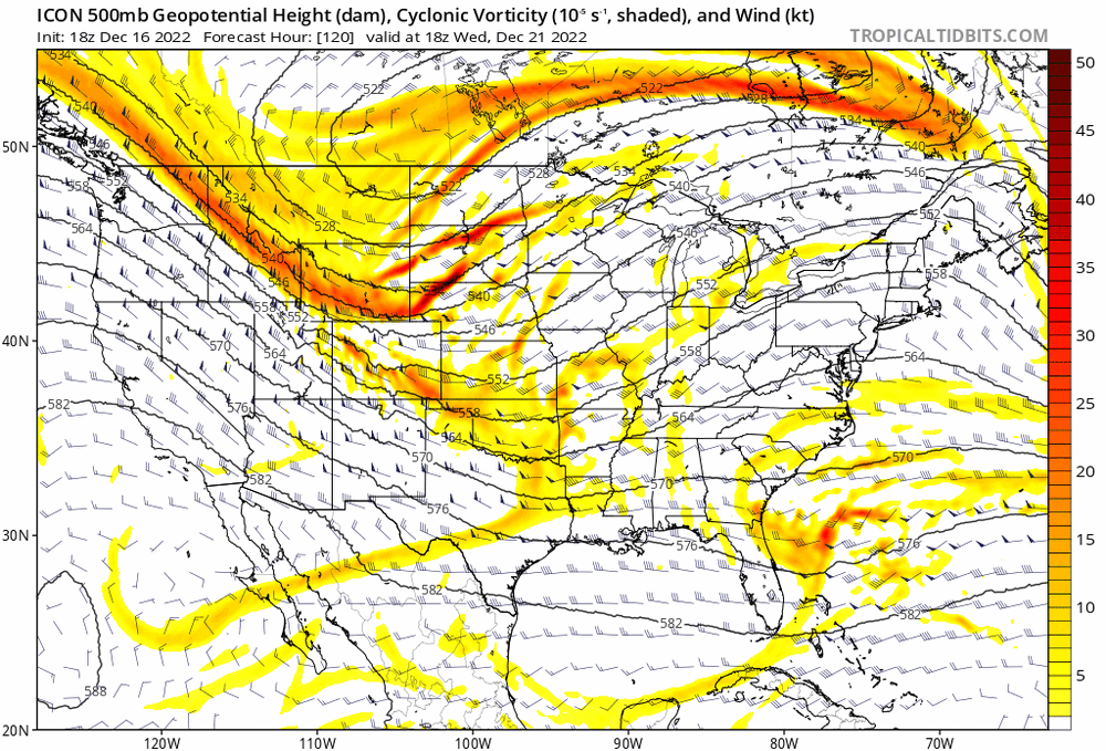
-
E PA/NJ/DE Winter 2022-2023 OBS Thread
Newman replied to Ralph Wiggum's topic in Philadelphia Region
Yeah early on it looked like it held serve, but the ridge out west shifted further west so it's amping up too soon. -
E PA/NJ/DE Winter 2022-2023 OBS Thread
Newman replied to Ralph Wiggum's topic in Philadelphia Region
GFS not blinking, gonna be a hit or at least off the coast this run again -
E PA/NJ/DE Winter 2022-2023 OBS Thread
Newman replied to Ralph Wiggum's topic in Philadelphia Region
FWIW, the NAM long range at hour 84 looks more like the GFS with the ejection of the PV into SE Canada -
It is, I measured it on google maps and it's a ~1,050ish mile difference in the low pressure center
-
Just incredible changes at the surface downstream due to the changes we saw with the handling of the PV energy at day 3-4

-
E PA/NJ/DE Winter 2022-2023 OBS Thread
Newman replied to Ralph Wiggum's topic in Philadelphia Region
Look at this 24 hour change, incredible