

MAG5035
-
Posts
5,718 -
Joined
-
Last visited
Content Type
Profiles
Blogs
Forums
American Weather
Media Demo
Store
Gallery
Posts posted by MAG5035
-
-
The eastern third of PA is very much in the game for direct impacts from the coastal low, and for the state as a whole it may not be the all or nothing proposition it was looking like a few days ago if the coastal ultimately develops too far east for most in here. Models are pretty solid now on showing general snowfall developing across most the state Friday as the phasing northern energy drops down and attending arctic boundary presses. I Mentioned this in two posts on Sunday, even on the first post during the day when the coastal aspect of this wasn’t anywhere near close to C-PA and I was still skeptical on a bigger storm happening at all. If the coastal trends closer like the Euro this setup could help in terms of a more expansive precip shield (even though the axis of heaviest would probably tend to be just east of most of the subforum)
What’s ultimately changed is the timeframe of this phasing occurring (faster). This was really well explained in the Mount Holly AFD that was shared in here first thing this morning. The faster ejection and phase presumably keeps the western ridge axis in a much more favorable positioning for us and not too far east. This is what changed the game with this and now that all the models are on board for the bigger storm happening this could absolutely trend better. We’ve been running a progressive pattern so it wouldn’t be too much to see this speed up a bit more. It also could trend back the wrong way too, let me be clear. The shortwave timing is very important.
At any rate, for any thought of the Euro being over amped the 18z NAM in “guru” range said hold my beer lol. There was a large difference between 12z Euro at 90 and the 18z NAM at 84hr.
-
 3
3
-
-
59 minutes ago, Atomixwx said:
I'm about to build a bobsled real quick and go sliding down Rte 53. If you start in Kylertown, it's a gradual down slope until the red light at 322 in Philipsburg.
Who needs Beijing?
You’d probably get more speed going down Sandy Ridge Mountain from P-burg to the Snappy’s in Bald Eagle lol.
-
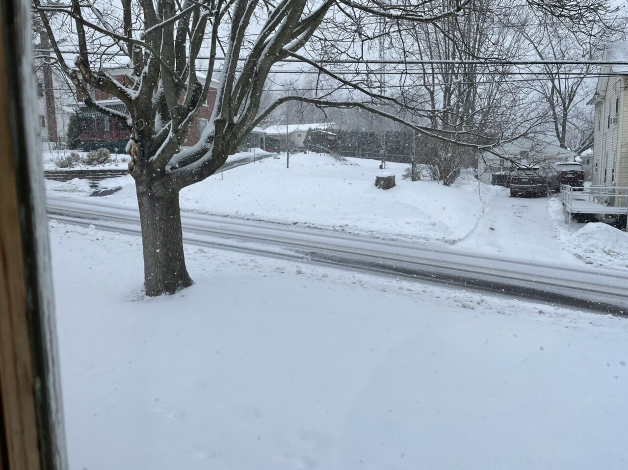
Just got home, all roads are pretty rough. Measured 1.5” with moderate snow and 28ºF. Back edge is coming soon but it’s probably going to get to 2” by then.
-
4
-
-
Currently up at Blue Knob summit, the snowboarding was pretty decent this afternoon. Plus got some time in the new snow falling.
-
6
-
-
Well I’m surprised @Blizzard of 93isn’t around tonight with updates haha but there has been a distinct shift in guidance (ops and ensembles) tonight towards this coastal system being a good bit closer to the coast and quite strong as it has been occasionally showing inconsistently on op guidance (mostly the GFS).
Tonights 0z Canadian actually gets the coastal system back into some of the Sus Valley which is roughly supported by it’s ensemble mean taking a developing low off the coast just inside the benchmark. The GFS and Euro have benchmark systems, which also show that approximately on their ensemble means. The Euro (in a massive difference from 12z Sunday) specifically detonated New England with exploding low pressure at sub 960 near the benchmark to an eventual 946mb in the Gulf of Maine.
Despite a few big C-PA hits on a few GEFS and Euro EPS members, the coastal storm is still ultimately too far east for us but this was the kind of model cycle I’ve been waiting to see in terms of collective support among all guidance of some kind of bigger coastal storm and associated phasing. And this is starting to show right around the D5-6 timeframe too, so we’ll see how this evolves. Like I mentioned earlier, what’s also to be considered is even if the coastal misses east is lighter snows from the northern branch wave that phases in to pop the coastal low. That’s also showing to a degree on guidance now as well.
-
2
-
-
1 hour ago, Atomixwx said:
Can confirm. What a snowy day. Roads are a disaster.
We’re probably going to get some kind of repeat of this starting late tomorrow afternoon into tomorrow evening with clipper #2 as well.
New 0z HRRR, and this seemed to do half decent with today’s event.

-
1
-
-
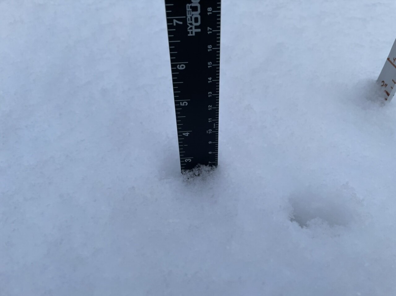
About 2.5” or so with light snow falling. Temp still between 27-28ºF. You can see how fluffy the snow is.
-
4
-
-
28ºF moderate snow. 1.7” now on the snowboard. 2” seems pretty attainable, I wonder if this can squeeze out 3” here. I think CTP should have issued advisories for at least the Laurel’s and maybe even a few of the central counties to match up with PBZ’s expansion of advisories they did overnight last night. If it’s a fluff bomb here at 1300’ it’s definitely one up at 2-3k feet in the Laurels. There have also been some issues on I-99 this afternoon, esp in Centre County.
-
1
-
-
27°F/25.5°F, light SW wind.
Light to Moderate rate currently after having a nice burst for a awhile. Over an inch.
-
3
-
-
17 minutes ago, Blizzard of 93 said:
Are you getting Clipper snow yet today?
Do you think the LSV has a chance of sneaking out 1 inch of snow out of this today?
What do you think of the coastal chance next week?
Yea had an initial bout of steady snow that’s put down a light coating on snow surfaces and some of the best stuff is moving in from western PA now with a decent steady snow resuming, so we’ll see how much make’s it off the Laurels.
I still think it’s doable to see a coating up to an inch in parts of the Sus Valley since better stuff will be trying to come in late afternoon. Actually looks like some patchy snow is trying to develop (via LWX radar) from H-burg south between 81 and 83, so will have to see what reaches the ground. Again it’s going to depend on the downsloping component. The stuff in western PA actually looks pretty decent. Short/near term guidance has been bringing the best stripe of snow across closer to 80. So I would favor the best chance of the T-1 to be H-burg north… but I think anyone in here has a chance at seeing something.
Still not high on the coastal chance next weekend. At the moment this may back in enough to be a New England or even Mid-Atlantic east of I-95 event but I think our only chance of snow from that may come from the actual northern stream disturbance that eventually fires the coastal.. which would probably be a lighter event like we’re seeing today. The MU director’s take that @Itstrainingtimeshared I think sums up that situation pretty well.
-
1
-
 1
1
-
-
Looks like the winners of the 0z version of the GFS snowstorm sweepstakes is the southern New England gang. Extreme eastern LI and Connecticut, all of RI and eastern Mass get rocked.
-
32 minutes ago, losetoa6 said:
Nice shift for the day 6/7 threat
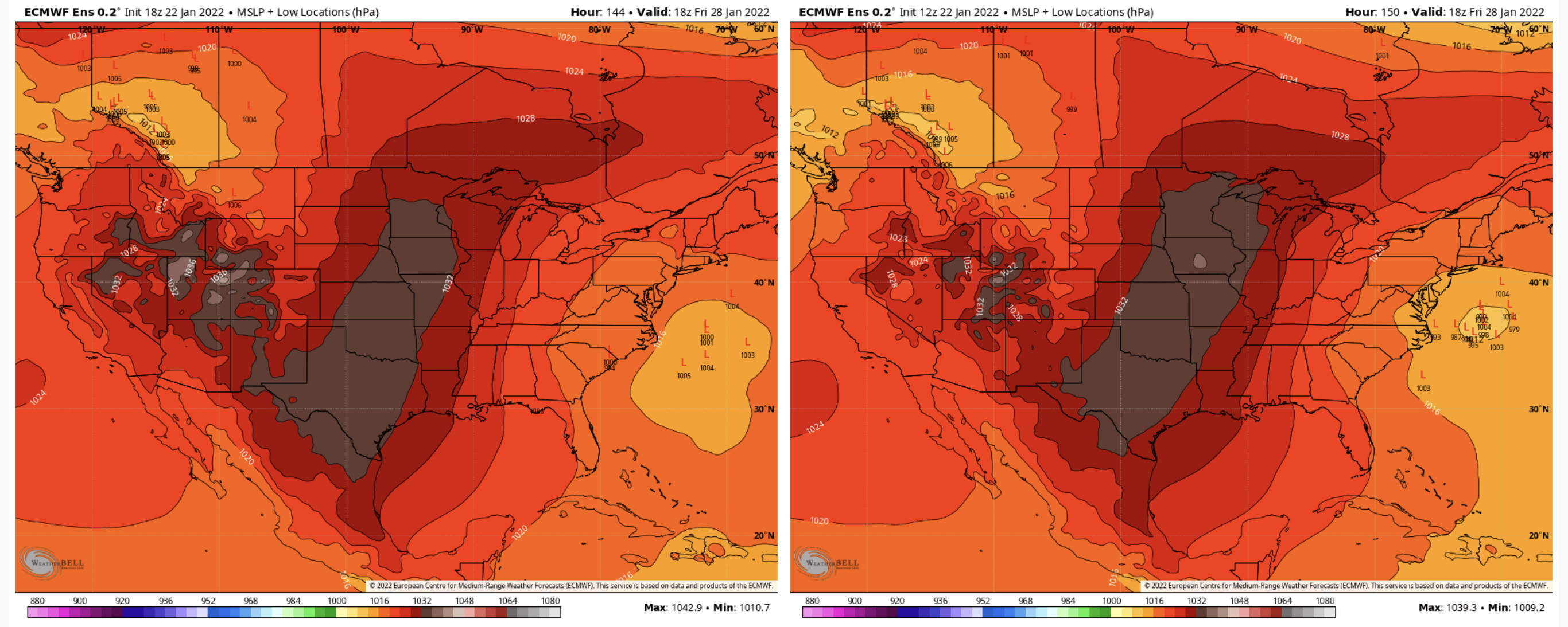
Here was the comparison between the 18z and the 12z. This things only beginning to materialize by the 144hr timeframe which is as far out as the 18z Euro EPS and control goes.
18z 12z
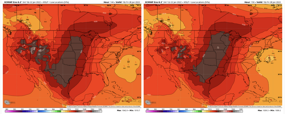
I’m intrigued by the timeframe to be sure but I’m not jumping gung ho on this threat until I see some more consistency on the operational guidance and ensemble guidance to start reeling the mean back towards the coast line. Ensembles have been seeing it to a degree but everything (GEFS, Euro EPS, CMC ens) is generally way to far out to sea to have us in the game for anything. Still pretty far out in range though, like I mentioned I think yesterday the storm last week really didn’t start showing consistently until it was around D5-6 and the pattern also makes it hard to see threats even in the medium range with the progression and lots of moving parts.
-
2
-
-
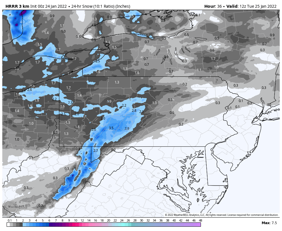
Here’s the 24hr snowfall version of that snowmap. Next.. lol.

-
1 hour ago, Wmsptwx said:
Have weird feeling tomorrow over performs for most….lol no idea why but I do.
It certainly could simply because it will be a high ratio snow, likely of the 18-20:1 variety overall and perhaps even higher ratios in the mountains where there will be some extra upslope lift on the westerly flow. Whole column from 850mb up is in the ideal temp range for snow growth. I think the Laurels counties probably could get an advisory type deal (PBZ already has them out). The big thing will be seeing how the precip makes it away from the Laurel’s and how much of a downsloping shadow gets cast towards the Sus Valley. Good chance most see a minimum coating to an inch though.
This whole process looks like it may repeat itself to some degree Monday evening regardless of what the southern stream wave Tuesday does because the second clipper low running the northern branch now looks like it’s going to run ahead of it.
Then later Tuesday would be the timeframe for the southern stream system to do something. GFS/Euro have become extremely disinterested in doing anything with it and instead squashing it into the Gulf of Mexico. Our newly anointed guru of the 60-84hr range the NAM brings it up enough to generate some light snow in PA on the arctic frontal boundary, which I think is what we should look for from that system as a best case scenario since we have the northern branch clipper low coming out ahead and thus not much opportunity to amplify and try to turn up.
Either way though, that’s three distinct chances at snowfall for C-PA the next 3 days even if they’re lighter events. And I have pretty high confidence in the first 2 doing something.
-
4
-
2
-
-
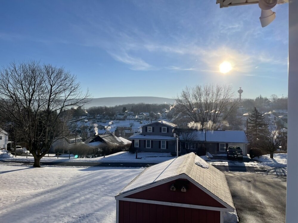
-3ºF was the low here this morning. Browsing the meso obs it looked like a lot of lows in the -7 to -10 range outside of town up and down the I-99 corridor. Weather station in south Philipsburg up by Atomix had a -13ºF. Looked like the big winner was the one in the northern tier near Smethport that’s always super cold, bottomed out at -21ºF. Euro def did well seeing the radiational cooling.
-
4
-
-
1 minute ago, losetoa6 said:
Impressive. What town are you nearest in Pa
I”m within the city of Altoona but on the corner of town only a couple miles from the Allegheny Front. I would imagine there’s already a couple spots outside of town that are below zero. On Mesowest there’s a station at the lower end of my county at -1ºF and I also saw a station on the outskirts of State College reporting a -4ºF.
-
16 minutes ago, Itstrainingtime said:
Also...what's going on with the bitterly cold temps for tonight? At 7pm I was at 15. Nearly 3 hours later, it's 18.
Cloud cover could be a part of it maybe, looked like the LSV was under the high cloud deck most of the early evening from the system that is currently a Carolina snow/ice event.
-
Down under 4ºF already here.
-
Well at any rate, looks like the Euro has the storm today haha. The Canadian did too, but it was slower by about a day or so and it was just approaching our region by it’s hour 240.
-
Some obs:
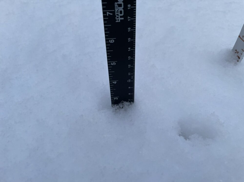
Currently 12ºF with 2ºF dewpoint. Temps fell below freezing overnight last night around 330am and were in the low 20s most of the day.
Snowpack is a pretty uniform 3-4” hard pack around the yard. Some deeper spots where it drifted.
-
1 hour ago, Blizzard of 93 said:
Yes please!
According to the Mid Atlantic thread, the 18z GEFS looked really good for this time period.
I didn’t really see anything that jumped out to me on the 18z GEFS guidance regarding that event. The storm signal is there, but it’s pretty scattershot on low positions and they’re mostly well offshore. That’s to be expected at that range but it wasn’t anything crazy in terms of a major storm signal. Surely the overall pattern for a bigger event is pretty favorable, but this is difficult pattern to assess individual storm potential out past 5 days or so. Our Sunday/Mon event at the beginning of this week wasn’t seen much at all consistently until it was within that timeframe, for example. There’s a lot of different shortwaves running a very progressive pattern and we need to line things up to pop a bigger storm… and models simply aren’t going to see that consistently even in the medium range.
I think our next potential widespread event looks to be the Tuesday-ish one, which will depend on a closed 500mb ejecting out of the SW and how that interacts with the dominant northern stream regime. Probably not a major event but it could be a light to moderate one if this heads the way of what the GFS has been showing. GEFS/Euro EPS shows it to some degree too. Something to monitor. I know some folks keep asking about where the clippers have been, well this is a pattern that’s good for producing them. So I wouldn’t be surprised if we score one or two of those during our cold 8-14 day stint. There is a weak clipper system progged before that Tuesday potential around Sunday eve, but that probably only has minor snowfall focused in the western half of the state.
-
2
-
1
-
-
Friday night has the potential to be a really cold morning not seen the last couple winters. Looking at models today everything is cold, but Euro looks like it’s envisioning an ideal radiational cooling night. I saw this shared in the Upstate NY thread, but interesting take from BGM
QuoteFriday night is starting to show the hallmarks of an extremely cold night under Arctic high pressure. Though model guidance is already quite low for minimum temperatures, this is a situation in which guidance typically struggles to keep up. The atmospheric column will be extremely dry, to the point that model precipitable water value values are just three to six hundredths of an inch; it simply just does not ever get lower than that around here. This along with snow on the ground should promote ideal radiational cooling, and there is concern that the bottom could really fall out for temperatures. Our forecast has large majority of the area reaching well below zero; in many cases by double digits. This already skews below most guidance, but it should be noted that there is at least a chance for some locations to hit 20 below. The biggest point of uncertainty, is whether a system shooting well offshore the Midatlantic Coast, could manage to yield a thin veil of high cirrus towards the Poconos-Catskills along with a strong upper jet maximum zipping through. If so, that would at least somewhat hold back the radiational cooling for the southeastern zones. Winds under high pressure will be light/variable to calm, so wind chill per se is not the issue here compared to just the straight up frigid temperatures. Considering how cold the prior 24 hours will have already been, we could see frozen pipe issues in addition to the typical exposure risk posed by extreme cold, as well as further buildup of ice in the rivers.
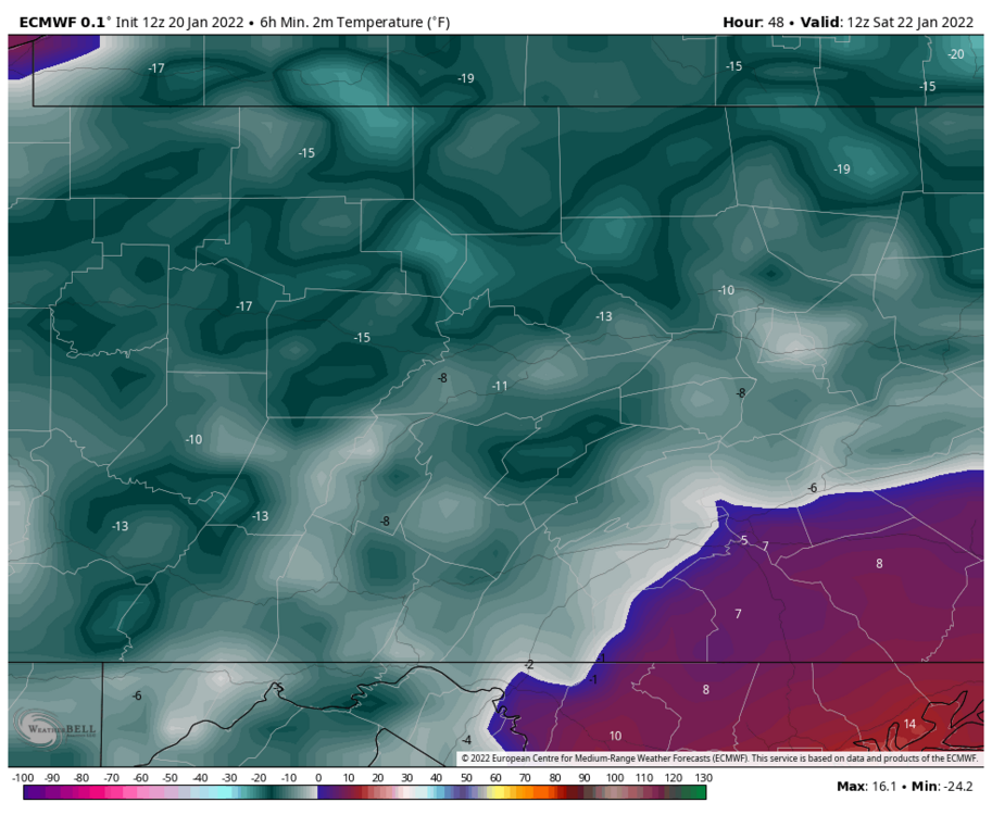

Seeing the whole area under PWAT’s of 3-5 HUNDREDTHS of an inch is pretty nuts. For reference that’s about 10-15% of the average PWAT value this time of the year, which is already about the coldest/driest time of the year climo wise. When the atmosphere is that dry, it presents the opportunity that if winds calm and the surface decouples, temps at least in local favored rad cooling spots could nosedive. So I don’t know if the Euro’s widespread significantly below zero temps comes the whole way to fruition but I can easily see some of the favorite rad cooling spots in the central counties bottom out at -10 to -15. And up north I wouldn’t be surprised at a -20. Even spots in the Lower Sus Valley where most of the pack was lost may undercut guidance and get near 0 or a couple degrees below. But we’ll see if we can get the clear skies and calm winds to maximize that potential.
-
3
-
-
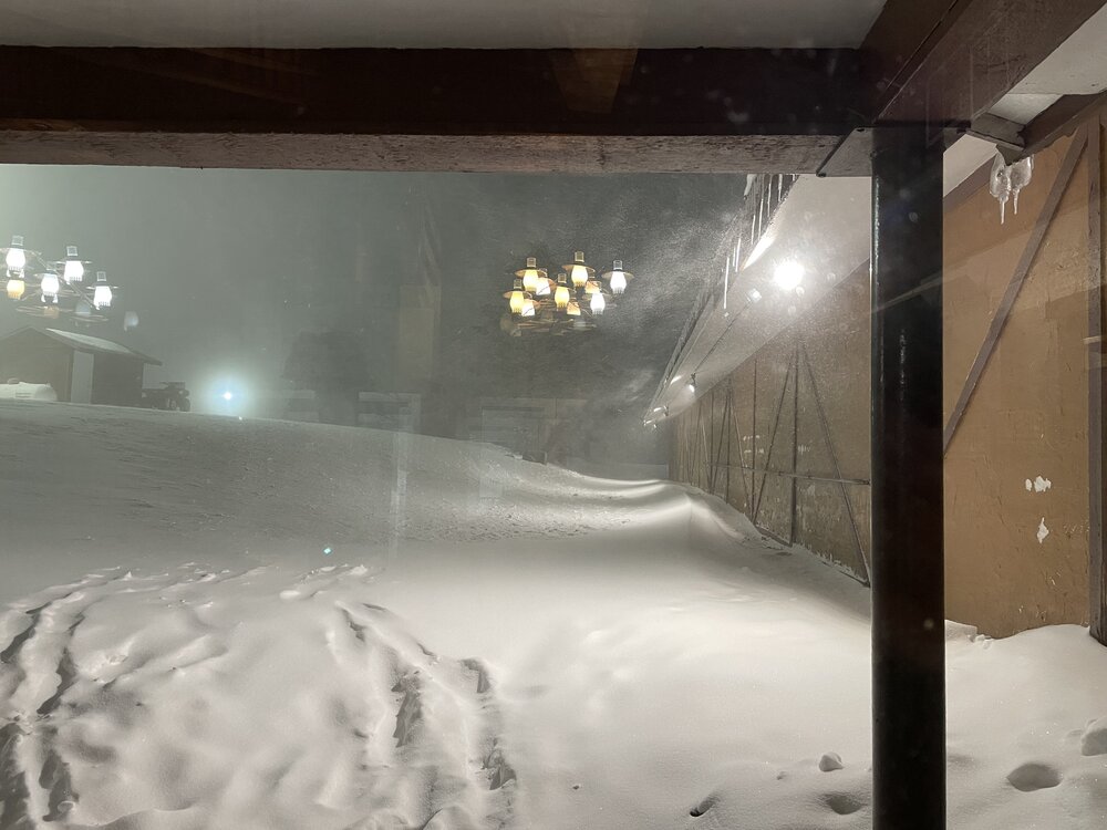
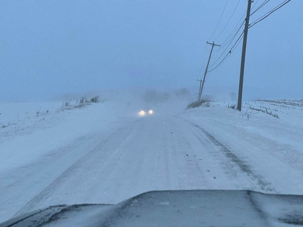
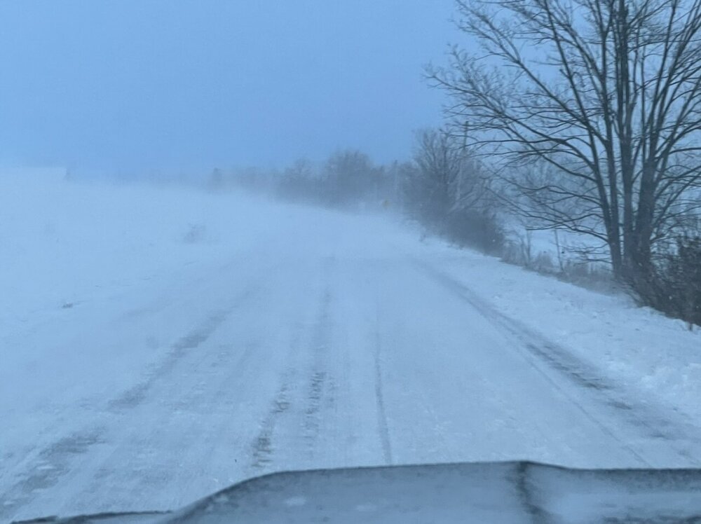
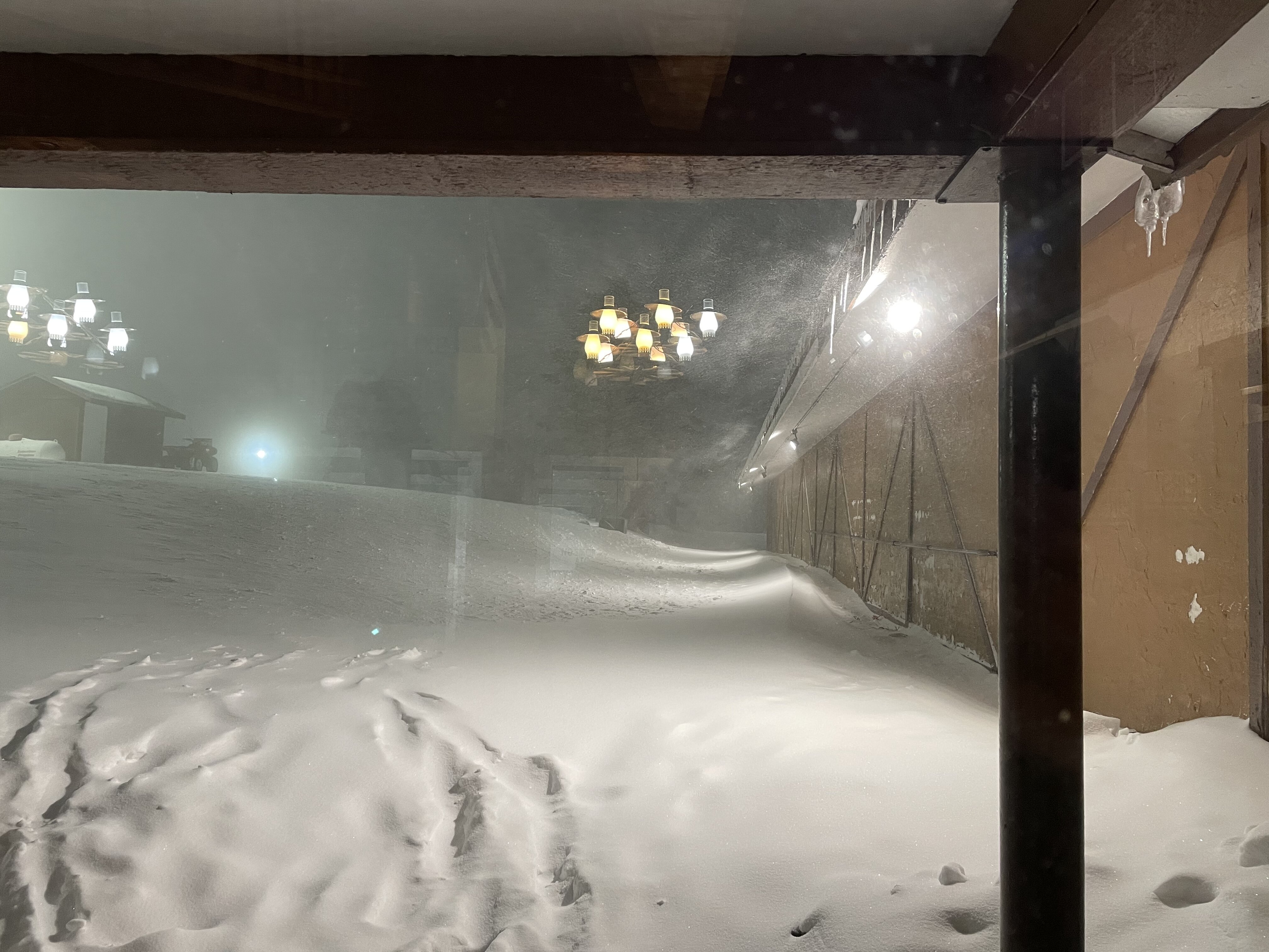
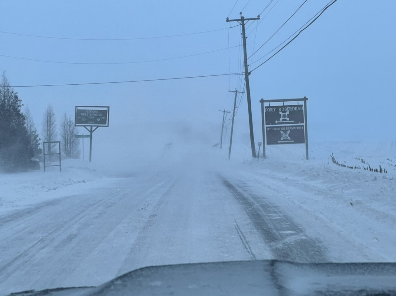
This was outside of town out in the valley before dark. Lots of blowing and drifting. Most secondary roads/streets are still in pretty rough shape.

-
5
-
-
6 minutes ago, losetoa6 said:
Agree....That's definitely preferable in most setups but h5 is definitely conducive for it climb far enough for a moderate hit per Euro .....if it holds

The mean western ridge axis being approx near the West Coast certainly gives this a chance to get us in the thick of things if we can phase shortwaves. Euro does this most successfully while the GFS southern stream 500mb wave digs down more in the SW/slows down and missed interacting with the northern shortwave.
-
1
-
1
-


Central PA - Winter 2021/2022
in Upstate New York/Pennsylvania
Posted
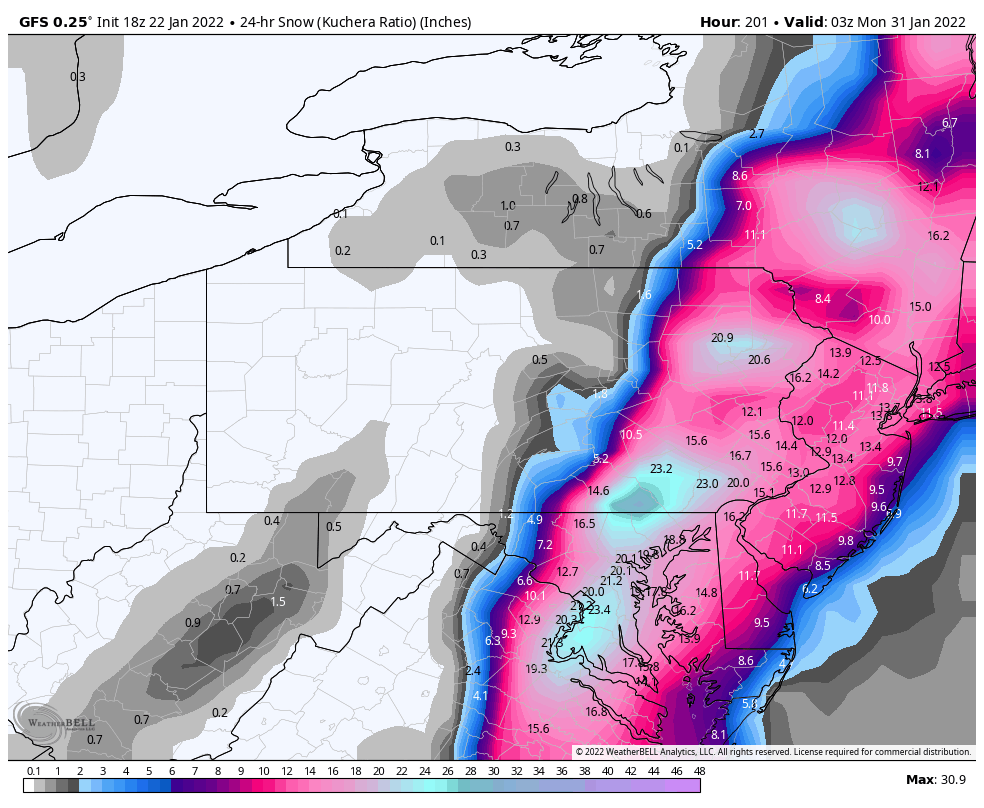
Nit picks aside on it shifting it’s swath east a bit (and south some with the initial snowfall development in our neck of the woods), GFS is still showing the same general theme of bombing the coastal storm out later and further east, only catching SNE with the more excessive snowfall. Euro has been exploding this into a big snowstorm starting much further down the coast. It’s a difference between a more run of the mill coastal with localized major snow (GFS) vs a sure fire NESIS cat 3+ considering how much of the megalopolis is within the 10+ in both the Euro and it’s ensemble mean.