

MAG5035
-
Posts
5,718 -
Joined
-
Last visited
Content Type
Profiles
Blogs
Forums
American Weather
Media Demo
Store
Gallery
Posts posted by MAG5035
-
-
8 minutes ago, Bubbler86 said:
Just ran through all the 12Z's out already...including the lesser revered...and the spread is all over the place. No more 1-2 feet in Central PA looks but lots of RGEM and Rap like large scale snows for large areas but an even amount of far eastern looks where someone like MDT gets 2.5". Nam 3K is one of them. Should be an exciting HH run tonight.
There wasn’t a point I’ve seen anywhere near 2 feet being portrayed anywhere in PA with this system. The NAM and couple global runs (think mainly the EC and Canadian) have tried to present a 10+ swath at times but that was like a 10-15” type range. I did look back and saw the 18z NAM that was posted last night. That still seemed like a pretty big exception to what has mostly looked like more of a 6-10” type event on the high end.
That’s the thing with this, up through the first part of yesterday this was still looking like a western half of PA bullseye. We’ve made a pretty big shift east to get the LSV fully involved. What that also means is this has became more progressive to get us there, so that’s going to take the top end off accumulation potential. It still looks like it could easily be the biggest snowfall of the season in parts of the LSV regardless, so I guess it’s all in one’s perspective of what’s a good storm.
-
 3
3
-
-
16 minutes ago, paweather said:
the NAM is a hit. Overdone but good hit:
I wouldn’t say it’s overdone, this is easily a 6-10” (or greater) type event for wherever the swath sets up. It’s a timing thing, NAM seems to both press the front pretty well and hold back the wave long enough.
-
1
-
-
1 hour ago, Itstrainingtime said:
Well I'll be doggoned - look who's getting excited for Saturday...
-
2/2 ..from the 40s around sunrise into the 20s during the afternoon, resulting in "flash freezes" & roadways turning icy, snow-packed, & slippery. Wind gusts of 50-60 mph will accompany the Arctic front & persist into Sat night, leading to downed trees/powerlines & power outages.
-
1/2 I'll be talking more about the Saturday storm tomorrow, but it's becoming increasingly likely that the two pieces of energy mentioned in Monday's SWD will join forces at "just the right time & place" to bring an accumulating snow event to southeastern PA. Temps will plunge..
Haha, time for the role reversal. Trying to nail stuff in the Sus Valley has been extremely frustrating for me this winter. With this setup I’m only going to acknowledge the western half of PA has the best chance of seeing what could be significant snow (6+) for now. I do agree on the flash freeze potential and likely some kind of snow accumulation with a big time shot of cold being pulled into a very rapidly deepening coastal low. Models, especially the global ones have been too overzealous on the eastern edge of snow swaths so I’m taking some pause for this. The potential for a good snow event for everyone is there though.
-
-
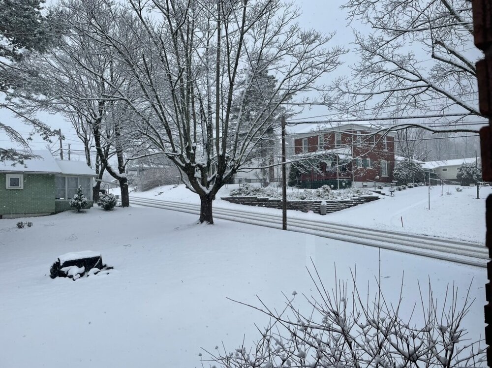
Still getting some snow bursts but additional accumulations have stopped with max solar and temps around 33ºF. Have measured 3.4” and it’s definitely a wet snow. Most roads are now wet. This was basically on target for what I was expecting here.
As I mentioned in my last post, problem for the Sus Valley was the best of the precip shield ending up tracking northwest. Rates would have overcome the marginal temps. But as it is, the result is the north-central being upgraded to warnings being a couple degrees colder and ended up with the best of the QPF.
-
1
-
-
38 minutes ago, ChesterfieldVa80 said:
Nice! Do you think blue knob is cashing in? I'm thinking about going there to ski one last time this weekend..
I’d imagine it’s cashing in at least about as much as here. I’m nearly 2k feet lower than Blue Knob summit here off the Allegheny front and I’m over 3” now. Surely it’s at least a couple degrees colder up there. They may not be getting quite the rates though. The big thing with the storm evolution I’m seeing this morning is that the best precip/rates is running western PA to central and esp northern PA above the turnpike. Pretty much looking like best precip is going the HRRR route (more NW axis) as opposed to even what the 6z NAM had this morning and especially what most 0z guidance had overnight. That’s unfortunately to the detriment of the LSV, which needed the rates the most to overcome the marginal temps.
At any rate, I’m not sure how much keeps til the weekend up there as we moderate prior to the next system. Good news though is the western half of the state is currently well positioned for potentially an even bigger snowfall with Fri Night/Sat’s system (especiallly in the higher ground) and a significant cold shot for the second half of the weekend. It’s unfortunate that what is looking like one the best synoptic snow weeks of the winter (with no stupid mix and ice) around these parts is coming after half decent conditions at Blue Knob were hit pretty hard by the mostly warm and wet weather the couple weeks.
-
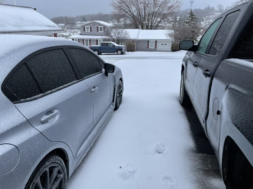
Already at 2.3” and moderate/heavy rates here. 31ºF
-
7
-
-
Snow has begun here, light dusting. 31ºF/26ºF
-
1
-
-
Current temp/dewpoint is 30ºF/23º. My biggest unmixed period of snowfall this winter was the Jan 16th event with 5.2” prior to the mixing and 982mb low going over my head. So having a look at things this evening I honestly give this event a slight chance of beating that here (Thinking about 3” in the backyard is a decent bet).
I tend to agree on the elevational nature of this event to a point and marginal sfc temps and whatnot, but I personally think it’s being overplayed with this setup. Like okay, I think most 4-6” or so amounts if they show up are likely going to be in the north-central and/or on the higher parts of the ridge and valley. However, this is a pretty decent slug of moisture coming at us being a southern stream system. If it comes in rocking rate wise right off the bat, elevation is probably going to matter less. Arrival time per the HRRR ranges from a couple hours pre-dawn SW to about 7-9am going LSV to northern tier… thus solar isn’t going to have too much of an influence during the first part of this event. Big question mark for me is right on the southern tier LSV, but even the more northerly HRRR manages a couple inches there. I will say that there is a chance that the southern tier LSV may mix or rain at the very beginning before cooling the column enough to snow when the heavier stuff sets in, so I wouldn’t get too scared right off the bat.
I know it feels like I’ve been at odds with CTP’s thinking pretty much every winter event this season when it comes to discussing my thoughts in here, but I do think this warrants an advisory for most or all of CTP’s CWA. Like I said, I think this is elevational to a degree but not enough so to think that a majority of the Sus Valley can’t manage 2” to verify an advisory (or 3” in this neck of the woods). Hope they’re right, because the heavier stuff arrives during a big portion of the morning rush tomorrow. They must be going off of the NBM (national model blend) pretty hard, because this is about the only guidance I can find that jives with their accumulation map well.
-
2
-
 1
1
-
-
15 minutes ago, Bubbler86 said:
WWA issued tomorrow?
I’m sure one would have to be at some point if the models hold with things. CTP doesn’t seem to be really acknowledging this as a strictly snow event anywhere, painting it as starting as snow/ice and going to a mix (rain/snow) during the day in their grids and referenced in their AFD. I mean i kinda agree that if we don’t have moderate or heavier rates that this could mix with rain in low spots given marginal surface/near surface temps but otherwise thermally this appears to me to be a strictly snow vs rain type event and pretty much all of our subforum has a sufficiently cold column for snow.
-
2
-
-
45 mph is the current measured peak gust back this way (around 730p). Temp is back to 38ºF
-
Nothing crazy to report here, I ended up going through a broken part of the line and didn’t even get a downpour. Only a gust to 32mph with the passage. Getting some higher gusts now post front (up to 34 mph max gust so far). Temp falling rapidly down to 52ºF… a 10 degree drop in the last 30 min.
-
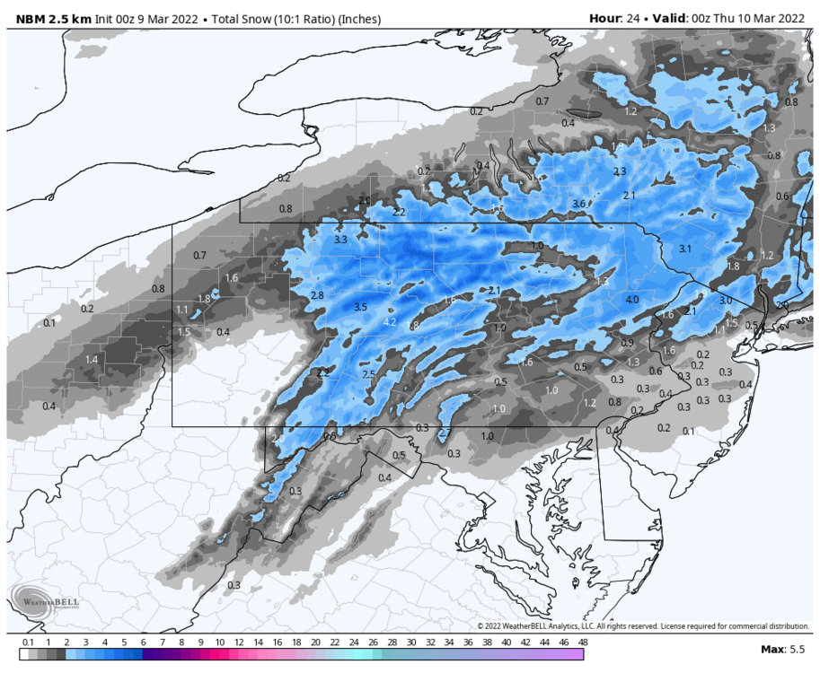
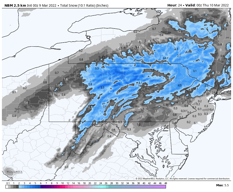
Have to acknowledge the winter threat coming up on Wednesday, I know I haven’t been posting as much lately. The key thing I see for this is simply where the best QPF and rates set up. It’s as simple as that really, given good agreement on progged low track to the south of PA and sufficient cold for a snow column. We go through this Every. Single. March/late season. If the rates are there, the snow is going to pile up on more than the mulch.. and that includes roadways and everything else in between except maybe @canderson’s property lol.
With that said, having chilly but somewhat marginal surface temps and the higher March solar insolation… an event with light rates (and/or the fringe areas within the precip shield) is probably going to have some trouble accumulating on a lot of surfaces outside of higher elevations. Most guidance and ensembles are showing decent rates/amounts over a good part of our subforum. The NAM seems to be the least on board for a widespread heavier event in C-PA actually having the axis of heaviest QPF running the northern half Mid-Atlantic forum’s turf and also our southern tier. 12z was pretty nice, however the new 18z has the same axis but tightened up the good QPF. It seems like the biggest amounts in play for this event is probably going to reside in the 3-6” range. Again, rates are important.. especially with this being progged to be generally a daytime event.
-
5
-
-
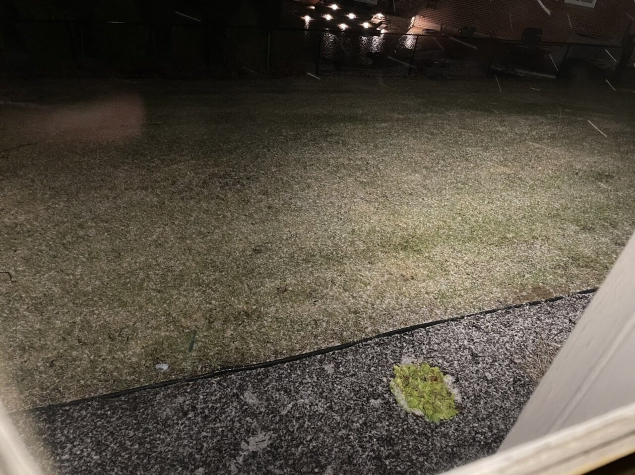
Not to snow on everyone’s Spring/Sixers parade haha, but I do have a changeover and some snow to report this early morning (dusting). 511 cams just up the hill from me in Cambria look to have gotten an inch or so.

-
2
-
-
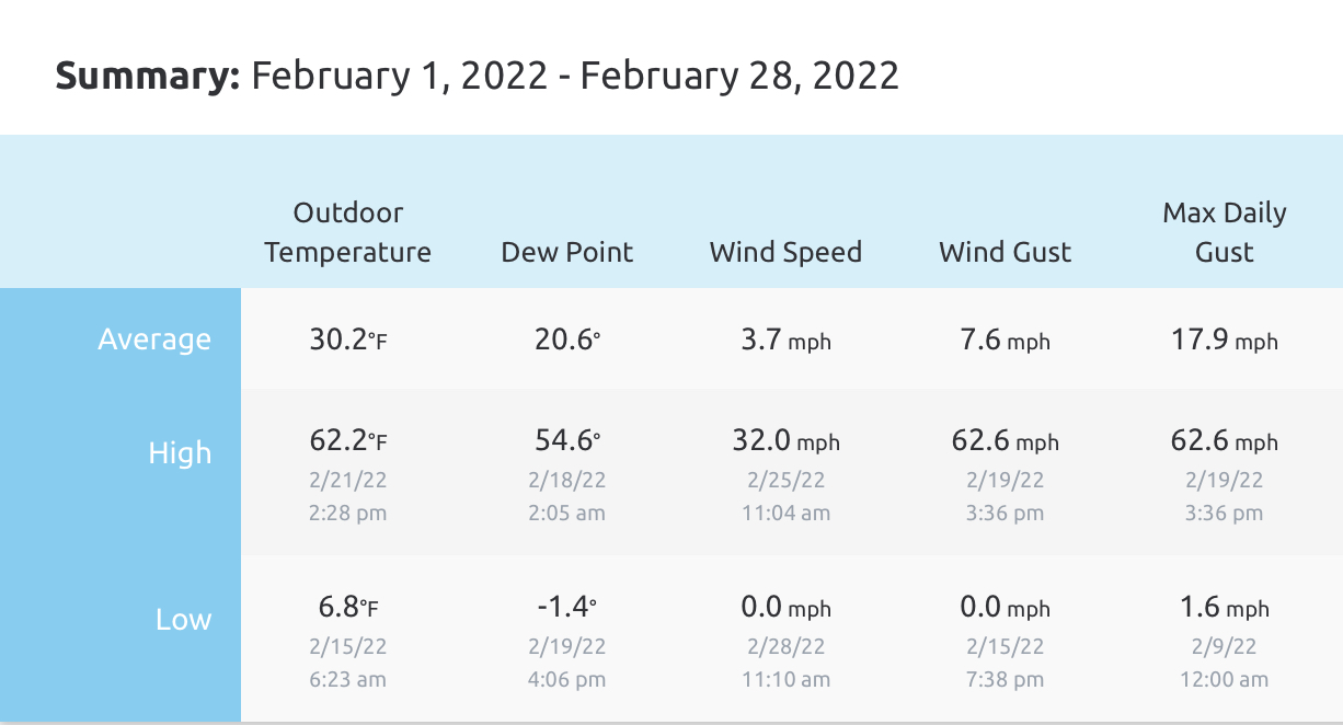
February was the first full month for my weather station so here were the basics for the month. The 30.2ºF mean looked pretty close to average compared to the local climo (KAOO) despite a handful of days that did spike up into the 50s and a couple 60+ days.

-
4
-
-
15 minutes ago, Mount Joy Snowman said:
Yeah they just illustrate rain falling into a surface temp of 32 or less so actual ice accretion is always much less but was still expecting at least a few reports around .5”. They just put out an updated PNS that includes five reports from Somerset County and not a one is over .3”. Heck, there was good reason to believe that Clearfield County would be ground zero for the icing and the lone ZR report from Clearfield so far is for only .13”. Oh well, not like loads of ice is a good thing.
Well the reason for less freezing rain in this general area and at least the eastern Laurels was because most of the precip fell as sleet. Surface temps weren’t super cold, but that 925-900mb layer definitely was.. and it held fast for the most of the heavier precip in a pretty big chunk of the central. The main warm advection push aloft during the bulk of the event came higher in the column from about 850-700mb level. There’s no input from terrain or CAD that high up to delay or mitigate a strong WAA push, so that can often overachieve… hence why it mixed all the way into NY and north central PA didn’t see much actual snow at all.
830am this morning
I measured 1.5” of sleet this morning and what I could guesstimate was about a tenth or so of ice… which has all melted off the trees this morning. Most of the sleet accum will definitely remain on the non-paved surfaces, but roads are in good shape now. It was real mess to clean up, I had to use the snowblower to remove it. But considering I’m in one of the 4 counties under a wind advisory this afternoon, I’m glad freezing rain issues weren’t huge. Extra bonus.. that 1.5” of sleet is technically the biggest snowfall I’ve had this month lol.
-
2
-
-
Pouring sleet right now, probably about an 80/20 blend IP vs ZR. Approx 1.2” of sleet accumulation. 31ºF/30ºF
-
1
-
-
Close to an inch of sleet on the ground. Think we’re starting to transition towards the ZR phase but precip is still about a 50/50 blend of sleet and freezing rain. The sleet on the ground is starting to firm up with more ZR in the mix but so far accrual is still in the glaze category and not really measurable yet.
30.7ºF/28.1ºF temp and dewpoint. Winds are up a bit, gusting past 15mph at times and mostly southerly.
-
RIght at a half inch of sleet now. Still mostly sleet and it’s pretty heavy at the moment with some large pellets. The street was actually plowed about an hour ago and the sleet’s been building back up on it.
Temp up a bit to 28ºF after bottoming out around 27ºF around 11pm.
-
15 minutes ago, Itstrainingtime said:
Rain here - no sleet at all at least at the onset.
Edit: it's raining hard.
You’ll have to see what the p-types are when that heavier stuff on your doorstep coming at you from the southern tier gets there.
-
An hour into sleet bomb 2022. Hey it can keep doing this over having a half inch of freezing rain.
-
Precip arrived just before 10. As expected, full blown pingers so far… with a tad of ZR in there enough to have a glaze on most non-treated surfaces. Already getting on the roads despite the road crews being on the scene. 27.5ºF.
-
Currently 28ºF/21ºF. It’s looking like this event will be rolling by about 10pm here.. gonna be a mess.
-
56 minutes ago, Itstrainingtime said:
33/28 here now - I expect zero icing on roads in this area. Perhaps some glazing on trees and power lines for a few hours later tonight. I think you need to get up in the MSV until there's issues of significance.
Not unexpected.
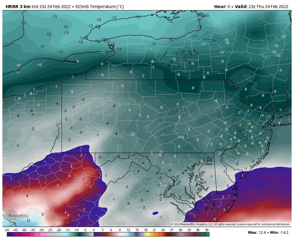
I wouldn’t write off issues completely. Yea surface temps got a tad freezing today, they were supposed to. They should fall below freezing when precip arrives. Here’s what the 23z HRRR just initialized 925mb (3000 ft) temps at.
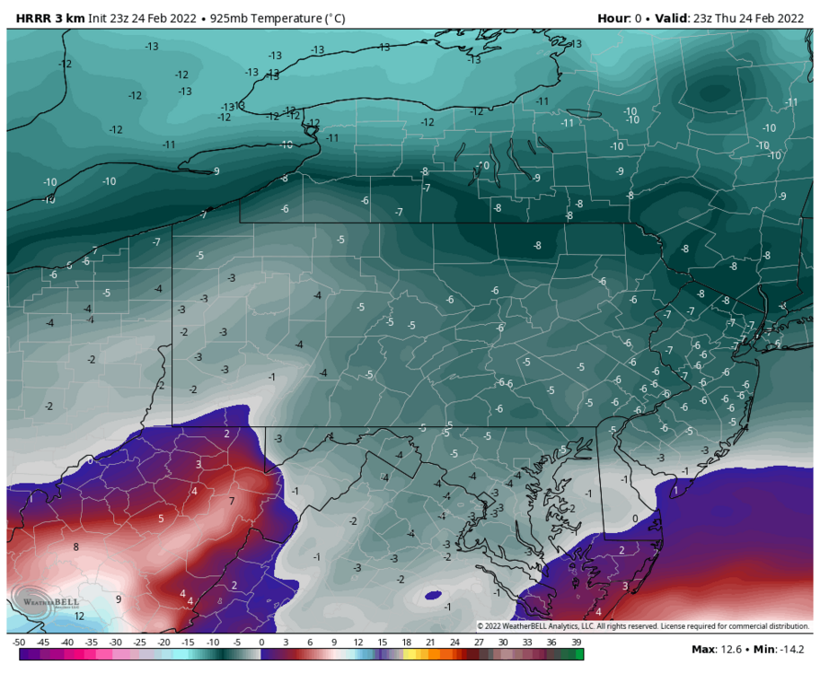
They’re about 1 degree or so warmer at precip arrival around 4-5z. But yea -6 to -5ºC is about 21-23ºF. Pretty decent depth and strength of the low level cold, so that depth suggests to me sleet’s definitely in the equation the first couple hours all the way to the mason-dixon despite what p-type maps show.
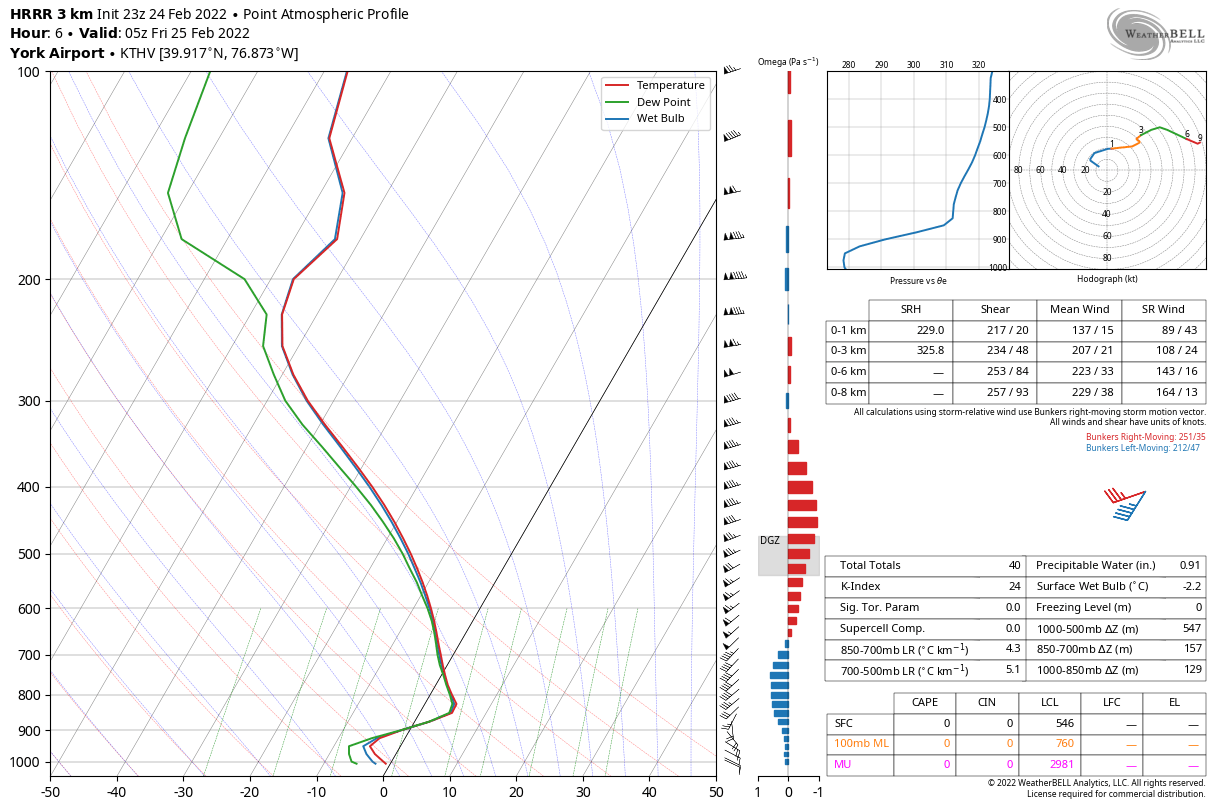
Here’s THV’s sounding generated from the HRRR at 05z (approximate precip arrival). The warm nose is elevated but easily notable, but the column is below freezing from 900mb (approx 4k feet) on down to the surface.

Otherwise I think CTP’s forecast/headlines are fine, though I probably would’ve considered a few more central/south like Centre, Huntingdon, Fulton, Franklin, for maybe a bit more freezing rain and less sleet. If 925-850 air advects in warmer/faster that could mean the I-80 counties also get 0.25”+ ice in exchange for a bit less sleet/snow. That’s definitely a distinct possibility as well.
I do think as noted by a few in here that QPF might be a thing in the LSV as noted on the newer NAM runs. If that’s the case, that’s probably a bigger limiting factor in higher ice totals than temps IMO. This isn’t Feb 3-4, the CAD is already locked in for most of the night with the precip attacking it.
-
1
-
-
45 minutes ago, canderson said:
From what I understand models are very poor at separating zr/sleet. Parameters and rates look like much more sleet than zr to me, except perhaps very late into the storm.
I just saw what the 18z Euro had and quite honestly it’s absurd what it’s p-type conditional has vs looking at it’s column temps. I made a post about that with the 12z run and I think 18z run is even colder. It’s even colder than the NAM aloft with all the NAM’s sleet.
So the Euro is printing out all that freezing rain in southern PA while at the same time having BOTH 925mb AND 850mb temps below zero in the entire LSV except near the Mason-Dixon Line at HR 36 and 39, which are significant precip frames. One thing or the other might be wrong, but if there is that cold of a column I can guarantee freezing rain isn’t going to be the dominant p-type during that portion of the storm.
-
2
-
1
-


Central PA - Winter 2021/2022
in Upstate New York/Pennsylvania
Posted
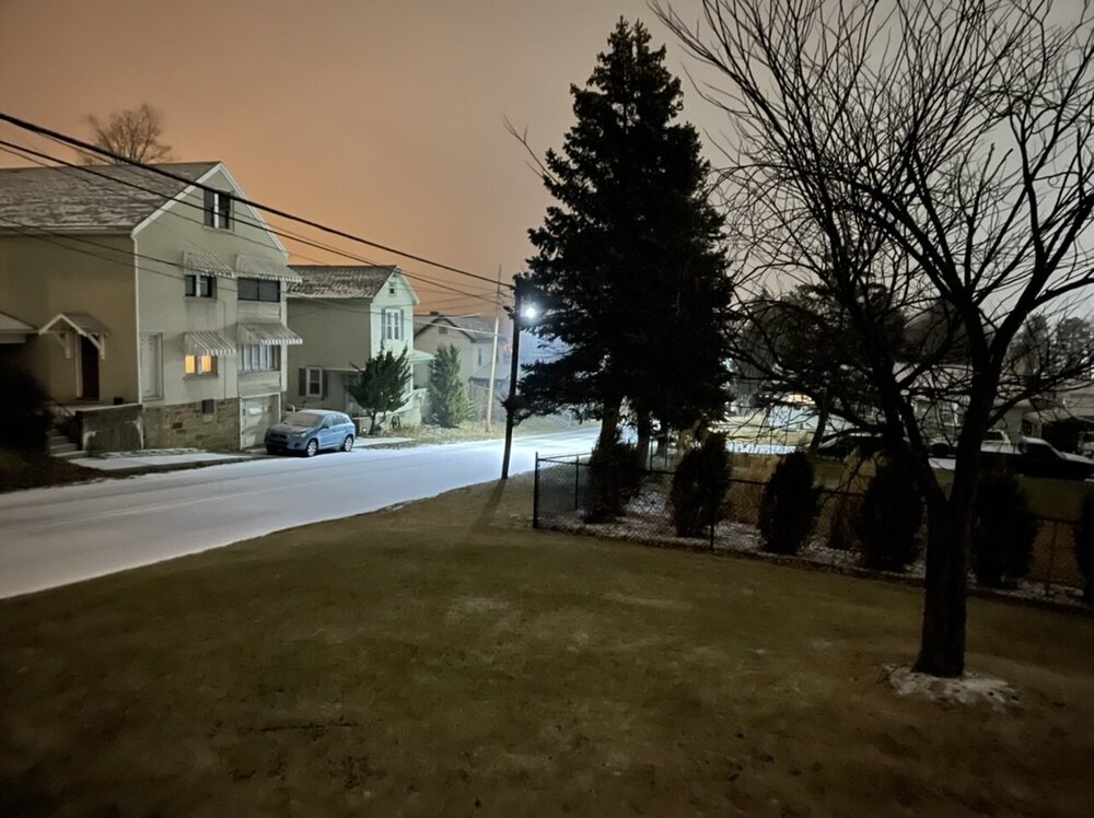
Frontal passage noted just before 11pm here. Temp/dew is down to 40/34.
511 cams in and around the Pittsburgh metro are rockin pretty good with snow on the ground (main roads still mainly wet).